
The Retreat at Walnut Creek
1459 Creekside Dr,
Walnut Creek, CA 94596
$2,081 - $3,679
Studio - 2 Beds
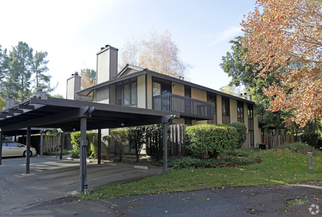
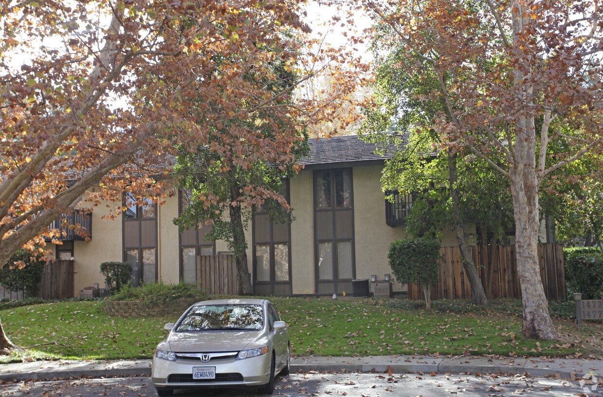
Experience Walnut Creek living at 1471 Pico Ct. This community is located in the Palos Verde Area area of Walnut Creek. From amenities to availability, the leasing team is available to help you find your new home. Your new home awaits you at 1471 Pico Ct. Contact us or stop by the leasing office to schedule a tour.
1471 Pico Ct is an apartment community located in Contra Costa County and the 94597 ZIP Code. This area is served by the Mt. Diablo Unified School District attendance zone.
Nestled in the East Bay region of the San Francisco Bay Area, Walnut Creek combines suburban comfort with city amenities. The city encompasses 1,800 acres of open space, featuring Shell Ridge and Lime Ridge trails for hiking and outdoor recreation. Downtown Walnut Creek features Broadway Plaza shopping district, while the Lesher Center for the Arts hosts performances and cultural events. The rental market shows a 1.7% annual increase, with one-bedroom units averaging $2,476 and two-bedroom homes typically renting for $2,953. Notable areas include Parkmead, Walnut Heights, and the Northgate district.
Established in 1849 along what early settlers called "Nuts Creek," Walnut Creek has grown into a community of over 70,000 residents. The Mediterranean climate makes it ideal for exploring outdoor spaces like Heather Farm Park and the Ruth Bancroft Garden.
Learn more about living in Walnut CreekCompare neighborhood and city base rent averages by bedroom.
| Palos Verde Area | Walnut Creek, CA | |
|---|---|---|
| Studio | - | $2,397 |
| 1 Bedroom | $2,340 | $2,518 |
| 2 Bedrooms | $2,876 | $3,024 |
| 3 Bedrooms | $3,889 | $4,097 |
| Colleges & Universities | Distance | ||
|---|---|---|---|
| Colleges & Universities | Distance | ||
| Drive: | 11 min | 4.4 mi | |
| Drive: | 19 min | 7.5 mi | |
| Drive: | 26 min | 14.5 mi | |
| Drive: | 27 min | 14.9 mi |


Transportation options available in Walnut Creek include Pleasant Hill / Contra Costa Centre, located 2.1 miles from 1471 Pico Ct. 1471 Pico Ct is near Metro Oakland International, located 24.3 miles or 36 minutes away, and San Francisco International, located 36.3 miles or 54 minutes away.
| Transit / Subway | Distance | ||
|---|---|---|---|
| Transit / Subway | Distance | ||
|
|
Drive: | 5 min | 2.1 mi |
|
|
Drive: | 7 min | 3.1 mi |
|
|
Drive: | 8 min | 4.3 mi |
|
|
Drive: | 12 min | 6.2 mi |
|
|
Drive: | 14 min | 8.4 mi |
| Commuter Rail | Distance | ||
|---|---|---|---|
| Commuter Rail | Distance | ||
|
|
Drive: | 18 min | 8.5 mi |
| Drive: | 26 min | 15.7 mi | |
|
|
Drive: | 25 min | 17.4 mi |
|
|
Drive: | 27 min | 18.9 mi |
| Drive: | 36 min | 23.9 mi |
| Airports | Distance | ||
|---|---|---|---|
| Airports | Distance | ||
|
Metro Oakland International
|
Drive: | 36 min | 24.3 mi |
|
San Francisco International
|
Drive: | 54 min | 36.3 mi |
Scores provided by
Traffic
-Airport
-Businesses
-Scores provided by
HowLoud What is a Sound Score Rating? A Sound Score Rating aggregates noise caused by vehicle traffic, airplane traffic and local sources. How It WorksTime and distance from 1471 Pico Ct.
| Shopping Centers | Distance | ||
|---|---|---|---|
| Shopping Centers | Distance | ||
| Walk: | 3 min | 0.2 mi | |
| Drive: | 5 min | 1.6 mi | |
| Drive: | 5 min | 1.8 mi |
| Parks and Recreation | Distance | ||
|---|---|---|---|
| Parks and Recreation | Distance | ||
|
Lindsay Wildlife Museum
|
Walk: | 19 min | 1.0 mi |
|
Larkey Park
|
Drive: | 3 min | 1.2 mi |
|
Butterfly Habitat Gardens
|
Drive: | 8 min | 3.5 mi |
|
Civic Park
|
Drive: | 8 min | 3.5 mi |
|
Gardens at Heather Farm
|
Drive: | 10 min | 4.2 mi |
| Hospitals | Distance | ||
|---|---|---|---|
| Hospitals | Distance | ||
| Drive: | 9 min | 3.9 mi | |
| Drive: | 9 min | 4.3 mi | |
| Drive: | 11 min | 6.7 mi |
| Military Bases | Distance | ||
|---|---|---|---|
| Military Bases | Distance | ||
| Drive: | 30 min | 11.6 mi | |
| Drive: | 20 min | 13.7 mi | |
| Drive: | 35 min | 17.4 mi |
Pets Allowed Fitness Center In Unit Washer & Dryer Stainless Steel Appliances Business Center Package Service Elevator
Pets Allowed Fitness Center In Unit Washer & Dryer Walk-In Closets Stainless Steel Appliances Hardwood Floors EV Charging
What Are Walk Score®, Transit Score®, and Bike Score® Ratings?
Walk Score® measures the walkability of any address. Transit Score® measures access to public transit. Bike Score® measures the bikeability of any address.
What is a Sound Score Rating?
A Sound Score Rating aggregates noise caused by vehicle traffic, airplane traffic and local sources.


