
$4,000 / Month
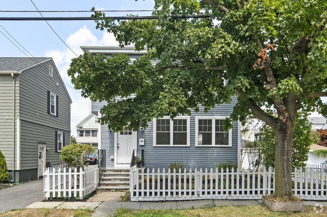
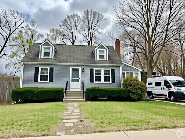
1471 High St
Westwood, MA 02090
2 Weeks Ago
Favorites
1471 High St

Favorites
Check Back Soon for Upcoming Availability
| Beds | Baths | Average SF |
|---|---|---|
| 3 Bedrooms 3 Bedrooms 3 Br | 2 Baths 2 Baths 2 Ba | 1,984 SF |
Fees and Policies
The fees below are based on community-supplied data and may exclude additional fees and utilities.
- Dogs Allowed
-
Fees not specified
- Cats Allowed
-
Fees not specified
Details
Utilities Included
-
Water
-
Sewer
About This Property
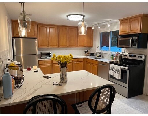
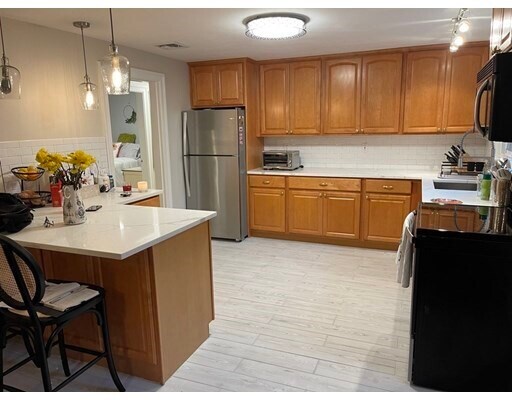
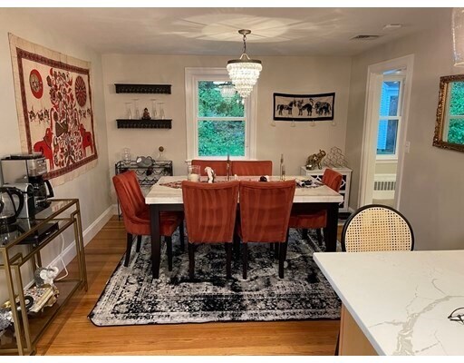
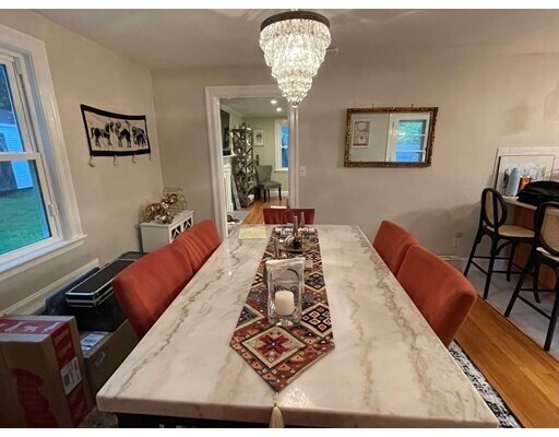
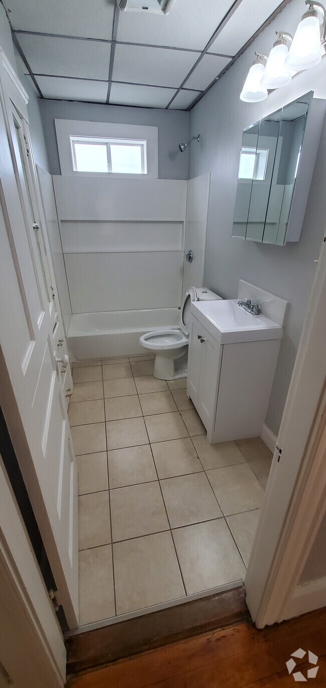
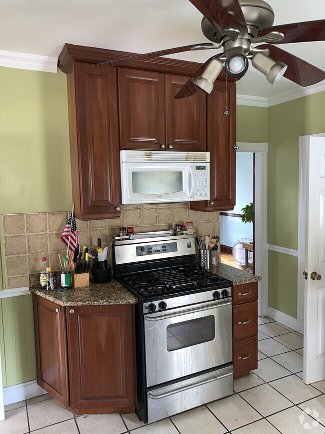
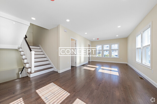
Welcome to this beautifully maintained and FURNISHED ranch style home. You will find a brand new kitchen with an island that opens up to the dining room as well as a large fire placed living room on the main level. In addition to that, you have 3 bedrooms and a bathroom on the main level and a great deck off of the kitchen. The finished lower level has a spacious family room, playroom, full bath, great storage, and access to the garage. Great location with amazing school systems around, this is a must-see!
1471 High St is a house located in Norfolk County and the 02090 ZIP Code. This area is served by the Westwood attendance zone.
House Features
Air Conditioning
Dishwasher
Microwave
Refrigerator
- Air Conditioning
- Fireplace
- Dishwasher
- Disposal
- Microwave
- Oven
- Range
- Refrigerator
- Freezer
- Deck
Location
Get Directions
Approximately 25 miles from Boston, the town of Westwood offers residents the simplicity of suburban living and the closeness to metropolitan nightlife and attractions. CNN/Money and Money Magazine named Westwood in their “100 Best Places to Live” in 2005.
Expansive greenspaces like Rice Reservation, Mulvehill- and Grimm Conservation, and Pheasant Hill makeup this unique, charming Norfolk County town. Ready for some fun-in-the-sun? Hale Reservation’s North Beach is a prime spot for sun and swim. Shopping and dining destinations include University Station, and college campuses and universities are easily accessible by I-95 and rail services provided by Massachusetts Bay Transportation Authority (MBTA).
Learn more about living in WestwoodBelow are rent ranges for similar nearby apartments
Amenities
- Air Conditioning
- Fireplace
- Dishwasher
- Disposal
- Microwave
- Oven
- Range
- Refrigerator
- Freezer
- Deck
Expenses
Utilities Included
Water, Sewer
Included
Education
| Colleges & Universities | Distance | ||
|---|---|---|---|
| Colleges & Universities | Distance | ||
| Drive: | 16 min | 8.2 mi | |
| Drive: | 18 min | 9.1 mi | |
| Drive: | 19 min | 10.2 mi | |
| Drive: | 22 min | 10.5 mi |
1471 High St is within 16 minutes or 8.2 miles from Babson College. It is also near Curry College and Wellesley College.
Schools


Public Elementary School
Grades PK-5
502 Students
Nearby
Public Elementary School
Grades K-5
287 Students
Nearby
Public Middle School
Grades 6-8
661 Students
Nearby
Public High School
Grades 9-12
902 Students
Attendance Zone
Private Elementary & Middle School
Grades PK-8
324 Students
Nearby
Private Middle & High School
Grades 7-12
965 Students
Nearby
School data provided by
 The GreatSchools Rating helps parents compare schools within a state based on a variety of school quality indicators and provides a helpful picture of how effectively each school serves all of its students. Ratings are on a scale of 1 (below average) to 10 (above average) and can include test scores, college readiness, academic progress, advanced courses, equity, discipline and attendance data. We also advise parents to visit schools, consider other information on school performance and programs, and consider family needs as part of the school selection process.
View GreatSchools Rating Methodology
View GreatSchools Rating Methodology
Transportation options available in Westwood include Newton Highlands Station, located 10.4 miles from 1471 High St. 1471 High St is near General Edward Lawrence Logan International, located 19.9 miles or 37 minutes away, and Worcester Regional, located 42.4 miles or 70 minutes away.
| Transit / Subway | Distance | ||
|---|---|---|---|
| Transit / Subway | Distance | ||
|
|
Drive: | 18 min | 10.4 mi |
|
|
Drive: | 18 min | 10.9 mi |
|
|
Drive: | 18 min | 11.2 mi |
|
|
Drive: | 21 min | 11.2 mi |
|
|
Drive: | 18 min | 11.8 mi |
| Commuter Rail | Distance | ||
|---|---|---|---|
| Commuter Rail | Distance | ||
|
|
Drive: | 8 min | 3.3 mi |
|
|
Drive: | 8 min | 3.3 mi |
|
|
Drive: | 8 min | 4.2 mi |
|
|
Drive: | 9 min | 4.7 mi |
|
|
Drive: | 10 min | 5.9 mi |
| Airports | Distance | ||
|---|---|---|---|
| Airports | Distance | ||
|
General Edward Lawrence Logan International
|
Drive: | 37 min | 19.9 mi |
|
Worcester Regional
|
Drive: | 70 min | 42.4 mi |
Time and distance from 1471 High St.
| Shopping Centers | Distance | ||
|---|---|---|---|
| Shopping Centers | Distance | ||
| Drive: | 5 min | 2.7 mi | |
| Drive: | 7 min | 3.2 mi | |
| Drive: | 8 min | 3.3 mi |
1471 High St has 3 shopping centers within 3.3 miles, which is about a 8-minute drive. The miles and minutes will be for the farthest away property.
| Parks and Recreation | Distance | ||
|---|---|---|---|
| Parks and Recreation | Distance | ||
|
Lookout Farm
|
Drive: | 15 min | 6.5 mi |
|
Horticultural Society at Elm Bank
|
Drive: | 18 min | 7.0 mi |
|
Mass Audubon's Moose Hill Wildlife Sanctuary
|
Drive: | 17 min | 7.5 mi |
|
Weezie's Garden for Children
|
Drive: | 22 min | 8.3 mi |
|
Elm Bank Reservation
|
Drive: | 22 min | 8.3 mi |
1471 High St has 5 parks within 8.3 miles, including Lookout Farm, Horticultural Society at Elm Bank, and Elm Bank Reservation.
| Hospitals | Distance | ||
|---|---|---|---|
| Hospitals | Distance | ||
| Walk: | 20 min | 1.0 mi | |
| Drive: | 7 min | 2.9 mi | |
| Drive: | 11 min | 6.1 mi |
1471 High St has 3 hospitals within 6.1 miles, the nearest is Westwood Pembroke Health Systems which is 1.0 miles away and a 20 minute walk.
| Military Bases | Distance | ||
|---|---|---|---|
| Military Bases | Distance | ||
| Drive: | 23 min | 9.9 mi |
1471 High St is 9.9 miles and a 23 minute drive from US Military Reservation.
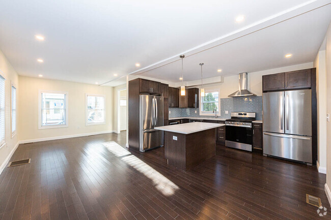
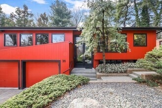
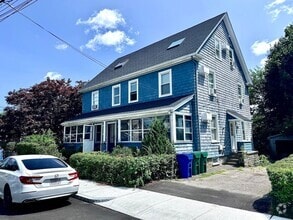
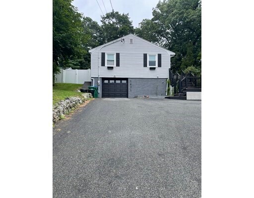
You May Also Like
Similar Rentals Nearby
What Are Walk Score®, Transit Score®, and Bike Score® Ratings?
Walk Score® measures the walkability of any address. Transit Score® measures access to public transit. Bike Score® measures the bikeability of any address.
What is a Sound Score Rating?
A Sound Score Rating aggregates noise caused by vehicle traffic, airplane traffic and local sources
1471 High St
Westwood, MA 02090