
Trio Apartments
621 E Colorado Blvd,
Pasadena, CA 91101
$2,686 - $4,161 Total Monthly Price
Studio - 2 Beds 13 Month Lease
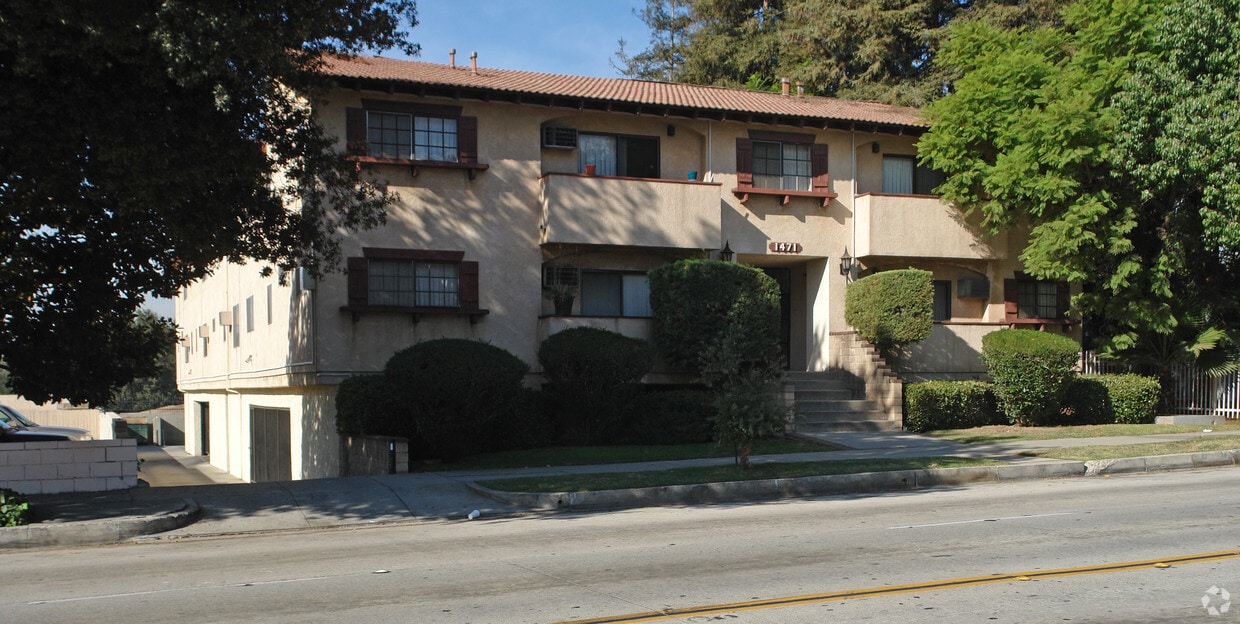
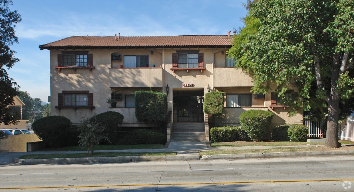

1471 Fair Oaks Ave offers a blend of comfort, style, and convenience. You'll find this community in the Northwest Pasadena area of Pasadena. The leasing staff is ready to help you find your new place. Drop by the leasing office to discuss your new apartment and make your move to 1471 Fair Oaks Ave.
1471 Fair Oaks Ave is an apartment community located in Los Angeles County and the 91103 ZIP Code. This area is served by the Pasadena Unified School District attendance zone.
Located at the base of the San Gabriel Mountains, Pasadena sits 11 miles northeast of downtown Los Angeles. The city combines historic architecture with modern living, featuring preserved Craftsman bungalows and stately homes along Orange Grove Boulevard. Old Pasadena's walkable streets house local shops, restaurants, and landmarks like the Pasadena Playhouse. One-bedroom apartments rent for $2,385 per month, while two-bedroom units average $3,059.
Home to the California Institute of Technology (Caltech) and the Jet Propulsion Laboratory (JPL), Pasadena boasts significant cultural attractions including the Norton Simon Museum and USC Pacific Asia Museum. Residents enjoy access to hiking trails in the Arroyo Seco and can explore neighborhoods ranging from South Lake Avenue to the historic Bungalow Heaven district. The annual Tournament of Roses Parade, a tradition since 1890, draws visitors from around the world.
Learn more about living in PasadenaCompare neighborhood and city base rent averages by bedroom.
| Northwest Pasadena | Pasadena, CA | |
|---|---|---|
| Studio | $1,444 | $1,971 |
| 1 Bedroom | $1,834 | $2,356 |
| 2 Bedrooms | $1,917 | $3,031 |
| 3 Bedrooms | $2,640 | $3,749 |
| Colleges & Universities | Distance | ||
|---|---|---|---|
| Colleges & Universities | Distance | ||
| Drive: | 5 min | 2.3 mi | |
| Drive: | 9 min | 3.1 mi | |
| Drive: | 8 min | 3.7 mi | |
| Drive: | 9 min | 4.0 mi |


Transportation options available in Pasadena include Memorial Park Station, located 1.8 miles from 1471 Fair Oaks Ave. 1471 Fair Oaks Ave is near Bob Hope, located 17.5 miles or 25 minutes away, and Los Angeles International, located 26.1 miles or 42 minutes away.
| Transit / Subway | Distance | ||
|---|---|---|---|
| Transit / Subway | Distance | ||
|
|
Drive: | 5 min | 1.8 mi |
|
|
Drive: | 6 min | 2.1 mi |
|
|
Drive: | 6 min | 2.7 mi |
|
|
Drive: | 5 min | 3.3 mi |
|
|
Drive: | 6 min | 4.3 mi |
| Commuter Rail | Distance | ||
|---|---|---|---|
| Commuter Rail | Distance | ||
|
|
Drive: | 14 min | 10.0 mi |
|
|
Drive: | 21 min | 11.1 mi |
|
|
Drive: | 17 min | 12.1 mi |
|
|
Drive: | 22 min | 13.3 mi |
| Drive: | 23 min | 15.1 mi |
| Airports | Distance | ||
|---|---|---|---|
| Airports | Distance | ||
|
Bob Hope
|
Drive: | 25 min | 17.5 mi |
|
Los Angeles International
|
Drive: | 42 min | 26.1 mi |
Scores provided by
Traffic
-Airport
-Businesses
-Scores provided by
HowLoud What is a Sound Score Rating? A Sound Score Rating aggregates noise caused by vehicle traffic, airplane traffic and local sources. How It WorksTime and distance from 1471 Fair Oaks Ave.
| Shopping Centers | Distance | ||
|---|---|---|---|
| Shopping Centers | Distance | ||
| Walk: | 6 min | 0.3 mi | |
| Drive: | 3 min | 1.2 mi | |
| Drive: | 2 min | 1.2 mi |
| Parks and Recreation | Distance | ||
|---|---|---|---|
| Parks and Recreation | Distance | ||
|
Kidspace Children's Museum
|
Drive: | 5 min | 2.0 mi |
|
Jet Propulsion Laboratory
|
Drive: | 4 min | 2.2 mi |
|
Eaton Canyon Nature Center
|
Drive: | 8 min | 3.9 mi |
|
Huntington Botanical Gardens
|
Drive: | 12 min | 5.1 mi |
|
Descanso Gardens
|
Drive: | 10 min | 5.6 mi |
| Hospitals | Distance | ||
|---|---|---|---|
| Hospitals | Distance | ||
| Drive: | 6 min | 2.5 mi | |
| Drive: | 7 min | 2.9 mi | |
| Drive: | 9 min | 5.6 mi |
| Military Bases | Distance | ||
|---|---|---|---|
| Military Bases | Distance | ||
| Drive: | 39 min | 27.6 mi | |
| Drive: | 49 min | 31.2 mi | |
| Drive: | 53 min | 38.5 mi |
Pets Allowed Fitness Center Pool In Unit Washer & Dryer Clubhouse Balcony
Pets Allowed Fitness Center Pool Maintenance on site High-Speed Internet Controlled Access EV Charging
What Are Walk Score®, Transit Score®, and Bike Score® Ratings?
Walk Score® measures the walkability of any address. Transit Score® measures access to public transit. Bike Score® measures the bikeability of any address.
What is a Sound Score Rating?
A Sound Score Rating aggregates noise caused by vehicle traffic, airplane traffic and local sources.

1471 Fair Oaks Ave
Pasadena, CA 91103


