
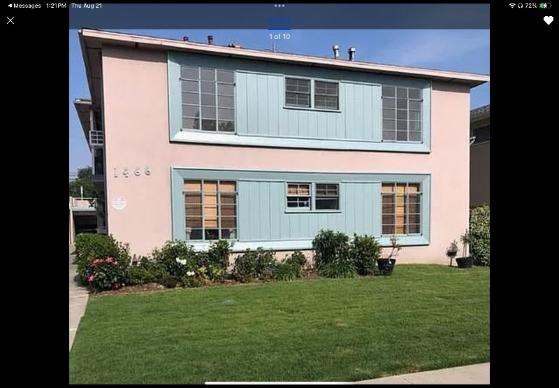
1466 S Sherbourne Dr Unit Z4
Los Angeles, CA 90035
-
Bedrooms
1
-
Bathrooms
1
-
Square Feet
675 sq ft
-
Available
Available Now
Highlights
- Pets Allowed
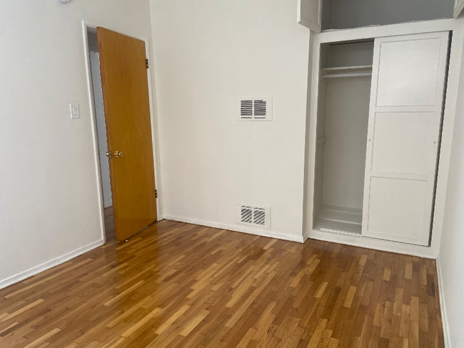
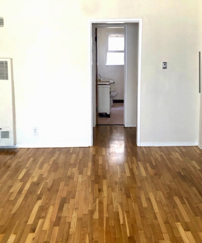
- Hardwood Floors

About This Home
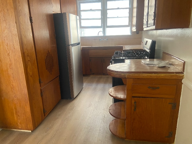
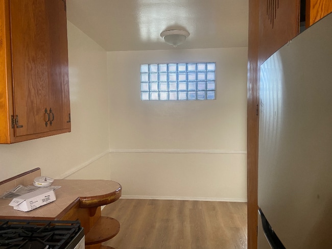
Property Id: 2097366 E-ZEE TO VIEW JUST CALL TO SCHEDULE ! LEASE SPECIAL $2,204/month!! Move in by Sept 15 and get Sept 15-30 free! Concession brings your net effective rent to $2,204/month on a 12-month lease. Gross rent: $2,300 (effective Oct 1). Updated 1-Bedroom in a quiet boutique 6-unit building in Pico-Robertson. Bright and inviting with an oversized kitchen featuring tiled counters, brand-new stainless steel refrigerator and stove, fresh flooring, plus a dining area. Real hardwood floors, oversized walk-in closet, A/C, and on-site washer/dryer. Includes 1 reserved parking space. Pets considered. Unbeatable location near Beverly Hills, Century City & Culver City. Enjoy trendy cafes, shops, and markets at your doorstep with easy freeway & transit access. E-ZEE TO VIEW! CALL TODAY!
1466 S Sherbourne Dr is an apartment community located in Los Angeles County and the 90035 ZIP Code.
Features
- Oven
- Refrigerator
- Hardwood Floors
Fees and Policies
The fees below are based on community-supplied data and may exclude additional fees and utilities.
- Dogs Allowed
-
Fees not specified
- Cats Allowed
-
Fees not specified
- Parking
-
Garage--
Details
Utilities Included
-
Water
-
Sewer
Contact
- Phone Number
- Contact
-
Source

- Oven
- Refrigerator
- Hardwood Floors
Pico-Robertson is a popular Los Angeles neighborhood situated directly south of Beverly Hills and east of Century City. Despite its location in the heart of glittery West Los Angeles near the Miracle Mile, Beverlywood, Carthay, and Cheviot Hills, Pico-Robertson is much more low-key. You won't find trendy hotspots and wild nightlife in Pico-Robertson, but you will find a strong sense of community and a quiet setting.
Pico-Robertson offers a unique collection of delis, bakeries, and more. It is named for the intersection of Pico Boulevard and Robertson Boulevard, and that's where you'll find the majority of the neighborhood's shops, restaurants, and cafes.
Learn more about living in Pico-Robertson| Colleges & Universities | Distance | ||
|---|---|---|---|
| Colleges & Universities | Distance | ||
| Drive: | 12 min | 4.6 mi | |
| Drive: | 12 min | 5.4 mi | |
| Drive: | 12 min | 5.9 mi | |
| Drive: | 12 min | 6.3 mi |
Transportation options available in Los Angeles include La Cienega/Jefferson, located 2.1 miles from 1466 S Sherbourne Dr Unit Z4. 1466 S Sherbourne Dr Unit Z4 is near Los Angeles International, located 9.2 miles or 19 minutes away, and Bob Hope, located 14.3 miles or 27 minutes away.
| Transit / Subway | Distance | ||
|---|---|---|---|
| Transit / Subway | Distance | ||
|
|
Drive: | 5 min | 2.1 mi |
|
|
Drive: | 5 min | 2.2 mi |
|
|
Drive: | 5 min | 3.0 mi |
|
|
Drive: | 7 min | 3.7 mi |
|
|
Drive: | 8 min | 3.7 mi |
| Commuter Rail | Distance | ||
|---|---|---|---|
| Commuter Rail | Distance | ||
|
|
Drive: | 17 min | 10.7 mi |
|
|
Drive: | 19 min | 10.8 mi |
|
|
Drive: | 21 min | 11.9 mi |
|
|
Drive: | 24 min | 12.2 mi |
|
|
Drive: | 26 min | 13.1 mi |
| Airports | Distance | ||
|---|---|---|---|
| Airports | Distance | ||
|
Los Angeles International
|
Drive: | 19 min | 9.2 mi |
|
Bob Hope
|
Drive: | 27 min | 14.3 mi |
Time and distance from 1466 S Sherbourne Dr Unit Z4.
| Shopping Centers | Distance | ||
|---|---|---|---|
| Shopping Centers | Distance | ||
| Walk: | 7 min | 0.4 mi | |
| Walk: | 8 min | 0.4 mi | |
| Walk: | 12 min | 0.6 mi |
| Parks and Recreation | Distance | ||
|---|---|---|---|
| Parks and Recreation | Distance | ||
|
Zimmer Children's Museum
|
Drive: | 4 min | 1.7 mi |
|
La Brea Tar Pits
|
Drive: | 4 min | 2.1 mi |
|
Virginia Robinson Gardens
|
Drive: | 9 min | 3.8 mi |
|
Kenneth Hahn State Recreation Area
|
Drive: | 12 min | 4.2 mi |
|
Mathias Botanical Garden
|
Drive: | 11 min | 5.0 mi |
| Hospitals | Distance | ||
|---|---|---|---|
| Hospitals | Distance | ||
| Drive: | 3 min | 1.2 mi | |
| Drive: | 3 min | 1.5 mi | |
| Drive: | 3 min | 1.6 mi |
| Military Bases | Distance | ||
|---|---|---|---|
| Military Bases | Distance | ||
| Drive: | 18 min | 10.8 mi |
You May Also Like
What Are Walk Score®, Transit Score®, and Bike Score® Ratings?
Walk Score® measures the walkability of any address. Transit Score® measures access to public transit. Bike Score® measures the bikeability of any address.
What is a Sound Score Rating?
A Sound Score Rating aggregates noise caused by vehicle traffic, airplane traffic and local sources
1466 S Sherbourne Dr
Los Angeles, CA 90035