
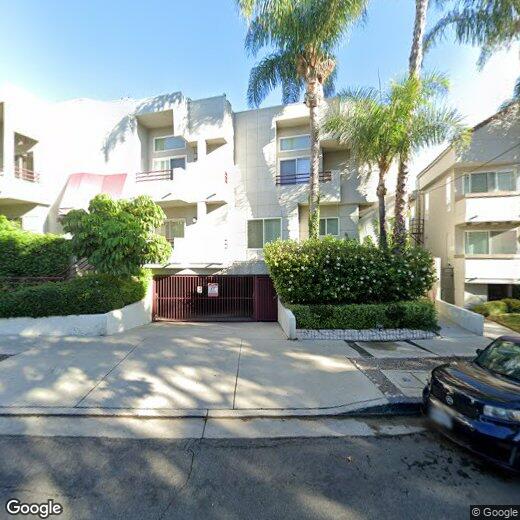
14631 Dickens St
14631 Dickens St
Sherman Oaks, CA 91403
Favorites
14631 Dickens St

Favorites
Check Back Soon for Upcoming Availability
| Beds | Baths | Average SF |
|---|---|---|
| 2 Bedrooms 2 Bedrooms 2 Br | 2.5 Baths 2.5 Baths 2.5 Ba | — |
14631 Dickens St,
Sherman Oaks,
CA
91403
Sherman Oaks sits in the heart of the San Fernando Valley, offering a grounded, residential feel while staying well-connected to the rest of Los Angeles. The neighborhood traces its roots to the early 20th century, when Gen. Moses Hazeltine Sherman developed the area as part of the Los Angeles Suburban Homes Company. Today, Sherman Oaks balances its historic character with the practicalities of modern city living. Ventura Boulevard runs through its core, lined with established restaurants, coffee shops, and local businesses that have served the community for decades. The nearby 101 and 405 freeways make commuting to major employment centers across the metro relatively straightforward.
The housing mix here leans toward mid-century apartment communities, garden-style buildings, and two-story walkups tucked along tree-lined streets.
Learn more about living in Sherman Oaks
Education
| Colleges & Universities | Distance | ||
|---|---|---|---|
| Colleges & Universities | Distance | ||
| Drive: | 9 min | 4.3 mi | |
| Drive: | 10 min | 7.4 mi | |
| Drive: | 15 min | 9.0 mi | |
| Drive: | 20 min | 10.1 mi |
14631 Dickens St is within 9 minutes or 4.3 miles from Valley College. It is also near New York Film Academy and UCLA.
Transportation options available in Sherman Oaks include Universal City/Studio City, located 6.5 miles from 14631 Dickens St. 14631 Dickens St is near Bob Hope, located 8.9 miles or 15 minutes away, and Los Angeles International, located 18.4 miles or 26 minutes away.
| Transit / Subway | Distance | ||
|---|---|---|---|
| Transit / Subway | Distance | ||
|
|
Drive: | 9 min | 6.5 mi |
|
|
Drive: | 10 min | 6.5 mi |
|
|
Drive: | 14 min | 9.5 mi |
|
|
Drive: | 13 min | 9.7 mi |
| Drive: | 14 min | 10.7 mi |
| Commuter Rail | Distance | ||
|---|---|---|---|
| Commuter Rail | Distance | ||
|
|
Drive: | 9 min | 4.8 mi |
|
|
Drive: | 15 min | 9.3 mi |
|
|
Drive: | 16 min | 9.8 mi |
| Drive: | 16 min | 10.1 mi | |
|
|
Drive: | 18 min | 10.5 mi |
| Airports | Distance | ||
|---|---|---|---|
| Airports | Distance | ||
|
Bob Hope
|
Drive: | 15 min | 8.9 mi |
|
Los Angeles International
|
Drive: | 26 min | 18.4 mi |
Walkability Near 14631 Dickens St Sherman Oaks, CA 91403
Getting Around
 What do Walkability, Transit, Drivability, and Bikeability mean?
Walkability measures the walking distance to day-to-day needs.
Transit measures access to public transportation.
Drivability measures congestion, parking availability, and access to major roads.
Bikeability measures the suitability for cycling.
How It Works
What do Walkability, Transit, Drivability, and Bikeability mean?
Walkability measures the walking distance to day-to-day needs.
Transit measures access to public transportation.
Drivability measures congestion, parking availability, and access to major roads.
Bikeability measures the suitability for cycling.
How It Works
Moderately Walkable
Walkability
70
/ 100
Some Public Transit
Transit
40
/ 100
Exceptionally Drivable
Drivability
90
/ 100
Fairly Bikeable
Bikeability
40
/ 100
Scores provided by
-
Soundscore™
-
/ 100
Traffic
-Airport
-Businesses
-Scores provided by
HowLoud What is a Sound Score Rating? A Sound Score Rating aggregates noise caused by vehicle traffic, airplane traffic and local sources. How It WorksTime and distance from 14631 Dickens St.
| Shopping Centers | Distance | ||
|---|---|---|---|
| Shopping Centers | Distance | ||
| Walk: | 2 min | 0.1 mi | |
| Walk: | 4 min | 0.2 mi | |
| Walk: | 7 min | 0.4 mi |
14631 Dickens St has 3 shopping centers within 0.4 mile, which is about a 7-minute walk. The miles and minutes will be for the farthest away property.
| Parks and Recreation | Distance | ||
|---|---|---|---|
| Parks and Recreation | Distance | ||
|
Los Encinos State Historic Park
|
Drive: | 6 min | 2.9 mi |
|
The Japanese Garden
|
Drive: | 6 min | 3.4 mi |
|
Sepulveda Basin Wildlife Reserve
|
Drive: | 10 min | 3.8 mi |
|
Skirball Cultural Center
|
Drive: | 8 min | 4.4 mi |
|
Sooky Goldman Nature Center
|
Drive: | 15 min | 5.4 mi |
14631 Dickens St has 5 parks within 5.4 miles, including Los Encinos State Historic Park, Sepulveda Basin Wildlife Reserve, and Skirball Cultural Center.
| Hospitals | Distance | ||
|---|---|---|---|
| Hospitals | Distance | ||
| Walk: | 16 min | 0.9 mi | |
| Drive: | 4 min | 2.1 mi | |
| Drive: | 7 min | 3.8 mi |
14631 Dickens St has 3 hospitals within 3.8 miles, the nearest is Sherman Oaks Hospital which is 0.9 mile away and a 16 minute walk.
| Military Bases | Distance | ||
|---|---|---|---|
| Military Bases | Distance | ||
| Drive: | 27 min | 21.0 mi | |
| Drive: | 49 min | 37.8 mi | |
| Drive: | 52 min | 40.0 mi |
14631 Dickens St has 3 military bases within 40.0 miles, the nearest is Los Angeles Air Force Base which is 21.0 miles away and a 27 minute drive.
You May Also Like
Similar Rentals Nearby
-
-
-
-
-
-
2 Beds$6,351+3 Beds$4,555+Total Monthly PriceTotal Monthly Price NewPrices include base rent and required monthly fees of $155. Variable costs based on usage may apply.Base Rent:2 Beds$6,195+3 Beds$4,399+3 Months Free
Pets Allowed Fitness Center Dishwasher Kitchen In Unit Washer & Dryer Walk-In Closets
-
-
-
-
1 / 19


What Are Walk Score®, Transit Score®, and Bike Score® Ratings?
Walk Score® measures the walkability of any address. Transit Score® measures access to public transit. Bike Score® measures the bikeability of any address.
What is a Sound Score Rating?
A Sound Score Rating aggregates noise caused by vehicle traffic, airplane traffic and local sources.
14631 Dickens St
Sherman Oaks, CA 91403