
1430 Tremont St
Boston, MA 02120
-
Bedrooms
4
-
Bathrooms
2
-
Square Feet
1,700 sq ft
-
Available
Available Sep 1, 2026

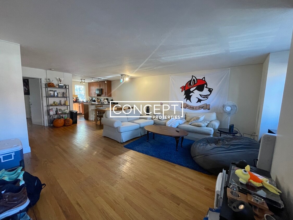
About This Home
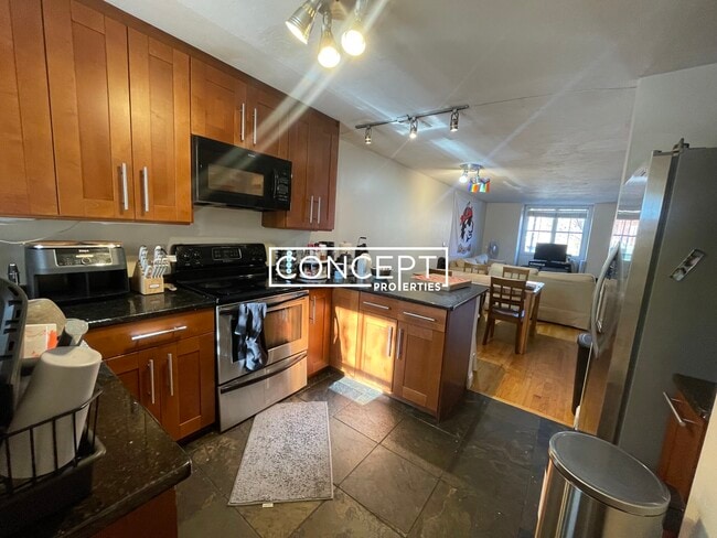
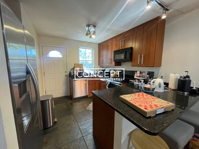
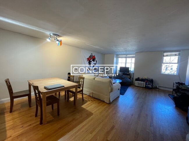
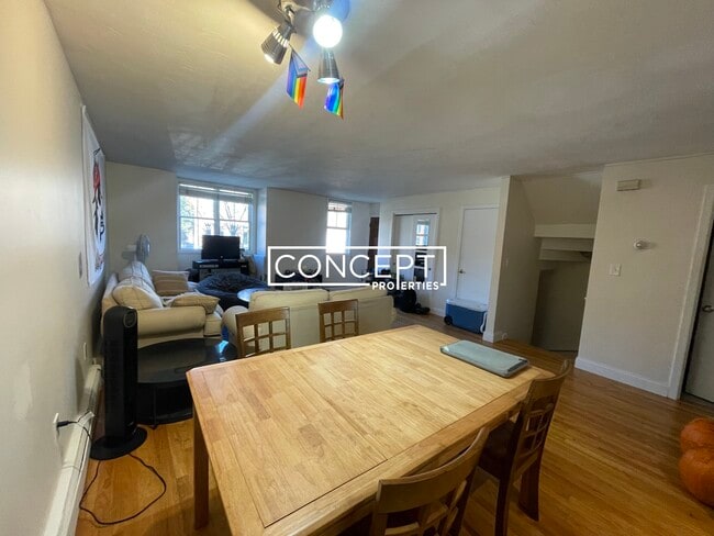
MISSION HILL 4 Bedroom 2 Bathroom TOWNHOUSE AVAILABLE 09/01!! Open Concept Washer/Dryer in Unit Gas Heating Back Porch Dishwasher Duplex Equal Sized Rooms Livingroom Storage Natural Sunlight Renovated Hardwood Floor Modern Kitchen 2 Full Modern Bathroom 1 Parking Spot INCLUDED Area Amenities Northeastern University Wentworth Southend Back Bay Fenway Bus: 14 Centre St @ Gardner St (0.20 mi) Bus: 22 Tremont St @ Roxbury Crossing Station (0.09 mi) Bus: 42 Washington St @ Bartlett St (0.55 mi) Bus: 45 205 Roxbury St (0.28 mi) Subway: Orange Line Roxbury Crossing (0.07 mi) Bus: 28 Malcolm X Blvd @ Tremont St (0.16 mi) Bus: 66 Tremont St @ Columbus Ave (0.06 mi) Bus: 39 Huntington Ave @ Longwood Ave (0.34 mi) Tram: E Longwood Medical Area (0.35 mi) Bus: 47 Ruggles St @ Huntington Ave (0.41 mi) Bus: 43 Tremont St @ Columbus Ave (0.56 mi) Rail: Providence/Stoughton Line Ruggles (0.50 mi) Bus: 19 Louis Prang St @ Evans Way (0.47 mi) Fee Disclosure: Ap
1430 Tremont St is a townhome located in Suffolk County and the 02120 ZIP Code.
Townhome Features
Washer/Dryer
Dishwasher
Granite Countertops
Microwave
- Washer/Dryer
- Dishwasher
- Disposal
- Granite Countertops
- Stainless Steel Appliances
- Pantry
- Eat-in Kitchen
- Microwave
- Range
- Dining Room
- Porch
Fees and Policies
The fees below are based on community-supplied data and may exclude additional fees and utilities.
- Cats Allowed
-
Fees not specified
-
Weight limit--
-
Pet Limit--
- Parking
-
Surface Lot--
Details
Lease Options
-
12 Months
Contact
- Phone Number
- Website View Property Website
- Contact
-
Source

- Washer/Dryer
- Dishwasher
- Disposal
- Granite Countertops
- Stainless Steel Appliances
- Pantry
- Eat-in Kitchen
- Microwave
- Range
- Dining Room
- Porch
Twenty minutes southwest of downtown Boston sits Highland Park, a primarily- residential neighborhood full of beautiful historic homes and apartments along tree-lined streets. The community features over a dozen parks and public green spaces, giving all residents easy access to trails, playgrounds, and historic sites wherever they may live.
The local dining scene is quite unique, with several African and Middle Eastern restaurants and cafes around the neighborhood. MBTA rail service on the west side of the neighborhood makes it easy for folks to get around the city for or leisure.
Learn more about living in Highland Park| Colleges & Universities | Distance | ||
|---|---|---|---|
| Colleges & Universities | Distance | ||
| Walk: | 9 min | 0.5 mi | |
| Walk: | 10 min | 0.5 mi | |
| Walk: | 10 min | 0.6 mi | |
| Drive: | 4 min | 1.6 mi |
Transportation options available in Boston include Roxbury Crossing Station, located 0.2 mile from 1430 Tremont St. 1430 Tremont St is near General Edward Lawrence Logan International, located 6.4 miles or 13 minutes away.
| Transit / Subway | Distance | ||
|---|---|---|---|
| Transit / Subway | Distance | ||
|
|
Walk: | 3 min | 0.2 mi |
|
|
Walk: | 9 min | 0.5 mi |
|
|
Walk: | 10 min | 0.5 mi |
|
|
Walk: | 10 min | 0.6 mi |
|
|
Walk: | 11 min | 0.6 mi |
| Commuter Rail | Distance | ||
|---|---|---|---|
| Commuter Rail | Distance | ||
|
|
Walk: | 10 min | 0.6 mi |
| Drive: | 4 min | 1.8 mi | |
|
|
Drive: | 3 min | 1.8 mi |
|
|
Drive: | 7 min | 2.1 mi |
|
|
Drive: | 9 min | 4.7 mi |
| Airports | Distance | ||
|---|---|---|---|
| Airports | Distance | ||
|
General Edward Lawrence Logan International
|
Drive: | 13 min | 6.4 mi |
Time and distance from 1430 Tremont St.
| Shopping Centers | Distance | ||
|---|---|---|---|
| Shopping Centers | Distance | ||
| Walk: | 16 min | 0.9 mi | |
| Drive: | 3 min | 1.4 mi | |
| Drive: | 4 min | 1.7 mi |
| Parks and Recreation | Distance | ||
|---|---|---|---|
| Parks and Recreation | Distance | ||
|
Roxbury Heritage State Park
|
Walk: | 8 min | 0.4 mi |
|
Charles River Reservation
|
Drive: | 4 min | 2.0 mi |
|
John Fitzgerald Kennedy National Historic Site
|
Drive: | 6 min | 2.1 mi |
|
Lower Neponset River Trail
|
Drive: | 4 min | 2.3 mi |
|
Coit Observatory
|
Drive: | 5 min | 2.4 mi |
| Hospitals | Distance | ||
|---|---|---|---|
| Hospitals | Distance | ||
| Walk: | 13 min | 0.7 mi | |
| Walk: | 14 min | 0.7 mi | |
| Walk: | 14 min | 0.7 mi |
| Military Bases | Distance | ||
|---|---|---|---|
| Military Bases | Distance | ||
| Drive: | 28 min | 15.1 mi | |
| Drive: | 31 min | 15.6 mi |
You May Also Like
What Are Walk Score®, Transit Score®, and Bike Score® Ratings?
Walk Score® measures the walkability of any address. Transit Score® measures access to public transit. Bike Score® measures the bikeability of any address.
What is a Sound Score Rating?
A Sound Score Rating aggregates noise caused by vehicle traffic, airplane traffic and local sources
1430 Tremont St
Boston, MA 02120