

$4,000
/ Month
14201 Dormansville Blvd
Upper Marlboro, MD 20774
2 Weeks Ago
|
Edit
Favorites
14201 Dormansville Blvd

Favorites
Check Back Soon for Upcoming Availability
| Beds | Baths | Average SF |
|---|---|---|
| 4 Bedrooms 4 Bedrooms 4 Br | 4 Baths 4 Baths 4 Ba | 4,441 SF |
About This Property
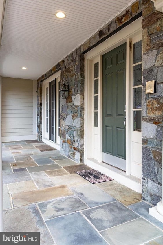
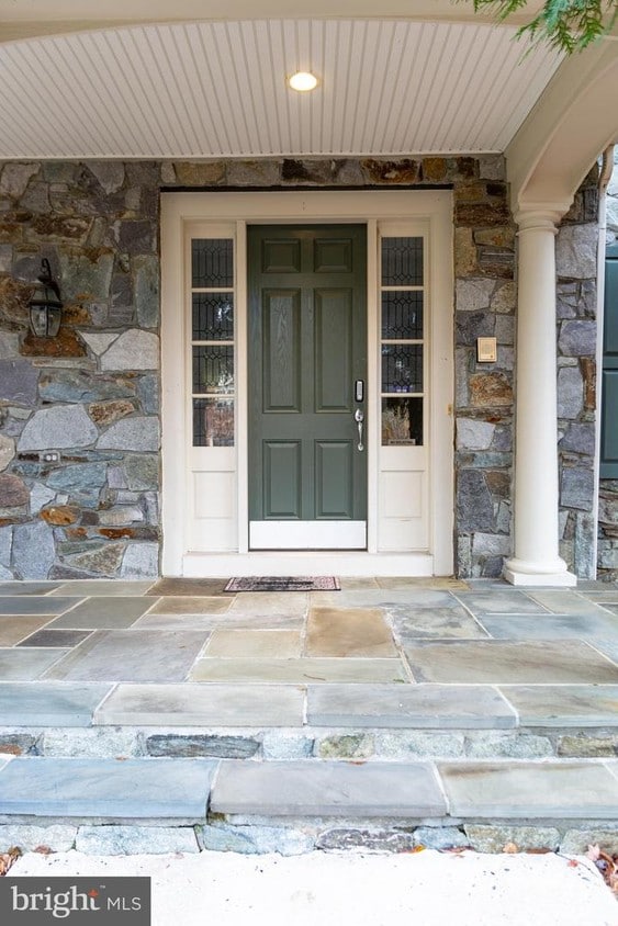
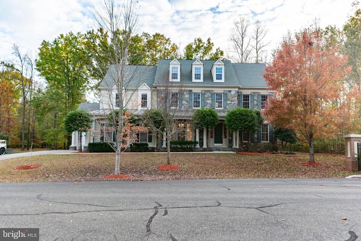
Oak Creek Community a Gated Golf Club community in Prince George's County. 18 hole champion golf course, The Grove Restaurant and Pro Shop, are all a part of this one of kind community. This home is a 6,700 square foot on all 3 levels with a 3 car garage. Home has 4 bedrooms and 3.5 bathroom, a large kitchen with stainless steel appliance, an office, tray ceiling recessed lighting, Jacuzzi, fireplaces, dual vanity and much more too much to list. Home also has a wet bar, and gym in the basement with an extra bedroom and bathroom. Community has a lot to offer from the Swimming pool to tennis court,community gym, soccer, and baseball field and much more. *****No Pets******
14201 Dormansville Blvd is a house located in Prince George's County and the 20774 ZIP Code. This area is served by the Prince George's County Public Schools attendance zone.
House Features
- Fireplace
- Dishwasher
- Basement
14201 Dormansville Blvd,
Upper Marlboro,
MD
20774
Popularly known as a government district in Prince George’s County in the state of Maryland, Upper Marlboro offers residents a small-town vibe. Lined with an assortment of businesses, Main Street provides immediate access to the courthouse and county administrative building.
You'll find a combination of busy thoroughfares within the city and a quiet atmosphere in the residential suburbs. To the west of downtown are residential homes on quiet streets with mostly single-family homes, parks, and civic centers. Take a short walk from Main Street to access the Prince George’s County Public system. Aside from the few grocery stores and big-box retailers, the rural nature of the area is the biggest draw for residents. But it also means you might have to head to surrounding areas for more shopping and restaurant options.
Learn more about living in Greater Upper MarlboroBelow are rent ranges for similar nearby apartments
Amenities
- Fireplace
- Dishwasher
- Basement
Education
| Colleges & Universities | Distance | ||
|---|---|---|---|
| Colleges & Universities | Distance | ||
| Drive: | 11 min | 4.9 mi | |
| Drive: | 14 min | 7.3 mi | |
| Drive: | 27 min | 14.1 mi | |
| Drive: | 31 min | 16.4 mi |
14201 Dormansville Blvd is within 11 minutes or 4.9 miles from Prince George's Comm. Coll.. It is also near Univ. of Md. Univ. Coll. and Bowie State University.
Schools


Public Elementary School
Grades K-5
517 Students
Attendance Zone
Public Elementary School
Grades PK-5
448 Students
Nearby
Public Middle School
Grades 6-8
915 Students
Attendance Zone
Public High School
Grades 9-12
2,257 Students
Attendance Zone
Private Elementary & Middle School
Grades PK-8
14 Students
Nearby
Private Elementary, Middle & High School
Grades PK-12
310 Students
Nearby
Private Middle & High School
Grades 6-12
120 Students
Nearby
School data provided by
 The GreatSchools Rating helps parents compare schools within a state based on a variety of school quality indicators and provides a helpful picture of how effectively each school serves all of its students. Ratings are on a scale of 1 (below average) to 10 (above average) and can include test scores, college readiness, academic progress, advanced courses, equity, discipline and attendance data. We also advise parents to visit schools, consider other information on school performance and programs, and consider family needs as part of the school selection process.
View GreatSchools Rating Methodology
Data provided by GreatSchools.org © 2026. All rights reserved.
View GreatSchools Rating Methodology
Data provided by GreatSchools.org © 2026. All rights reserved.
Transportation options available in Upper Marlboro include Largo Town Center, located 6.6 miles from 14201 Dormansville Blvd. 14201 Dormansville Blvd is near Ronald Reagan Washington Ntl, located 23.1 miles or 38 minutes away, and Baltimore/Washington International Thurgood Marshall, located 31.0 miles or 50 minutes away.
| Transit / Subway | Distance | ||
|---|---|---|---|
| Transit / Subway | Distance | ||
|
|
Drive: | 14 min | 6.6 mi |
|
|
Drive: | 15 min | 8.3 mi |
|
|
Drive: | 16 min | 9.5 mi |
|
|
Drive: | 19 min | 10.3 mi |
|
|
Drive: | 21 min | 11.5 mi |
| Commuter Rail | Distance | ||
|---|---|---|---|
| Commuter Rail | Distance | ||
| Drive: | 21 min | 11.5 mi | |
|
|
Drive: | 21 min | 11.5 mi |
| Drive: | 22 min | 12.1 mi | |
|
Bowie State Marc Sb
|
Drive: | 27 min | 14.1 mi |
| Drive: | 26 min | 14.3 mi |
| Airports | Distance | ||
|---|---|---|---|
| Airports | Distance | ||
|
Ronald Reagan Washington Ntl
|
Drive: | 38 min | 23.1 mi |
|
Baltimore/Washington International Thurgood Marshall
|
Drive: | 50 min | 31.0 mi |
Walkability Near 14201 Dormansville Blvd Upper Marlboro, MD 20774
Getting Around
 What do Walkability, Transit, Drivability, and Bikeability mean?
Walkability measures the walking distance to day-to-day needs.
Transit measures access to public transportation.
Drivability measures congestion, parking availability, and access to major roads.
Bikeability measures the suitability for cycling.
How It Works
What do Walkability, Transit, Drivability, and Bikeability mean?
Walkability measures the walking distance to day-to-day needs.
Transit measures access to public transportation.
Drivability measures congestion, parking availability, and access to major roads.
Bikeability measures the suitability for cycling.
How It Works
Not Walkable
Walkability
10
/ 100
Minimal Public Transit
Transit
0
/ 100
Exceptionally Drivable
Drivability
100
/ 100
Fairly Bikeable
Bikeability
40
/ 100
Scores provided by
-
Soundscore™
-
/ 100
Traffic
-Airport
-Businesses
-Scores provided by
HowLoud What is a Sound Score Rating? A Sound Score Rating aggregates noise caused by vehicle traffic, airplane traffic and local sources. How It WorksTime and distance from 14201 Dormansville Blvd.
| Shopping Centers | Distance | ||
|---|---|---|---|
| Shopping Centers | Distance | ||
| Drive: | 8 min | 3.5 mi | |
| Drive: | 9 min | 3.8 mi | |
| Drive: | 8 min | 3.9 mi |
14201 Dormansville Blvd has 3 shopping centers within 3.9 miles, which is about a 8-minute drive. The miles and minutes will be for the farthest away property.
| Parks and Recreation | Distance | ||
|---|---|---|---|
| Parks and Recreation | Distance | ||
|
Watkins Nature Center
|
Drive: | 6 min | 2.5 mi |
|
Old Maryland Farm
|
Drive: | 6 min | 2.6 mi |
|
Watkins Regional Park
|
Drive: | 10 min | 3.5 mi |
|
School House Pond
|
Drive: | 13 min | 6.4 mi |
|
Queen Anne Natural Area
|
Drive: | 18 min | 8.6 mi |
14201 Dormansville Blvd has 5 parks within 8.6 miles, including Watkins Nature Center, Old Maryland Farm, and Watkins Regional Park.
| Hospitals | Distance | ||
|---|---|---|---|
| Hospitals | Distance | ||
| Drive: | 21 min | 11.6 mi | |
| Drive: | 22 min | 12.3 mi |
14201 Dormansville Blvd is 11.6 miles from University of Maryland Prince George's Hospital Center, and is convenient to other hospitals, including Doctors Community Hospital.
| Military Bases | Distance | ||
|---|---|---|---|
| Military Bases | Distance | ||
| Drive: | 21 min | 11.1 mi |
14201 Dormansville Blvd is 11.1 miles and a 21 minute drive from Andrews Airforce Base.
You May Also Like
Similar Rentals Nearby


What Are Walk Score®, Transit Score®, and Bike Score® Ratings?
Walk Score® measures the walkability of any address. Transit Score® measures access to public transit. Bike Score® measures the bikeability of any address.
What is a Sound Score Rating?
A Sound Score Rating aggregates noise caused by vehicle traffic, airplane traffic and local sources.
14201 Dormansville Blvd
Upper Marlboro, MD 20774