1 / 53


Bedrooms
2
Bathrooms
1.5
Square Feet
960 sq ft
Available
Available Aug 7

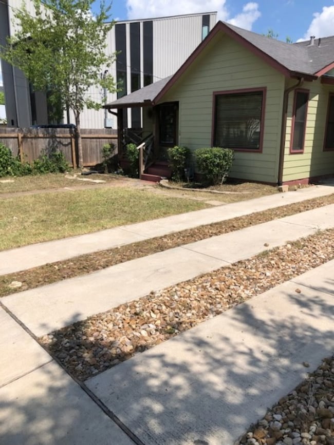
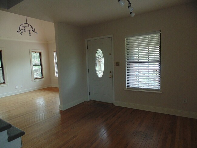
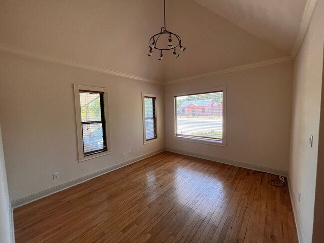
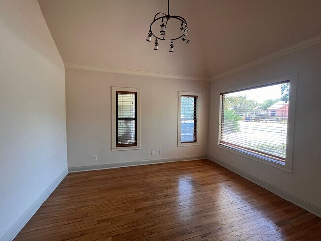
2bed/1.5 bath + attic space that could be used for storage or a study space. Wood floors, stainless steel appliances and lots of natural light. Fenced in yard with a storage shed. Available for August 2026 prelease. - Tenants pay all utilities - Security deposit due within 48 hours after application approval - First full months rent due after lease signing Pet Fees: $200 pet deposit + $200 pet fee/per pet
1410 W 51St St is a house located in Travis County and the 78756 ZIP Code. This area is served by the Austin Independent attendance zone.
The fees listed below are community-provided and may exclude utilities or add-ons. All payments are made directly to the property and are non-refundable unless otherwise specified. Use the Cost Calculator to determine costs based on your needs.
Property Fee Disclaimer: Based on community-supplied data and independent market research. Subject to change without notice. May exclude fees for mandatory or optional services and usage-based utilities.
Situated between Allandale and North Loop, Brentwood is roughly five miles north of Downtown Austin. Its proximity to downtown, combined with its cozy, tree-filled suburban vibe, makes Brentwood a terrific option for those looking for a quiet, attractive neighborhood still near the city. With ample sidewalks and bike lanes, Brentwood is great for pedestrians. With the University of Texas at Austin just three miles south, Brentwood provides a more peaceful option for students as well.
With its excellent schools and tidy bungalows, Brentwood is one of Austin’s top neighborhoods. It is known for its close-knit, community and local businesses that have served the neighborhood for decades. Brentwood Park serves as a gathering place for residents, providing tennis and basketball courts, playgrounds, and a swimming pool. The park is also the location of annual events like the Violet Crown Festival.
Learn more about living in Brentwood| Colleges & Universities | Distance | ||
|---|---|---|---|
| Colleges & Universities | Distance | ||
| Drive: | 8 min | 3.8 mi | |
| Drive: | 9 min | 5.5 mi | |
| Drive: | 11 min | 5.7 mi | |
| Drive: | 14 min | 6.8 mi |


Transportation options available in Austin include Highland Station, located 2.0 miles from 1410 W 51st St. 1410 W 51st St is near Austin-Bergstrom International, located 14.5 miles or 27 minutes away.
| Transit / Subway | Distance | ||
|---|---|---|---|
| Transit / Subway | Distance | ||
| Drive: | 5 min | 2.0 mi | |
| Drive: | 6 min | 2.3 mi | |
| Drive: | 9 min | 4.6 mi | |
| Drive: | 9 min | 5.5 mi | |
| Drive: | 10 min | 5.9 mi |
| Commuter Rail | Distance | ||
|---|---|---|---|
| Commuter Rail | Distance | ||
|
|
Drive: | 11 min | 6.1 mi |
|
|
Drive: | 42 min | 33.9 mi |
|
|
Drive: | 44 min | 36.0 mi |
| Airports | Distance | ||
|---|---|---|---|
| Airports | Distance | ||
|
Austin-Bergstrom International
|
Drive: | 27 min | 14.5 mi |
Time and distance from 1410 W 51st St.
| Shopping Centers | Distance | ||
|---|---|---|---|
| Shopping Centers | Distance | ||
| Walk: | 4 min | 0.2 mi | |
| Walk: | 6 min | 0.3 mi | |
| Walk: | 8 min | 0.4 mi |
| Parks and Recreation | Distance | ||
|---|---|---|---|
| Parks and Recreation | Distance | ||
|
Elisabet Ney Museum
|
Drive: | 4 min | 1.8 mi |
|
Beverly S. Sheffield Northwest District Park
|
Drive: | 6 min | 2.3 mi |
|
Shoal Creek Greenbelt Park
|
Drive: | 6 min | 2.6 mi |
|
Bright Leaf Preserve
|
Drive: | 7 min | 3.3 mi |
|
Mayfield Park and Preserve
|
Drive: | 6 min | 3.3 mi |
| Hospitals | Distance | ||
|---|---|---|---|
| Hospitals | Distance | ||
| Drive: | 3 min | 1.4 mi | |
| Drive: | 3 min | 1.4 mi | |
| Drive: | 4 min | 1.8 mi |
| Military Bases | Distance | ||
|---|---|---|---|
| Military Bases | Distance | ||
| Drive: | 87 min | 71.0 mi | |
| Drive: | 90 min | 71.8 mi |
Pets Allowed Dishwasher In Unit Washer & Dryer Maintenance on site Stainless Steel Appliances Granite Countertops


What Are Walk Score®, Transit Score®, and Bike Score® Ratings?
Walk Score® measures the walkability of any address. Transit Score® measures access to public transit. Bike Score® measures the bikeability of any address.
What is a Sound Score Rating?
A Sound Score Rating aggregates noise caused by vehicle traffic, airplane traffic and local sources
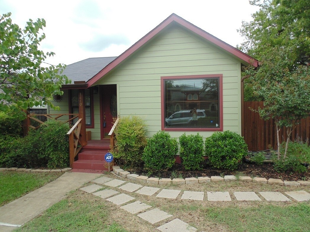
1410 W 51st St
Austin, TX 78756


