


$6,800
Total Monthly Price
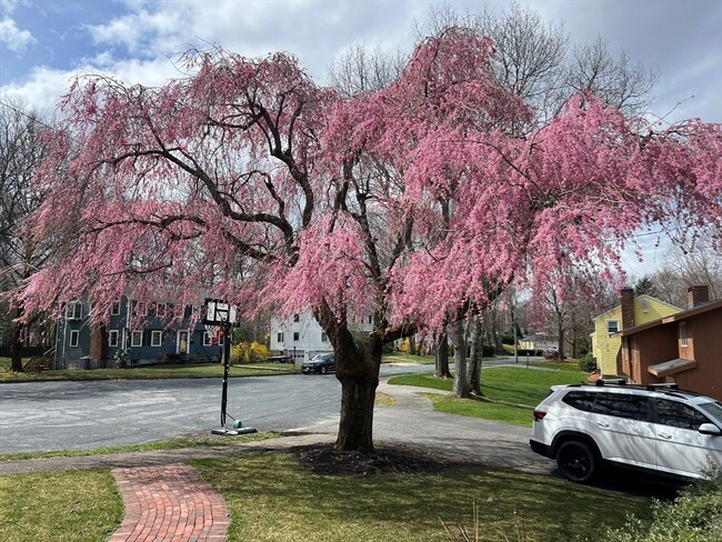
14 Lilac Cir
Wellesley, MA 02482
Today
|
Edit
Favorites
781-771-5572
-
Bedrooms
6
-
Bathrooms
3
-
Square Feet
3,400 sq ft
-
Available
Not Available
Highlights
- Deck
- Property is near public transit and schools
- Living Room with Fireplace
- Wood Flooring
- 2 Fireplaces
- Great Room
14 Lilac Cir

Favorites
About This Home
$6,800 deposit,
Not Available
¡Ubicación fabulosa! Cerca del centro y del tren. Casa amplia, lista para entrar a vivir, en una calle sin salida. Sala, comedor, cocina/desayunador, 4 dormitorios, dos baños completos (uno con el dormitorio principal) en la planta baja. Preciosa planta baja con salida al exterior, sala familiar, 2 o 3 dormitorios, oficina y baño completo. Puertas francesas que dan a la terraza con vista a un hermoso jardín cercado. Aire acondicionado central. Garaje para 2 autos con entrada directa. Se admiten mascotas según el caso. ¡No se la pierda! MLS# 73352155
14 Lilac Cir is a house located in Norfolk County and the 02482 ZIP Code. This area is served by the Wellesley attendance zone.
* Price shown is total price based on community-supplied monthly required fees. Excludes user-selected optional fees and variable or usage-based fees and required charges due at or prior to move-in or at move-out. Price, availability, fees, and any applicable rent special are subject to change without notice.
* Square footage definitions vary. Displayed square footage is approximate.
Home Details
Home Type
Single Family Detached Home
Year Built
Built in 1965
Bedrooms and Bathrooms
Bathtub with Shower
Primary bedroom located on second floor
Bathtub Includes Tile Surround
Separate Shower
3 Full Bathrooms
6 Bedrooms
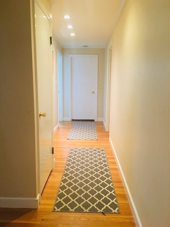
Flooring
Wood
Ceramic Tile
Home Design
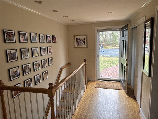
Entry on the 1st floor
Interior Spaces
Living Room with Fireplace
2 Fireplaces
Great Room
Home Office
Bay Window
French Doors
Dining Area
3,400 Sq Ft Home
Kitchen
Solid Surface Countertops
Breakfast Area or Nook
Stainless Steel Appliances
Range
Dishwasher
Disposal
Laundry
Dryer
Laundry on main level
Washer
Listing and Financial Details
Security Deposit $6,800
Assessor Parcel Number 263205
Rent includes occupancy only
Location
Property is near public transit and schools
Lot Details
0.57 Acre Lot
Outdoor Features
Deck
Parking
2 Car Garage
4 Open Parking Spaces
Schools
Sprague Elementary School
WMS Middle School
Wellesley High School
Utilities
Cooling Available
Heating System Uses Natural Gas
Community Details
Amenities
Shops
Overview
No Home Owners Association
Pet Policy
Call for details about the types of pets allowed
Fees and Policies
The fees listed below are community-provided and may exclude utilities or add-ons. All payments are made directly to the property and are non-refundable unless otherwise specified. Use the Cost Calculator to determine costs based on your needs.
-
One-Time Basics
-
Due at Move-In
-
Security Deposit - RefundableCharged per unit.$6,800
-
-
Due at Move-In
Property Fee Disclaimer: Based on community-supplied data and independent market research. Subject to change without notice. May exclude fees for mandatory or optional services and usage-based utilities.
Contact
- Listed by Jodie Zinna | Coldwell Banker Realty - Wellesley
- Phone Number
-
Source
 MLS Property Information Network
The property listing data and information set forth herein were provided to MLS Property Information Network, Inc. from third party sources, including sellers, lessors and public records, and were compiled by MLS Property Information Network, Inc. The property listing data and information are for the personal, non-commercial use of consumers having a good faith interest in purchasing or leasing listed properties of the type displayed to them and may not be used for any purpose other than to identify prospective properties which such consumers may have a good faith interest in purchasing or leasing. MLS Property Information Network, Inc. and its subscribers disclaim any and all representations and warranties as to the accuracy of the property listing data and information set forth herein. All properties are subject to prior sale, change or withdrawal. Copyright © 2026 MLS Property Information Network, Inc. All rights reserved.
Location
Get Directions
Just west of Boston and East of Worcester sits Metro West, a region that houses a group of towns and cities with significant historical backgrounds. A total of 19 municipalities make up the core of this community, but other municipalities are considered to be a part of the Interstate 495/Metro West Corridor.
Learn more about living in Metro West
Amenities
- Lavavajillas
- Zona de eliminación de desechos
- Fogón
- Nevera
- Cubierta
Education
| Colleges & Universities | Distance | ||
|---|---|---|---|
| Colleges & Universities | Distance | ||
| Drive: | 6 min | 2.0 mi | |
| Drive: | 7 min | 2.9 mi | |
| Drive: | 15 min | 6.6 mi | |
| Drive: | 14 min | 7.5 mi |
14 Lilac Cir is within 6 minutes or 2.0 miles from Wellesley College. It is also near Babson College and Brandeis University.
Schools


Public Elementary School
Grades PK-5
699 Students
Nearby
Public Elementary School
Grades K-5
287 Students
Attendance Zone
Public Middle School
Grades 6-8
922 Students
Attendance Zone
Public High School
Grades 9-12
1,412 Students
Attendance Zone
Private Elementary & Middle School
Grades PK-8
185 Students
Nearby
Private Middle & High School
Grades 6-12
475 Students
Nearby
School data provided by
 The GreatSchools Rating helps parents compare schools within a state based on a variety of school quality indicators and provides a helpful picture of how effectively each school serves all of its students. Ratings are on a scale of 1 (below average) to 10 (above average) and can include test scores, college readiness, academic progress, advanced courses, equity, discipline and attendance data. We also advise parents to visit schools, consider other information on school performance and programs, and consider family needs as part of the school selection process.
View GreatSchools Rating Methodology
Data provided by GreatSchools.org © 2026. All rights reserved.
View GreatSchools Rating Methodology
Data provided by GreatSchools.org © 2026. All rights reserved.
Transportation options available in Wellesley include Woodland Station, located 4.1 miles from 14 Lilac Cir. 14 Lilac Cir is near General Edward Lawrence Logan International, located 18.1 miles or 30 minutes away, and Worcester Regional, located 31.5 miles or 54 minutes away.
| Transit / Subway | Distance | ||
|---|---|---|---|
| Transit / Subway | Distance | ||
|
|
Drive: | 8 min | 4.1 mi |
|
|
Drive: | 10 min | 4.2 mi |
|
|
Drive: | 9 min | 4.8 mi |
|
|
Drive: | 11 min | 5.4 mi |
|
|
Drive: | 11 min | 5.6 mi |
| Commuter Rail | Distance | ||
|---|---|---|---|
| Commuter Rail | Distance | ||
|
|
Drive: | 3 min | 1.3 mi |
|
|
Drive: | 4 min | 2.1 mi |
|
|
Drive: | 7 min | 2.9 mi |
|
|
Drive: | 7 min | 3.7 mi |
|
|
Drive: | 10 min | 4.8 mi |
| Airports | Distance | ||
|---|---|---|---|
| Airports | Distance | ||
|
General Edward Lawrence Logan International
|
Drive: | 30 min | 18.1 mi |
|
Worcester Regional
|
Drive: | 54 min | 31.5 mi |
Time and distance from 14 Lilac Cir.
| Shopping Centers | Distance | ||
|---|---|---|---|
| Shopping Centers | Distance | ||
| Walk: | 17 min | 0.9 mi | |
| Drive: | 3 min | 1.2 mi | |
| Drive: | 4 min | 1.4 mi |
14 Lilac Cir has 3 shopping centers within 1.4 miles, which is about a 4-minute drive. The miles and minutes will be for the farthest away property.
| Parks and Recreation | Distance | ||
|---|---|---|---|
| Parks and Recreation | Distance | ||
|
Whitin Observatory
|
Drive: | 4 min | 1.2 mi |
|
Wellesley College Botanic Gardens
|
Drive: | 3 min | 1.4 mi |
|
Weezie's Garden for Children
|
Drive: | 9 min | 3.3 mi |
|
Elm Bank Reservation
|
Drive: | 9 min | 3.3 mi |
|
Horticultural Society at Elm Bank
|
Drive: | 11 min | 3.5 mi |
14 Lilac Cir has 5 parks within 3.5 miles, including Whitin Observatory, Wellesley College Botanic Gardens, and Horticultural Society at Elm Bank.
| Hospitals | Distance | ||
|---|---|---|---|
| Hospitals | Distance | ||
| Drive: | 7 min | 3.9 mi | |
| Drive: | 9 min | 4.8 mi | |
| Drive: | 14 min | 7.6 mi |
14 Lilac Cir has 3 hospitals within 7.6 miles, the nearest is Newton - Wellesley Hospital which is 3.9 miles away and a 7 minute drive.
| Military Bases | Distance | ||
|---|---|---|---|
| Military Bases | Distance | ||
| Drive: | 9 min | 4.4 mi | |
| Drive: | 26 min | 14.0 mi |
14 Lilac Cir is 4.4 miles from US Military Reservation, and is convenient to other military bases, including Hanscom Air Force Base.
You May Also Like
Similar Rentals Nearby
-
-

-

-

-

-

-

-
 4 Beds, 3 Baths, 1,929 sq ft$4,300Total Monthly PriceTotal Monthly Price NewPrices include all required monthly fees.210 Adams St
 -
 6 Beds, 5 Baths, 4,000 sq ft$5,800Total Monthly PriceTotal Monthly Price NewPrices include all required monthly fees.8 Brandley Rd
 -
 4 Beds, 1 Bath, 1,500 sq ft$3,600Total Monthly PriceTotal Monthly Price NewPrices include all required monthly fees.12 Dalrymple St
What Are Walk Score®, Transit Score®, and Bike Score® Ratings?
Walk Score® measures the walkability of any address. Transit Score® measures access to public transit. Bike Score® measures the bikeability of any address.
What is a Sound Score Rating?
A Sound Score Rating aggregates noise caused by vehicle traffic, airplane traffic and local sources
14 Lilac Cir
Wellesley, MA 02482