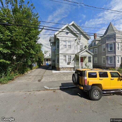

138 Brown St
12 Month Lease
138 Brown St
Waltham, MA 02453
2 Weeks Ago
|
Edit
Favorites
138 Brown St

Favorites
Check Back Soon for Upcoming Availability
138 Brown St,
Waltham,
MA
02453
Located 11 miles west of Boston along the Charles River, Waltham combines metropolitan accessibility with tree-lined neighborhoods. The city earned its "Watch City" nickname through its historic watchmaking industry and now houses both Brandeis and Bentley Universities. The rental market remains competitive, with average rents ranging from $2,002 for studios to $3,843 for three-bedroom units. Housing options span from riverside apartment communities to historic homes in established neighborhoods like Piety Corner and the Highlands.
Moody Street, known locally as "Restaurant Row," serves as the city's downtown hub, featuring an international array of restaurants and independent shops. The Charles River Museum of Industry & Innovation chronicles the area's manufacturing legacy, while the riverside paths offer miles of walking and cycling routes. Residents enjoy access to several parks and green spaces, including the preserved Gore Place estate and the scenic Prospect Hill Park.
Learn more about living in Waltham
Education
| Colleges & Universities | Distance | ||
|---|---|---|---|
| Colleges & Universities | Distance | ||
| Drive: | 6 min | 2.1 mi | |
| Drive: | 6 min | 2.4 mi | |
| Drive: | 13 min | 5.3 mi | |
| Drive: | 12 min | 5.7 mi |
138 Brown St is within 6 minutes or 2.1 miles from Brandeis University. It is also near Bentley University and Boston College.
Transportation options available in Waltham include Riverside Station, located 2.4 miles from 138 Brown St. 138 Brown St is near General Edward Lawrence Logan International, located 13.7 miles or 24 minutes away, and Worcester Regional, located 40.2 miles or 58 minutes away.
| Transit / Subway | Distance | ||
|---|---|---|---|
| Transit / Subway | Distance | ||
|
|
Drive: | 6 min | 2.4 mi |
|
|
Drive: | 6 min | 3.0 mi |
|
|
Drive: | 8 min | 3.4 mi |
|
|
Drive: | 10 min | 4.2 mi |
|
|
Drive: | 10 min | 4.5 mi |
| Commuter Rail | Distance | ||
|---|---|---|---|
| Commuter Rail | Distance | ||
| Walk: | 16 min | 0.8 mi | |
|
|
Walk: | 16 min | 0.8 mi |
|
|
Drive: | 5 min | 2.1 mi |
|
|
Drive: | 11 min | 5.9 mi |
|
|
Drive: | 12 min | 6.7 mi |
| Airports | Distance | ||
|---|---|---|---|
| Airports | Distance | ||
|
General Edward Lawrence Logan International
|
Drive: | 24 min | 13.7 mi |
|
Worcester Regional
|
Drive: | 58 min | 40.2 mi |
Walkability Near 138 Brown St Waltham, MA 02453
Getting Around
 What do Walkability, Transit, Drivability, and Bikeability mean?
Walkability measures the walking distance to day-to-day needs.
Transit measures access to public transportation.
Drivability measures congestion, parking availability, and access to major roads.
Bikeability measures the suitability for cycling.
How It Works
What do Walkability, Transit, Drivability, and Bikeability mean?
Walkability measures the walking distance to day-to-day needs.
Transit measures access to public transportation.
Drivability measures congestion, parking availability, and access to major roads.
Bikeability measures the suitability for cycling.
How It Works
Moderately Walkable
Walkability
70
/ 100
Some Public Transit
Transit
40
/ 100
Moderately Drivable
Drivability
60
/ 100
Moderately Bikeable
Bikeability
60
/ 100
Scores provided by
-
Soundscore™
-
/ 100
Traffic
-Airport
-Businesses
-Scores provided by
HowLoud What is a Sound Score Rating? A Sound Score Rating aggregates noise caused by vehicle traffic, airplane traffic and local sources. How It WorksTime and distance from 138 Brown St.
| Shopping Centers | Distance | ||
|---|---|---|---|
| Shopping Centers | Distance | ||
| Drive: | 3 min | 1.4 mi | |
| Drive: | 3 min | 1.5 mi | |
| Drive: | 4 min | 1.5 mi |
138 Brown St has 3 shopping centers within 1.5 miles, which is about a 4-minute drive. The miles and minutes will be for the farthest away property.
| Parks and Recreation | Distance | ||
|---|---|---|---|
| Parks and Recreation | Distance | ||
|
Beaver Brook Reservation
|
Drive: | 6 min | 3.1 mi |
|
Land's Sake Farm
|
Drive: | 9 min | 4.4 mi |
|
Hemlock Gorge Reservation
|
Drive: | 11 min | 4.8 mi |
|
Mass Audubon's Habitat Education Center and Wildlife Sanctuary
|
Drive: | 11 min | 4.9 mi |
|
Hammond Pond Reservation
|
Drive: | 11 min | 5.2 mi |
138 Brown St has 5 parks within 5.2 miles, including Beaver Brook Reservation, Land's Sake Farm, and Hemlock Gorge Reservation.
| Hospitals | Distance | ||
|---|---|---|---|
| Hospitals | Distance | ||
| Drive: | 3 min | 1.1 mi | |
| Drive: | 6 min | 3.1 mi | |
| Drive: | 7 min | 3.5 mi |
138 Brown St has 3 hospitals within 3.5 miles, the nearest is Walden Behavioral Care which is 1.1 miles away and a 3 minute drive.
| Military Bases | Distance | ||
|---|---|---|---|
| Military Bases | Distance | ||
| Drive: | 18 min | 8.5 mi | |
| Drive: | 20 min | 10.7 mi |
138 Brown St is 8.5 miles from Hanscom Air Force Base, and is convenient to other military bases, including US Military Reservation.
You May Also Like
Similar Rentals Nearby


What Are Walk Score®, Transit Score®, and Bike Score® Ratings?
Walk Score® measures the walkability of any address. Transit Score® measures access to public transit. Bike Score® measures the bikeability of any address.
What is a Sound Score Rating?
A Sound Score Rating aggregates noise caused by vehicle traffic, airplane traffic and local sources.