$2,950
/ Month
1379 Camino Peral
Moraga, CA 94556
Today
Favorites
-
Bedrooms
2
-
Bathrooms
2
-
Square Feet
1,031 sq ft
-
Available
Available Sep 1
1379 Camino Peral

Favorites
About This Home
12 Month Lease,
$3,000 deposit,
Available Sep 1
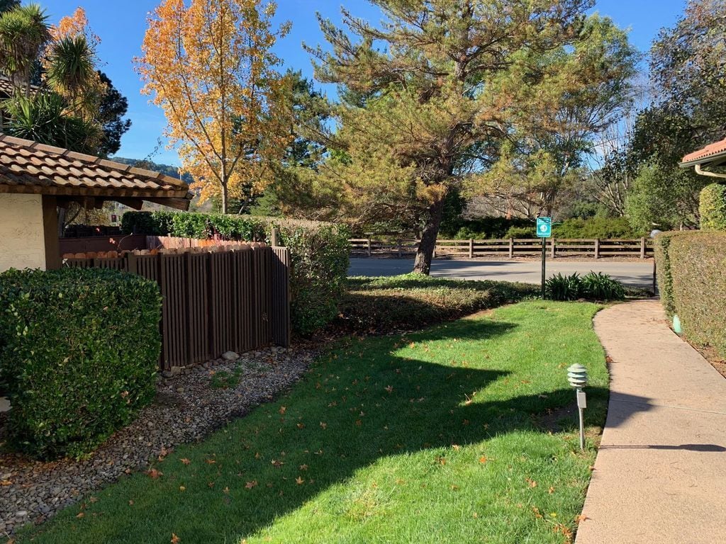
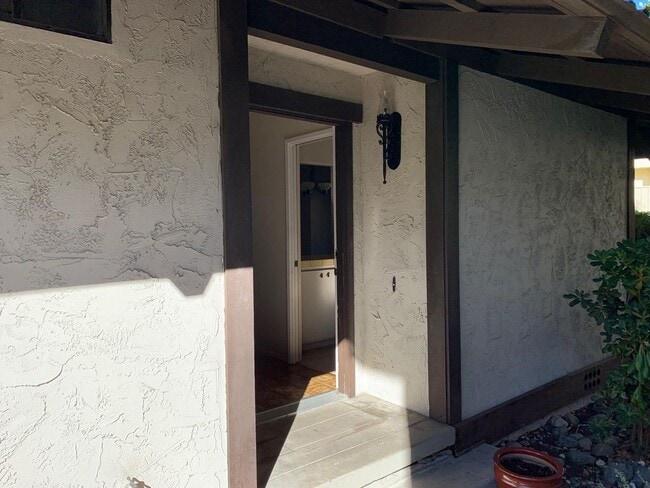
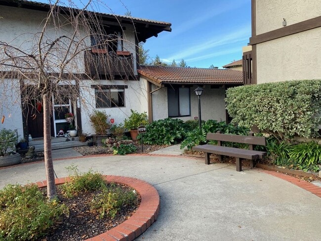
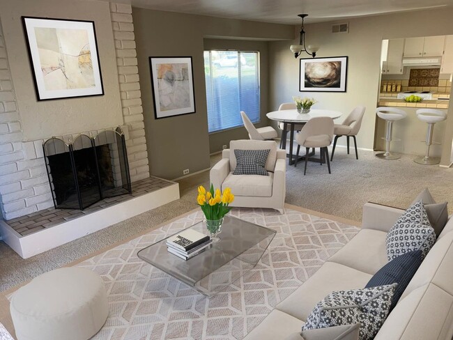
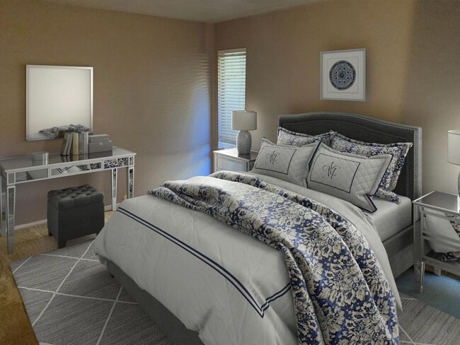
Location! Location! Location! Walk to Moraga Commons Park (1 min), Safeway (5 mins), Moraga Farmers Market (5 mins), or Moraga Public Library (6 mins). Situated in a peaceful, private and lush setting, this single-story Moraga townhome is an end-unit with only 1 shared wall and no upstairs neighbors. New carpet! With 1 assigned covered parking spot, tons of closet space and convenient laundry, you can't beat the location in Moraga. Zoned for Los Perales Elementary, Joaquin Moraga Middle School and Campolindo High School. Good credit and 1 year lease required.
1379 Camino Peral is a townhome located in Contra Costa County and the 94556 ZIP Code. This area is served by the Moraga Elementary attendance zone.
* Price shown is base rent and may not include non-optional fees and utilities. Price, availability, fees, and any applicable rent special are subject to change without notice.
* Square footage definitions vary. Displayed square footage is approximate.
Townhome Features
Heating
Carpet
Framed Mirrors
Cable Ready
- Heating
- Cable Ready
- Storage Space
- Framed Mirrors
- Carpet
- Laundry Facilities
Fees and Policies
The fees below are based on community-supplied data and may exclude additional fees and utilities.
- Parking
-
Covered--
Details
Utilities Included
-
Water
-
Trash Removal
-
Sewer
Contact
- Contact
Location
Get Directions
The city of Moraga is a small East Bay suburb located about fifteen miles from Oakland. Perched in the rolling hills of Contra Costa County, residents enjoy beautiful scenery and terrific opportunities to spend quality time outdoors, whether in the city at Moraga Commons Park or just outside of town at Las Trampas Regional Wilderness.
Primarily a residential community, most of the shopping, dining, and entertainment in Moraga is found at the centrally-located Rheem Valley Shopping Center and Moraga Valley Shopping Center, both located along Moraga Road. The community features an excellent public school system and a very low crime rate, making it a great choice for folks raising families.
Learn more about living in Moraga
Education
| Colleges & Universities | Distance | ||
|---|---|---|---|
| Colleges & Universities | Distance | ||
| Drive: | 3 min | 1.1 mi | |
| Drive: | 27 min | 10.4 mi | |
| Drive: | 26 min | 11.8 mi | |
| Drive: | 24 min | 12.4 mi |
1379 Camino Peral is within 3 minutes or 1.1 miles from Saint Marys Coll. of Calif.. It is also near Mills College and UC Berkeley.
Schools


Public Elementary School
Grades K-5
375 Students
Attendance Zone
Public Elementary & Middle School
Grades K-8
656 Students
Nearby
Public Middle School
Grades 6-8
629 Students
Attendance Zone
Public High School
Grades 9-12
1,343 Students
Attendance Zone
Private Elementary & Middle School
Grades PK-8
119 Students
Nearby
Private Elementary & Middle School
Grades K-8
302 Students
Nearby
Private High School
Grades 9-12
Nearby
School data provided by
 The GreatSchools Rating helps parents compare schools within a state based on a variety of school quality indicators and provides a helpful picture of how effectively each school serves all of its students. Ratings are on a scale of 1 (below average) to 10 (above average) and can include test scores, college readiness, academic progress, advanced courses, equity, discipline and attendance data. We also advise parents to visit schools, consider other information on school performance and programs, and consider family needs as part of the school selection process.
View GreatSchools Rating Methodology
Data provided by GreatSchools.org © 2025. All rights reserved.
View GreatSchools Rating Methodology
Data provided by GreatSchools.org © 2025. All rights reserved.
Transportation options available in Moraga include Lafayette Station, located 5.3 miles from 1379 Camino Peral. 1379 Camino Peral is near Metro Oakland International, located 16.5 miles or 34 minutes away, and San Francisco International, located 33.6 miles or 53 minutes away.
| Transit / Subway | Distance | ||
|---|---|---|---|
| Transit / Subway | Distance | ||
|
|
Drive: | 10 min | 5.3 mi |
|
|
Drive: | 12 min | 5.7 mi |
|
|
Drive: | 12 min | 5.7 mi |
|
|
Drive: | 15 min | 8.0 mi |
|
|
Drive: | 19 min | 10.2 mi |
| Commuter Rail | Distance | ||
|---|---|---|---|
| Commuter Rail | Distance | ||
|
|
Drive: | 25 min | 13.0 mi |
|
|
Drive: | 25 min | 14.8 mi |
|
|
Drive: | 28 min | 16.7 mi |
|
|
Drive: | 39 min | 20.4 mi |
| Drive: | 39 min | 20.4 mi |
| Airports | Distance | ||
|---|---|---|---|
| Airports | Distance | ||
|
Metro Oakland International
|
Drive: | 34 min | 16.5 mi |
|
San Francisco International
|
Drive: | 53 min | 33.6 mi |
Time and distance from 1379 Camino Peral.
| Shopping Centers | Distance | ||
|---|---|---|---|
| Shopping Centers | Distance | ||
| Walk: | 5 min | 0.3 mi | |
| Drive: | 4 min | 1.9 mi | |
| Drive: | 10 min | 4.9 mi |
1379 Camino Peral has 3 shopping centers within 4.9 miles, which is about a 10-minute walk. The miles and minutes will be for the farthest away property.
| Parks and Recreation | Distance | ||
|---|---|---|---|
| Parks and Recreation | Distance | ||
|
Redwood Regional Park
|
Drive: | 14 min | 5.6 mi |
|
Sibley Volcanic Regional Preserve
|
Drive: | 19 min | 7.7 mi |
|
Joaquin Miller Park
|
Drive: | 19 min | 7.9 mi |
|
Chabot Space & Science Center
|
Drive: | 21 min | 8.1 mi |
|
Roberts Regional Recreation Area
|
Drive: | 22 min | 8.7 mi |
1379 Camino Peral has 5 parks within 8.7 miles, including Redwood Regional Park, Sibley Volcanic Regional Preserve, and Roberts Regional Recreation Area.
| Hospitals | Distance | ||
|---|---|---|---|
| Hospitals | Distance | ||
| Drive: | 15 min | 8.2 mi | |
| Drive: | 25 min | 10.5 mi | |
| Drive: | 26 min | 11.0 mi |
1379 Camino Peral has 3 hospitals within 11.0 miles, the nearest is Kaiser Foundation Hospital - Walnut Creek which is 8.2 miles away and a 15 minute drive.
| Military Bases | Distance | ||
|---|---|---|---|
| Military Bases | Distance | ||
| Drive: | 35 min | 14.7 mi | |
| Drive: | 32 min | 16.5 mi |
1379 Camino Peral is 14.7 miles from Military Reservation, and is convenient to other military bases, including Oakland Army Base.
Amenities
- Heating
- Cable Ready
- Storage Space
- Framed Mirrors
- Carpet
- Laundry Facilities
1379 Camino Peral Photos
What Are Walk Score®, Transit Score®, and Bike Score® Ratings?
Walk Score® measures the walkability of any address. Transit Score® measures access to public transit. Bike Score® measures the bikeability of any address.
What is a Sound Score Rating?
A Sound Score Rating aggregates noise caused by vehicle traffic, airplane traffic and local sources

1379 Camino Peral
Moraga, CA 94556