
$4,000
/ Month
1367 De Haro St
San Francisco, CA 94107
Today
|
Edit
Favorites
415-706-2987
-
Bedrooms
2
-
Bathrooms
1
-
Square Feet
--
-
Available
Available Now
1367 De Haro St

Favorites
About This Home
Available Now
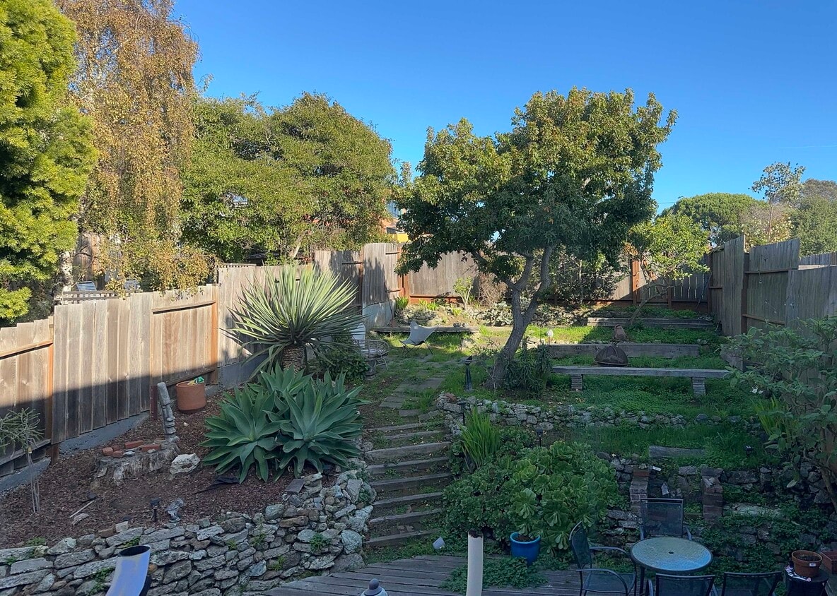
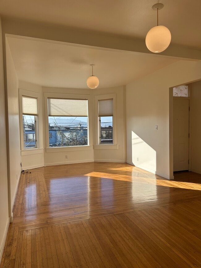
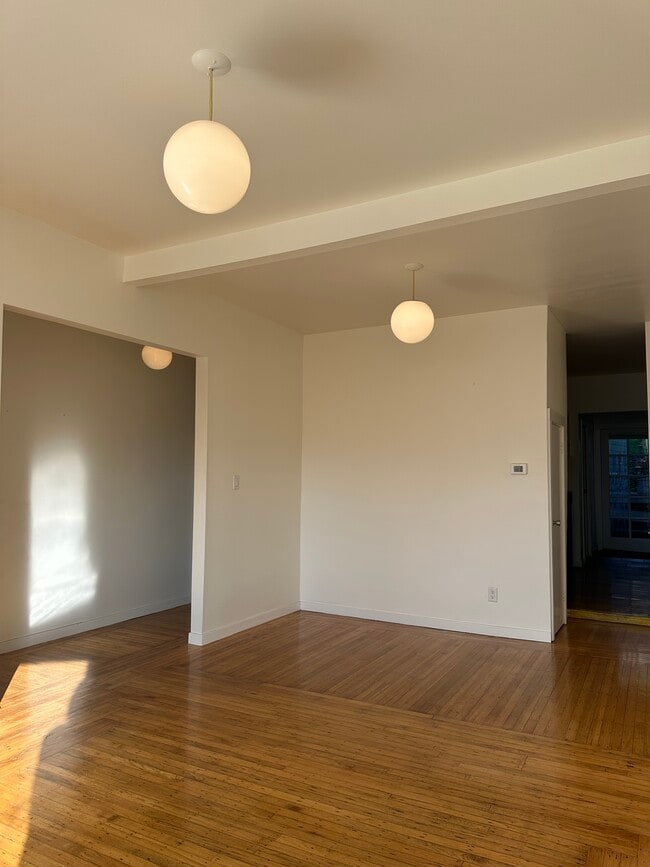
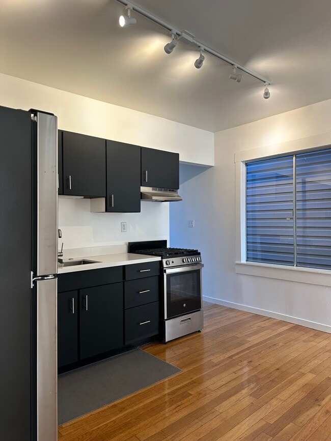
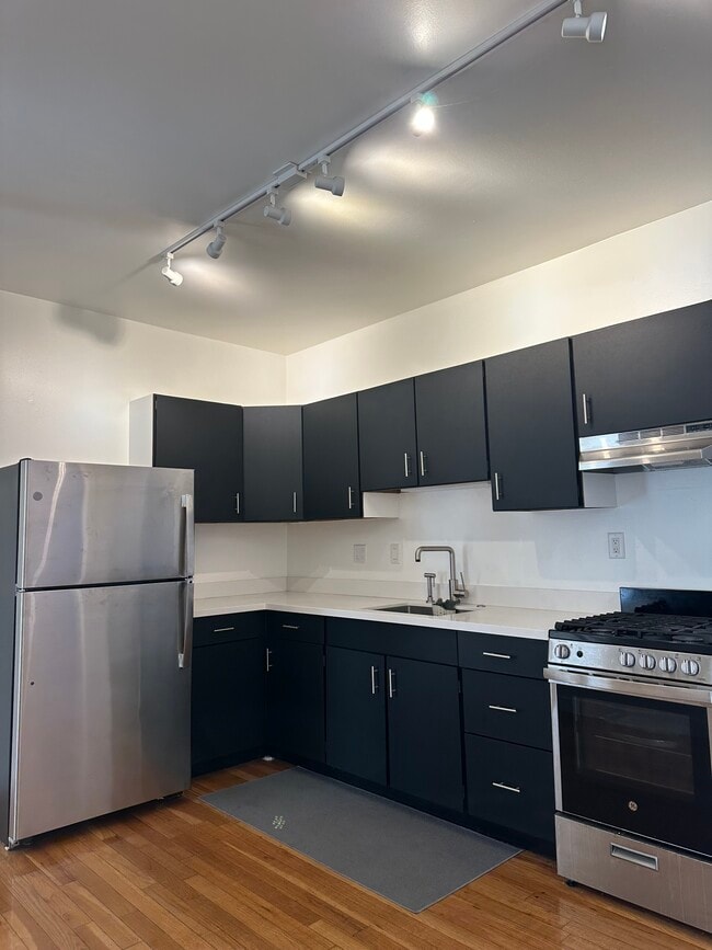
Description:This townhouse is on De Haro and 25 Street on Potrero Hill, known for its sunny climate and amazing restaurants, bars and shops. Whole Foods is nearby at Rhode Island and 17th Street. This townhouse has super easy access to 280 and 101. Townhouse includes:Two bedrooms, one with gorgeous view looking out over the Mission, you can see Golden Gate Bridge as well as Bay Bridge, the other bedroom looks out on the huge back yardHuge backyard – perfect for relaxingLight filled living/dining areaHardwood floorsKitchen with gas stove, refrigeratorNice sized bathroom with bath and showerLots of closet spaceWasher and dryerGarage 2 car parking (driveway and garage)Security deposit is last months rent and $1000.00 cleaning depositThis is a non-smoking unit.No pets allowedApproximately 850sq ft Location:De Haro between 24th and 25th St, San Francisco, CA
1367 De Haro St is a townhome located in San Francisco County and the 94107 ZIP Code. This area is served by the San Francisco Unified attendance zone.
* Price shown is base rent. Excludes user-selected optional fees and variable or usage-based fees and required charges due at or prior to move-in or at move-out. Price, availability, fees, and any applicable rent special are subject to change without notice.
* Square footage definitions vary. Displayed square footage is approximate.
Contact
- Listed by Juno Duenas
- Phone Number
- Contact
Location
Get Directions
Nestled between the Mission District and Dogpatch, Potrero is a diverse, family-friendly neighborhood. Known for its rolling hills and stellar city views, Potrero is an upscale urban local with Victorian houses and high-rise apartments available for rent. A feeling of closeness prevails in Potrero, and those who choose to reside in the cozy homes on these steep hills often say it feels as if they live in a small village. Great for families looking to raise children in a close-knit environment, Potrero has several community gardens and community centers, parks, grocers, offices, bookstores, and restaurants. Along 18th Street you’ll find everything from quaint eateries to edgy live music spots. Once you move in, be sure to go on a tour at the historic Anchor Brewing Company! If you want even more options for shopping, dining, and entertainment, there are plenty of spots nearby in Dog Patch and the Mission District.
Learn more about living in Potrero
Education
| Colleges & Universities | Distance | ||
|---|---|---|---|
| Colleges & Universities | Distance | ||
| Drive: | 4 min | 1.2 mi | |
| Drive: | 5 min | 2.4 mi | |
| Drive: | 7 min | 3.7 mi | |
| Drive: | 8 min | 4.2 mi |
1367 De Haro St is within 4 minutes or 1.2 miles from California College of the Arts. It is also near UC San Francisco, Mission Bay and Academy of Art University.
Schools


Public Elementary School
Grades K-5
322 Students
Attendance Zone
Public Elementary School
Grades K-5
Nearby
Public Middle School
Grades 6-8
848 Students
Attendance Zone
Public Middle & High School
Grades 8-12
401 Students
Attendance Zone
Public High School
Grades 9-12
506 Students
Attendance Zone
Private Elementary & Middle School
Grades PK-8
Nearby
Private Middle & High School
Grades 8-12
11 Students
Nearby
School data provided by
 The GreatSchools Rating helps parents compare schools within a state based on a variety of school quality indicators and provides a helpful picture of how effectively each school serves all of its students. Ratings are on a scale of 1 (below average) to 10 (above average) and can include test scores, college readiness, academic progress, advanced courses, equity, discipline and attendance data. We also advise parents to visit schools, consider other information on school performance and programs, and consider family needs as part of the school selection process.
View GreatSchools Rating Methodology
Data provided by GreatSchools.org © 2025. All rights reserved.
View GreatSchools Rating Methodology
Data provided by GreatSchools.org © 2025. All rights reserved.
Transportation options available in San Francisco include Third Street & Marin St, located 1.0 mile from 1367 De Haro St. 1367 De Haro St is near San Francisco International, located 11.7 miles or 19 minutes away, and Metro Oakland International, located 21.4 miles or 32 minutes away.
| Transit / Subway | Distance | ||
|---|---|---|---|
| Transit / Subway | Distance | ||
| Walk: | 19 min | 1.0 mi | |
|
|
Walk: | 20 min | 1.1 mi |
|
|
Drive: | 3 min | 1.1 mi |
|
|
Drive: | 3 min | 1.2 mi |
|
|
Drive: | 4 min | 1.4 mi |
| Commuter Rail | Distance | ||
|---|---|---|---|
| Commuter Rail | Distance | ||
| Drive: | 4 min | 1.9 mi | |
| Drive: | 4 min | 2.0 mi | |
| Drive: | 5 min | 3.0 mi | |
| Drive: | 5 min | 3.1 mi | |
| Drive: | 7 min | 3.8 mi |
| Airports | Distance | ||
|---|---|---|---|
| Airports | Distance | ||
|
San Francisco International
|
Drive: | 19 min | 11.7 mi |
|
Metro Oakland International
|
Drive: | 32 min | 21.4 mi |
Time and distance from 1367 De Haro St.
| Shopping Centers | Distance | ||
|---|---|---|---|
| Shopping Centers | Distance | ||
| Drive: | 3 min | 1.3 mi | |
| Drive: | 5 min | 1.4 mi | |
| Drive: | 4 min | 1.9 mi |
1367 De Haro St has 3 shopping centers within 1.9 miles, which is about a 4-minute drive. The miles and minutes will be for the farthest away property.
| Parks and Recreation | Distance | ||
|---|---|---|---|
| Parks and Recreation | Distance | ||
|
Heron's Head Park
|
Drive: | 5 min | 1.9 mi |
|
Children's Creativity Museum
|
Drive: | 6 min | 3.3 mi |
|
Buena Vista Park
|
Drive: | 8 min | 3.8 mi |
|
Randall Museum
|
Drive: | 9 min | 4.1 mi |
|
Candlestick Point State Recreation Area
|
Drive: | 11 min | 4.6 mi |
1367 De Haro St has 5 parks within 4.6 miles, including Heron's Head Park, Children's Creativity Museum, and Randall Museum.
| Hospitals | Distance | ||
|---|---|---|---|
| Hospitals | Distance | ||
| Walk: | 11 min | 0.6 mi | |
| Drive: | 5 min | 1.6 mi | |
| Drive: | 7 min | 3.5 mi |
1367 De Haro St has 3 hospitals within 3.5 miles, the nearest is Zuckerberg San Francisco General Hospital & Trauma Center which is 0.6 mile away and a 11 minute walk.
| Military Bases | Distance | ||
|---|---|---|---|
| Military Bases | Distance | ||
| Drive: | 15 min | 7.5 mi | |
| Drive: | 28 min | 16.0 mi |
1367 De Haro St is 7.5 miles from Treasure Island Naval Station, and is convenient to other military bases, including Alameda/US Naval Air Station San Francisco.
You May Also Like
Similar Rentals Nearby


What Are Walk Score®, Transit Score®, and Bike Score® Ratings?
Walk Score® measures the walkability of any address. Transit Score® measures access to public transit. Bike Score® measures the bikeability of any address.
What is a Sound Score Rating?
A Sound Score Rating aggregates noise caused by vehicle traffic, airplane traffic and local sources

1367 De Haro St
San Francisco, CA 94107