
$2,200 / Month
13601 Sir Thomas Way Unit 2-C-42
Silver Spring, MD 20904
Today
Favorites
301-742-9907
-
Bedrooms
2
-
Bathrooms
2
-
Square Feet
--
-
Available
Available May 17
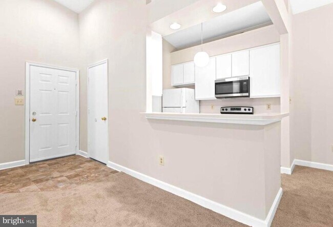
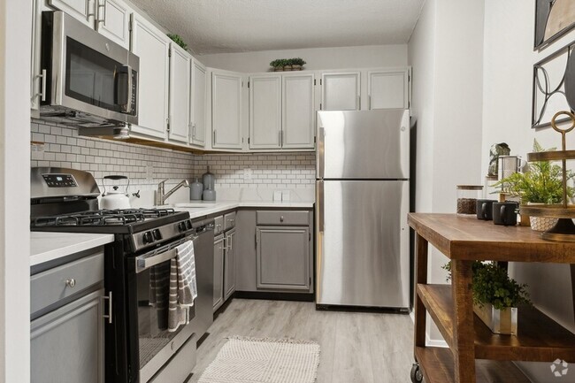
Highlights
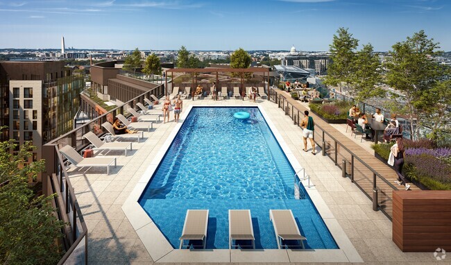
- Penthouse
- Community Pool
- Doors with lever handles
- Central Heating and Cooling System
13601 Sir Thomas Way Unit 2-C-42

Favorites
About This Home
Available May 17
TENANT OCCUPIED! CALL ME FIRST PLEASE! 2 days appointment in advance! Bring your great client! CREDIT MUST BE OVER 650. APPLY ON MY WEBSITE. Long and Foster
13601 Sir Thomas Way is an apartment community located in Montgomery County and the 20904 ZIP Code.
* Price shown is base rent and may not include non-optional fees and utilities.
Price, availability, fees, and any applicable rent special are subject to change without notice.
* Square footage definitions vary. Displayed square footage is approximate.
Home Details
Home Type
Penthouse
Year Built
Built in 1991
Accessible Home Design
Doors with lever handles
Entry on the 3rd floor
Bedrooms and Bathrooms
2 Main Level Bedrooms
2 Full Bathrooms
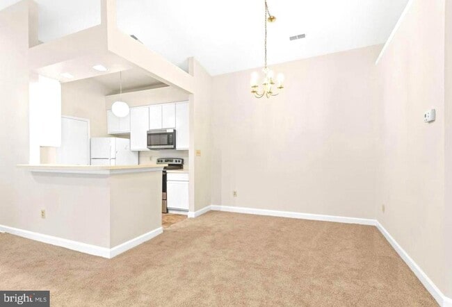
Home Design
Back-to-Back Home
Advanced Framing
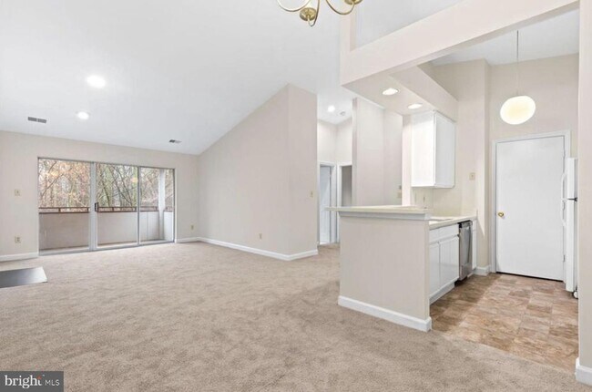
Interior Spaces
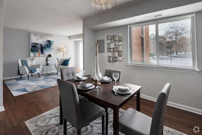
1,112 Sq Ft Home
Property has 1 Level
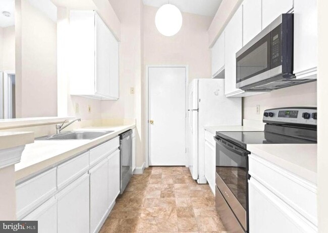
Laundry
Washer and Dryer Hookup
Listing and Financial Details
Security Deposit $2,200
18-Month Min and 36-Month Max Lease Term
Available 7/1/25
Assessor Parcel Number 160502876935
Coming Soon on 5/15/25
Residential Lease
Parking
On-Street Parking
Utilities
Central Heating and Cooling System
Electric Water Heater
Community Details
Overview
Low-Rise Condominium
The Vineyards Codm Community
The Vineyards Codm Subdivision
Pet Policy
Pets Allowed
Pet Size Limit
Pet Deposit $300
Recreation
Community Pool
Contact
- Listed by Bahador Tabarzadi | Long & Foster Real Estate, Inc.
- Phone Number
- Contact
-
Source
 Bright MLS, Inc.
Copyright © 2025 Bright MLS, Inc.
Location
Get Directions
Fairland is a park-like suburb with an active community. Fairland Recreational Park sits on the edge of town and offers extensive hiking and biking trails, athletic fields, and tennis courts. Nearby green spaces include Calverton-Galway Local Park, West Fairland Local Park, and Little Paint Branch Park. The Highway 29 and State Route 200 intersection sits near the heart of town, connecting residents to nearby destinations. Public schools, medical centers, and retail hubs reside in the neighborhood, but Fairland is mainly residential. Apartments, single-family homes, and townhomes are available for rent that range from moderately priced to upscale. Residents enjoy a quick commute into Washington, DC, located approximately 16 miles south of town, as well as Baltimore, located roughly 28 miles northeast.
Learn more about living in Fairland
Education
| Colleges & Universities | Distance | ||
|---|---|---|---|
| Colleges & Universities | Distance | ||
| Drive: | 18 min | 9.2 mi | |
| Drive: | 17 min | 9.9 mi | |
| Drive: | 20 min | 12.4 mi | |
| Drive: | 23 min | 13.7 mi |
13601 Sir Thomas Way Unit 2-C-42 is within 18 minutes or 9.2 miles from University of Maryland. It is also near Montgomery Coll., Takoma Park and Howard Community College.
Transportation options available in Silver Spring include Glenmont, located 7.7 miles from 13601 Sir Thomas Way Unit 2-C-42. 13601 Sir Thomas Way Unit 2-C-42 is near Ronald Reagan Washington Ntl, located 20.7 miles or 36 minutes away, and Baltimore/Washington International Thurgood Marshall, located 23.4 miles or 31 minutes away.
| Transit / Subway | Distance | ||
|---|---|---|---|
| Transit / Subway | Distance | ||
|
|
Drive: | 14 min | 7.7 mi |
|
|
Drive: | 17 min | 8.8 mi |
|
Forest Glen
|
Drive: | 14 min | 8.9 mi |
|
|
Drive: | 15 min | 9.3 mi |
|
|
Drive: | 18 min | 10.7 mi |
| Commuter Rail | Distance | ||
|---|---|---|---|
| Commuter Rail | Distance | ||
|
Muirkirk
|
Drive: | 7 min | 4.8 mi |
|
|
Drive: | 13 min | 7.7 mi |
|
|
Drive: | 14 min | 8.6 mi |
|
|
Drive: | 14 min | 8.7 mi |
|
|
Drive: | 17 min | 8.8 mi |
| Airports | Distance | ||
|---|---|---|---|
| Airports | Distance | ||
|
Ronald Reagan Washington Ntl
|
Drive: | 36 min | 20.7 mi |
|
Baltimore/Washington International Thurgood Marshall
|
Drive: | 31 min | 23.4 mi |
Time and distance from 13601 Sir Thomas Way Unit 2-C-42.
| Shopping Centers | Distance | ||
|---|---|---|---|
| Shopping Centers | Distance | ||
| Drive: | 3 min | 1.2 mi | |
| Drive: | 3 min | 1.3 mi | |
| Drive: | 7 min | 3.2 mi |
13601 Sir Thomas Way Unit 2-C-42 has 3 shopping centers within 3.2 miles, which is about a 7-minute drive. The miles and minutes will be for the farthest away property.
| Parks and Recreation | Distance | ||
|---|---|---|---|
| Parks and Recreation | Distance | ||
|
Maydale Conservation Park and Nature Center
|
Drive: | 7 min | 3.3 mi |
|
Fairland Regional Park
|
Drive: | 7 min | 3.7 mi |
|
Brookside Nature Center
|
Drive: | 12 min | 6.5 mi |
|
Browns Bridge Recreation Area
|
Drive: | 15 min | 8.4 mi |
|
University of Maryland Observatory
|
Drive: | 16 min | 8.5 mi |
13601 Sir Thomas Way Unit 2-C-42 has 5 parks within 8.5 miles, including Fairland Regional Park, Maydale Conservation Park and Nature Center, and Brookside Nature Center.
| Hospitals | Distance | ||
|---|---|---|---|
| Hospitals | Distance | ||
| Drive: | 8 min | 3.5 mi | |
| Drive: | 8 min | 4.9 mi | |
| Drive: | 15 min | 8.5 mi |
13601 Sir Thomas Way Unit 2-C-42 has 3 hospitals within 8.5 miles, the nearest is Adventist Healthcare White Oak Medical Center which is 3.5 miles away and a 8 minute drive.
You May Also Like
Similar Rentals Nearby


What Are Walk Score®, Transit Score®, and Bike Score® Ratings?
Walk Score® measures the walkability of any address. Transit Score® measures access to public transit. Bike Score® measures the bikeability of any address.
What is a Sound Score Rating?
A Sound Score Rating aggregates noise caused by vehicle traffic, airplane traffic and local sources
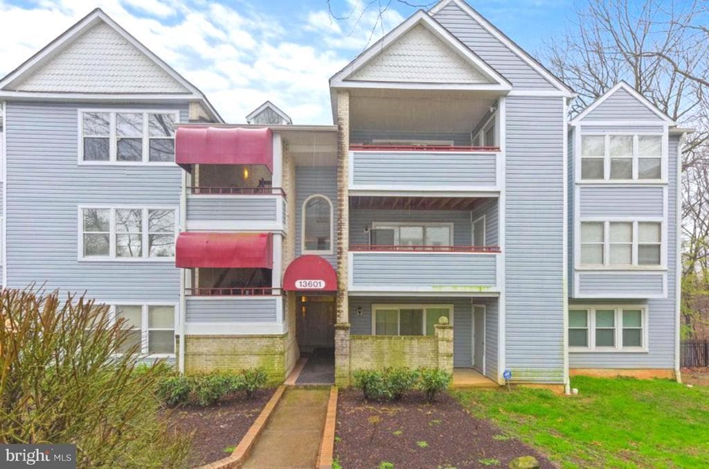
13601 Sir Thomas Way
Silver Spring, MD 20904