

136 W F St Unit Water and 1st Street
Benicia, CA 94510
-
Bedrooms
2
-
Bathrooms
1
-
Square Feet
800 sq ft
-
Available
Available Now

Fees and Policies
Details
Property Information
-
3 units
Contact
- Contact
Benicia sits on the north bank of the Carquinez Strait, quietly holding onto a history that most California cities can only read about — it served as the state capital for thirteen months between 1853 and 1854, and the original Capitol building still stands downtown. That sense of history gives the city a grounded, unhurried character that sets it apart from busier Bay Area neighbors. Situated in Solano County, Benicia connects easily to Vallejo to the west and Martinez across the strait, while Interstate 680 and 780 put Sacramento, Oakland, and San Francisco within reasonable driving distance.
Daily life here moves at a pace that encourages actually noticing your surroundings. The downtown area anchors the city with waterfront views, local shops, and a working arts district that grew out of the converted Benicia Arsenal — once the largest weapons storehouse on the West Coast.
Learn more about living in Benicia| Colleges & Universities | Distance | ||
|---|---|---|---|
| Colleges & Universities | Distance | ||
| Drive: | 16 min | 10.0 mi | |
| Drive: | 21 min | 11.1 mi | |
| Drive: | 24 min | 16.7 mi | |
| Drive: | 25 min | 17.4 mi |
Transportation options available in Benicia include North Concord / Martinez, located 11.1 miles from 136 W F St Unit Water and 1st Street. 136 W F St Unit Water and 1st Street is near Metro Oakland International, located 37.5 miles or 49 minutes away, and San Francisco International, located 47.2 miles or 65 minutes away.
| Transit / Subway | Distance | ||
|---|---|---|---|
| Transit / Subway | Distance | ||
|
|
Drive: | 16 min | 11.1 mi |
|
|
Drive: | 17 min | 11.6 mi |
| Commuter Rail | Distance | ||
|---|---|---|---|
| Commuter Rail | Distance | ||
|
|
Drive: | 9 min | 6.1 mi |
|
|
Drive: | 27 min | 20.8 mi |
| Drive: | 29 min | 21.0 mi | |
|
|
Drive: | 31 min | 24.7 mi |
| Drive: | 35 min | 27.0 mi |
| Airports | Distance | ||
|---|---|---|---|
| Airports | Distance | ||
|
Metro Oakland International
|
Drive: | 49 min | 37.5 mi |
|
San Francisco International
|
Drive: | 65 min | 47.2 mi |
Scores provided by
Traffic
-Airport
-Businesses
-Scores provided by
HowLoud What is a Sound Score Rating? A Sound Score Rating aggregates noise caused by vehicle traffic, airplane traffic and local sources. How It WorksTime and distance from 136 W F St Unit Water and 1st Street.
| Shopping Centers | Distance | ||
|---|---|---|---|
| Shopping Centers | Distance | ||
| Walk: | 10 min | 0.6 mi | |
| Walk: | 12 min | 0.6 mi | |
| Walk: | 17 min | 0.9 mi |
| Parks and Recreation | Distance | ||
|---|---|---|---|
| Parks and Recreation | Distance | ||
|
Benicia Capitol State Historic Park
|
Walk: | 3 min | 0.2 mi |
|
Benicia State Recreation Area
|
Drive: | 10 min | 4.4 mi |
|
Martinez Regional Shoreline
|
Drive: | 11 min | 5.5 mi |
|
Alhambra Creek Watershed
|
Drive: | 9 min | 6.1 mi |
|
Carquinez Strait Regional Shoreline
|
Drive: | 19 min | 11.5 mi |
| Hospitals | Distance | ||
|---|---|---|---|
| Hospitals | Distance | ||
| Drive: | 11 min | 6.7 mi | |
| Drive: | 13 min | 8.1 mi | |
| Drive: | 14 min | 9.2 mi |
| Military Bases | Distance | ||
|---|---|---|---|
| Military Bases | Distance | ||
| Drive: | 5 min | 2.3 mi | |
| Drive: | 19 min | 10.5 mi |
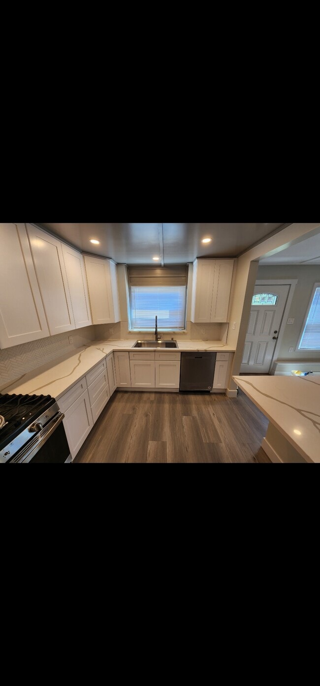
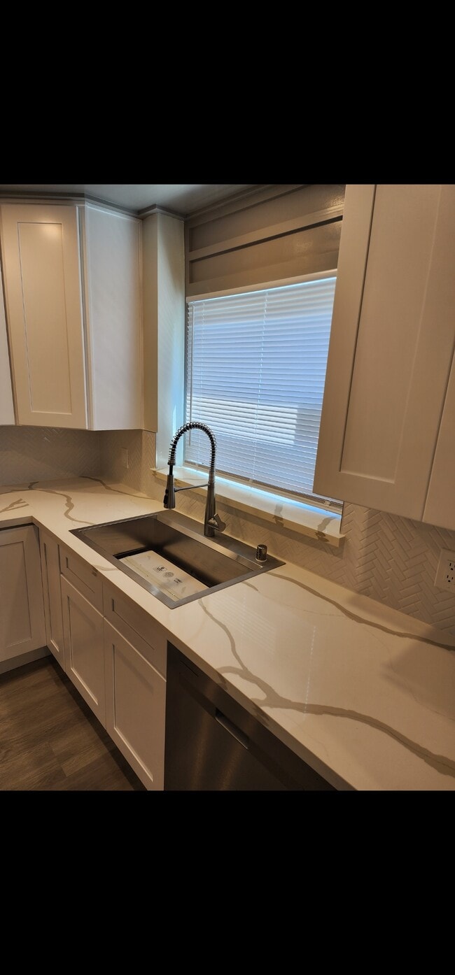
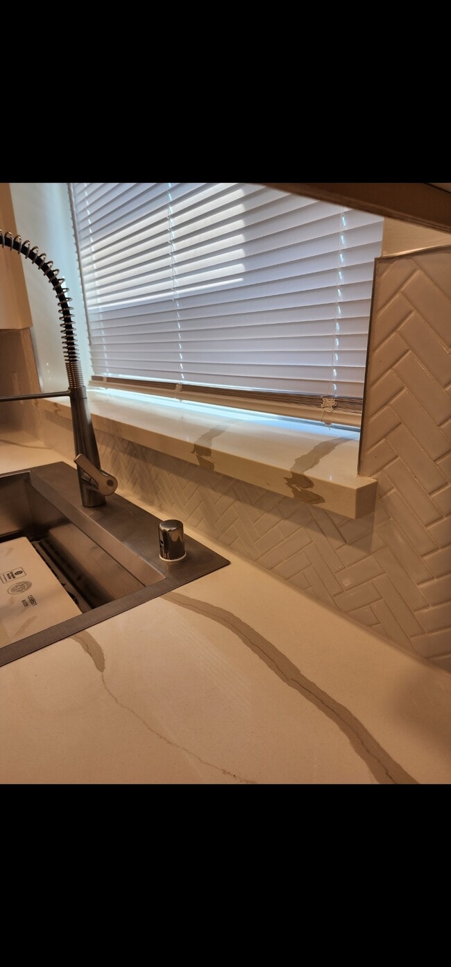
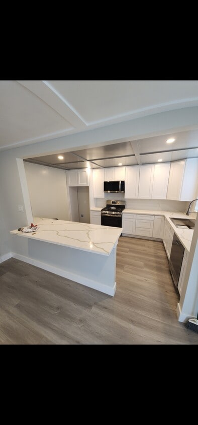
136 W F St Unit Water and 1st Street Photos
What Are Walk Score®, Transit Score®, and Bike Score® Ratings?
Walk Score® measures the walkability of any address. Transit Score® measures access to public transit. Bike Score® measures the bikeability of any address.
What is a Sound Score Rating?
A Sound Score Rating aggregates noise caused by vehicle traffic, airplane traffic and local sources.
136 W F St
Benicia, CA 94510