
$3,750 / Month
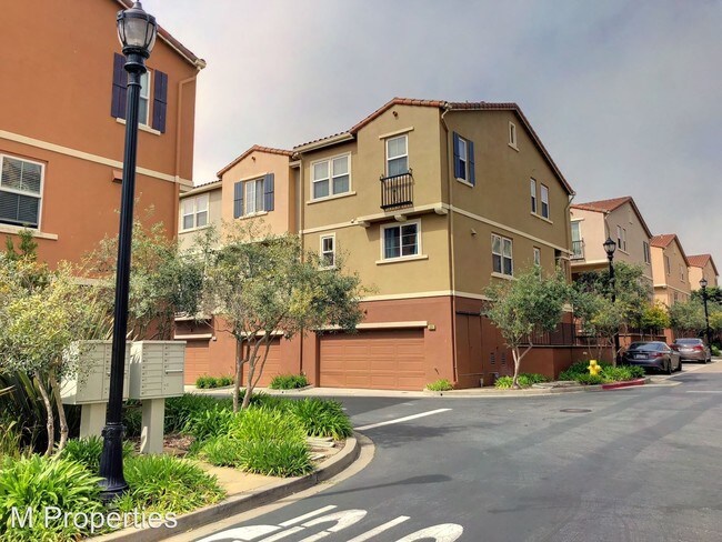
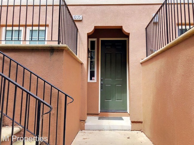
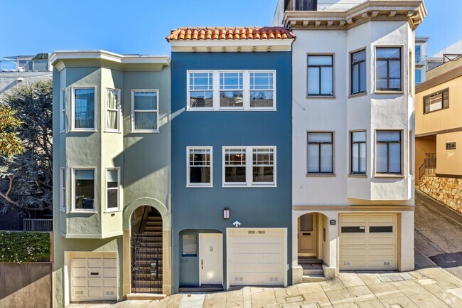
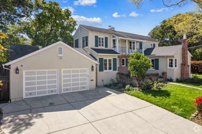
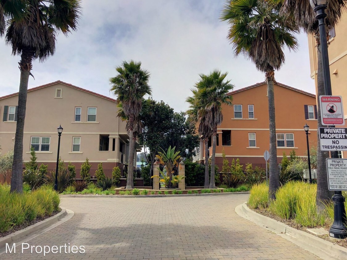
1335 Isabelle Cir
South San Francisco, CA 94080
2 Weeks Ago
Favorites
1335 Isabelle Cir

Favorites
Check Back Soon for Upcoming Availability
| Beds | Baths | Average SF |
|---|---|---|
| 2 Bedrooms 2 Bedrooms 2 Br | 2.5 Baths 2.5 Baths 2.5 Ba | 1,290 SF |
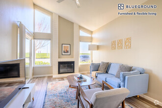
About This Property
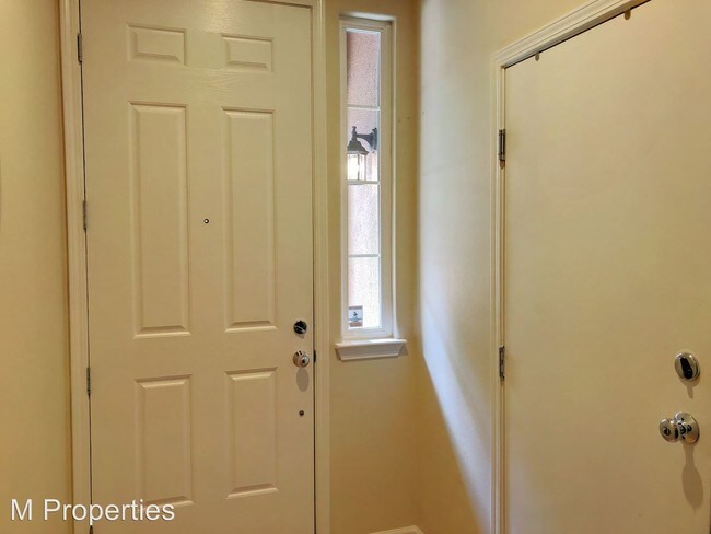
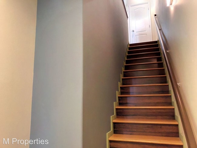
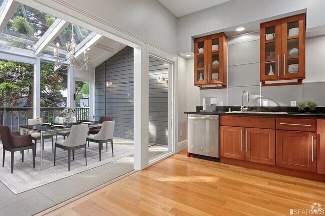
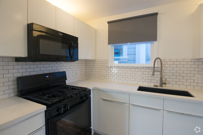
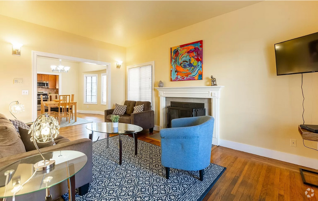
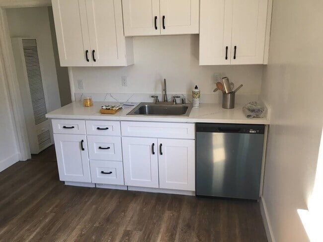
(415) 294-1640 - 2 Bed, 2.5 Bath Luxury Townhome - Close to Shopping + BART - This lovely 3 level townhome is conveniently located just a 6 minute walk to SSF Bart and less than a 5 minute walk to Trader Joe's and Starbucks Coffee. The first floor of the townhome holds the spacious 2+ car garage and plenty of storage space. The 2nd floor features an updated kitchen, half bath, and large living area. The top floor holds the 2 master suites, each with plenty of closet space and full bath. The townhome also includes an in-unit Washer and Dryer, and optional bed with mattress and Sectional Sofa. Amenities: - Townhome Community with a Small Playground and Dog Trails - 6 min walking distance to Bart - Unit is within a newer townhome complex near shops and grocery stores - Less than a 5 minute walk to Trader Joes, Starbucks, and other shops - Less than a 5 minute Drive to HWY 280 Showings: - By Appointment only Lease Terms: - Minimum 12 Month Lease - Security Deposit $3,750 - Building Move-In and Move-Out Fee Required - Renters Insurance Required - Tenant PG&E, Water, and Garbage - No Smoking & No Pets Application Process: - Apply Online - $30 Application Fee per Adult (RLNE3990530)
1335 Isabelle Cir is a house located in San Mateo County and the 94080 ZIP Code. This area is served by the South San Francisco Unified attendance zone.
Location
Get Directions
Colma is a quaint neighborhood on the southeastern side of Downtown Daly. Located less than 10 miles south of Downtown San Francisco, Colma is filled with apartment rentals and abundant amenities. Proximity to the Pacific Ocean and plenty of green space make this neighborhood a favorite for renters seeking a peaceful, naturally beautiful community within a short commute of San Francisco. Stroll the hilly, oceanfront trails at Mussel Rock Beach Park, where locals enjoy paragliding, hang-gliding, bird watching and more. Play a round of golf at one of the many courses nearby, such as the highly rated Lake Merced Golf Club, a challenging course with spectacular views, towering trees, and tilted greens. Abundant shopping options can be found in this neighborhood, ranging from department stores to specialty shops.
Learn more about living in ColmaBelow are rent ranges for similar nearby apartments
Education
| Colleges & Universities | Distance | ||
|---|---|---|---|
| Colleges & Universities | Distance | ||
| Drive: | 10 min | 4.8 mi | |
| Drive: | 11 min | 6.1 mi | |
| Drive: | 11 min | 6.5 mi | |
| Drive: | 17 min | 8.6 mi |
1335 Isabelle Cir is within 10 minutes or 4.8 miles from Skyline College. It is also near City College of San Francisco and San Francisco State University.
Schools


Public Elementary School
Grades K-5
Nearby
Public Elementary School
Grades K-5
334 Students
Attendance Zone
Public Middle School
Grades 6-8
628 Students
Attendance Zone
Public High School
Grades 9-12
1,173 Students
Attendance Zone
Private Elementary, Middle & High School
Grades 1-12
17 Students
Nearby
Private Elementary & Middle School
Grades PK-8
129 Students
Nearby
Private Elementary & Middle School
Grades K-8
Nearby
School data provided by
 The GreatSchools Rating helps parents compare schools within a state based on a variety of school quality indicators and provides a helpful picture of how effectively each school serves all of its students. Ratings are on a scale of 1 (below average) to 10 (above average) and can include test scores, college readiness, academic progress, advanced courses, equity, discipline and attendance data. We also advise parents to visit schools, consider other information on school performance and programs, and consider family needs as part of the school selection process.
View GreatSchools Rating Methodology
View GreatSchools Rating Methodology
Transportation options available in South San Francisco include South San Francisco, located 0.2 mile from 1335 Isabelle Cir. 1335 Isabelle Cir is near San Francisco International, located 6.0 miles or 12 minutes away, and Metro Oakland International, located 31.0 miles or 44 minutes away.
| Transit / Subway | Distance | ||
|---|---|---|---|
| Transit / Subway | Distance | ||
|
|
Walk: | 3 min | 0.2 mi |
|
|
Walk: | 4 min | 0.2 mi |
|
|
Drive: | 4 min | 2.2 mi |
|
|
Drive: | 7 min | 3.1 mi |
|
|
Drive: | 9 min | 4.4 mi |
| Commuter Rail | Distance | ||
|---|---|---|---|
| Commuter Rail | Distance | ||
| Drive: | 7 min | 3.1 mi | |
| Drive: | 6 min | 3.5 mi | |
| Drive: | 12 min | 6.3 mi | |
| Drive: | 13 min | 7.6 mi | |
| Drive: | 15 min | 11.5 mi |
| Airports | Distance | ||
|---|---|---|---|
| Airports | Distance | ||
|
San Francisco International
|
Drive: | 12 min | 6.0 mi |
|
Metro Oakland International
|
Drive: | 44 min | 31.0 mi |
Time and distance from 1335 Isabelle Cir.
| Shopping Centers | Distance | ||
|---|---|---|---|
| Shopping Centers | Distance | ||
| Walk: | 10 min | 0.5 mi | |
| Drive: | 3 min | 1.3 mi | |
| Drive: | 3 min | 1.4 mi |
1335 Isabelle Cir has 3 shopping centers within 1.4 miles, which is about a 3-minute walk. The miles and minutes will be for the farthest away property.
| Parks and Recreation | Distance | ||
|---|---|---|---|
| Parks and Recreation | Distance | ||
|
San Bruno Mountain State Park
|
Drive: | 15 min | 6.5 mi |
|
Charles F. Hagar Planetarium
|
Drive: | 13 min | 6.7 mi |
|
San Francisco State Univ. Observatory
|
Drive: | 13 min | 6.7 mi |
|
Candlestick Point State Recreation Area
|
Drive: | 17 min | 8.4 mi |
|
Pacifica State Beach
|
Drive: | 13 min | 8.5 mi |
1335 Isabelle Cir has 5 parks within 8.5 miles, including San Bruno Mountain State Park, Charles F. Hagar Planetarium, and San Francisco State Univ. Observatory.
| Hospitals | Distance | ||
|---|---|---|---|
| Hospitals | Distance | ||
| Walk: | 15 min | 0.8 mi | |
| Drive: | 5 min | 2.5 mi | |
| Drive: | 12 min | 8.1 mi |
1335 Isabelle Cir has 3 hospitals within 8.1 miles, the nearest is Kaiser Foundation Hospital - South San Francisco which is 0.8 mile away and a 15 minute walk.
| Military Bases | Distance | ||
|---|---|---|---|
| Military Bases | Distance | ||
| Drive: | 24 min | 10.7 mi | |
| Drive: | 25 min | 11.2 mi |
1335 Isabelle Cir is 10.7 miles from East Fort Miley, and is convenient to other military bases, including West Fort Miley.
You May Also Like
Similar Rentals Nearby

What Are Walk Score®, Transit Score®, and Bike Score® Ratings?
Walk Score® measures the walkability of any address. Transit Score® measures access to public transit. Bike Score® measures the bikeability of any address.
What is a Sound Score Rating?
A Sound Score Rating aggregates noise caused by vehicle traffic, airplane traffic and local sources
1335 Isabelle Cir
South San Francisco, CA 94080