-

-
Duplex

$1,250
Total Monthly Price
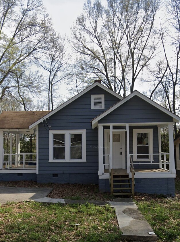
1332 McClelland Ave
East Point, GA 30344
Favorites
1332 McClelland Ave

Favorites
Check Back Soon for Upcoming Availability
| Beds | Baths | Average SF |
|---|---|---|
| 1 Bedroom 1 Bedroom 1 Br | 1 Bath 1 Bath 1 Ba | 540 SF |
Fees and Policies
The fees listed below are community-provided and may exclude utilities or add-ons. All payments are made directly to the property and are non-refundable unless otherwise specified.
- Parking
-
Surface Lot--
Details
Property Information
-
2 units
1332 McClelland Ave is a townhome located in Fulton County and the 30344 ZIP Code.
Townhome Features
- Washer/Dryer Hookup
1332 McClelland Ave,
East Point,
GA
30344
Situated just inside the perimeter on the southwest corner of Atlanta, East Point is a small city ideally positioned for commuters. Virtually anywhere else in the Atlanta area is easily accessible by car or MARTA service, both bus and rail. The area along Main Street near the MARTA station is a bustling hub of restaurants, nightlife, and arts venues. East Point is also home to the Dick Lane Velodrome, a unique bicycling racetrack offering classes for all ages in addition to competitions. Rent is fairly inexpensive, with many houses and apartments available for under $700 per month.
Learn more about living in East PointBelow are rent ranges for similar nearby apartments
Amenities
- Washer/Dryer Hookup
Education
| Colleges & Universities | Distance | ||
|---|---|---|---|
| Colleges & Universities | Distance | ||
| Drive: | 6 min | 2.9 mi | |
| Drive: | 10 min | 3.6 mi | |
| Drive: | 7 min | 3.8 mi | |
| Drive: | 9 min | 4.0 mi |
1332 McClelland Ave is within 6 minutes or 2.9 miles from Atlanta Metropolitan State. It is also near Atlanta Technical College and Morehouse School of Medicine.
Transportation options available in East Point include Lakewood/Ft Mcpherson, located 0.4 mile from 1332 McClelland Ave. 1332 McClelland Ave is near Hartsfield - Jackson Atlanta International, located 7.0 miles or 13 minutes away.
| Transit / Subway | Distance | ||
|---|---|---|---|
| Transit / Subway | Distance | ||
|
|
Walk: | 7 min | 0.4 mi |
|
|
Drive: | 2 min | 1.4 mi |
|
|
Drive: | 4 min | 2.1 mi |
|
|
Drive: | 5 min | 3.0 mi |
|
|
Drive: | 7 min | 3.9 mi |
| Commuter Rail | Distance | ||
|---|---|---|---|
| Commuter Rail | Distance | ||
|
|
Drive: | 16 min | 8.6 mi |
| Airports | Distance | ||
|---|---|---|---|
| Airports | Distance | ||
|
Hartsfield - Jackson Atlanta International
|
Drive: | 13 min | 7.0 mi |
Walkability Near 1332 McClelland Ave East Point, GA 30344
Getting Around
 What do Walkability, Transit, Drivability, and Bikeability mean?
Walkability measures the walking distance to day-to-day needs.
Transit measures access to public transportation.
Drivability measures congestion, parking availability, and access to major roads.
Bikeability measures the suitability for cycling.
How It Works
What do Walkability, Transit, Drivability, and Bikeability mean?
Walkability measures the walking distance to day-to-day needs.
Transit measures access to public transportation.
Drivability measures congestion, parking availability, and access to major roads.
Bikeability measures the suitability for cycling.
How It Works
Somewhat Walkable
Walkability
30
/ 100
Good Public Transit
Transit
60
/ 100
Exceptionally Drivable
Drivability
100
/ 100
Somewhat Bikeable
Bikeability
20
/ 100
Scores provided by
-
Soundscore™
-
/ 100
Traffic
-Airport
-Businesses
-Scores provided by
HowLoud What is a Sound Score Rating? A Sound Score Rating aggregates noise caused by vehicle traffic, airplane traffic and local sources. How It WorksTime and distance from 1332 McClelland Ave.
| Shopping Centers | Distance | ||
|---|---|---|---|
| Shopping Centers | Distance | ||
| Walk: | 8 min | 0.4 mi | |
| Drive: | 3 min | 1.3 mi | |
| Drive: | 2 min | 1.3 mi |
1332 McClelland Ave has 3 shopping centers within 1.3 miles, which is about a 2-minute drive. The miles and minutes will be for the farthest away property.
| Parks and Recreation | Distance | ||
|---|---|---|---|
| Parks and Recreation | Distance | ||
|
West Atlanta Watershed Alliance (WAWA)
|
Drive: | 8 min | 3.7 mi |
|
Park Pride
|
Drive: | 8 min | 4.5 mi |
|
Cascade Springs Nature Preserve
|
Drive: | 10 min | 4.8 mi |
|
Atlanta BeltLine Southwest Connector Spur Trail
|
Drive: | 11 min | 5.1 mi |
|
Zoo Atlanta
|
Drive: | 11 min | 5.7 mi |
1332 McClelland Ave has 5 parks within 5.7 miles, including West Atlanta Watershed Alliance (WAWA), Cascade Springs Nature Preserve, and Park Pride.
| Hospitals | Distance | ||
|---|---|---|---|
| Hospitals | Distance | ||
| Drive: | 10 min | 5.4 mi | |
| Drive: | 11 min | 6.2 mi | |
| Drive: | 12 min | 6.6 mi |
1332 McClelland Ave has 3 hospitals within 6.6 miles, the nearest is Grady Memorial Hospital which is 5.4 miles away and a 10 minute drive.
| Military Bases | Distance | ||
|---|---|---|---|
| Military Bases | Distance | ||
| Walk: | 13 min | 0.7 mi | |
| Drive: | 23 min | 11.9 mi | |
| Drive: | 34 min | 22.0 mi |
1332 McClelland Ave has 3 military bases within 22.0 miles, the nearest is Fort McPherson which is 0.7 mile away and a 13 minute walk.
You May Also Like
Similar Rentals Nearby
-
-
-
1 Bed$2,039+2 Beds$2,587+Total Monthly PriceTotal Monthly Price NewPrices include base rent and required monthly fees of $4. Variable costs based on usage may apply.Base Rent:1 Bed$2,034+2 Beds$2,582+Specials
Pets Allowed Fitness Center Pool Walk-In Closets Maintenance on site High-Speed Internet Controlled Access
-
1 Bed$1,570+2 Beds$2,305+3 Beds$3,073Total Monthly PriceTotal Monthly Price NewPrices include base rent and required monthly fees of $83. Variable costs based on usage may apply.Base Rent:1 Bed$1,486+2 Beds$2,221+3 Beds$2,989+Specials
Pets Allowed Fitness Center Pool Grill Business Center Hardwood Floors
-
-
-
1 Bed$2,165+2 Beds$2,346+3 Beds$3,138+Total Monthly PriceTotal Monthly Price NewPrices include base rent and required monthly fees of $174. Variable costs based on usage may apply.Base Rent:1 Bed$1,835+2 Beds$2,171+3 Beds$2,963+2 Months Free
Pets Allowed Fitness Center Pool Dishwasher In Unit Washer & Dryer Walk-In Closets Stainless Steel Appliances
-
1 Bed$1,409+2 Beds$1,639+3 Beds$2,241+Total Monthly PriceTotal Monthly Price NewPrices include required monthly fees of $143.Base Rent:1 Bed$1,265+2 Beds$1,495+3 Beds$2,097+Specials
Pets Allowed Fitness Center Pool Kitchen Walk-In Closets Clubhouse
-
1 Bed$1,718+2 Beds$2,028+Total Monthly PriceTotal Monthly Price NewPrices include base rent and required monthly fees of $108 - $111. Variable costs based on usage may apply.Base Rent:1 Bed$1,610+2 Beds$1,920+
Pets Allowed Fitness Center Walk-In Closets Stainless Steel Appliances Controlled Access Hardwood Floors EV Charging
-
1 Bed$1,561+2 Beds$2,212+3 Beds$2,818+Total Monthly PriceTotal Monthly Price NewPrices include base rent and required monthly fees of $125. Variable costs based on usage may apply.Base Rent:1 Bed$1,435+2 Beds$2,076+3 Beds$2,692+2 Months Free
Pets Allowed Pool In Unit Washer & Dryer Clubhouse Stainless Steel Appliances Granite Countertops Gated


What Are Walk Score®, Transit Score®, and Bike Score® Ratings?
Walk Score® measures the walkability of any address. Transit Score® measures access to public transit. Bike Score® measures the bikeability of any address.
What is a Sound Score Rating?
A Sound Score Rating aggregates noise caused by vehicle traffic, airplane traffic and local sources.
1332 McClelland Ave
East Point, GA 30344