$2,100
/ Month
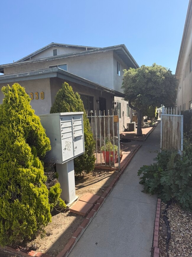
1330 Stevens Ave
San Gabriel, CA 91776
Today
|
Edit
Favorites
626-380-8379
-
Bedrooms
2
-
Bathrooms
1
-
Square Feet
650 sq ft
-
Available
Available Now
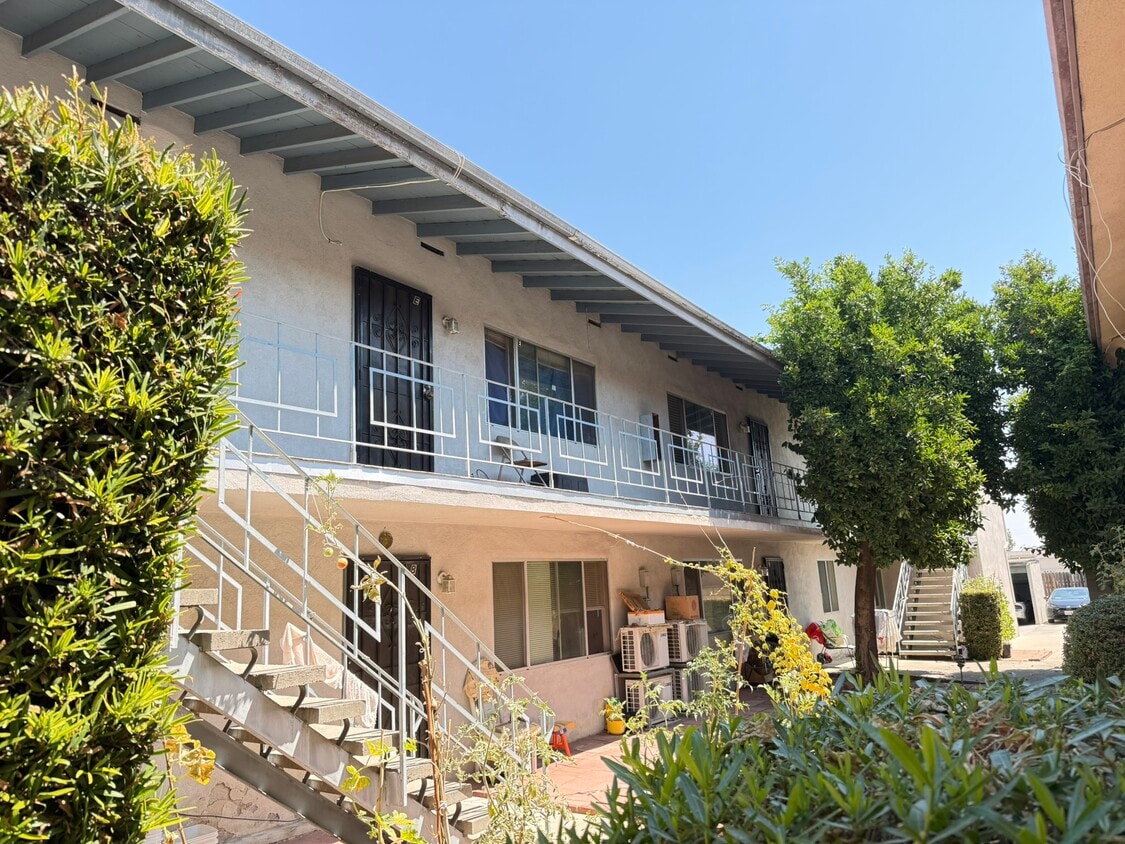
1330 Stevens Ave

Favorites
About This Home
12 Month Lease,
$2,100 deposit,
Available Now
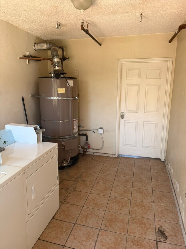
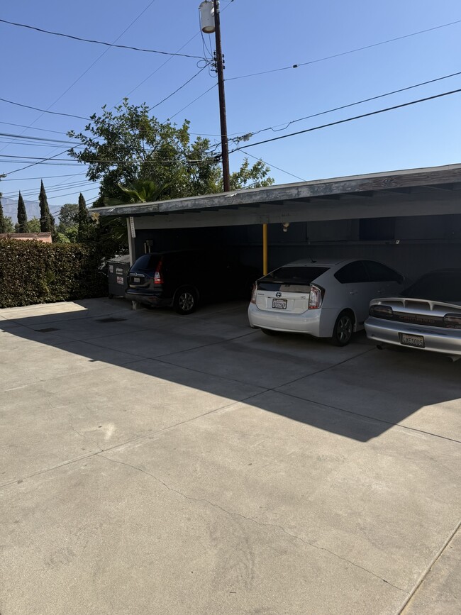
Upstairs unit for rent, coin laundry, close to shopping center. Tenant paid electric and gas.
1330 Stevens Ave is a townhome located in Los Angeles County and the 91776 ZIP Code. This area is served by the San Gabriel Unified attendance zone.
* Price shown is base rent. Excludes user-selected optional fees and variable or usage-based fees and required charges due at or prior to move-in or at move-out. Price, availability, fees, and any applicable rent special are subject to change without notice.
* Square footage definitions vary. Displayed square footage is approximate.
Townhome Features
- Laundry Facilities
Fees and Policies
The fees below are based on community-supplied data and may exclude additional fees and utilities.
- Cats Allowed
-
Fees not specified
-
Weight limit--
-
Pet Limit--
Details
Utilities Included
-
Water
-
Trash Removal
Property Information
-
Built in 1961
Contact
- Phone Number
Location
Get Directions
Situated about ten miles northeast of Los Angeles, San Gabriel is a scenic suburb often regarded as the “Birthplace of the Los Angeles Region.” The city boasts a rich history dating back to the 1700s, when the Mission San Gabriel (known as the “Pride of the California Missions”) was founded.
San Gabriel’s historic roots are on display to this day, with the vibrant Mission District serving as the city’s hub of culture, art, and history. City Hall, the San Gabriel Mission Playhouse, and numerous well-maintained Spanish Colonial Revival style buildings are the cornerstones of the District. A host of diverse eateries, cafes, offices, shops, and museums—including the famed San Gabriel Mission—are also found in this vibrant downtown area.
Area residents enjoy a bevy of outdoor activities at Vincent Lugo Park, Smith Park, and San Gabriel Country Club.
Learn more about living in San Gabriel
Education
| Colleges & Universities | Distance | ||
|---|---|---|---|
| Colleges & Universities | Distance | ||
| Drive: | 9 min | 4.8 mi | |
| Drive: | 14 min | 5.1 mi | |
| Drive: | 13 min | 5.2 mi | |
| Drive: | 11 min | 5.5 mi |
1330 Stevens Ave is within 9 minutes or 4.8 miles from Cal State Los Angeles. It is also near Caltech and Art Center College of Design.
Schools


Public Elementary School
Grades K-5
605 Students
Attendance Zone
Public Elementary School
Grades K-6
454 Students
Nearby
Public Middle School
Grades 6-8
927 Students
Attendance Zone
Public High School
Grades 9-12
1,527 Students
Attendance Zone
Private Elementary & Middle School
Grades PK-8
168 Students
Nearby
Private Elementary, Middle & High School
Grades K-12
Nearby
Private Elementary & Middle School
Grades PK-8
150 Students
Nearby
School data provided by
 The GreatSchools Rating helps parents compare schools within a state based on a variety of school quality indicators and provides a helpful picture of how effectively each school serves all of its students. Ratings are on a scale of 1 (below average) to 10 (above average) and can include test scores, college readiness, academic progress, advanced courses, equity, discipline and attendance data. We also advise parents to visit schools, consider other information on school performance and programs, and consider family needs as part of the school selection process.
View GreatSchools Rating Methodology
Data provided by GreatSchools.org © 2026. All rights reserved.
View GreatSchools Rating Methodology
Data provided by GreatSchools.org © 2026. All rights reserved.
Transportation options available in San Gabriel include South Pasadena, located 4.7 miles from 1330 Stevens Ave. 1330 Stevens Ave is near Bob Hope, located 23.5 miles or 32 minutes away, and Long Beach (Daugherty Field), located 23.9 miles or 35 minutes away.
| Transit / Subway | Distance | ||
|---|---|---|---|
| Transit / Subway | Distance | ||
|
|
Drive: | 13 min | 4.7 mi |
|
|
Drive: | 13 min | 5.5 mi |
|
|
Drive: | 11 min | 5.7 mi |
|
|
Drive: | 15 min | 7.3 mi |
|
|
Drive: | 12 min | 7.7 mi |
| Commuter Rail | Distance | ||
|---|---|---|---|
| Commuter Rail | Distance | ||
|
|
Drive: | 10 min | 5.9 mi |
|
|
Drive: | 15 min | 7.1 mi |
|
|
Drive: | 15 min | 9.0 mi |
|
|
Drive: | 17 min | 11.5 mi |
| Drive: | 16 min | 12.8 mi |
| Airports | Distance | ||
|---|---|---|---|
| Airports | Distance | ||
|
Bob Hope
|
Drive: | 32 min | 23.5 mi |
|
Long Beach (Daugherty Field)
|
Drive: | 35 min | 23.9 mi |
Time and distance from 1330 Stevens Ave.
| Shopping Centers | Distance | ||
|---|---|---|---|
| Shopping Centers | Distance | ||
| Walk: | 7 min | 0.4 mi | |
| Walk: | 8 min | 0.4 mi | |
| Walk: | 8 min | 0.5 mi |
1330 Stevens Ave has 3 shopping centers within 0.5 mile, which is about a 8-minute walk. The miles and minutes will be for the farthest away property.
| Parks and Recreation | Distance | ||
|---|---|---|---|
| Parks and Recreation | Distance | ||
|
Huntington Botanical Gardens
|
Drive: | 13 min | 4.4 mi |
|
Whittier Narrows Recreation Area
|
Drive: | 12 min | 5.3 mi |
|
Los Angeles County Arboretum
|
Drive: | 16 min | 6.8 mi |
|
Whittier Narrows Nature Center
|
Drive: | 14 min | 7.2 mi |
|
Audubon Center at Debs Park
|
Drive: | 16 min | 10.9 mi |
1330 Stevens Ave has 5 parks within 10.9 miles, including Huntington Botanical Gardens, Whittier Narrows Recreation Area, and Whittier Narrows Nature Center.
| Hospitals | Distance | ||
|---|---|---|---|
| Hospitals | Distance | ||
| Drive: | 5 min | 1.7 mi | |
| Drive: | 4 min | 2.2 mi | |
| Drive: | 7 min | 2.8 mi |
1330 Stevens Ave has 3 hospitals within 2.8 miles, the nearest is San Gabriel Valley Medical Center which is 1.7 miles away and a 5 minute drive.
| Military Bases | Distance | ||
|---|---|---|---|
| Military Bases | Distance | ||
| Drive: | 35 min | 26.5 mi | |
| Drive: | 39 min | 27.5 mi |
1330 Stevens Ave is 26.5 miles from Los Angeles Air Force Base, and is convenient to other military bases, including Los Alamitos Army Airfield.
Amenities
- Laundry Facilities
1330 Stevens Ave Photos
What Are Walk Score®, Transit Score®, and Bike Score® Ratings?
Walk Score® measures the walkability of any address. Transit Score® measures access to public transit. Bike Score® measures the bikeability of any address.
What is a Sound Score Rating?
A Sound Score Rating aggregates noise caused by vehicle traffic, airplane traffic and local sources

1330 Stevens Ave
San Gabriel, CA 91776