

$2,600 - $3,000
Total Monthly Price
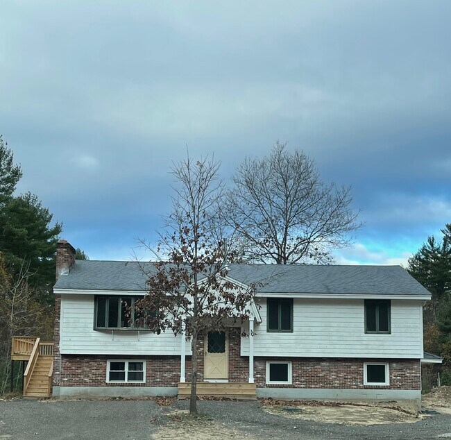
133 Windham Rd
Pelham, NH 03076
2 Weeks Ago
|
Edit
Favorites
133 Windham Rd

Favorites
Check Back Soon for Upcoming Availability
| Beds | Baths | Average SF |
|---|---|---|
| 2 Bedrooms 2 Bedrooms 2 Br | 1 Bath 1 Bath 1 Ba | 1,500 SF |
| 3 Bedrooms 3 Bedrooms 3 Br | 1 Bath 1 Bath 1 Ba | 1,500 SF |
Fees and Policies
The fees listed below are community-provided and may exclude utilities or add-ons. All payments are made directly to the property and are non-refundable unless otherwise specified.
- Dogs Allowed
-
Fees not specified
- Cats Allowed
-
Fees not specified
- Parking
-
Surface Lot--
Details
Utilities Included
-
Sewer
Property Information
-
2 units
133 Windham Rd is an apartment community located in Hillsborough County and the 03076 ZIP Code.
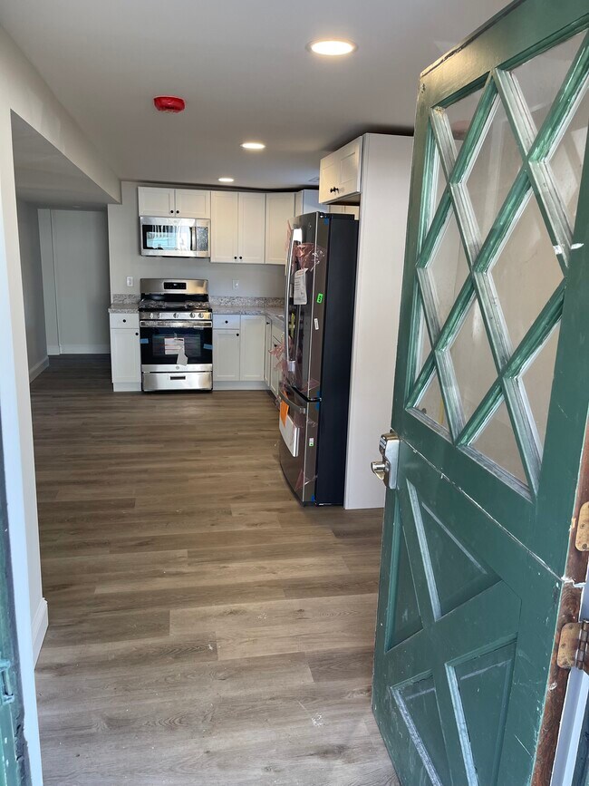
Apartment Features
Washer/Dryer
Air Conditioning
Dishwasher
Fireplace
- Washer/Dryer
- Air Conditioning
- Smoke Free
- Fireplace
- Dishwasher
133 Windham Rd,
Pelham,
NH
03076
Amenities
- Washer/Dryer
- Air Conditioning
- Smoke Free
- Fireplace
- Dishwasher
Expenses
Utilities Included
Sewer
Included
Education
| Colleges & Universities | Distance | ||
|---|---|---|---|
| Colleges & Universities | Distance | ||
| Drive: | 15 min | 7.2 mi | |
| Drive: | 15 min | 7.6 mi | |
| Drive: | 21 min | 10.8 mi | |
| Drive: | 31 min | 15.5 mi |
133 Windham Rd is within 15 minutes or 7.2 miles from Middlesex C.C., Lowell Campus. It is also near UMass Lowell and Rivier College.
Walkability Near 133 Windham Rd Pelham, NH 03076
Getting Around
 What do Walkability, Transit, Drivability, and Bikeability mean?
Walkability measures the walking distance to day-to-day needs.
Transit measures access to public transportation.
Drivability measures congestion, parking availability, and access to major roads.
Bikeability measures the suitability for cycling.
How It Works
What do Walkability, Transit, Drivability, and Bikeability mean?
Walkability measures the walking distance to day-to-day needs.
Transit measures access to public transportation.
Drivability measures congestion, parking availability, and access to major roads.
Bikeability measures the suitability for cycling.
How It Works
Somewhat Walkable
Walkability
30
/ 100
Exceptionally Drivable
Drivability
100
/ 100
Fairly Bikeable
Bikeability
40
/ 100
Scores provided by
-
Soundscore™
-
/ 100
Traffic
-Airport
-Businesses
-Scores provided by
HowLoud What is a Sound Score Rating? A Sound Score Rating aggregates noise caused by vehicle traffic, airplane traffic and local sources. How It WorksYou May Also Like
Similar Rentals Nearby
-
-
-
-
-
-
-
-
2 Beds$2,765+3 Beds$4,491+Total Monthly PriceTotal Monthly Price NewPrices include all required monthly fees.Specials
Pets Allowed Fitness Center Pool Kitchen In Unit Washer & Dryer Balcony
-
2 Beds$2,711+3 Beds$4,102+Total Monthly PriceTotal Monthly Price NewPrices include base rent and required monthly fees. Variable costs based on usage may apply.Specials
Pets Allowed Fitness Center Pool Dishwasher Refrigerator Kitchen
-


What Are Walk Score®, Transit Score®, and Bike Score® Ratings?
Walk Score® measures the walkability of any address. Transit Score® measures access to public transit. Bike Score® measures the bikeability of any address.
What is a Sound Score Rating?
A Sound Score Rating aggregates noise caused by vehicle traffic, airplane traffic and local sources.

133 Windham Rd
Pelham, NH 03076