
$3,500
Total Monthly Price
12 Month Lease
133 Walnut St
Wellesley, MA 02481
Today
|
Edit
Favorites
857-285-5575
-
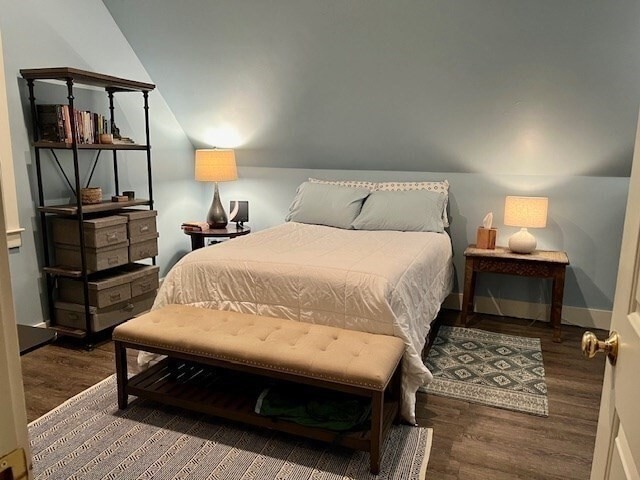
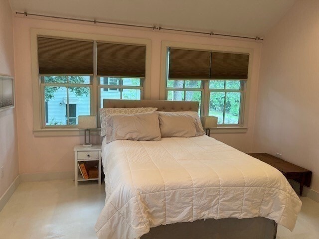
Bedrooms
2
-
Bathrooms
2
-
Square Feet
1,001 sq ft
-
Available
Available Feb 1
Highlight
- Security System
133 Walnut St

Favorites
About This Home
12 Month Lease,
$3,500 deposit,
Available Feb 1
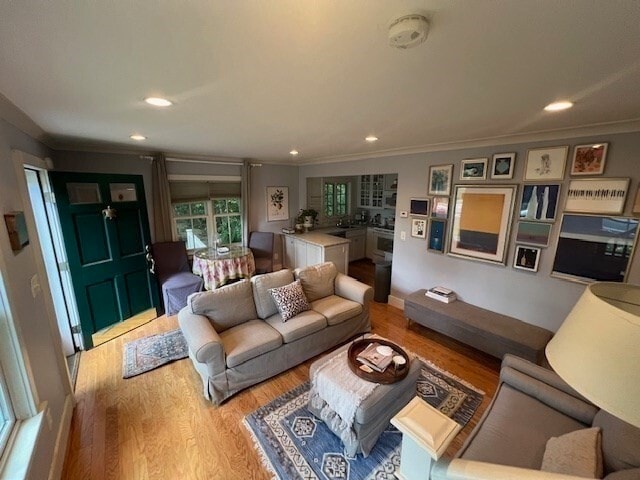
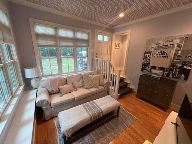
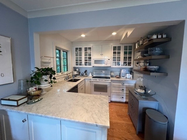
****** Available Now ***** Cozy updated 2 bedroom/2 bathroom home in convenient location is now available. This home located in the Poet's Corner Section of Wellesley offers convenience to highways, Newton-Wellesley Hospital, Schofield School and recreational venues. Updated kitchen and bathrooms, central air conditioning, washer and dryer, off-street parking and outdoor space are just a few of the amenities you will find. Enjoy all the outdoor activities Wellesley has to offer. Tenant handles lawn care, snow removal and utilities.
133 Walnut St is a house located in Norfolk County and the 02481 ZIP Code.
* Price shown is total price based on community-supplied monthly required fees. Excludes user-selected optional fees and variable or usage-based fees and required charges due at or prior to move-in or at move-out. Price, availability, fees, and any applicable rent special are subject to change without notice.
* Square footage definitions vary. Displayed square footage is approximate.
House Features
Washer/Dryer
Air Conditioning
High Speed Internet Access
Wi-Fi
- High Speed Internet Access
- Wi-Fi
- Washer/Dryer
- Air Conditioning
- Heating
- Ceiling Fans
- Cable Ready
- Security System
- Storage Space
- Tub/Shower
- Kitchen
- Lawn
Fees and Policies
The fees below are based on community-supplied data and may exclude additional fees and utilities.
- Parking
-
Surface Lot--
Contact
- Phone Number
- Contact
Location
Get Directions
Just west of Boston and East of Worcester sits Metro West, a region that houses a group of towns and cities with significant historical backgrounds. A total of 19 municipalities make up the core of this community, but other municipalities are considered to be a part of the Interstate 495/Metro West Corridor.
Learn more about living in Metro West
Education
| Colleges & Universities | Distance | ||
|---|---|---|---|
| Colleges & Universities | Distance | ||
| Drive: | 8 min | 3.4 mi | |
| Drive: | 9 min | 3.8 mi | |
| Drive: | 9 min | 3.9 mi | |
| Drive: | 11 min | 5.8 mi |
133 Walnut St is within 8 minutes or 3.4 miles from Babson College. It is also near Wellesley College and Brandeis University.
Transportation options available in Wellesley include Woodland Station, located 1.1 miles from 133 Walnut St. 133 Walnut St is near General Edward Lawrence Logan International, located 15.1 miles or 24 minutes away, and Worcester Regional, located 39.3 miles or 56 minutes away.
| Transit / Subway | Distance | ||
|---|---|---|---|
| Transit / Subway | Distance | ||
|
|
Drive: | 2 min | 1.1 mi |
|
|
Drive: | 4 min | 1.5 mi |
|
|
Drive: | 3 min | 1.8 mi |
|
|
Drive: | 6 min | 2.8 mi |
|
|
Drive: | 6 min | 3.0 mi |
| Commuter Rail | Distance | ||
|---|---|---|---|
| Commuter Rail | Distance | ||
|
|
Drive: | 3 min | 1.2 mi |
|
|
Drive: | 3 min | 1.5 mi |
|
|
Drive: | 6 min | 3.6 mi |
|
|
Drive: | 12 min | 7.3 mi |
|
|
Drive: | 13 min | 8.1 mi |
| Airports | Distance | ||
|---|---|---|---|
| Airports | Distance | ||
|
General Edward Lawrence Logan International
|
Drive: | 24 min | 15.1 mi |
|
Worcester Regional
|
Drive: | 56 min | 39.3 mi |
Time and distance from 133 Walnut St.
| Shopping Centers | Distance | ||
|---|---|---|---|
| Shopping Centers | Distance | ||
| Drive: | 5 min | 2.4 mi | |
| Drive: | 5 min | 2.4 mi | |
| Drive: | 5 min | 3.3 mi |
133 Walnut St has 3 shopping centers within 3.3 miles, which is about a 5-minute drive. The miles and minutes will be for the farthest away property.
| Parks and Recreation | Distance | ||
|---|---|---|---|
| Parks and Recreation | Distance | ||
|
Hemlock Gorge Reservation
|
Drive: | 6 min | 2.5 mi |
|
Whitin Observatory
|
Drive: | 8 min | 3.3 mi |
|
Wellesley College Botanic Gardens
|
Drive: | 7 min | 3.6 mi |
|
Cutler Park Reservation
|
Drive: | 7 min | 3.9 mi |
|
Land's Sake Farm
|
Drive: | 10 min | 4.0 mi |
133 Walnut St has 5 parks within 4.0 miles, including Hemlock Gorge Reservation, Whitin Observatory, and Wellesley College Botanic Gardens.
| Hospitals | Distance | ||
|---|---|---|---|
| Hospitals | Distance | ||
| Walk: | 16 min | 0.8 mi | |
| Drive: | 9 min | 4.4 mi | |
| Drive: | 8 min | 4.7 mi |
133 Walnut St has 3 hospitals within 4.7 miles, the nearest is Newton - Wellesley Hospital which is 0.8 mile away and a 16 minute walk.
| Military Bases | Distance | ||
|---|---|---|---|
| Military Bases | Distance | ||
| Drive: | 12 min | 6.9 mi | |
| Drive: | 19 min | 11.0 mi |
133 Walnut St is 6.9 miles from US Military Reservation, and is convenient to other military bases, including Hanscom Air Force Base.
Amenities
- High Speed Internet Access
- Wi-Fi
- Washer/Dryer
- Air Conditioning
- Heating
- Ceiling Fans
- Cable Ready
- Security System
- Storage Space
- Tub/Shower
- Kitchen
- Lawn
133 Walnut St Photos
What Are Walk Score®, Transit Score®, and Bike Score® Ratings?
Walk Score® measures the walkability of any address. Transit Score® measures access to public transit. Bike Score® measures the bikeability of any address.
What is a Sound Score Rating?
A Sound Score Rating aggregates noise caused by vehicle traffic, airplane traffic and local sources
133 Walnut St
Wellesley, MA 02481