
$1,400
/ Month
133 Walnut St
Pottstown, PA 19464
2 Weeks Ago
|
Edit
Favorites
133 Walnut St

Favorites
Check Back Soon for Upcoming Availability
| Beds | Baths | Average SF |
|---|---|---|
| 2 Bedrooms 2 Bedrooms 2 Br | 1 Bath 1 Bath 1 Ba | 2,415 SF |
About This Property
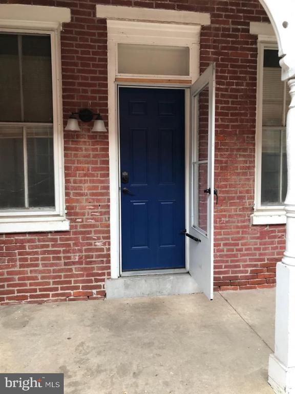
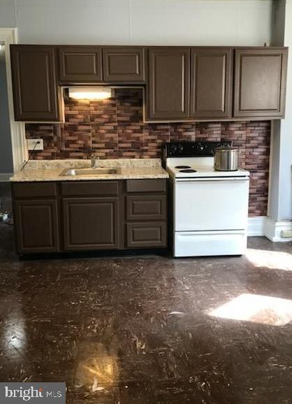
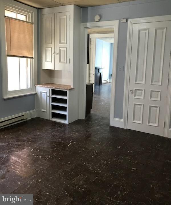
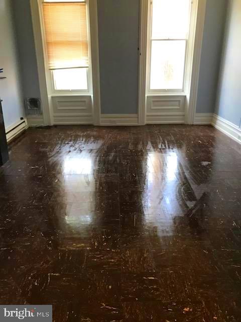
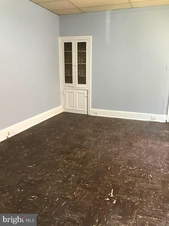
Two bedroom unit on the first floor with private entrance on the side. Fresh paint through out, tile floors, large bedrooms. Shared use of the yard.
133 Walnut St is a house located in Philadelphia County and the 19464 ZIP Code. This area is served by the The School District of Philadelphia attendance zone.
Location
Get Directions
Known locally as “Old City,” Center City East comprises some of Philadelphia's oldest buildings, dating back to colonial times. The area includes the Graff house, where Thomas Jefferson lived while writing the Declaration of Independence; Independence Hall, where it was signed and ratified; and numerous other legendary American artifacts and landmarks such as the Liberty Bell.
As you might expect, it’s an extremely popular tourist destination, but the vintage buildings are home to exquisite restaurants and a thriving nightlife scene that locals can’t get enough of. Philadelphia’s Chinatown takes up a significant portion of the neighborhood, injecting international flair into the all-American landscape. The tight layout gives many residents the option of walking to work, the grocery store, or out to eat, while PATCO and SEPTA service provide several convenient options for getting around the city.
Learn more about living in Center City EastBelow are rent ranges for similar nearby apartments
Education
| Colleges & Universities | Distance | ||
|---|---|---|---|
| Colleges & Universities | Distance | ||
| Walk: | 3 min | 0.2 mi | |
| Drive: | 4 min | 1.1 mi | |
| Drive: | 3 min | 1.2 mi | |
| Drive: | 4 min | 1.5 mi |
133 Walnut St is within 3 minutes or 0.2 mile from Thomas Jefferson University. It is also near The Art Inst. of Philadelphia and Drexel Univ., Hahnemann.
Schools


Public Elementary & Middle School
Grades PK-8
405 Students
Nearby
Public Elementary & Middle School
Grades K-8
628 Students
Attendance Zone
Public High School
Grades 9-12
466 Students
Attendance Zone
Private Elementary School
Grades PK-1
8 Students
Nearby
Private Elementary & Middle School
Grades K-8
250 Students
Nearby
Private Middle & High School
Grades 8-12
60 Students
Nearby
School data provided by
 The GreatSchools Rating helps parents compare schools within a state based on a variety of school quality indicators and provides a helpful picture of how effectively each school serves all of its students. Ratings are on a scale of 1 (below average) to 10 (above average) and can include test scores, college readiness, academic progress, advanced courses, equity, discipline and attendance data. We also advise parents to visit schools, consider other information on school performance and programs, and consider family needs as part of the school selection process.
View GreatSchools Rating Methodology
Data provided by GreatSchools.org © 2025. All rights reserved.
View GreatSchools Rating Methodology
Data provided by GreatSchools.org © 2025. All rights reserved.
Transportation options available in Pottstown include 9Th-10Th & Locust St, located 0.2 mile from 133 Walnut St. 133 Walnut St is near Philadelphia International, located 12.0 miles or 22 minutes away, and Trenton Mercer, located 33.5 miles or 49 minutes away.
| Transit / Subway | Distance | ||
|---|---|---|---|
| Transit / Subway | Distance | ||
|
|
Walk: | 3 min | 0.2 mi |
|
|
Walk: | 5 min | 0.3 mi |
|
|
Walk: | 8 min | 0.4 mi |
|
|
Walk: | 8 min | 0.4 mi |
|
|
Walk: | 9 min | 0.5 mi |
| Commuter Rail | Distance | ||
|---|---|---|---|
| Commuter Rail | Distance | ||
|
|
Walk: | 9 min | 0.5 mi |
|
|
Drive: | 4 min | 1.2 mi |
|
|
Drive: | 5 min | 1.8 mi |
| Drive: | 7 min | 2.4 mi | |
| Drive: | 7 min | 2.9 mi |
| Airports | Distance | ||
|---|---|---|---|
| Airports | Distance | ||
|
Philadelphia International
|
Drive: | 22 min | 12.0 mi |
|
Trenton Mercer
|
Drive: | 49 min | 33.5 mi |
Time and distance from 133 Walnut St.
| Shopping Centers | Distance | ||
|---|---|---|---|
| Shopping Centers | Distance | ||
| Walk: | 8 min | 0.5 mi | |
| Walk: | 9 min | 0.5 mi | |
| Walk: | 11 min | 0.6 mi |
133 Walnut St has 3 shopping centers within 0.6 mile, which is about a 11-minute walk. The miles and minutes will be for the farthest away property.
| Parks and Recreation | Distance | ||
|---|---|---|---|
| Parks and Recreation | Distance | ||
|
Independence National Historical Park
|
Walk: | 8 min | 0.4 mi |
|
Lower Delaware National Wild and Scenic River
|
Walk: | 13 min | 0.7 mi |
|
Great Egg Harbor River
|
Walk: | 13 min | 0.7 mi |
|
Thaddeus Kosciuszko National Memorial
|
Walk: | 13 min | 0.7 mi |
|
Independence Seaport Museum
|
Drive: | 5 min | 1.3 mi |
133 Walnut St has 5 parks within 1.3 miles, including Independence National Historical Park, Lower Delaware National Wild and Scenic River, and Great Egg Harbor River.
| Hospitals | Distance | ||
|---|---|---|---|
| Hospitals | Distance | ||
| Walk: | 1 min | 0.1 mi | |
| Walk: | 5 min | 0.3 mi | |
| Walk: | 5 min | 0.3 mi |
133 Walnut St has 3 hospitals within 0.3 mile, the nearest is Wills Eye Hospital which is 0.1 mile away and a 1 minute walk.
| Military Bases | Distance | ||
|---|---|---|---|
| Military Bases | Distance | ||
| Drive: | 13 min | 6.4 mi |
133 Walnut St is 6.4 miles and a 13 minute drive from Philadelphia Naval Busi Center.
You May Also Like
Similar Rentals Nearby


What Are Walk Score®, Transit Score®, and Bike Score® Ratings?
Walk Score® measures the walkability of any address. Transit Score® measures access to public transit. Bike Score® measures the bikeability of any address.
What is a Sound Score Rating?
A Sound Score Rating aggregates noise caused by vehicle traffic, airplane traffic and local sources

133 Walnut St
Pottstown, PA 19464