$2,050 / Month
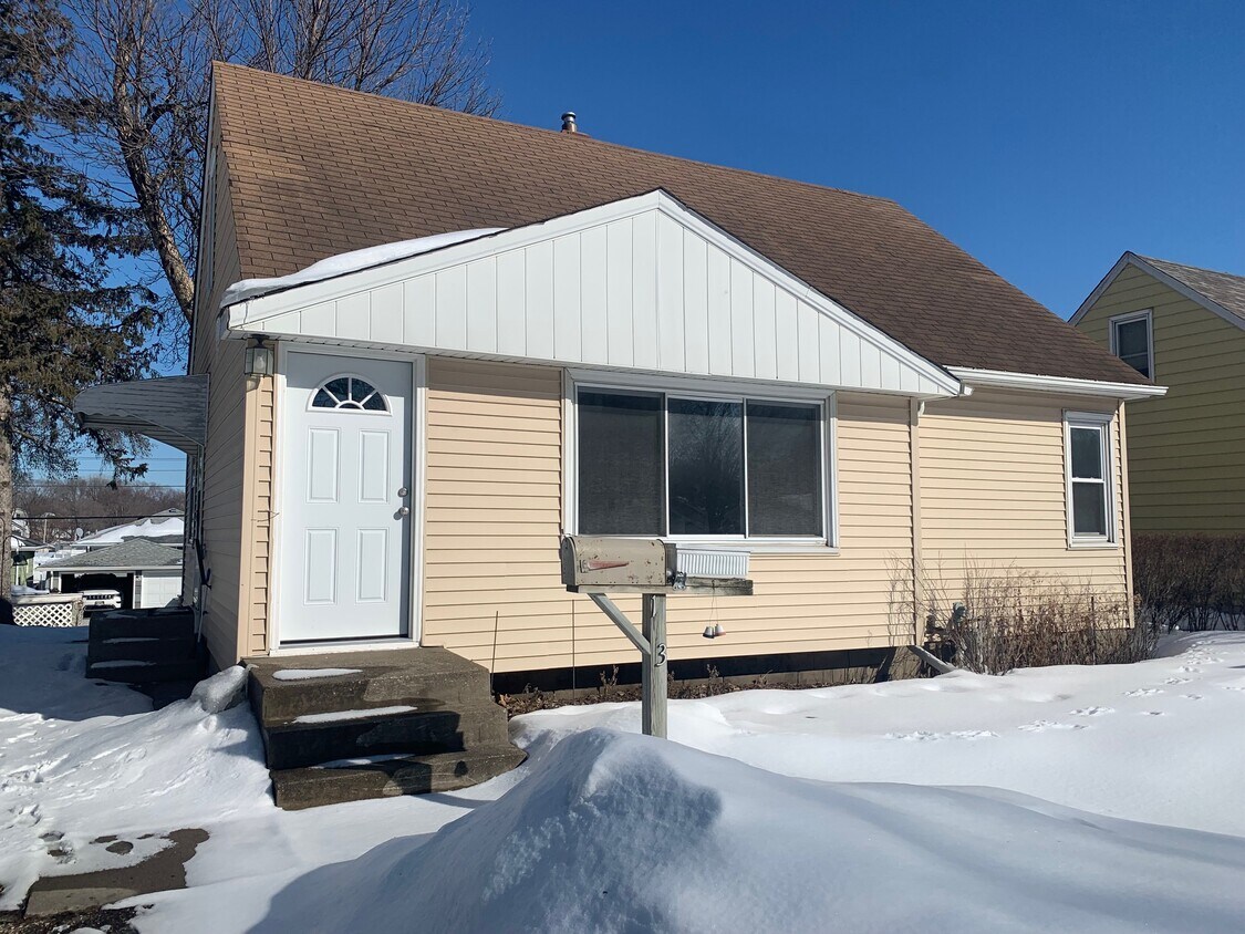
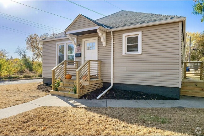
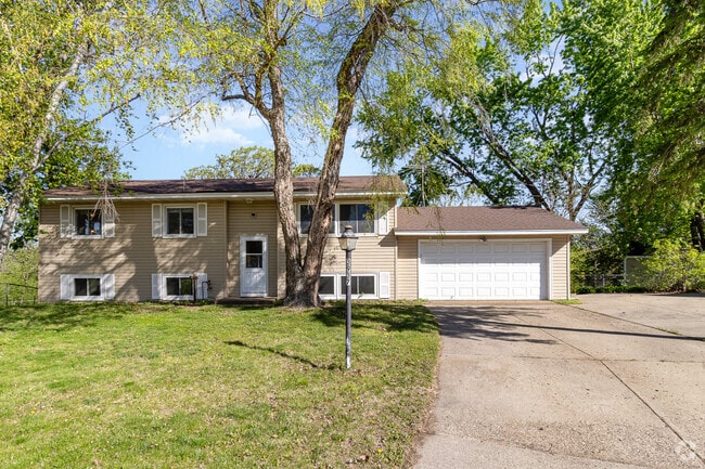
133 22nd Ave S
South Saint Paul, MN 55075
2 Weeks Ago
Favorites
133 22nd Ave S

Favorites
Check Back Soon for Upcoming Availability
| Beds | Baths | Average SF |
|---|---|---|
| 3 Bedrooms 3 Bedrooms 3 Br | 1 Bath 1 Bath 1 Ba | 1,155 SF |
Fees and Policies
The fees below are based on community-supplied data and may exclude additional fees and utilities.
- Parking
-
Garage--
About This Property
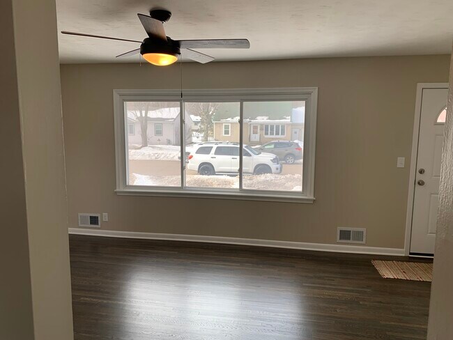
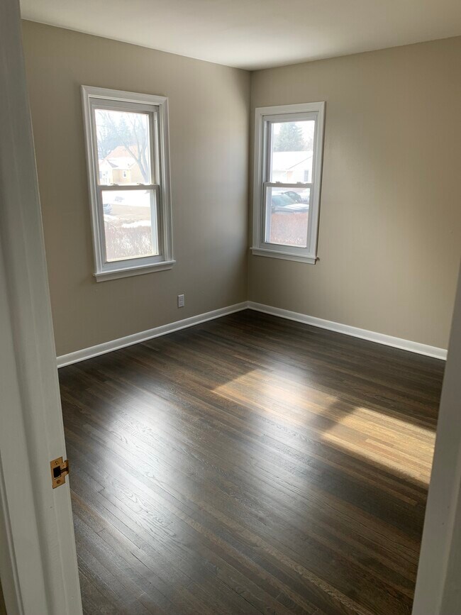
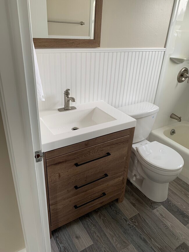
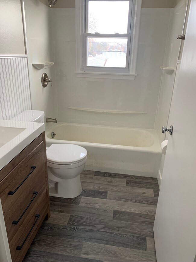
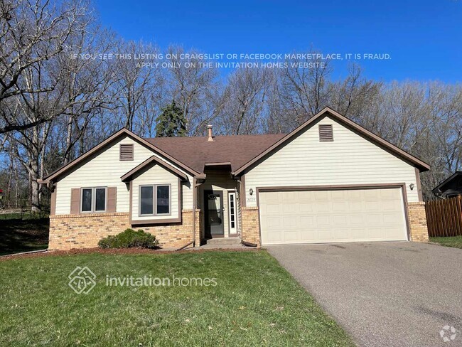
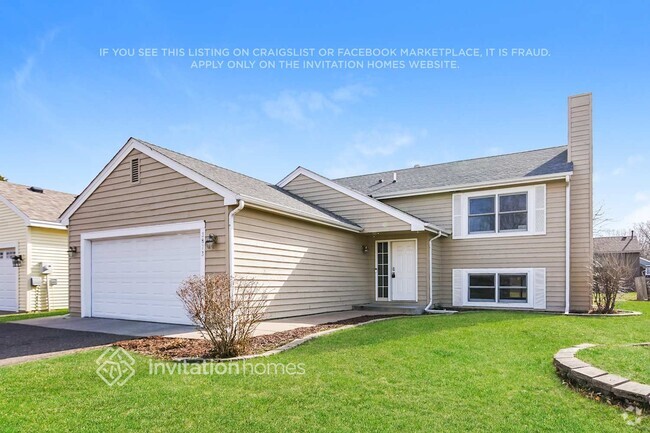
Freshly remodeled home conveniently located just of highway 52 in South Saint Paul. Remodel includes bathroom renovation, new flooring throughout the home including natural hardwoods on main floor living and bed rooms along with new lighting! Also included forced air heat/central AC, 2 car garage and on street parking.
133 22nd Ave S is a house located in Dakota County and the 55075 ZIP Code.
House Features
Washer/Dryer
Air Conditioning
Hardwood Floors
Microwave
- Washer/Dryer
- Air Conditioning
- Heating
- Ceiling Fans
- Smoke Free
- Cable Ready
- Storage Space
- Tub/Shower
- Eat-in Kitchen
- Kitchen
- Microwave
- Oven
- Range
- Refrigerator
- Freezer
- Hardwood Floors
- Yard
- Lawn
Location
Get Directions
South St. Paul is southwest of the Minneapolis/St. Paul area and is conveniently located off Highway 494 along the banks of the Mississippi. With a rich historic background and cultural diversity, the South St. Paul area is known for a laid-back lifestyle while providing a comfortable and affordable way of life.
South St. Paul prides itself on being a family-friendly community while also offering easy access to all the comforts of big city life. The area has a wide range of entertainment and recreational opportunities and hosts community events all year around.
Learn more about living in South St PaulBelow are rent ranges for similar nearby apartments
Amenities
- Washer/Dryer
- Air Conditioning
- Heating
- Ceiling Fans
- Smoke Free
- Cable Ready
- Storage Space
- Tub/Shower
- Eat-in Kitchen
- Kitchen
- Microwave
- Oven
- Range
- Refrigerator
- Freezer
- Hardwood Floors
- Yard
- Lawn
Education
| Colleges & Universities | Distance | ||
|---|---|---|---|
| Colleges & Universities | Distance | ||
| Drive: | 10 min | 4.9 mi | |
| Drive: | 10 min | 5.8 mi | |
| Drive: | 12 min | 6.3 mi | |
| Drive: | 15 min | 9.2 mi |
133 22nd Ave S is within 10 minutes or 4.9 miles from Inver Hills Community College. It is also near Metropolitan State University and Saint Paul College.
Transportation options available in South Saint Paul include Central Station, located 5.1 miles from 133 22nd Ave S. 133 22nd Ave S is near Minneapolis-St Paul International/Wold-Chamberlain, located 9.7 miles or 17 minutes away.
| Transit / Subway | Distance | ||
|---|---|---|---|
| Transit / Subway | Distance | ||
| Drive: | 10 min | 5.1 mi | |
| Drive: | 10 min | 5.2 mi | |
| Drive: | 10 min | 5.3 mi | |
| Drive: | 11 min | 5.6 mi | |
| Drive: | 11 min | 5.7 mi |
| Commuter Rail | Distance | ||
|---|---|---|---|
| Commuter Rail | Distance | ||
|
|
Drive: | 10 min | 5.4 mi |
|
|
Drive: | 28 min | 16.0 mi |
|
|
Drive: | 31 min | 21.9 mi |
|
|
Drive: | 41 min | 30.0 mi |
|
|
Drive: | 42 min | 31.7 mi |
| Airports | Distance | ||
|---|---|---|---|
| Airports | Distance | ||
|
Minneapolis-St Paul International/Wold-Chamberlain
|
Drive: | 17 min | 9.7 mi |
Time and distance from 133 22nd Ave S.
| Shopping Centers | Distance | ||
|---|---|---|---|
| Shopping Centers | Distance | ||
| Walk: | 14 min | 0.7 mi | |
| Walk: | 17 min | 0.9 mi | |
| Drive: | 3 min | 1.3 mi |
133 22nd Ave S has 3 shopping centers within 1.3 miles, which is about a 3-minute walk. The miles and minutes will be for the farthest away property.
| Parks and Recreation | Distance | ||
|---|---|---|---|
| Parks and Recreation | Distance | ||
|
Dodge Nature Center
|
Drive: | 7 min | 2.6 mi |
|
Kellogg Mall Park
|
Drive: | 9 min | 5.1 mi |
|
Cherokee Regional Park
|
Drive: | 12 min | 5.3 mi |
|
Science Museum of Minnesota
|
Drive: | 11 min | 6.0 mi |
|
Indian Mounds Park
|
Drive: | 13 min | 6.8 mi |
133 22nd Ave S has 5 parks within 6.8 miles, including Dodge Nature Center, Cherokee Regional Park, and Kellogg Mall Park.
| Hospitals | Distance | ||
|---|---|---|---|
| Hospitals | Distance | ||
| Drive: | 11 min | 5.7 mi | |
| Drive: | 11 min | 6.0 mi | |
| Drive: | 11 min | 6.1 mi |
133 22nd Ave S has 3 hospitals within 6.1 miles, the nearest is St. Joseph's Hospital which is 5.7 miles away and a 11 minute drive.
| Military Bases | Distance | ||
|---|---|---|---|
| Military Bases | Distance | ||
| Drive: | 15 min | 8.6 mi |
133 22nd Ave S is 8.6 miles and a 15 minute drive from Fort Snelling Military Reservation.
You May Also Like
Similar Rentals Nearby
What Are Walk Score®, Transit Score®, and Bike Score® Ratings?
Walk Score® measures the walkability of any address. Transit Score® measures access to public transit. Bike Score® measures the bikeability of any address.
What is a Sound Score Rating?
A Sound Score Rating aggregates noise caused by vehicle traffic, airplane traffic and local sources

133 22nd Ave S
South Saint Paul, MN 55075