
Presidential Towers
555 W Madison St,
Chicago, IL 60661
$1,631 - $6,372
Studio - 2 Beds


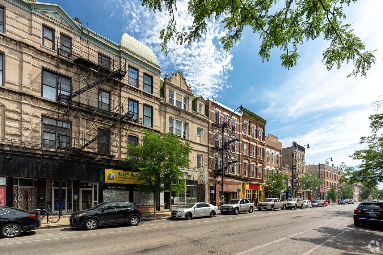
Located in the heart of Pilsen this building has been thoughtfully updated with all of the amenities and top quality finish. Each apartment is unique! Come and see the south facing front units with their beautiful quartz countertops, white shaker cabinets and beautifully tiled bathrooms. The entire building has been high speed internet with a building provided WiFi access point in each apartment. Email contact is preferred.
1328 W 18th St is an apartment community located in Cook County and the 60608 ZIP Code. This area is served by the Chicago Public Schools attendance zone.
Unique Features
Laundry Facilities
Controlled Access
Gated
Key Fob Entry
Washer/Dryer
Air Conditioning
Dishwasher
High Speed Internet Access
Hardwood Floors
Island Kitchen
Granite Countertops
Microwave
Located on the Lower West Side of Chicago, Pilsen is a vibrant neighborhood known for its many bold murals and exciting cultural offerings. Pilsen residents enjoy access to eclectic vintage stores, local coffee shops, and cozy cafes along with a host of bodegas, panaderias, and delicious Mexican cuisine on bustling West 18th Street.
Pilsen is home to the National Museum of Mexican Art, a respected cultural institution featuring a robust collection of high-quality works. There are also plenty of art galleries and studios in the neighborhood, contributing to Pilsen’s artistic reputation. Getting around from your Pilsen rental is simple with convenience to public buses, the Pink Line, and Metra as well as the Eisenhower, Dan Ryan, and Stevenson Expressways.
Learn more about living in PilsenCompare neighborhood and city base rent averages by bedroom.
| Pilsen | Chicago, IL | |
|---|---|---|
| Studio | $1,613 | $1,644 |
| 1 Bedroom | $1,569 | $2,046 |
| 2 Bedrooms | $1,922 | $2,580 |
| 3 Bedrooms | $2,531 | $3,089 |
| Colleges & Universities | Distance | ||
|---|---|---|---|
| Colleges & Universities | Distance | ||
| Walk: | 17 min | 0.9 mi | |
| Drive: | 3 min | 1.6 mi | |
| Drive: | 5 min | 2.3 mi | |
| Drive: | 6 min | 2.4 mi |


Transportation options available in Chicago include 18Th Street Station, located 0.6 mile from 1328 W 18th St. 1328 W 18th St is near Chicago Midway International, located 8.0 miles or 14 minutes away, and Chicago O'Hare International, located 18.9 miles or 30 minutes away.
| Transit / Subway | Distance | ||
|---|---|---|---|
| Transit / Subway | Distance | ||
|
|
Walk: | 10 min | 0.6 mi |
|
|
Drive: | 3 min | 1.1 mi |
|
|
Drive: | 3 min | 1.4 mi |
|
|
Drive: | 4 min | 1.5 mi |
|
|
Drive: | 5 min | 2.6 mi |
| Commuter Rail | Distance | ||
|---|---|---|---|
| Commuter Rail | Distance | ||
|
|
Walk: | 16 min | 0.8 mi |
|
|
Drive: | 3 min | 1.3 mi |
|
|
Drive: | 6 min | 2.4 mi |
|
|
Drive: | 6 min | 2.4 mi |
|
|
Drive: | 6 min | 2.6 mi |
| Airports | Distance | ||
|---|---|---|---|
| Airports | Distance | ||
|
Chicago Midway International
|
Drive: | 14 min | 8.0 mi |
|
Chicago O'Hare International
|
Drive: | 30 min | 18.9 mi |
Scores provided by
Traffic
-Airport
-Businesses
-Scores provided by
HowLoud What is a Sound Score Rating? A Sound Score Rating aggregates noise caused by vehicle traffic, airplane traffic and local sources. How It WorksTime and distance from 1328 W 18th St.
| Shopping Centers | Distance | ||
|---|---|---|---|
| Shopping Centers | Distance | ||
| Walk: | 18 min | 0.9 mi | |
| Drive: | 2 min | 1.2 mi | |
| Drive: | 3 min | 1.5 mi |
| Parks and Recreation | Distance | ||
|---|---|---|---|
| Parks and Recreation | Distance | ||
|
Women's Park and Gardens
|
Drive: | 6 min | 2.3 mi |
|
Douglas Park and Community Center
|
Drive: | 6 min | 2.8 mi |
|
Field Museum of Natural History
|
Drive: | 7 min | 2.9 mi |
|
Burnham Park
|
Drive: | 7 min | 2.9 mi |
|
Dunbar Park
|
Drive: | 6 min | 3.2 mi |
| Hospitals | Distance | ||
|---|---|---|---|
| Hospitals | Distance | ||
| Drive: | 3 min | 1.3 mi | |
| Drive: | 4 min | 1.8 mi | |
| Drive: | 4 min | 1.9 mi |
| Military Bases | Distance | ||
|---|---|---|---|
| Military Bases | Distance | ||
| Drive: | 38 min | 26.6 mi | |
| Drive: | 42 min | 29.3 mi | |
| Drive: | 53 min | 34.3 mi |
What Are Walk Score®, Transit Score®, and Bike Score® Ratings?
Walk Score® measures the walkability of any address. Transit Score® measures access to public transit. Bike Score® measures the bikeability of any address.
What is a Sound Score Rating?
A Sound Score Rating aggregates noise caused by vehicle traffic, airplane traffic and local sources.
1328 W 18th St
Chicago, IL 60608


