

$1,150
/ Month
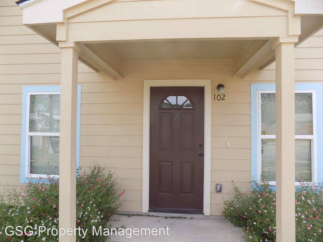
1318 Neer Ave
San Antonio, TX 78201
2 Weeks Ago
|
Edit
Favorites
1318 Neer Ave

Favorites
Check Back Soon for Upcoming Availability
| Beds | Baths | Average SF |
|---|---|---|
| 3 Bedrooms 3 Bedrooms 3 Br | 2 Baths 2 Baths 2 Ba | 1,075 SF |
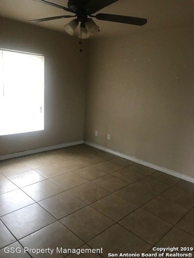
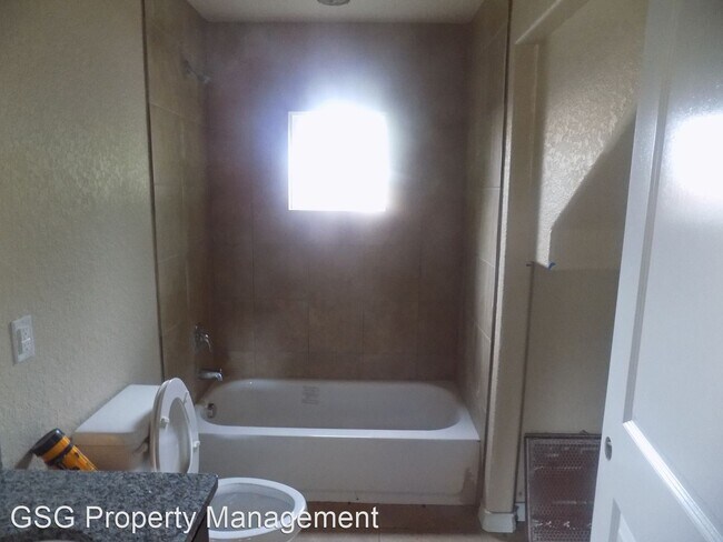
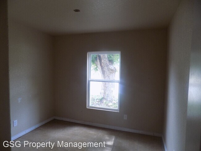
About This Property
(210) 930-4440 - - (RLNE2421126)
1318 Neer Ave is an apartment community located in Bexar County and the 78201 ZIP Code.
1318 Neer Ave,
San Antonio,
TX
78201
Los Angeles Heights-Keystone is located about four miles northwest of Downtown San Antonio and is bordered on its eastern edge by I-10, making this neighborhood a great option for commuters. This densely-populated neighborhood offers wooded residential areas filled with bungalows and ranch-style homes. The commercial zones include West Avenue and Fredericksburg Road. Here, you’ll find a variety of shops and restaurants, including local favorites like De Wese’s Tip Top Café and Original Donut Shop.
Residents of Los Angeles Heights-Keystone enjoy easy access to nearby colleges, including San Antonio College, St. Mary’s University, and Our Lady of the Lake University. The neighborhood is also convenient to Ingram Park Mall, the San Antonio Aquarium, University Hospital, the San Antonio Zoo, and North Star Mall.
Learn more about living in Los Angeles Heights-KeystoneBelow are rent ranges for similar nearby apartments
Education
| Colleges & Universities | Distance | ||
|---|---|---|---|
| Colleges & Universities | Distance | ||
| Drive: | 6 min | 3.0 mi | |
| Drive: | 9 min | 3.5 mi | |
| Drive: | 8 min | 3.6 mi | |
| Drive: | 10 min | 5.3 mi |
1318 Neer Ave is within 6 minutes or 3.0 miles from San Antonio College. It is also near Trinity University and Univ. of the Incarnate Word.
Walkability Near 1318 Neer Ave San Antonio, TX 78201
Getting Around
 What do Walkability, Transit, Drivability, and Bikeability mean?
Walkability measures the walking distance to day-to-day needs.
Transit measures access to public transportation.
Drivability measures congestion, parking availability, and access to major roads.
Bikeability measures the suitability for cycling.
How It Works
What do Walkability, Transit, Drivability, and Bikeability mean?
Walkability measures the walking distance to day-to-day needs.
Transit measures access to public transportation.
Drivability measures congestion, parking availability, and access to major roads.
Bikeability measures the suitability for cycling.
How It Works
Moderately Walkable
Walkability
60
/ 100
Some Public Transit
Transit
40
/ 100
Moderately Drivable
Drivability
70
/ 100
Fairly Bikeable
Bikeability
50
/ 100
Scores provided by
-
Soundscore™
-
/ 100
Traffic
-Airport
-Businesses
-Scores provided by
HowLoud What is a Sound Score Rating? A Sound Score Rating aggregates noise caused by vehicle traffic, airplane traffic and local sources. How It WorksYou May Also Like
Similar Rentals Nearby
-
-
-
-
-
-
-
3 Beds$1,826+Total Monthly PriceTotal Monthly Price NewPrices include base rent and required monthly fees of $71. Variable costs based on usage may apply.Base Rent:3 Beds$1,755+Discounts
Pets Allowed Pool Kitchen In Unit Washer & Dryer Clubhouse Patio Ceiling Fans
-
-
-


What Are Walk Score®, Transit Score®, and Bike Score® Ratings?
Walk Score® measures the walkability of any address. Transit Score® measures access to public transit. Bike Score® measures the bikeability of any address.
What is a Sound Score Rating?
A Sound Score Rating aggregates noise caused by vehicle traffic, airplane traffic and local sources.
1318 Neer Ave
San Antonio, TX 78201