
$2,399 / Month
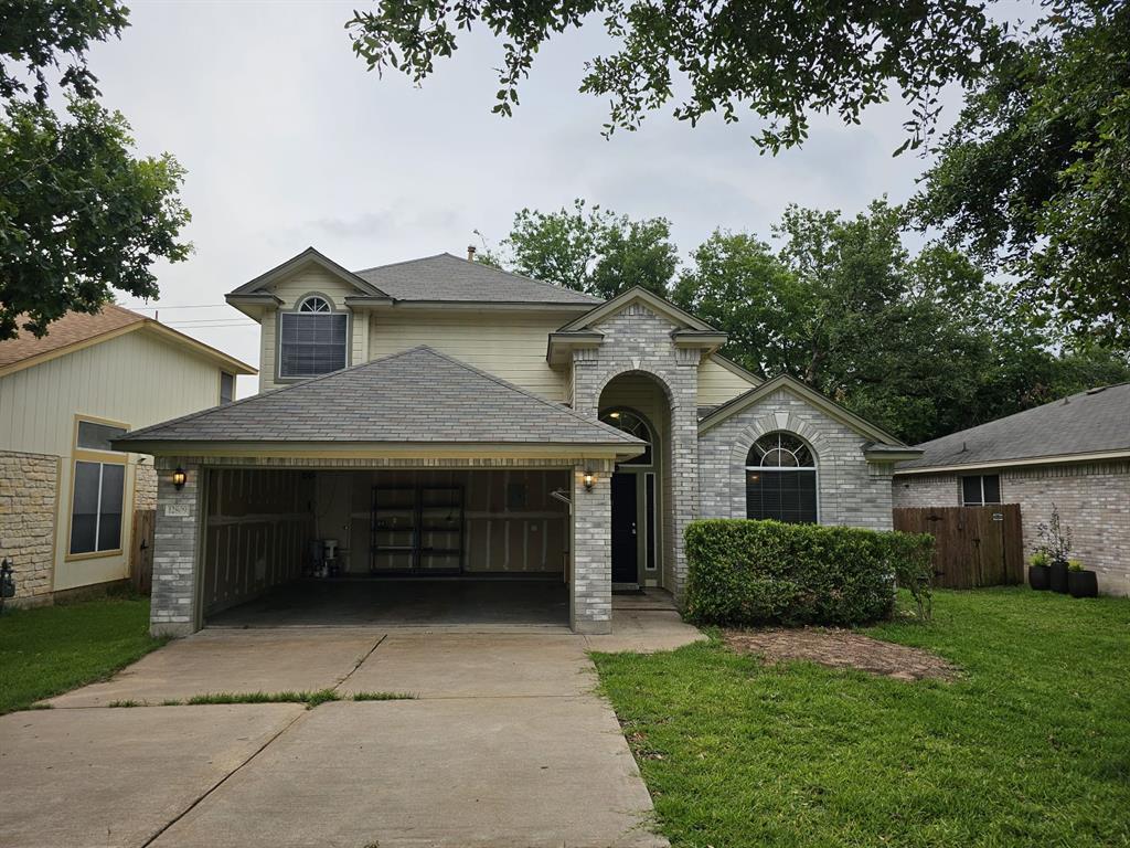
12809 War Path
Austin, TX 78727
2 Weeks Ago
Favorites
12809 War Path

Favorites
Check Back Soon for Upcoming Availability
| Beds | Baths | Average SF |
|---|---|---|
| 3 Bedrooms 3 Bedrooms 3 Br | 3 Baths 3 Baths 3 Ba | 1,946 SF |
Fees and Policies
The fees below are based on community-supplied data and may exclude additional fees and utilities.
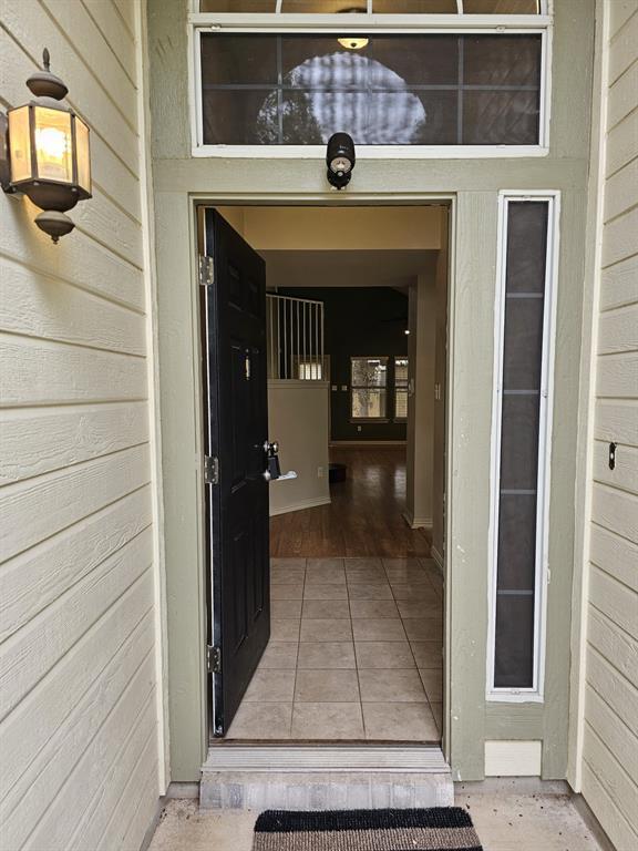
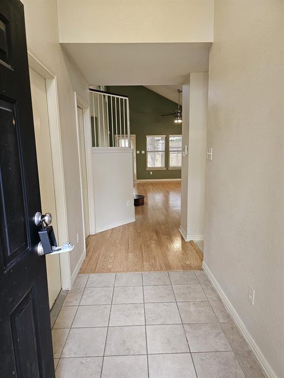
About This Property
Beautiful Home in Highly Desirable North Austin Community! This well maintained home is ready for you to move in! Enjoy the bright and open floor plan with 3 large bedrooms upstairs and a bonus room can be use as 4th bedroom. Impeccable neighborhood community pools. Closed to Domain, Costco, HEB plus, Lowes, Whole Foods, Walmart, Target - all within 1-5 miles. It also closed to all major employees Apple, IBM, Amazon, Visa, Indeed etc
12809 War Path is a house located in Travis County and the 78727 ZIP Code. This area is served by the Austin Independent attendance zone.
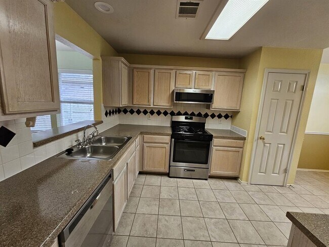
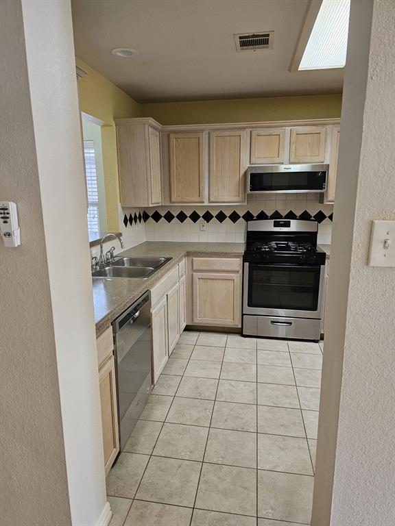
House Features
Dishwasher
Hardwood Floors
Microwave
Refrigerator
- Dishwasher
- Microwave
- Refrigerator
- Hardwood Floors
- Carpet
- Tile Floors
Location
Get Directions
The Travis County community of McNeil covers a large expanse of north Austin. Much of the area belongs to the Austin White Lime Company, but the surrounding roads and residential areas in the southern part of McNeil provide a beautiful sprawling landscape for renters of all types.
There’s a selection of homes in all styles in McNeil Estates, a compact residential area that sits just off of North Mopac Expressway and West Parmer Lane. McNeil is also receiving a number of modern apartment complexes, each offering upscale amenities and stylish living less than 30 minutes from Downtown Austin.
Yett Creek Neighborhood Park sits just outside of McNeil and offers 40 acres of forest to explore on walking trails. With all of the surrounding highways, McNeil is a fantastic, affordable spot for those who commute to the city for work. The nearby thoroughfares also mean you can be at Lake Travis or San Antonio in no time.
Learn more about living in McNeilBelow are rent ranges for similar nearby apartments
| Beds | Average Size | Lowest | Typical | Premium |
|---|---|---|---|---|
| Studio Studio Studio | 565-572 Sq Ft | $1,199 | $1,689 | $2,077 |
| 1 Bed 1 Bed 1 Bed | 738-741 Sq Ft | $1,005 | $1,666 | $4,074 |
| 2 Beds 2 Beds 2 Beds | 1121-1123 Sq Ft | $1,100 | $2,249 | $4,240 |
| 3 Beds 3 Beds 3 Beds | 1380 Sq Ft | $1,400 | $2,801 | $5,879 |
| 4 Beds 4 Beds 4 Beds | 2040 Sq Ft | $2,250 | $2,415 | $2,595 |
Amenities
- Dishwasher
- Microwave
- Refrigerator
- Hardwood Floors
- Carpet
- Tile Floors
Education
| Colleges & Universities | Distance | ||
|---|---|---|---|
| Colleges & Universities | Distance | ||
| Drive: | 7 min | 3.0 mi | |
| Drive: | 11 min | 6.8 mi | |
| Drive: | 17 min | 9.9 mi | |
| Drive: | 20 min | 12.0 mi |
12809 War Path is within 7 minutes or 3.0 miles from Austin C.C., Northridge Campus. It is also near The Art Institute of Austin and Austin C.C., Cypress Creek.
Schools


Public Elementary School
Grades PK-5
760 Students
Attendance Zone
Public Middle School
Grades 6-8
1,237 Students
Attendance Zone
Public High School
Grades 9-12
2,210 Students
Attendance Zone
Private Elementary & Middle School
Grades PK-8
Nearby
Private Elementary School
Grades PK-6
9 Students
Nearby
Private Elementary & Middle School
Grades PK-8
178 Students
Nearby
Private High School
Grades 6 & 9-12
Nearby
School data provided by
 The GreatSchools Rating helps parents compare schools within a state based on a variety of school quality indicators and provides a helpful picture of how effectively each school serves all of its students. Ratings are on a scale of 1 (below average) to 10 (above average) and can include test scores, college readiness, academic progress, advanced courses, equity, discipline and attendance data. We also advise parents to visit schools, consider other information on school performance and programs, and consider family needs as part of the school selection process.
View GreatSchools Rating Methodology
Data provided by GreatSchools.org © 2025. All rights reserved.
View GreatSchools Rating Methodology
Data provided by GreatSchools.org © 2025. All rights reserved.
Transportation options available in Austin include Howard Station, located 2.9 miles from 12809 War Path. 12809 War Path is near Austin-Bergstrom International, located 24.2 miles or 38 minutes away.
| Transit / Subway | Distance | ||
|---|---|---|---|
| Transit / Subway | Distance | ||
| Drive: | 6 min | 2.9 mi | |
| Drive: | 7 min | 3.5 mi | |
| Drive: | 10 min | 4.2 mi | |
| Drive: | 12 min | 6.7 mi | |
| Drive: | 15 min | 8.4 mi |
| Commuter Rail | Distance | ||
|---|---|---|---|
| Commuter Rail | Distance | ||
|
|
Drive: | 20 min | 13.5 mi |
|
|
Drive: | 35 min | 26.9 mi |
| Airports | Distance | ||
|---|---|---|---|
| Airports | Distance | ||
|
Austin-Bergstrom International
|
Drive: | 38 min | 24.2 mi |
Time and distance from 12809 War Path.
| Shopping Centers | Distance | ||
|---|---|---|---|
| Shopping Centers | Distance | ||
| Walk: | 8 min | 0.5 mi | |
| Walk: | 15 min | 0.8 mi | |
| Drive: | 3 min | 1.3 mi |
12809 War Path has 3 shopping centers within 1.3 miles, which is about a 3-minute walk. The miles and minutes will be for the farthest away property.
| Parks and Recreation | Distance | ||
|---|---|---|---|
| Parks and Recreation | Distance | ||
|
Balcones District Park
|
Drive: | 4 min | 1.4 mi |
|
Walnut Creek Park
|
Drive: | 6 min | 3.4 mi |
|
The Stephen F. Austin Planetarium
|
Drive: | 8 min | 3.9 mi |
|
Great Hills Park
|
Drive: | 11 min | 5.1 mi |
|
Bull Creek Greenbelt
|
Drive: | 11 min | 6.4 mi |
12809 War Path has 5 parks within 6.4 miles, including Balcones District Park, Walnut Creek Park, and The Stephen F. Austin Planetarium.
| Hospitals | Distance | ||
|---|---|---|---|
| Hospitals | Distance | ||
| Drive: | 4 min | 2.0 mi | |
| Drive: | 9 min | 4.6 mi | |
| Drive: | 11 min | 7.0 mi |
12809 War Path has 3 hospitals within 7.0 miles, the nearest is North Austin Medical Center which is 2.0 miles away and a 4 minute drive.
| Military Bases | Distance | ||
|---|---|---|---|
| Military Bases | Distance | ||
| Drive: | 82 min | 64.6 mi | |
| Drive: | 97 min | 79.4 mi |
12809 War Path is 64.6 miles from Fort Hood, and is convenient to other military bases, including Randolph Air Force Base.
You May Also Like
Similar Rentals Nearby


What Are Walk Score®, Transit Score®, and Bike Score® Ratings?
Walk Score® measures the walkability of any address. Transit Score® measures access to public transit. Bike Score® measures the bikeability of any address.
What is a Sound Score Rating?
A Sound Score Rating aggregates noise caused by vehicle traffic, airplane traffic and local sources
12809 War Path
Austin, TX 78727