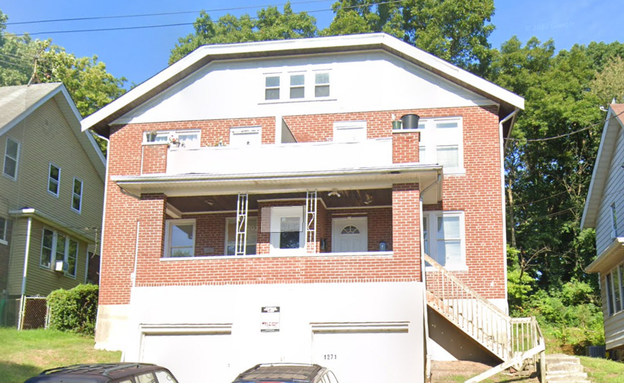
$1,195 / Month

1271 Rutledge Ave Unit 1

,

Cincinnati, OH 45205

2 Weeks Ago
| Edit

Under 30 minutes

Commute Time is calculated at rush hour.
Share Listing
Favorites
1271 Rutledge Ave Unit 1
Share Listing
Favorites

Check Back Soon for Upcoming Availability

Beds Baths Average SF
4 Bedrooms 4 Bedrooms 4 Br 1 Bath 1 Bath 1 Ba

About This Property

Check out your new address in Cincinnati, OH. This property is located at 1271 Rutledge Ave in the West Price Hill area of Cincinnati. Stop searching and find your new home. To learn more about this property, contact us.

1271 Rutledge Ave is an apartment community located in Hamilton County and the 45205 ZIP Code.

Features

  • Dishwasher
Location
1271 Rutledge Ave, Cincinnati,
OH 45205
Get Directions
Neighborhood

Located about four miles away from Downtown Cincinnati, West Price Hill is known for its affordability and wide range of rental options. Along with having condos and apartments available for rent at various price points, West Price Hill has single-family homes in a variety of architectural styles including Queen Anne, Greek Revival, Second Empire, and Italianate. The neighborhood has several restaurants and stores, but is also just a few miles from commercial hubs like Glenway Crossing, so necessities aren’t far from home. West Price Hill has multiple parks like Rapid Run Park for residents to enjoy. Parks along the Ohio River like Mount Echo Park await just a few minutes south of the neighborhood as well. If you’re looking for a central location with affordable options, West Price Hill is a great choice.

Learn more about living in West Price Hill 

Below are rent ranges for similar nearby apartments

Amenities
  • Dishwasher
Education
Colleges & Universities Distance
Drive: 9 min 4.0 mi
Drive: 13 min 5.6 mi
Drive: 15 min 5.8 mi
Drive: 15 min 6.0 mi
1271 Rutledge Ave Unit 1 is within 9 minutes or 4.0 miles from College of Mount St. Joseph. It is also near Cincinnati State and University of Cincinnati.
Transportation

Transportation options available in Cincinnati include Brewery District Station - Elm & Henry, located 4.5 miles from 1271 Rutledge Ave Unit 1. 1271 Rutledge Ave Unit 1 is near Cincinnati/Northern Kentucky International, located 17.9 miles or 34 minutes away.

Transit / Subway Distance
Drive: 11 min 4.5 mi
Drive: 11 min 4.7 mi
Drive: 13 min 4.7 mi
Drive: 11 min 4.7 mi
Drive: 12 min 5.0 mi
Commuter Rail Distance
Drive: 11 min 4.7 mi
Airports Distance
Airports Distance
Cincinnati/Northern Kentucky International
Drive: 34 min 17.9 mi

Walkability Near 1271 Rutledge Ave Cincinnati, OH 45205

Getting Around
Fairly Walkable
Walkability
40 / 100
Limited Public Transit
Transit
30 / 100
Very Drivable
Drivability
80 / 100
Fairly Bikeable
Bikeability
40 / 100

Scores provided by

What do Walkability, Transit, Drivability, and Bikeability mean? Walkability measures the walking distance to day-to-day needs. Transit measures access to public transportation. Drivability measures congestion, parking availability, and access to major roads. Bikeability measures the suitability for cycling. How It Works
-
Soundscore
- / 100

Traffic

-

Airport

-

Businesses

-

Scores provided by

HowLoud What is a Sound Score Rating? A Sound Score Rating aggregates noise caused by vehicle traffic, airplane traffic and local sources. How It Works
Points of Interest

Time and distance from 1271 Rutledge Ave Unit 1.

Shopping Centers Distance
Drive: 3 min 1.3 mi
Drive: 4 min 1.4 mi
Drive: 4 min 1.5 mi
1271 Rutledge Ave Unit 1 has 3 shopping centers within 1.5 miles, which is about a 4-minute drive. The miles and minutes will be for the farthest away property.
Parks and Recreation Distance
Imago Earth Center
Drive: 5 min 1.7 mi
Wilson Commons
Drive: 7 min 2.4 mi
Embshoff Woods
Drive: 8 min 2.9 mi
Museum of Natural History and Science
Drive: 11 min 4.7 mi
Cincinnati History Museum
Drive: 11 min 4.8 mi
1271 Rutledge Ave Unit 1 has 5 parks within 4.8 miles, including Imago Earth Center, Wilson Commons, and Embshoff Woods.
Hospitals Distance
Hospitals Distance
Drive: 14 min 5.6 mi
Drive: 12 min 5.6 mi
Drive: 15 min 6.1 mi
1271 Rutledge Ave Unit 1 has 3 hospitals within 6.1 miles, the nearest is Christ Hospital which is 5.6 miles away and a 14 minute drive.
Military Bases Distance
Drive: 76 min 56.7 mi
Drive: 82 min 61.8 mi
Drive: 85 min 65.1 mi
1271 Rutledge Ave Unit 1 has 3 military bases within 65.1 miles, the nearest is Gentile Air Force Station which is 56.7 miles away and a 76 minute drive.

You May Also Like

Similar Rentals Nearby