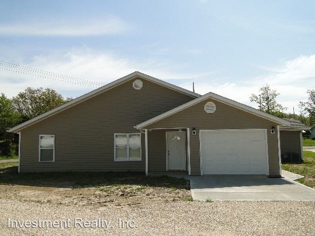
$765 / Month

12701 Co Rd 5090

,

Rolla, MO 65401

2 Weeks Ago
| Edit

Under 30 minutes

Commute Time is calculated at rush hour.
Share Listing
Favorites
12701 Co Rd 5090
Share Listing
Favorites

Check Back Soon for Upcoming Availability

Beds Baths Average SF
2 Bedrooms 2 Bedrooms 2 Br 2 Baths 2 Baths 2 Ba

Fees and Policies

The fees listed below are community-provided and may exclude utilities or add-ons. All payments are made directly to the property and are non-refundable unless otherwise specified.

About This Property

(573) 364-4050 - - 1st Month Rent $1415.00 Washer/Dryer Hookup 1 Car Garage Stainless Looking Appliances Water/Sewer Paid (RLNE1860933) Appliances: Dishwasher, Refrigerator, Range, Microwave.

12701 Co Rd 5090 is an apartment community located in Phelps County and the 65401 ZIP Code.

Features

  • Dishwasher
Location
12701 Co Rd 5090, Rolla,
MO 65401
Get Directions
City - Rolla

Rolla is a small city in central Missouri, located roughly halfway between Saint Louis and Springfield along Interstate 44. The city is perhaps best known as the home of Missouri University of Science and Technology, which serves around 9,000 students from around the world and operates as one of the community’s biggest employers. The Downtown district along Pine Street is just a short walk from campus, providing a diverse mix of shopping, dining, and nightlife catering to the college crowd and locals alike.

The landscape surrounding Rolla is ideal for outdoor exploration, with Fort Leonard Wood and Mark Twain National Forest sitting just outside the city limits and sprawling greenspaces like Southview and Ber Juan Parks just a few blocks away from most neighborhoods.

Learn more about living in Rolla 
Amenities
  • Dishwasher
Education
Colleges & Universities Distance
Drive: 9 min 3.8 mi
12701 Co Rd 5090 is within 9 minutes or 3.8 miles from Missouri Univ. of Sci. &Tech..
Transportation

Walkability Near 12701 Co Rd 5090 Rolla, MO 65401

Getting Around
Somewhat Walkable
Walkability
20 / 100
Exceptionally Drivable
Drivability
90 / 100
Fairly Bikeable
Bikeability
40 / 100

Scores provided by

What do Walkability, Transit, Drivability, and Bikeability mean? Walkability measures the walking distance to day-to-day needs. Transit measures access to public transportation. Drivability measures congestion, parking availability, and access to major roads. Bikeability measures the suitability for cycling. How It Works
-
Soundscore
- / 100

Traffic

-

Airport

-

Businesses

-

Scores provided by

HowLoud What is a Sound Score Rating? A Sound Score Rating aggregates noise caused by vehicle traffic, airplane traffic and local sources. How It Works
Points of Interest

Time and distance from 12701 Co Rd 5090.

Shopping Centers Distance
Drive: 4 min 1.9 mi
Drive: 6 min 2.9 mi
Drive: 10 min 3.8 mi
12701 Co Rd 5090 has 3 shopping centers within 3.8 miles, which is about a 10-minute drive. The miles and minutes will be for the farthest away property.
Hospitals Distance
Hospitals Distance
Drive: 10 min 4.0 mi
12701 Co Rd 5090 is 4.0 miles and a 10 minute drive from Phelps County Regional Medical Center.
Military Bases Distance
Drive: 55 min 37.4 mi
Drive: 61 min 48.9 mi
Drive: 66 min 52.3 mi
12701 Co Rd 5090 has 3 military bases within 52.3 miles, the nearest is Fort Leonard Wood Piney which is 37.4 miles away and a 55 minute drive.

You May Also Like

Similar Rentals Nearby