
$2,990 / Month
127 Shirley St Unit #1
Boston, MA 02119
2 Weeks Ago
Favorites
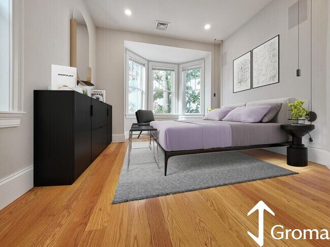
127 Shirley St Unit #1

Favorites
Check Back Soon for Upcoming Availability
| Beds | Baths | Average SF |
|---|---|---|
| 2 Bedrooms 2 Bedrooms 2 Br | 1.5 Baths 1.5 Baths 1.5 Ba | 10,000 SF |
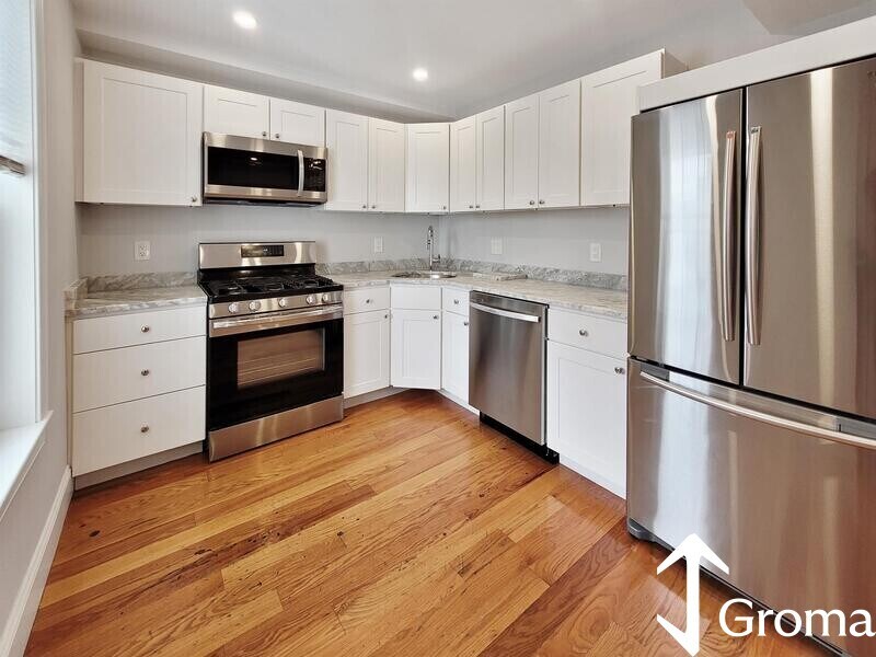
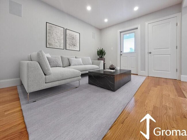
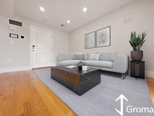
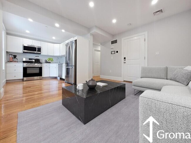
About This Property
Public Building Description Great location on the border of Roxbury and Dorchester near vibrant Uphams Corner! Close to shopping, dining, bars, parks, and more! Nice central location close to the Commuter Rail at Uphams Corner & Newmarket stops with many MBTA bus stops around the area. Just under 1 mile to Red Line trains & Commuter Rail at JFK/UMass station! LOcal attractions include the newly expanding South Bay Plaza, Andrew Square, Dudley Square, JFK Library, UMass Boston, Carson Beach, Joe Moakley park w/ tennis, baseball, and basketball facilities, and a quick commute to Boston Medical Center and Boston University’s School of Public Health with BU Medical & Dental Schools. Easy access to all of the city from this lovely neighborhood in Roxbury!
127 Shirley St is a condo located in Suffolk County and the 02119 ZIP Code.
Location
Get Directions
Less than four miles outside of Downtown Boston sits Dudley-Brunswick King. Full of non-profit organizations committed to advancing the community, Dudley-Brunswick King is home to the Food Project, CommonWealth Kitchen, Project Hope, and the Dudley Street Neighborhood Initiative.
Dudley-Brunswick King residents enjoy access to cultural and educational venues such as the Boston Public Library and Oodua African Movie Center. There are a number of parks and green spaces in Dudley-Brunswick King including Clifford Playground, Mary Hannon Park, Ceylon Park, Brunswick-King Play Area, Dacia/Woodcliff Streets Garden, and multiple community gardens sponsored by the Food Project. Boston’s biggest park, Franklin Park, is also nearby and contains numerous amenities.
Convenient to the MBTA Commuter Rail, bus routes, and major highways as well as Boston Logan International Airport, Dudley-Brunswick King allows for easy commutes and travels.
Learn more about living in Dudley-Brunswick KingBelow are rent ranges for similar nearby apartments
| Beds | Average Size | Lowest | Typical | Premium |
|---|---|---|---|---|
| Studio Studio Studio | 7464 Sq Ft | $1,800 | $2,196 | $2,495 |
| 1 Bed 1 Bed 1 Bed | 2868-2870 Sq Ft | $750 | $2,246 | $2,850 |
| 2 Beds 2 Beds 2 Beds | 2922-2923 Sq Ft | $2,250 | $2,819 | $4,400 |
| 3 Beds 3 Beds 3 Beds | 2666 Sq Ft | $1,050 | $3,220 | $4,700 |
| 4 Beds 4 Beds 4 Beds | 4134 Sq Ft | $1,075 | $3,946 | $5,500 |
Education
| Colleges & Universities | Distance | ||
|---|---|---|---|
| Colleges & Universities | Distance | ||
| Drive: | 4 min | 1.8 mi | |
| Drive: | 5 min | 2.0 mi | |
| Drive: | 6 min | 2.3 mi | |
| Drive: | 6 min | 2.7 mi |
127 Shirley St Unit #1 is within 5 minutes or 2.0 miles from Northeastern University. It is also near Wentworth Inst. of Technology and Berklee College of Music.
Transportation options available in Boston include Andrew Station, located 0.9 mile from 127 Shirley St Unit #1. 127 Shirley St Unit #1 is near General Edward Lawrence Logan International, located 5.5 miles or 12 minutes away.
| Transit / Subway | Distance | ||
|---|---|---|---|
| Transit / Subway | Distance | ||
|
|
Walk: | 18 min | 0.9 mi |
|
|
Drive: | 3 min | 1.7 mi |
|
|
Drive: | 4 min | 1.9 mi |
|
|
Drive: | 5 min | 2.0 mi |
|
|
Drive: | 5 min | 2.1 mi |
| Commuter Rail | Distance | ||
|---|---|---|---|
| Commuter Rail | Distance | ||
| Walk: | 4 min | 0.3 mi | |
|
|
Walk: | 14 min | 0.8 mi |
|
|
Drive: | 4 min | 1.6 mi |
| Drive: | 4 min | 2.1 mi | |
|
|
Drive: | 5 min | 2.2 mi |
| Airports | Distance | ||
|---|---|---|---|
| Airports | Distance | ||
|
General Edward Lawrence Logan International
|
Drive: | 12 min | 5.5 mi |
Time and distance from 127 Shirley St Unit #1.
| Shopping Centers | Distance | ||
|---|---|---|---|
| Shopping Centers | Distance | ||
| Walk: | 9 min | 0.5 mi | |
| Drive: | 3 min | 1.1 mi | |
| Drive: | 4 min | 1.6 mi |
127 Shirley St Unit #1 has 3 shopping centers within 1.6 miles, which is about a 4-minute walk. The miles and minutes will be for the farthest away property.
| Parks and Recreation | Distance | ||
|---|---|---|---|
| Parks and Recreation | Distance | ||
|
Roxbury Heritage State Park
|
Drive: | 3 min | 1.4 mi |
|
Lower Neponset River Trail
|
Drive: | 4 min | 1.8 mi |
|
Dorchester Shores Reservation
|
Drive: | 5 min | 2.3 mi |
|
Franklin Park Zoo
|
Drive: | 4 min | 2.4 mi |
|
Boston Public Garden
|
Drive: | 7 min | 3.1 mi |
127 Shirley St Unit #1 has 5 parks within 3.1 miles, including Roxbury Heritage State Park, Lower Neponset River Trail, and Franklin Park Zoo.
| Hospitals | Distance | ||
|---|---|---|---|
| Hospitals | Distance | ||
| Walk: | 16 min | 0.8 mi | |
| Walk: | 19 min | 1.0 mi | |
| Drive: | 5 min | 2.4 mi |
127 Shirley St Unit #1 has 3 hospitals within 2.4 miles, the nearest is Boston Medical Center which is 0.8 mile away and a 16 minute walk.
| Military Bases | Distance | ||
|---|---|---|---|
| Military Bases | Distance | ||
| Drive: | 33 min | 17.3 mi |
127 Shirley St Unit #1 is 17.3 miles and a 33 minute drive from Hanscom Air Force Base.
You May Also Like
Similar Rentals Nearby


What Are Walk Score®, Transit Score®, and Bike Score® Ratings?
Walk Score® measures the walkability of any address. Transit Score® measures access to public transit. Bike Score® measures the bikeability of any address.
What is a Sound Score Rating?
A Sound Score Rating aggregates noise caused by vehicle traffic, airplane traffic and local sources

127 Shirley St
Boston, MA 02119