
Broadway Towers
1150 E St,
San Diego, CA 92101
$2,456 - $4,919
1-3 Beds
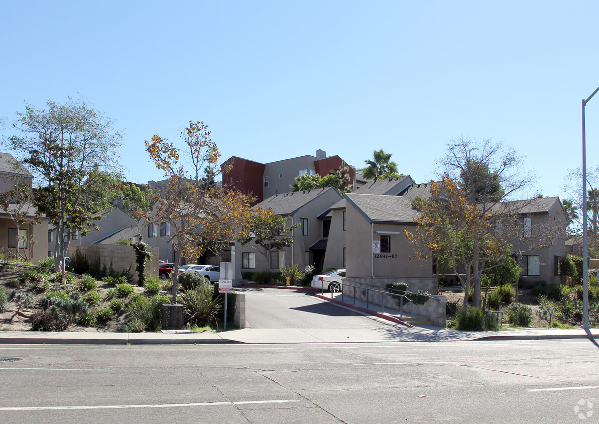
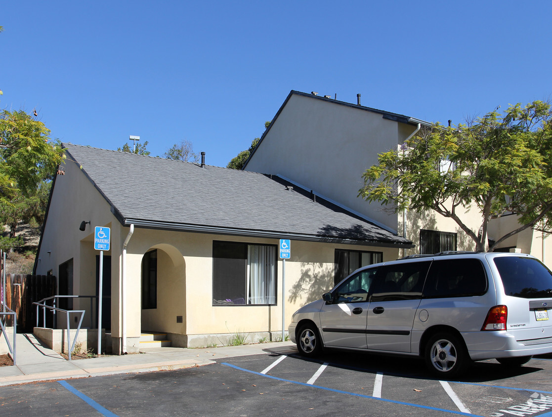
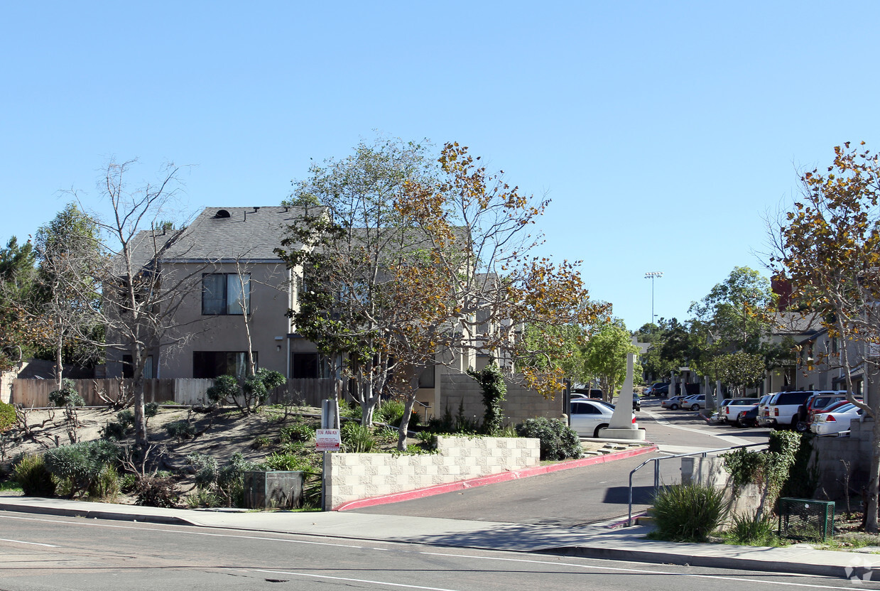
12643-12687 El Camino Real in San Diego is ready for you to move in. The location in San Diego's 92130 area is an ideal place for residents. From amenities to availability, the team of leasing professionals is ready to help you find your perfect fit. Make sure you to view the available floorplans. Stop by 12643-12687 El Camino Real today.
12643-12687 El Camino Real is an apartment community located in San Diego County and the 92130 ZIP Code. This area is served by the Del Mar Union Elementary School District attendance zone.
Situated in the northwestern portion of San Diego, Carmel Valley is regarded as one of the most luxurious neighborhoods in the city. Carmel Valley touts spacious homes atop steep hills, upscale shopping centers, delightful restaurants, and exceptional schools.
The neighborhood’s natural beauty and prime location contributes to an enviable, active lifestyle. A host of lush neighborhood parks and numerous recreation centers offer plenty of options for enjoying the outdoors. Carmel Valley also borders the sprawling Torrey Pines State Reserve, which is a great spot for exploring multi-use trails, beautiful beaches, lagoons, and observing wildlife.
The University of California San Diego lies just south of the neighborhood in addition to Westfield UTC, Birch Aquarium at Scripps Institution of Oceanography, La Jolla Shores Park, and several renowned medical centers. Convenience to I-5 and I-805 makes getting around from Carmel Valley a breeze.
Learn more about living in Carmel ValleyCompare neighborhood and city base rent averages by bedroom.
| Carmel Valley | San Diego, CA | |
|---|---|---|
| Studio | $3,185 | $2,025 |
| 1 Bedroom | $3,257 | $2,413 |
| 2 Bedrooms | $4,206 | $3,060 |
| 3 Bedrooms | $4,874 | $3,919 |
| Colleges & Universities | Distance | ||
|---|---|---|---|
| Colleges & Universities | Distance | ||
| Drive: | 10 min | 6.4 mi | |
| Drive: | 11 min | 6.4 mi | |
| Drive: | 14 min | 7.7 mi | |
| Drive: | 18 min | 11.0 mi |


Transportation options available in San Diego include Ucsd Health La Jolla Station, located 6.1 miles from 12643-12687 El Camino Real. 12643-12687 El Camino Real is near San Diego International, located 17.0 miles or 24 minutes away.
| Transit / Subway | Distance | ||
|---|---|---|---|
| Transit / Subway | Distance | ||
|
|
Drive: | 10 min | 6.1 mi |
|
|
Drive: | 11 min | 6.5 mi |
|
|
Drive: | 12 min | 7.1 mi |
|
|
Drive: | 13 min | 7.1 mi |
|
|
Drive: | 12 min | 7.1 mi |
| Commuter Rail | Distance | ||
|---|---|---|---|
| Commuter Rail | Distance | ||
|
|
Drive: | 8 min | 5.0 mi |
|
|
Drive: | 9 min | 5.5 mi |
|
|
Drive: | 13 min | 9.1 mi |
|
|
Drive: | 19 min | 13.5 mi |
|
|
Drive: | 21 min | 15.2 mi |
| Airports | Distance | ||
|---|---|---|---|
| Airports | Distance | ||
|
San Diego International
|
Drive: | 24 min | 17.0 mi |
Scores provided by
Traffic
-Airport
-Businesses
-Scores provided by
HowLoud What is a Sound Score Rating? A Sound Score Rating aggregates noise caused by vehicle traffic, airplane traffic and local sources. How It WorksTime and distance from 12643-12687 El Camino Real.
| Shopping Centers | Distance | ||
|---|---|---|---|
| Shopping Centers | Distance | ||
| Walk: | 9 min | 0.5 mi | |
| Walk: | 10 min | 0.6 mi | |
| Walk: | 14 min | 0.8 mi |
| Parks and Recreation | Distance | ||
|---|---|---|---|
| Parks and Recreation | Distance | ||
|
Torrey Pines State Beach
|
Drive: | 11 min | 4.3 mi |
|
San Dieguito County Park
|
Drive: | 9 min | 5.6 mi |
|
Cardiff State Beach
|
Drive: | 11 min | 6.0 mi |
|
Torrey Pines State Reserve
|
Drive: | 11 min | 6.0 mi |
|
Los Penasquitos Canyon Preserve
|
Drive: | 21 min | 8.8 mi |
| Hospitals | Distance | ||
|---|---|---|---|
| Hospitals | Distance | ||
| Drive: | 9 min | 5.4 mi | |
| Drive: | 10 min | 6.3 mi | |
| Drive: | 11 min | 7.8 mi |
| Military Bases | Distance | ||
|---|---|---|---|
| Military Bases | Distance | ||
| Drive: | 26 min | 15.4 mi | |
| Drive: | 26 min | 17.6 mi | |
| Drive: | 30 min | 19.8 mi |
Cats Allowed Fitness Center Pool In Unit Washer & Dryer Clubhouse Playground Fireplace
Pets Allowed Fitness Center Pool In Unit Washer & Dryer Business Center
Pets Allowed Fitness Center Pool Dishwasher Refrigerator Kitchen
Pets Allowed Fitness Center Pool In Unit Washer & Dryer Balcony
Pets Allowed Pool Dishwasher In Unit Washer & Dryer Stainless Steel Appliances Package Service Gated
What Are Walk Score®, Transit Score®, and Bike Score® Ratings?
Walk Score® measures the walkability of any address. Transit Score® measures access to public transit. Bike Score® measures the bikeability of any address.
What is a Sound Score Rating?
A Sound Score Rating aggregates noise caused by vehicle traffic, airplane traffic and local sources.


