
$795
Total Monthly Price
12601 N 1st Ave
Lindstrom, MN 55045
2 Weeks Ago
|
Edit
Favorites
12601 N 1st Ave

Favorites
Check Back Soon for Upcoming Availability
| Beds | Baths | Average SF |
|---|---|---|
| 1 Bedroom 1 Bedroom 1 Br | 1 Bath 1 Bath 1 Ba | 650 SF |
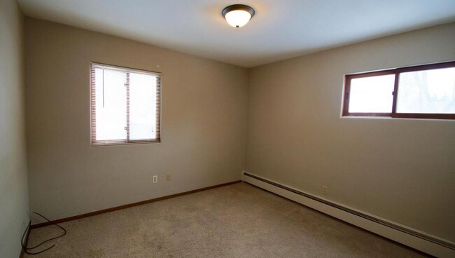
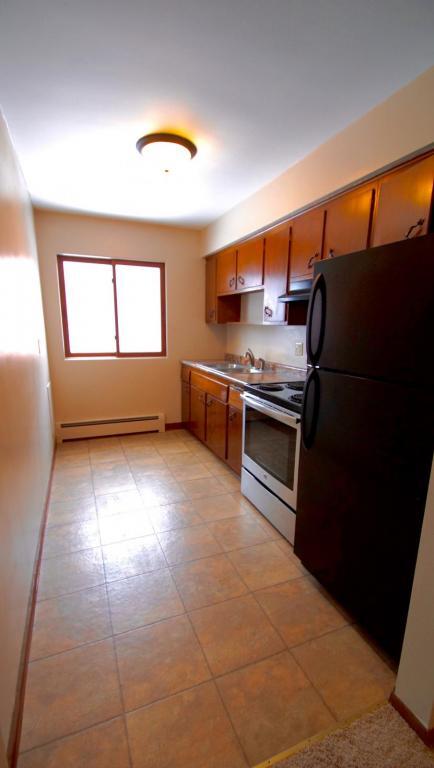
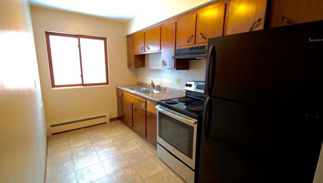
About This Property
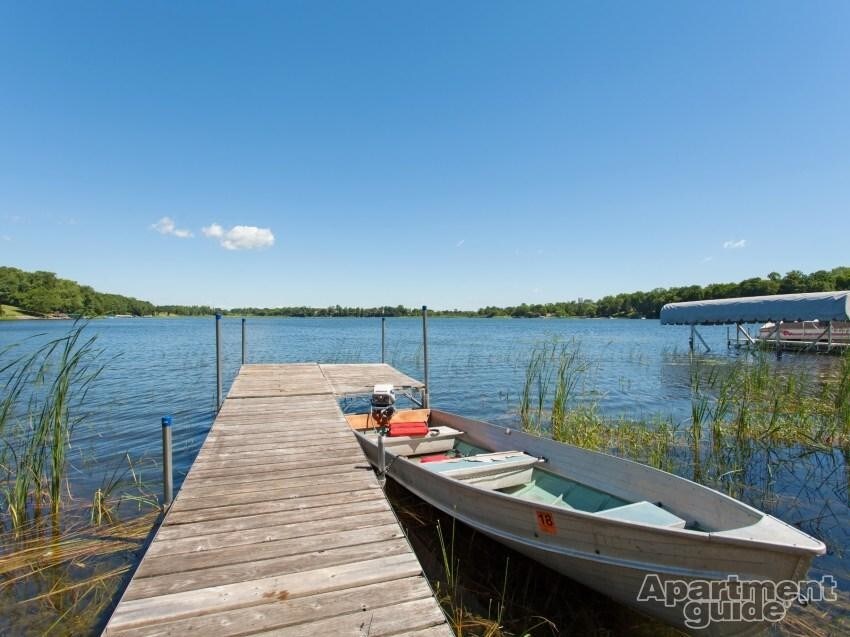
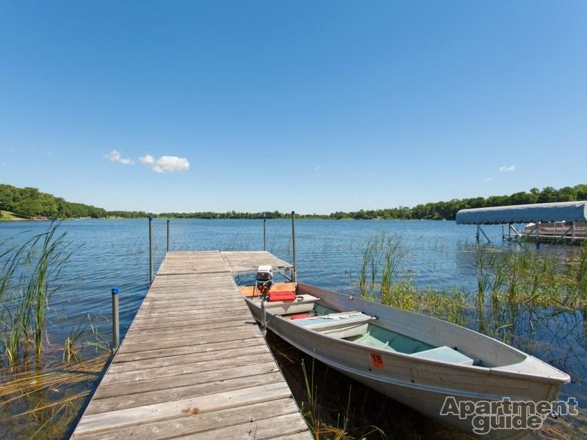
Available in Aug 2020 Top Floor One Bedroom Apartment with Private Deck Overlooking S. Lindstrom/Chisago Lake. Located just 45 min North of Mpls/St Paul in a small eleven unit building with shared laundry, off-street parking and a dock on North Lindstrom Lake. In town location within walking distance to shops, restaurants, etc. Cats OK with $300 Pet Fee. Owner pays heat, water, sewer bill plus garbage pick up. Tenant's only utility cost is the minimal electric bill. Secure Building. For more info or to schedule a showing enter your info online at http://bit.ly/rkrRentals Lindstrom is in the center of The Chisago Lakes Area between Chisago City and Center Citer, Shafer and Taylors Falls. This unit is located in town and close to major employers Hazelden/Betty Ford and halfway between Polaris in Wyoming MN and Osceola WI. FULL Rental Inventory at www.RedKeyRents.com
12601 N 1st Ave is an apartment community located in Chisago County and the 55045 ZIP Code.
12601 N 1st Ave,
Lindstrom,
MN
55045
Education
| Colleges & Universities | Distance | ||
|---|---|---|---|
| Colleges & Universities | Distance | ||
| Drive: | 42 min | 26.7 mi | |
| Drive: | 39 min | 33.2 mi | |
| Drive: | 40 min | 34.2 mi | |
| Drive: | 48 min | 38.5 mi |
12601 N 1st Ave is within 42 minutes or 26.7 miles from Anoka-Ramsey C.C., Cambridge. It is also near Century College and Bethel University, Saint Paul.
Walkability Near 12601 N 1st Ave Lindstrom, MN 55045
Getting Around
 What do Walkability, Transit, Drivability, and Bikeability mean?
Walkability measures the walking distance to day-to-day needs.
Transit measures access to public transportation.
Drivability measures congestion, parking availability, and access to major roads.
Bikeability measures the suitability for cycling.
How It Works
What do Walkability, Transit, Drivability, and Bikeability mean?
Walkability measures the walking distance to day-to-day needs.
Transit measures access to public transportation.
Drivability measures congestion, parking availability, and access to major roads.
Bikeability measures the suitability for cycling.
How It Works
Fairly Walkable
Walkability
40
/ 100
Exceptionally Drivable
Drivability
90
/ 100
Fairly Bikeable
Bikeability
50
/ 100
Scores provided by
-
Soundscore™
-
/ 100
Traffic
-Airport
-Businesses
-Scores provided by
HowLoud What is a Sound Score Rating? A Sound Score Rating aggregates noise caused by vehicle traffic, airplane traffic and local sources. How It WorksYou May Also Like
-
The Ephesians at Lexington
8927 Syndicate Ave
Circle Pines, MN 55014
$1,780 Plus Fees
2 Br 12 Month Lease 23.6 mi
-
Ridgewood Apartments
7501-7511 Greenfield Ave
Mounds View, MN 55112
$1,325 - $1,597 Plus Fees
1-2 Br 12 Month Lease 26.1 mi
-
H2 Flats
2659 County Road H2
Mounds View, MN 55112
$1,489 Total Monthly Price
2 Br 12 Month Lease 26.6 mi
Similar Rentals Nearby
-
-
1 Bed$1,870+2 Beds$2,175+Total Monthly Price12 Month LeaseTotal Monthly Price NewPrices include all required monthly fees.
Pets Allowed Fitness Center In Unit Washer & Dryer Walk-In Closets Stainless Steel Appliances Hardwood Floors Elevator
-
-
1 Bed$1,359+2 Beds$1,444+3 Beds$1,989+Total Monthly PriceTotal Monthly Price NewPrices include all required monthly fees.
Pets Allowed Fitness Center Pool Dishwasher Refrigerator Kitchen
-
-
-
Plus Fees1 Bed$1,556+3 Beds$2,420+
-
-
Plus Fees1 Bed$1,345+2 Beds$2,056
-

")


What Are Walk Score®, Transit Score®, and Bike Score® Ratings?
Walk Score® measures the walkability of any address. Transit Score® measures access to public transit. Bike Score® measures the bikeability of any address.
What is a Sound Score Rating?
A Sound Score Rating aggregates noise caused by vehicle traffic, airplane traffic and local sources.
12601 N 1st Ave
Lindstrom, MN 55045