$1,400
Total Monthly Price
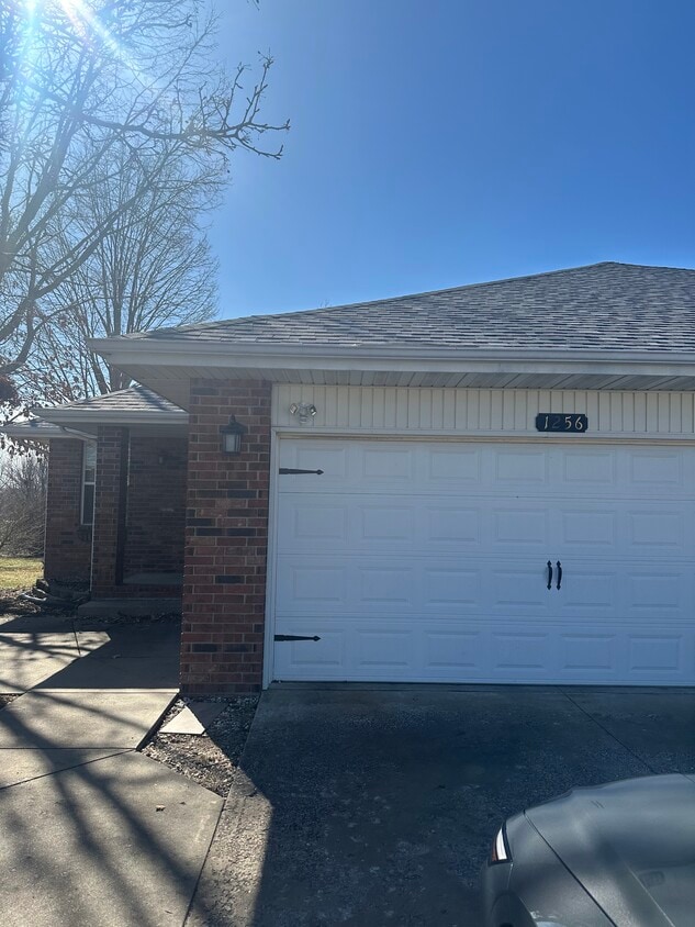
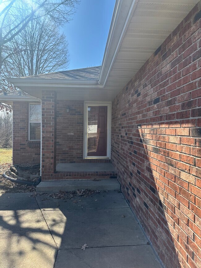
1256 W Bluegrass Rd
Nixa, MO 65714
Today
|
Edit
Favorites
417-374-3384
-
Bedrooms
2
-
Bathrooms
2
-
Square Feet
1,200 sq ft
-
Available
Available Now
Highlights
- Pets Allowed
- Deck
1256 W Bluegrass Rd

Favorites
About This Home
12 Month Lease,
$2,800 deposit,
Available Now
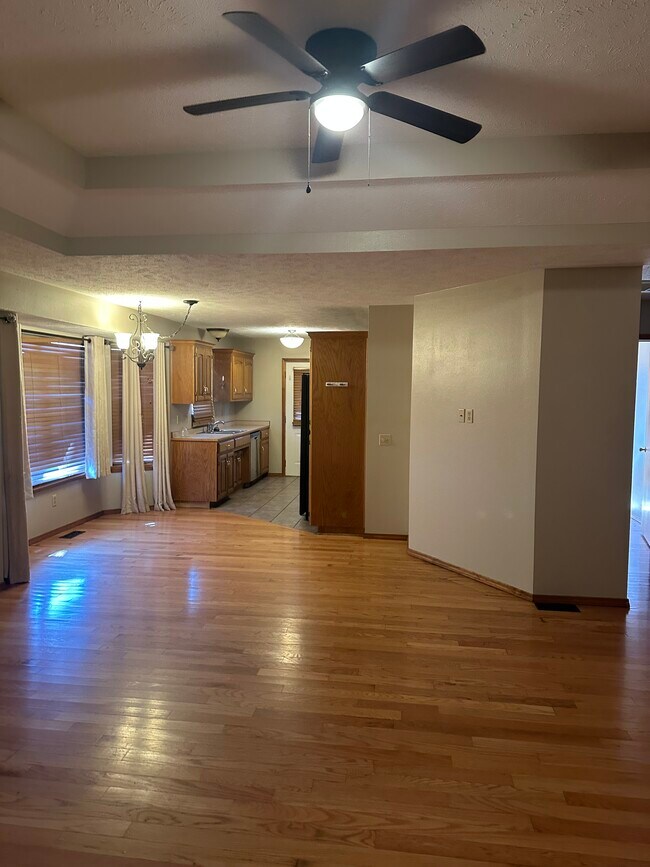
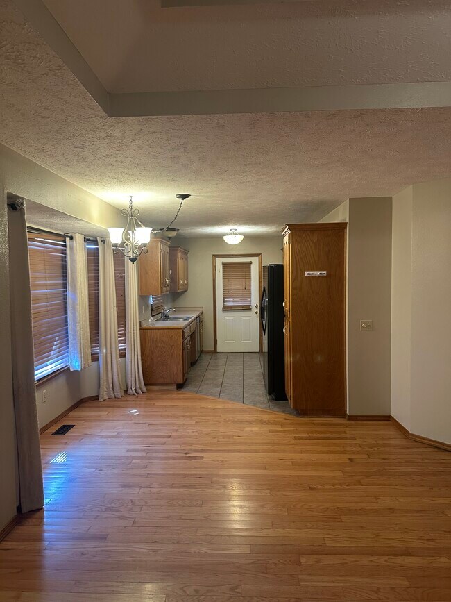
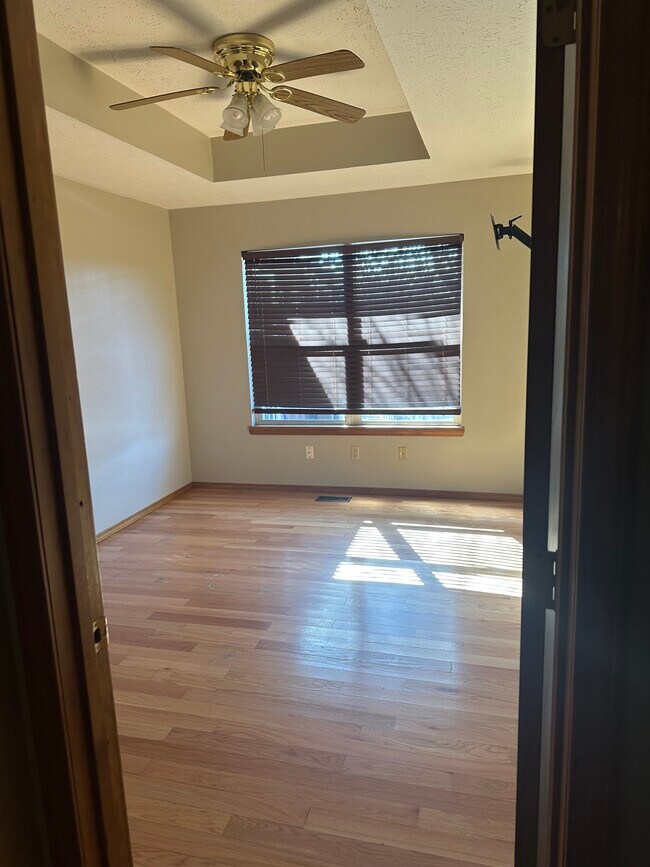
Duplex unit. Newly sanded and stained deck/porch, New roof, New paint, Open living space, Near Nixa High. Fully fenced in backyard.
1256 W Bluegrass Rd is a house located in Christian County and the 65714 ZIP Code. This area is served by the Nixa Public Schools School District attendance zone.
* Price shown is total price based on community-supplied monthly required fees. Excludes user-selected optional fees and variable or usage-based fees and required charges due at or prior to move-in or at move-out. Price, availability, fees, and any applicable rent special are subject to change without notice.
* Square footage definitions vary. Displayed square footage is approximate.
House Features
Washer/Dryer Hookup
Tub/Shower
Ceiling Fans
Heating
- Washer/Dryer Hookup
- Heating
- Ceiling Fans
- Tub/Shower
- Porch
- Deck
Fees and Policies
The fees listed below are community-provided and may exclude utilities or add-ons. All payments are made directly to the property and are non-refundable unless otherwise specified.
- Dogs Allowed
-
Fees not specified
- Cats Allowed
-
Fees not specified
- Parking
-
Garage--
Contact
- Phone Number
- Contact
Location
Get Directions
Education
| Colleges & Universities | Distance | ||
|---|---|---|---|
| Colleges & Universities | Distance | ||
| Drive: | 27 min | 14.3 mi | |
| Drive: | 30 min | 15.3 mi | |
| Drive: | 30 min | 15.8 mi | |
| Drive: | 32 min | 16.7 mi |
1256 W Bluegrass Rd is within 27 minutes or 14.3 miles from Missouri State University. It is also near Drury University and Ozarks Tech. C.C., Springfield.
Schools


Public Elementary School
Grades PK-5
434 Students
Nearby
Public Elementary School
Grades K-5
383 Students
Attendance Zone
Public Elementary School
Grades K-5
487 Students
Attendance Zone
Public Elementary School
Grades K-5
453 Students
Attendance Zone
Public Middle School
Grades 6-8
1,067 Students
Attendance Zone
Public High School
Grades 9-12
1,957 Students
Attendance Zone
Private Elementary, Middle & High School
Grades PK-12
151 Students
Nearby
Private Elementary & Middle School
Grades PK-8
241 Students
Nearby
Private Elementary School
Grades PK-6
80 Students
Nearby
School data provided by
 The GreatSchools Rating helps parents compare schools within a state based on a variety of school quality indicators and provides a helpful picture of how effectively each school serves all of its students. Ratings are on a scale of 1 (below average) to 10 (above average) and can include test scores, college readiness, academic progress, advanced courses, equity, discipline and attendance data. We also advise parents to visit schools, consider other information on school performance and programs, and consider family needs as part of the school selection process.
View GreatSchools Rating Methodology
Data provided by GreatSchools.org © 2026. All rights reserved.
View GreatSchools Rating Methodology
Data provided by GreatSchools.org © 2026. All rights reserved.
Getting Around
 What do Walkability, Transit, Drivability, and Bikeability mean?
Walkability measures the walking distance to day-to-day needs.
Transit measures access to public transportation.
Drivability measures congestion, parking availability, and access to major roads.
Bikeability measures the suitability for cycling.
How It Works
What do Walkability, Transit, Drivability, and Bikeability mean?
Walkability measures the walking distance to day-to-day needs.
Transit measures access to public transportation.
Drivability measures congestion, parking availability, and access to major roads.
Bikeability measures the suitability for cycling.
How It Works
Somewhat Walkable
Walkability
20
/ 100
Exceptionally Drivable
Drivability
90
/ 100
Somewhat Bikeable
Bikeability
30
/ 100
Scores provided by
Calm
Soundscore™
84
/ 100
Traffic
CalmAirport
CalmBusinesses
CalmScores provided by
HowLoud What is a Sound Score Rating? A Sound Score Rating aggregates noise caused by vehicle traffic, airplane traffic and local sources. How It Works
Amenities
- Washer/Dryer Hookup
- Heating
- Ceiling Fans
- Tub/Shower
- Porch
- Deck
1256 W Bluegrass Rd Photos
What Are Walk Score®, Transit Score®, and Bike Score® Ratings?
Walk Score® measures the walkability of any address. Transit Score® measures access to public transit. Bike Score® measures the bikeability of any address.
What is a Sound Score Rating?
A Sound Score Rating aggregates noise caused by vehicle traffic, airplane traffic and local sources.

1256 W Bluegrass Rd
Nixa, MO 65714