
Holly Street Village
151-151 E Holly St,
Pasadena, CA 91103
$2,520 - $10,005 Total Monthly Price
Studio - 3 Beds 12 Month Lease
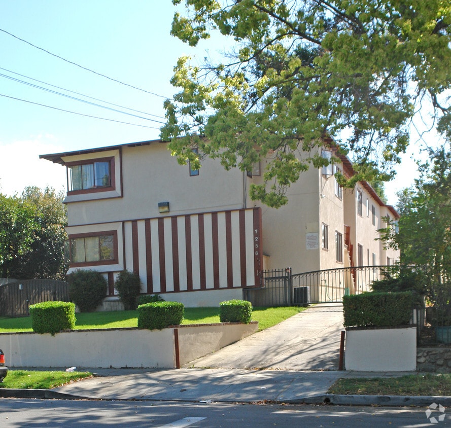
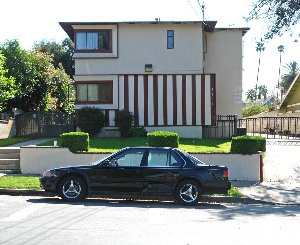
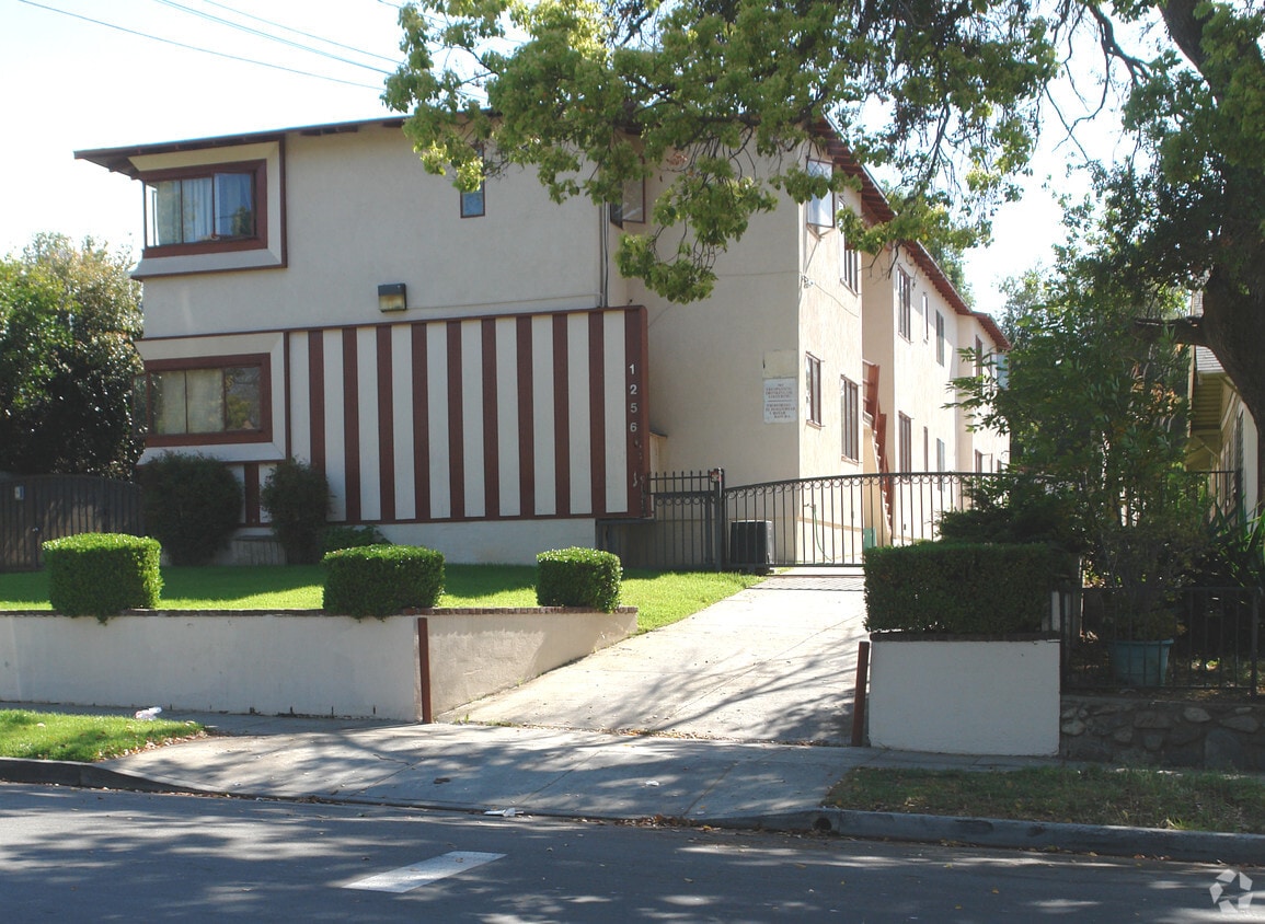

Explore a new place to live at 1256 Summit Ave in Pasadena, CA. The location in Pasadena's 91103 area has so much to offer its residents. The professional leasing staff is ready to match you with your perfect place. Be sure to come for a visit to check out the current floorplan options. Stop by to schedule your tour.
1256 Summit Ave is an apartment community located in Los Angeles County and the 91103 ZIP Code. This area is served by the Pasadena Unified School District attendance zone.
Near the San Gabriel Mountains, where I-210 meets State Route 134 and becomes the Foothill Freeway, rests Pasadena’s Garfield Heights neighborhood. Primarily a residential area, Garfield Heights contains a number of markets, churches, and temples. Garfield Heights residents enjoy access to neighboring parks such as La Pintoresca Park and City of Pasadena Robinson Park.
There are a host of amenities located within close proximity to Garfield Heights. Among the many amenities are the Rose Bowl Stadium, Kidspace Children’s Museum, Norton Simon Museum, Brookside Golf and Country Club, Pasadena Convention Center, Paseo Colorado, and the California Institute of Technology.
Served by several Metro Local lines and Pasadena Transit routes, getting around Garfield Height is a breeze.
Learn more about living in Garfield HeightsCompare neighborhood and city base rent averages by bedroom.
| Garfield Heights | Pasadena, CA | |
|---|---|---|
| Studio | $892 | $1,963 |
| 1 Bedroom | $1,269 | $2,347 |
| 2 Bedrooms | $1,777 | $3,047 |
| 3 Bedrooms | $1,682 | $3,685 |
| Colleges & Universities | Distance | ||
|---|---|---|---|
| Colleges & Universities | Distance | ||
| Drive: | 4 min | 1.8 mi | |
| Drive: | 10 min | 3.2 mi | |
| Drive: | 8 min | 3.3 mi | |
| Drive: | 9 min | 3.5 mi |


Transportation options available in Pasadena include Memorial Park Station, located 1.6 miles from 1256 Summit Ave. 1256 Summit Ave is near Bob Hope, located 17.5 miles or 25 minutes away, and Los Angeles International, located 26.0 miles or 42 minutes away.
| Transit / Subway | Distance | ||
|---|---|---|---|
| Transit / Subway | Distance | ||
|
|
Drive: | 4 min | 1.6 mi |
|
|
Drive: | 6 min | 2.0 mi |
|
|
Drive: | 4 min | 2.0 mi |
|
|
Drive: | 7 min | 2.6 mi |
|
|
Drive: | 6 min | 3.1 mi |
| Commuter Rail | Distance | ||
|---|---|---|---|
| Commuter Rail | Distance | ||
|
|
Drive: | 14 min | 9.9 mi |
|
|
Drive: | 20 min | 10.9 mi |
|
|
Drive: | 21 min | 11.0 mi |
|
|
Drive: | 22 min | 12.0 mi |
| Drive: | 23 min | 15.0 mi |
| Airports | Distance | ||
|---|---|---|---|
| Airports | Distance | ||
|
Bob Hope
|
Drive: | 25 min | 17.5 mi |
|
Los Angeles International
|
Drive: | 42 min | 26.0 mi |
Scores provided by
Traffic
-Airport
-Businesses
-Scores provided by
HowLoud What is a Sound Score Rating? A Sound Score Rating aggregates noise caused by vehicle traffic, airplane traffic and local sources. How It WorksTime and distance from 1256 Summit Ave.
| Shopping Centers | Distance | ||
|---|---|---|---|
| Shopping Centers | Distance | ||
| Walk: | 2 min | 0.1 mi | |
| Walk: | 19 min | 1.0 mi | |
| Drive: | 3 min | 1.2 mi |
| Parks and Recreation | Distance | ||
|---|---|---|---|
| Parks and Recreation | Distance | ||
|
Kidspace Children's Museum
|
Drive: | 5 min | 2.0 mi |
|
Jet Propulsion Laboratory
|
Drive: | 5 min | 2.3 mi |
|
Eaton Canyon Nature Center
|
Drive: | 8 min | 3.7 mi |
|
Huntington Botanical Gardens
|
Drive: | 11 min | 4.6 mi |
|
Descanso Gardens
|
Drive: | 10 min | 5.7 mi |
| Hospitals | Distance | ||
|---|---|---|---|
| Hospitals | Distance | ||
| Drive: | 6 min | 2.5 mi | |
| Drive: | 7 min | 2.9 mi | |
| Drive: | 9 min | 5.0 mi |
| Military Bases | Distance | ||
|---|---|---|---|
| Military Bases | Distance | ||
| Drive: | 39 min | 27.6 mi | |
| Drive: | 49 min | 31.1 mi | |
| Drive: | 53 min | 38.4 mi |
Pets Allowed Fitness Center Pool In Unit Washer & Dryer Clubhouse Balcony
Pets Allowed Fitness Center Pool Maintenance on site High-Speed Internet Controlled Access EV Charging
What Are Walk Score®, Transit Score®, and Bike Score® Ratings?
Walk Score® measures the walkability of any address. Transit Score® measures access to public transit. Bike Score® measures the bikeability of any address.
What is a Sound Score Rating?
A Sound Score Rating aggregates noise caused by vehicle traffic, airplane traffic and local sources.


