

$3,293
/ Month
125 Francisco Dr
South San Francisco, CA 94080
2 Weeks Ago
|
Edit
Favorites
125 Francisco Dr

Favorites
Check Back Soon for Upcoming Availability
| Beds | Baths | Average SF |
|---|---|---|
| 2 Bedrooms 2 Bedrooms 2 Br | 1 Bath 1 Bath 1 Ba | 800 SF |
Fees and Policies
The fees below are based on community-supplied data and may exclude additional fees and utilities.
Details
Property Information
-
Built in 2024
About This Property
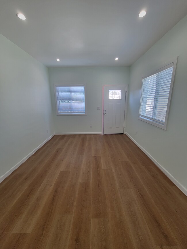
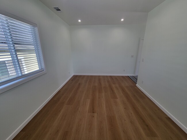
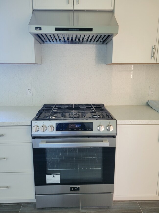
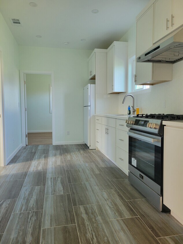
Home built in July 2024 The home is very spacious for an 800 sq ft home, located near Tanforan Mall, SFO Airport, 101 and 280 freeways, and in walking distance to El Camino Real and The See's Candie production / store. There are 2 spaces to park your car. The area is very safe and peaceful with lots of beautiful walking paths nearby and within walking distance to the redeveloped Orange Park for family picnics and children to play at. The home is cable and internet connection ready, each bedroom and living room has a Cat6 wall jack for easy access to internet connection. For any parties interested to fill out an application to rent. Lease is for 1 year that will renew every year. Rent $3293.00 / month Deposit: $3800.00 We require these documents: -Copy of California ID -Copy of current credit report -Copy of last 2 month's paystubs If anything else is needed we still state it at a future time.
125 Francisco Dr is a house located in San Mateo County and the 94080 ZIP Code.
House Features
Washer/Dryer
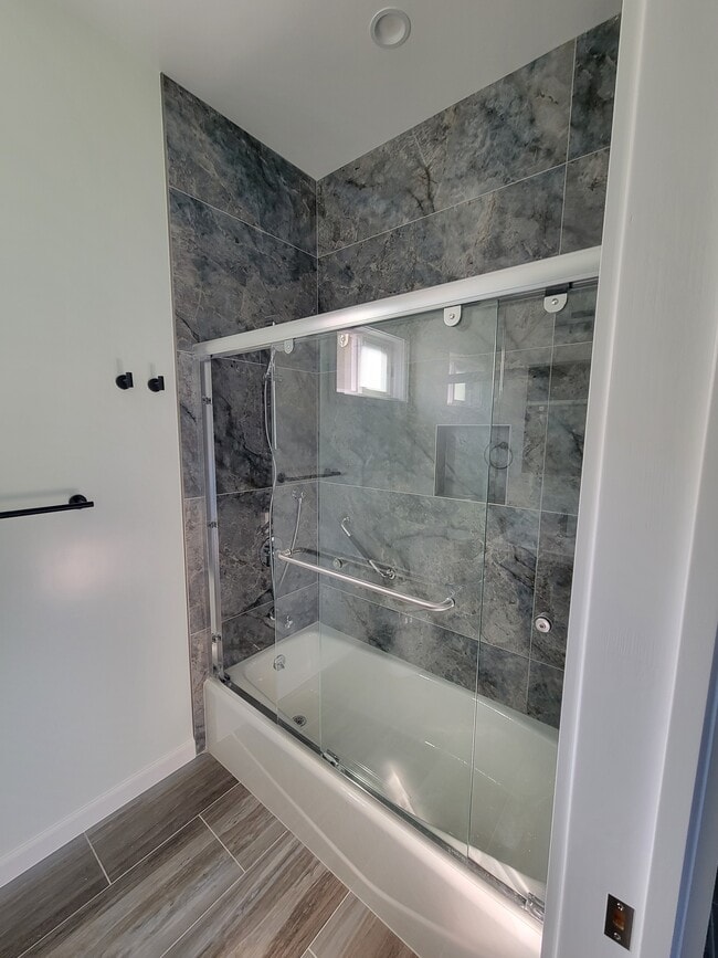
Tub/Shower
Heating
Cable Ready
- Washer/Dryer
- Heating
- Cable Ready
- Tub/Shower
- Walking/Biking Trails
Location
Get Directions
South San Francisco, known locally as "South City," sits between San Bruno Mountain and San Francisco Bay. Once an industrial center, it's now home to numerous biotechnology companies. The rental market offers options at various price points, with average rents ranging from $2,432 for studios to $4,068 for three-bedroom apartments.
The city's downtown along Grand Avenue features independent shops and local eateries that contribute to its community atmosphere. Sign Hill Park, home to the historic "South San Francisco The Industrial City" sign, provides hiking trails with sweeping views of the bay. Orange Memorial Park offers recreational facilities, including a swimming pool and seasonal farmers' market. East of Highway 101, the city has developed into a biotechnology research center, with Genentech's campus serving as a major employer.
Learn more about living in South San FranciscoBelow are rent ranges for similar nearby apartments
Amenities
- Washer/Dryer
- Heating
- Cable Ready
- Tub/Shower
- Walking/Biking Trails
Education
| Colleges & Universities | Distance | ||
|---|---|---|---|
| Colleges & Universities | Distance | ||
| Drive: | 8 min | 3.8 mi | |
| Drive: | 14 min | 7.8 mi | |
| Drive: | 14 min | 8.2 mi | |
| Drive: | 20 min | 10.4 mi |
125 Francisco Dr is within 8 minutes or 3.8 miles from Skyline College. It is also near City College of San Francisco and San Francisco State University.
Transportation options available in South San Francisco include San Bruno Station, located 0.7 mile from 125 Francisco Dr. 125 Francisco Dr is near San Francisco International, located 4.1 miles or 9 minutes away, and Metro Oakland International, located 29.7 miles or 44 minutes away.
| Transit / Subway | Distance | ||
|---|---|---|---|
| Transit / Subway | Distance | ||
|
|
Walk: | 14 min | 0.7 mi |
|
|
Drive: | 4 min | 2.0 mi |
|
|
Drive: | 4 min | 2.0 mi |
| Drive: | 5 min | 2.7 mi | |
|
|
Drive: | 6 min | 2.9 mi |
| Commuter Rail | Distance | ||
|---|---|---|---|
| Commuter Rail | Distance | ||
| Drive: | 3 min | 1.6 mi | |
| Drive: | 4 min | 2.0 mi | |
| Drive: | 9 min | 4.5 mi | |
| Drive: | 10 min | 6.3 mi | |
| Drive: | 11 min | 6.4 mi |
| Airports | Distance | ||
|---|---|---|---|
| Airports | Distance | ||
|
San Francisco International
|
Drive: | 9 min | 4.1 mi |
|
Metro Oakland International
|
Drive: | 44 min | 29.7 mi |
Time and distance from 125 Francisco Dr.
| Shopping Centers | Distance | ||
|---|---|---|---|
| Shopping Centers | Distance | ||
| Walk: | 6 min | 0.3 mi | |
| Walk: | 11 min | 0.6 mi | |
| Walk: | 13 min | 0.7 mi |
125 Francisco Dr has 3 shopping centers within 0.7 mile, which is about a 13-minute walk. The miles and minutes will be for the farthest away property.
| Parks and Recreation | Distance | ||
|---|---|---|---|
| Parks and Recreation | Distance | ||
|
Bayside Park
|
Drive: | 10 min | 6.5 mi |
|
Candlestick Point State Recreation Area
|
Drive: | 15 min | 7.3 mi |
|
Pacifica State Beach
|
Drive: | 14 min | 8.2 mi |
|
San Bruno Mountain State Park
|
Drive: | 18 min | 8.2 mi |
|
San Pedro Valley Park
|
Drive: | 21 min | 10.4 mi |
125 Francisco Dr has 5 parks within 10.4 miles, including San Bruno Mountain State Park, Bayside Park, and Candlestick Point State Recreation Area.
| Hospitals | Distance | ||
|---|---|---|---|
| Hospitals | Distance | ||
| Drive: | 3 min | 1.5 mi | |
| Drive: | 8 min | 4.3 mi | |
| Drive: | 8 min | 4.4 mi |
125 Francisco Dr has 3 hospitals within 4.4 miles, the nearest is Kaiser Foundation Hospital - South San Francisco which is 1.5 miles away and a 3 minute drive.
| Military Bases | Distance | ||
|---|---|---|---|
| Military Bases | Distance | ||
| Drive: | 27 min | 12.4 mi | |
| Drive: | 27 min | 13.0 mi |
125 Francisco Dr is 12.4 miles from East Fort Miley, and is convenient to other military bases, including West Fort Miley.
You May Also Like
Similar Rentals Nearby


What Are Walk Score®, Transit Score®, and Bike Score® Ratings?
Walk Score® measures the walkability of any address. Transit Score® measures access to public transit. Bike Score® measures the bikeability of any address.
What is a Sound Score Rating?
A Sound Score Rating aggregates noise caused by vehicle traffic, airplane traffic and local sources
125 Francisco Dr
South San Francisco, CA 94080