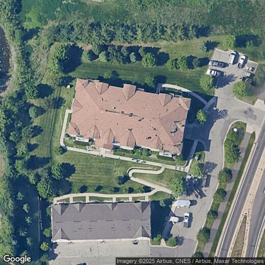
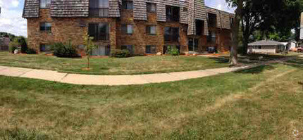
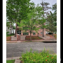
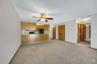
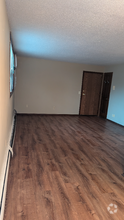
1244 County Road D E Unit 203
1244 County Road D E Unit 203
Maplewood, MN 55109
2 Weeks Ago
Favorites
1244 County Road D E Unit 203
Favorites
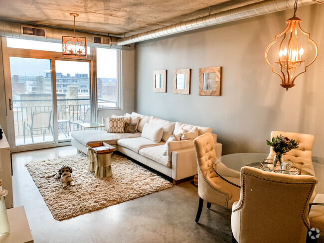
Check Back Soon for Upcoming Availability
| Beds | Baths | Average SF |
|---|---|---|
| 2 Bedrooms 2 Bedrooms 2 Br | 2 Baths 2 Baths 2 Ba | — |
Location
Get Directions
Maplewood’s prime location lends a ten-minute drive to Saint Paul and a 20-minute drive to Minneapolis, making it an ideal spot for commuters and those who like to be just on the outskirts of city life.
Renting in Maplewood grants you the opportunity to partake in an active adventure, such as riding through bike trails from Maplewood to both Saint Paul and Minneapolis at Battle Creek Regional Park. While it’s close to major cities, Maplewood has its charms as well. You can catch your favorite band at Myth, practice your golf swing at Keller Golf Course, see a movie at the discounted Plaza Maplewood Theatre, and buy your next gift at the Maplewood Mall.
Learn more about living in Maplewood
Education
| Colleges & Universities | Distance | ||
|---|---|---|---|
| Colleges & Universities | Distance | ||
| Drive: | 6 min | 4.2 mi | |
| Drive: | 11 min | 5.8 mi | |
| Drive: | 13 min | 8.3 mi | |
| Drive: | 14 min | 8.8 mi |
1244 County Road D E Unit 203 is within 6 minutes or 4.2 miles from Century College. It is also near Metropolitan State University and Northwestern College.
Transportation options available in Maplewood include Robert St Station, located 7.8 miles from 1244 County Road D E Unit 203. 1244 County Road D E Unit 203 is near Minneapolis-St Paul International/Wold-Chamberlain, located 17.4 miles or 27 minutes away.
| Transit / Subway | Distance | ||
|---|---|---|---|
| Transit / Subway | Distance | ||
| Drive: | 11 min | 7.8 mi | |
| Drive: | 12 min | 7.9 mi | |
| Drive: | 12 min | 8.0 mi | |
| Drive: | 12 min | 8.0 mi | |
| Drive: | 12 min | 8.1 mi |
| Commuter Rail | Distance | ||
|---|---|---|---|
| Commuter Rail | Distance | ||
|
|
Drive: | 12 min | 8.0 mi |
|
|
Drive: | 19 min | 13.7 mi |
|
|
Drive: | 24 min | 14.7 mi |
|
|
Drive: | 29 min | 21.8 mi |
|
|
Drive: | 30 min | 23.5 mi |
| Airports | Distance | ||
|---|---|---|---|
| Airports | Distance | ||
|
Minneapolis-St Paul International/Wold-Chamberlain
|
Drive: | 27 min | 17.4 mi |
Time and distance from 1244 County Road D E Unit 203.
| Shopping Centers | Distance | ||
|---|---|---|---|
| Shopping Centers | Distance | ||
| Walk: | 3 min | 0.2 mi | |
| Drive: | 4 min | 1.6 mi | |
| Drive: | 5 min | 1.9 mi |
1244 County Road D E Unit 203 has 3 shopping centers within 1.9 miles, which is about a 5-minute walk. The miles and minutes will be for the farthest away property.
| Parks and Recreation | Distance | ||
|---|---|---|---|
| Parks and Recreation | Distance | ||
|
Phelan Regional Park
|
Drive: | 8 min | 3.9 mi |
|
Keller Regional Park
|
Drive: | 7 min | 3.9 mi |
|
Phalen Park
|
Drive: | 8 min | 4.0 mi |
|
Arlington/Arkwright Park
|
Drive: | 8 min | 4.5 mi |
|
Harriet Alexander Nature Center
|
Drive: | 9 min | 5.7 mi |
1244 County Road D E Unit 203 has 5 parks within 5.7 miles, including Keller Regional Park, Phelan Regional Park, and Phalen Park.
| Hospitals | Distance | ||
|---|---|---|---|
| Hospitals | Distance | ||
| Drive: | 3 min | 1.4 mi | |
| Drive: | 11 min | 7.6 mi | |
| Drive: | 11 min | 7.6 mi |
1244 County Road D E Unit 203 has 3 hospitals within 7.6 miles, the nearest is Healtheast St. John's Hospital which is 1.4 miles away and a 3 minute drive.
| Military Bases | Distance | ||
|---|---|---|---|
| Military Bases | Distance | ||
| Drive: | 26 min | 16.2 mi |
1244 County Road D E Unit 203 is 16.2 miles and a 26 minute drive from Fort Snelling Military Reservation.
You May Also Like
Similar Rentals Nearby
-
-
-
-
-
-
 $1,3002 Beds, 1 Bath, 925 sq ftApartment for Rent
 -
-
-
-
What Are Walk Score®, Transit Score®, and Bike Score® Ratings?
Walk Score® measures the walkability of any address. Transit Score® measures access to public transit. Bike Score® measures the bikeability of any address.
What is a Sound Score Rating?
A Sound Score Rating aggregates noise caused by vehicle traffic, airplane traffic and local sources

1244 County Road D E
Maplewood, MN 55109