
$2,750
/ Month
12420 Skyline Blvd
Oakland, CA 94619
2 Weeks Ago
|
Edit
Favorites
12420 Skyline Blvd

Favorites
Check Back Soon for Upcoming Availability
| Beds | Baths | Average SF |
|---|---|---|
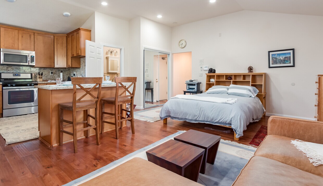
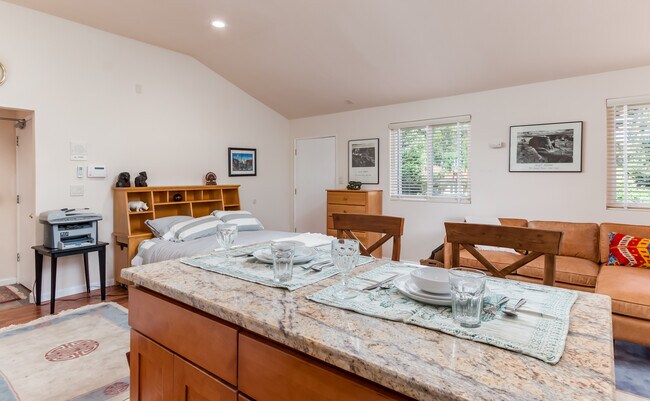
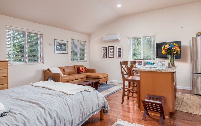
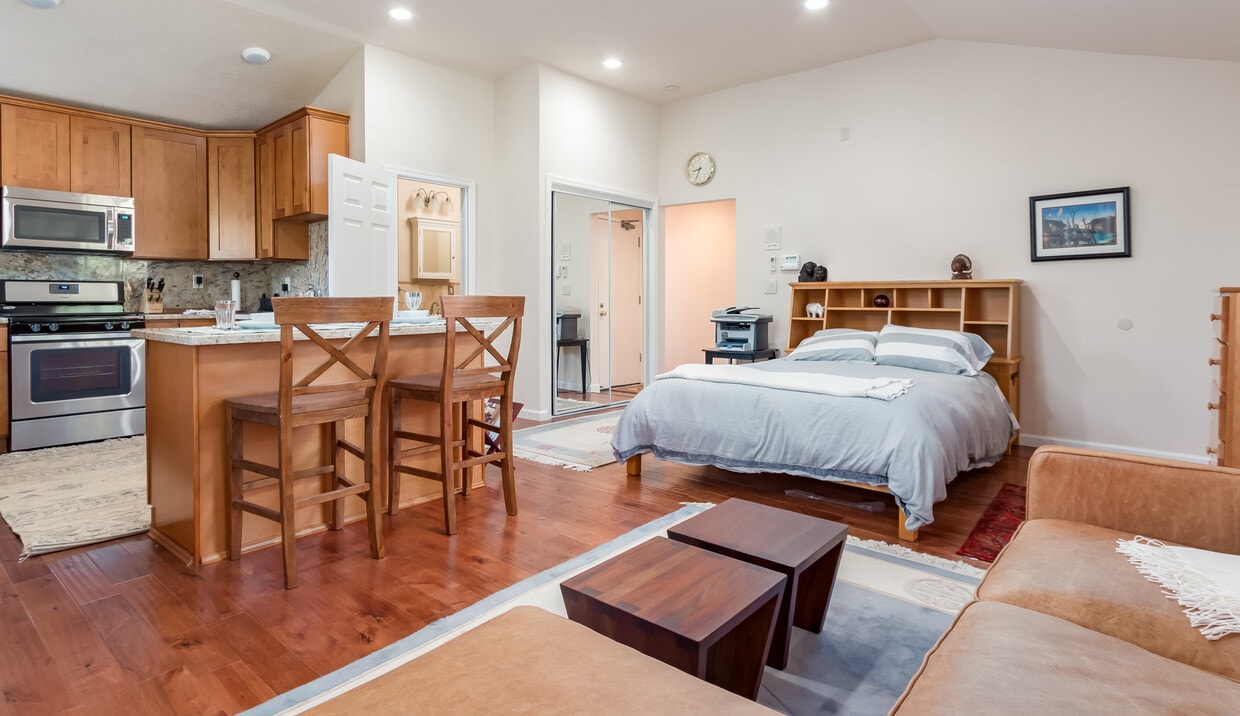
| Studio Studio 0 Br | 1 Bath 1 Bath 1 Ba | 550 SF |
Fees and Policies
The fees below are based on community-supplied data and may exclude additional fees and utilities.
- Parking
-
Other--
Details
Utilities Included
-
Gas
-
Water
-
Electricity
-
Heat
-
Trash Removal
-
Sewer
-
Cable
-
Air Conditioning
Property Information
-
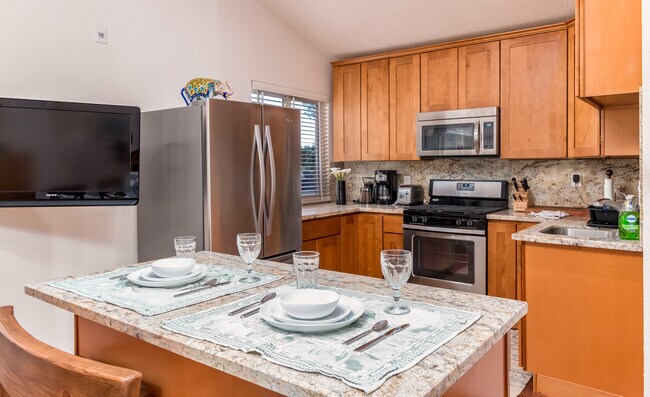
Furnished Units Available
12420 Skyline Blvd is a house located in Alameda County and the 94619 ZIP Code.
House Features
- Air Conditioning
- Smoke Free
- Furnished
- Gated
Location
Get Directions
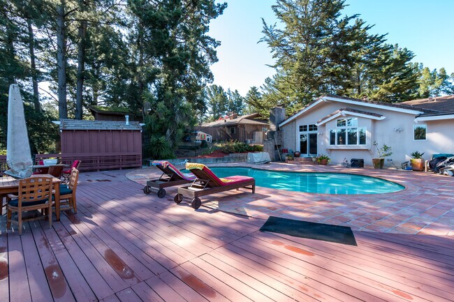
Southeast Oakland is a fast-growing neighborhood along Interstate 580. Located only five miles north of the community is Downtown Oakland — a commuter's dream. Outdoor enthusiasts will enjoy a visit to Reinhardt Redwood Regional Park, a vast forest with picnic areas, campsites, fishing, and horseback riding. Residents can visit the Oakland Zoo, home to more than 700 native and exotic animals, or check out live shows at the Fox Theater. Most dining and shopping opportunities lie within the neighborhoods of Oakland and Alameda. Travelers will appreciate the proximity to the Oakland International and San Francisco International airports, less than eight miles away. Single-family homes and apartments are available to rent.
Learn more about living in Southeast Oakland HillsBelow are rent ranges for similar nearby apartments
Amenities
- Air Conditioning
- Smoke Free
- Furnished
- Gated
Expenses
Utilities Included
Gas, Water, Electricity, Heat, Trash Removal, Sewer, Cable, Air Conditioning
Included
Education
| Colleges & Universities | Distance | ||
|---|---|---|---|
| Colleges & Universities | Distance | ||
| Drive: | 10 min | 3.7 mi | |
| Drive: | 12 min | 6.9 mi | |
| Drive: | 13 min | 7.4 mi | |
| Drive: | 23 min | 9.1 mi |
12420 Skyline Blvd is within 10 minutes or 3.7 miles from Mills College. It is also near Laney College and Samuel Merritt University.
Transportation options available in Oakland include Fruitvale Station, located 4.7 miles from 12420 Skyline Blvd. 12420 Skyline Blvd is near Metro Oakland International, located 9.8 miles or 16 minutes away, and San Francisco International, located 29.0 miles or 43 minutes away.
| Transit / Subway | Distance | ||
|---|---|---|---|
| Transit / Subway | Distance | ||
|
|
Drive: | 8 min | 4.7 mi |
|
|
Drive: | 11 min | 6.3 mi |
|
|
Drive: | 14 min | 7.3 mi |
|
|
Drive: | 15 min | 9.0 mi |
|
|
Drive: | 15 min | 10.2 mi |
| Commuter Rail | Distance | ||
|---|---|---|---|
| Commuter Rail | Distance | ||
|
|
Drive: | 14 min | 8.1 mi |
|
|
Drive: | 15 min | 10.0 mi |
|
|
Drive: | 18 min | 12.1 mi |
|
|
Drive: | 21 min | 13.7 mi |
| Drive: | 21 min | 13.7 mi |
| Airports | Distance | ||
|---|---|---|---|
| Airports | Distance | ||
|
Metro Oakland International
|
Drive: | 16 min | 9.8 mi |
|
San Francisco International
|
Drive: | 43 min | 29.0 mi |
Time and distance from 12420 Skyline Blvd.
| Shopping Centers | Distance | ||
|---|---|---|---|
| Shopping Centers | Distance | ||
| Drive: | 4 min | 1.8 mi | |
| Drive: | 7 min | 3.9 mi | |
| Drive: | 8 min | 4.1 mi |
12420 Skyline Blvd has 3 shopping centers within 4.1 miles, which is about a 8-minute drive. The miles and minutes will be for the farthest away property.
| Parks and Recreation | Distance | ||
|---|---|---|---|
| Parks and Recreation | Distance | ||
|
Leona Canyon Regional Open Space Preserve
|
Drive: | 4 min | 2.0 mi |
|
Roberts Regional Recreation Area
|
Drive: | 5 min | 2.1 mi |
|
Redwood Regional Park
|
Drive: | 5 min | 2.4 mi |
|
Chabot Space & Science Center
|
Drive: | 8 min | 2.8 mi |
|
Joaquin Miller Park
|
Drive: | 7 min | 2.9 mi |
12420 Skyline Blvd has 5 parks within 2.9 miles, including Leona Canyon Regional Open Space Preserve, Roberts Regional Recreation Area, and Redwood Regional Park.
| Hospitals | Distance | ||
|---|---|---|---|
| Hospitals | Distance | ||
| Drive: | 9 min | 4.4 mi | |
| Drive: | 9 min | 4.8 mi | |
| Drive: | 11 min | 7.0 mi |
12420 Skyline Blvd has 3 hospitals within 7.0 miles, the nearest is Telecare Heritage Psychiatric Health Facility which is 4.4 miles away and a 9 minute drive.
| Military Bases | Distance | ||
|---|---|---|---|
| Military Bases | Distance | ||
| Drive: | 22 min | 10.7 mi | |
| Drive: | 22 min | 12.5 mi |
12420 Skyline Blvd is 10.7 miles from Alameda/US Naval Air Station Alameda, and is convenient to other military bases, including Oakland Army Base.
You May Also Like
Similar Rentals Nearby


What Are Walk Score®, Transit Score®, and Bike Score® Ratings?
Walk Score® measures the walkability of any address. Transit Score® measures access to public transit. Bike Score® measures the bikeability of any address.
What is a Sound Score Rating?
A Sound Score Rating aggregates noise caused by vehicle traffic, airplane traffic and local sources
12420 Skyline Blvd
Oakland, CA 94619