$2,650 / Month
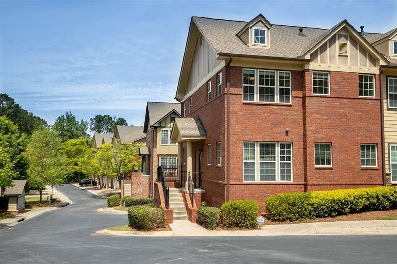
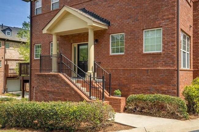
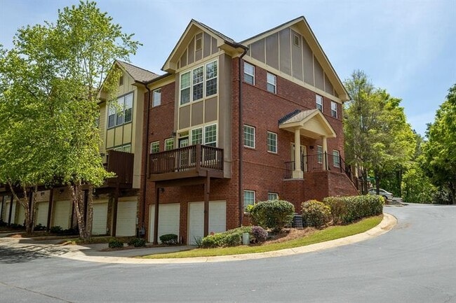
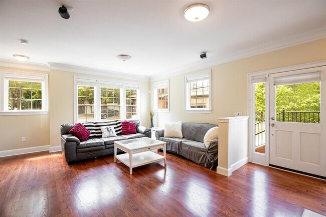
1240 Ashford Creek Way NE
Atlanta, GA 30319
2 Weeks Ago
Favorites
1240 Ashford Creek Way NE

Favorites
Check Back Soon for Upcoming Availability
| Beds | Baths | Average SF |
|---|---|---|
| 2 Bedrooms 2 Bedrooms 2 Br | 2.5 Baths 2.5 Baths 2.5 Ba | 1,945 SF |
Fees and Policies
The fees below are based on community-supplied data and may exclude additional fees and utilities.
- Dogs Allowed
-
Fees not specified
- Cats Allowed
-
Fees not specified
About This Property
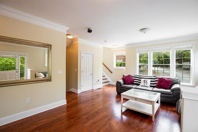
Come see this one-of-a-kind brick townhome in gated Ashford Creek. This end unit boasts a newly opened main level flooded with natural light and a great roommate plan with a spacious master bathroom. Located at the rear of the neighborhood, this home faces a peaceful lake and gazebo. Ashford Creek is down the street from Blackburn Park, YMCA, and Marist School. Home comes with all appliances including washer/dryer & refrigerator. Neighborhood amenities include clubhouse, pool, and fitness center.
1240 Ashford Creek Way NE is a townhome located in DeKalb County and the 30319 ZIP Code. This area is served by the DeKalb County attendance zone.
Location
Get Directions
North Brookhaven is one of Atlanta's most popular neighborhoods, located just inside the Perimeter to the east of Chamblee extending southward to Windsor Parkway. North Brookhaven includes the historic Peachtree Golf Club, Blackburn Park, and Murphey Candler Park. The community’s scenic parks offer fantastic options for outdoor recreation along with regular events and festivals.
North Brookhaven’s top-ranking schools draw many families to the area. The neighborhood is home to Oglethorpe University, making it a popular choice for students, faculty, and staff as well. Commuters appreciate the neighborhood’s access to Interstate 285, MARTA’s Gold Line, Georgia State Route 400, and Peachtree Road, which all connect North Brookhaven to employment-rich communities like Perimeter Center, Buckhead, Midtown, and Downtown Atlanta.
North Brookhaven residents don’t have to travel far from their apartments to enjoy a night out.
Learn more about living in North BrookhavenBelow are rent ranges for similar nearby apartments
| Beds | Average Size | Lowest | Typical | Premium |
|---|---|---|---|---|
| Studio Studio Studio | 520-521 Sq Ft | $1,134 | $1,812 | $4,463 |
| 1 Bed 1 Bed 1 Bed | 782-783 Sq Ft | $1,044 | $2,059 | $4,803 |
| 2 Beds 2 Beds 2 Beds | 1213 Sq Ft | $1,409 | $2,778 | $7,977 |
| 3 Beds 3 Beds 3 Beds | 1692 Sq Ft | $2,448 | $3,813 | $5,879 |
| 4 Beds 4 Beds 4 Beds | 3666 Sq Ft | $2,750 | $8,646 | $20,000 |
Education
| Colleges & Universities | Distance | ||
|---|---|---|---|
| Colleges & Universities | Distance | ||
| Drive: | 6 min | 2.5 mi | |
| Drive: | 8 min | 3.2 mi | |
| Drive: | 9 min | 3.9 mi | |
| Drive: | 14 min | 5.7 mi |
1240 Ashford Creek Way NE is within 6 minutes or 2.5 miles from Oglethorpe University. It is also near Argosy University, Atlanta and The Art Institute of Atlanta.
Schools


Public Elementary School
Grades PK-5
696 Students
Attendance Zone
Public Middle School
Grades 6-8
975 Students
Attendance Zone
Public High School
Grades 9-12
1,776 Students
Attendance Zone
Private Elementary & Middle School
Grades PK-8
559 Students
Nearby
Private Middle & High School
Grades 7-12
1,104 Students
Nearby
School data provided by
 The GreatSchools Rating helps parents compare schools within a state based on a variety of school quality indicators and provides a helpful picture of how effectively each school serves all of its students. Ratings are on a scale of 1 (below average) to 10 (above average) and can include test scores, college readiness, academic progress, advanced courses, equity, discipline and attendance data. We also advise parents to visit schools, consider other information on school performance and programs, and consider family needs as part of the school selection process.
View GreatSchools Rating Methodology
Data provided by GreatSchools.org © 2025. All rights reserved.
View GreatSchools Rating Methodology
Data provided by GreatSchools.org © 2025. All rights reserved.
Transportation options available in Atlanta include Dunwoody Station, located 2.3 miles from 1240 Ashford Creek Way NE. 1240 Ashford Creek Way NE is near Hartsfield - Jackson Atlanta International, located 22.1 miles or 36 minutes away.
| Transit / Subway | Distance | ||
|---|---|---|---|
| Transit / Subway | Distance | ||
|
|
Drive: | 5 min | 2.3 mi |
|
|
Drive: | 5 min | 2.3 mi |
|
|
Drive: | 7 min | 2.8 mi |
|
|
Drive: | 7 min | 3.3 mi |
|
|
Drive: | 8 min | 3.5 mi |
| Commuter Rail | Distance | ||
|---|---|---|---|
| Commuter Rail | Distance | ||
|
|
Drive: | 17 min | 9.1 mi |
| Airports | Distance | ||
|---|---|---|---|
| Airports | Distance | ||
|
Hartsfield - Jackson Atlanta International
|
Drive: | 36 min | 22.1 mi |
Time and distance from 1240 Ashford Creek Way NE.
| Shopping Centers | Distance | ||
|---|---|---|---|
| Shopping Centers | Distance | ||
| Walk: | 5 min | 0.3 mi | |
| Walk: | 9 min | 0.5 mi | |
| Walk: | 11 min | 0.6 mi |
1240 Ashford Creek Way NE has 3 shopping centers within 0.6 mile, which is about a 11-minute walk. The miles and minutes will be for the farthest away property.
| Parks and Recreation | Distance | ||
|---|---|---|---|
| Parks and Recreation | Distance | ||
|
Dunwoody Nature Center
|
Drive: | 11 min | 4.9 mi |
|
Sandy Springs Historic Site
|
Drive: | 11 min | 5.2 mi |
|
Blue Heron Nature Preserve
|
Drive: | 12 min | 5.2 mi |
|
Atlanta Audubon Society
|
Drive: | 12 min | 5.3 mi |
|
Chastain Park
|
Drive: | 15 min | 5.8 mi |
1240 Ashford Creek Way NE has 5 parks within 5.8 miles, including Sandy Springs Historic Site, Dunwoody Nature Center, and Blue Heron Nature Preserve.
| Hospitals | Distance | ||
|---|---|---|---|
| Hospitals | Distance | ||
| Drive: | 5 min | 2.5 mi | |
| Drive: | 5 min | 2.5 mi | |
| Drive: | 5 min | 2.5 mi |
1240 Ashford Creek Way NE has 3 hospitals within 2.5 miles, the nearest is Children's Healthcare of Atlanta - Scottish Rite Hospital which is 2.5 miles away and a 5 minute drive.
| Military Bases | Distance | ||
|---|---|---|---|
| Military Bases | Distance | ||
| Drive: | 28 min | 15.6 mi | |
| Drive: | 31 min | 17.0 mi |
1240 Ashford Creek Way NE is 15.6 miles from Dobbins Air Force Base, and is convenient to other military bases, including Fort McPherson.
You May Also Like
Similar Rentals Nearby


What Are Walk Score®, Transit Score®, and Bike Score® Ratings?
Walk Score® measures the walkability of any address. Transit Score® measures access to public transit. Bike Score® measures the bikeability of any address.
What is a Sound Score Rating?
A Sound Score Rating aggregates noise caused by vehicle traffic, airplane traffic and local sources

1240 Ashford Creek Way NE
Atlanta, GA 30319