$3,300
/ Month
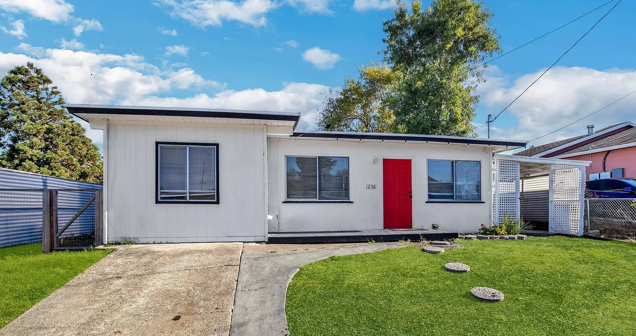
1238 Frances Rd
San Pablo, CA 94806
3 Days Ago
|
Edit
Favorites
650-618-0053
-
Bedrooms
3
-
Bathrooms
1
-
Square Feet
900 sq ft
-
Available
Available Now
Highlight
- Playground
1238 Frances Rd

Favorites
About This Home
12 Month Lease,
$3,300 deposit,
Available Now
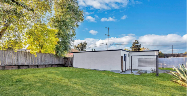
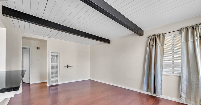
A cozy home of 3 bedrooms and 1 bath - Special $300 credit to move in. Come live in the beautiful home in San Pablo, CA. A cozy home of 3 bedrooms and 1 bathroom with huge backyard for playground and make a delicious BBQ with family. Close to highways 80 and 580. Don’t miss this charming place! Please contact me for further details. Se Habla Español. Available now to move in. Special $300.00 credit toward your first month rent. The house utilities are not included.
1238 Frances Rd is a house located in Contra Costa County and the 94806 ZIP Code. This area is served by the West Contra Costa Unified attendance zone.
* Price shown is base rent. Excludes user-selected optional fees and variable or usage-based fees and required charges due at or prior to move-in or at move-out. Price, availability, fees, and any applicable rent special are subject to change without notice.
* Square footage definitions vary. Displayed square footage is approximate.
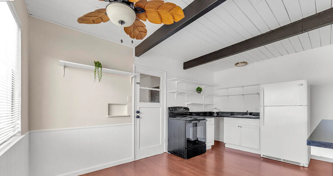
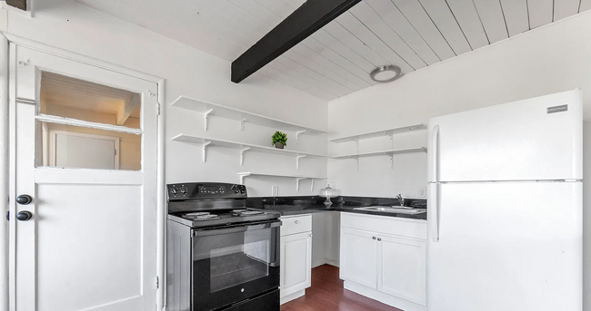
House Features
- Heating
- Ceiling Fans
- Storage Space
- Tub/Shower
- Playground
- Grill
Fees and Policies
The fees below are based on community-supplied data and may exclude additional fees and utilities.
- Parking
-
Other--
Contact
- Phone Number
- Contact
Location
Get Directions
Completely encompassed by the city of Richmond, San Pablo is a unique city nearing the coast of both the San Francisco Bay and San Pablo Bay. Beautiful bay views along the west coast are always a plus in our book! And on the other end of town, San Pablo borders Wildcat Canyon Regional Park. Though wildcat sightings are unlikely, these picturesque rolling hills are more known for their multi-use trails, playgrounds, and scenic picnic spots.
San Pablo boasts a diverse community with relatively affordable housing in comparison to neighboring cities. The city’s tight-knit community supports education and community growth, and Contra Costa College is a pristine example of that with its welcoming atmosphere and numerous athletic programs.
Along with a family-friendly vibe, San Pablo is a great place to find everyday conveniences such as casual dining, grocery stores, banks, and more.
Learn more about living in San Pablo
Education
| Colleges & Universities | Distance | ||
|---|---|---|---|
| Colleges & Universities | Distance | ||
| Drive: | 6 min | 2.5 mi | |
| Drive: | 20 min | 12.6 mi | |
| Drive: | 24 min | 13.6 mi | |
| Drive: | 27 min | 16.3 mi |
1238 Frances Rd is within 6 minutes or 2.5 miles from Contra Costa College. It is also near Berkeley City College and UC Berkeley.
Schools


Public Elementary School
Grades K-5
270 Students
Nearby
Public Elementary & Middle School
Grades K-8
475 Students
Attendance Zone
Public Middle School
Grades 7-8
399 Students
Attendance Zone
Public High School
Grades 9-12
1,280 Students
Attendance Zone
Private Elementary & Middle School
Grades PK-8
225 Students
Nearby
Private Elementary & Middle School
Grades 1-8
15 Students
Nearby
Private High School
Grades 9-12
12 Students
Nearby
School data provided by
 The GreatSchools Rating helps parents compare schools within a state based on a variety of school quality indicators and provides a helpful picture of how effectively each school serves all of its students. Ratings are on a scale of 1 (below average) to 10 (above average) and can include test scores, college readiness, academic progress, advanced courses, equity, discipline and attendance data. We also advise parents to visit schools, consider other information on school performance and programs, and consider family needs as part of the school selection process.
View GreatSchools Rating Methodology
Data provided by GreatSchools.org © 2026. All rights reserved.
View GreatSchools Rating Methodology
Data provided by GreatSchools.org © 2026. All rights reserved.
Transportation options available in San Pablo include Richmond Station, located 4.5 miles from 1238 Frances Rd. 1238 Frances Rd is near Metro Oakland International, located 25.6 miles or 35 minutes away, and San Francisco International, located 33.2 miles or 47 minutes away.
| Transit / Subway | Distance | ||
|---|---|---|---|
| Transit / Subway | Distance | ||
|
|
Drive: | 9 min | 4.5 mi |
|
|
Drive: | 10 min | 6.6 mi |
|
|
Drive: | 10 min | 6.6 mi |
|
|
Drive: | 13 min | 8.5 mi |
|
|
Drive: | 18 min | 12.0 mi |
| Commuter Rail | Distance | ||
|---|---|---|---|
| Commuter Rail | Distance | ||
| Drive: | 9 min | 4.7 mi | |
|
|
Drive: | 16 min | 11.2 mi |
| Drive: | 22 min | 13.9 mi | |
| Drive: | 22 min | 14.8 mi | |
|
|
Drive: | 23 min | 15.9 mi |
| Airports | Distance | ||
|---|---|---|---|
| Airports | Distance | ||
|
Metro Oakland International
|
Drive: | 35 min | 25.6 mi |
|
San Francisco International
|
Drive: | 47 min | 33.2 mi |
Time and distance from 1238 Frances Rd.
| Shopping Centers | Distance | ||
|---|---|---|---|
| Shopping Centers | Distance | ||
| Walk: | 11 min | 0.6 mi | |
| Walk: | 12 min | 0.7 mi | |
| Drive: | 3 min | 1.2 mi |
1238 Frances Rd has 3 shopping centers within 1.2 miles, which is about a 3-minute drive. The miles and minutes will be for the farthest away property.
| Parks and Recreation | Distance | ||
|---|---|---|---|
| Parks and Recreation | Distance | ||
|
Point Pinole Regional Shoreline
|
Drive: | 4 min | 1.7 mi |
|
Ohlone Wilderness
|
Drive: | 9 min | 4.2 mi |
|
Sobrante Ridge Regional Preserve
|
Drive: | 12 min | 5.7 mi |
|
Kennedy Grove Regional Recreation Area
|
Drive: | 14 min | 7.1 mi |
|
Wildcat Canyon Regional Park
|
Drive: | 17 min | 9.1 mi |
1238 Frances Rd has 5 parks within 9.1 miles, including Point Pinole Regional Shoreline, Ohlone Wilderness, and Sobrante Ridge Regional Preserve.
| Hospitals | Distance | ||
|---|---|---|---|
| Hospitals | Distance | ||
| Drive: | 20 min | 14.3 mi |
1238 Frances Rd is 14.3 miles and a 20 minute drive from Adventist Health Vallejo.
| Military Bases | Distance | ||
|---|---|---|---|
| Military Bases | Distance | ||
| Drive: | 6 min | 2.6 mi | |
| Drive: | 16 min | 9.1 mi | |
| Drive: | 25 min | 15.7 mi |
1238 Frances Rd has 3 military bases within 15.7 miles, the nearest is Armory West Contra Costa which is 2.6 miles away and a 6 minute drive.
Amenities
- Heating
- Ceiling Fans
- Storage Space
- Tub/Shower
- Grill
- Playground
1238 Frances Rd Photos
What Are Walk Score®, Transit Score®, and Bike Score® Ratings?
Walk Score® measures the walkability of any address. Transit Score® measures access to public transit. Bike Score® measures the bikeability of any address.
What is a Sound Score Rating?
A Sound Score Rating aggregates noise caused by vehicle traffic, airplane traffic and local sources

1238 Frances Rd
San Pablo, CA 94806