
$2,900 / Month
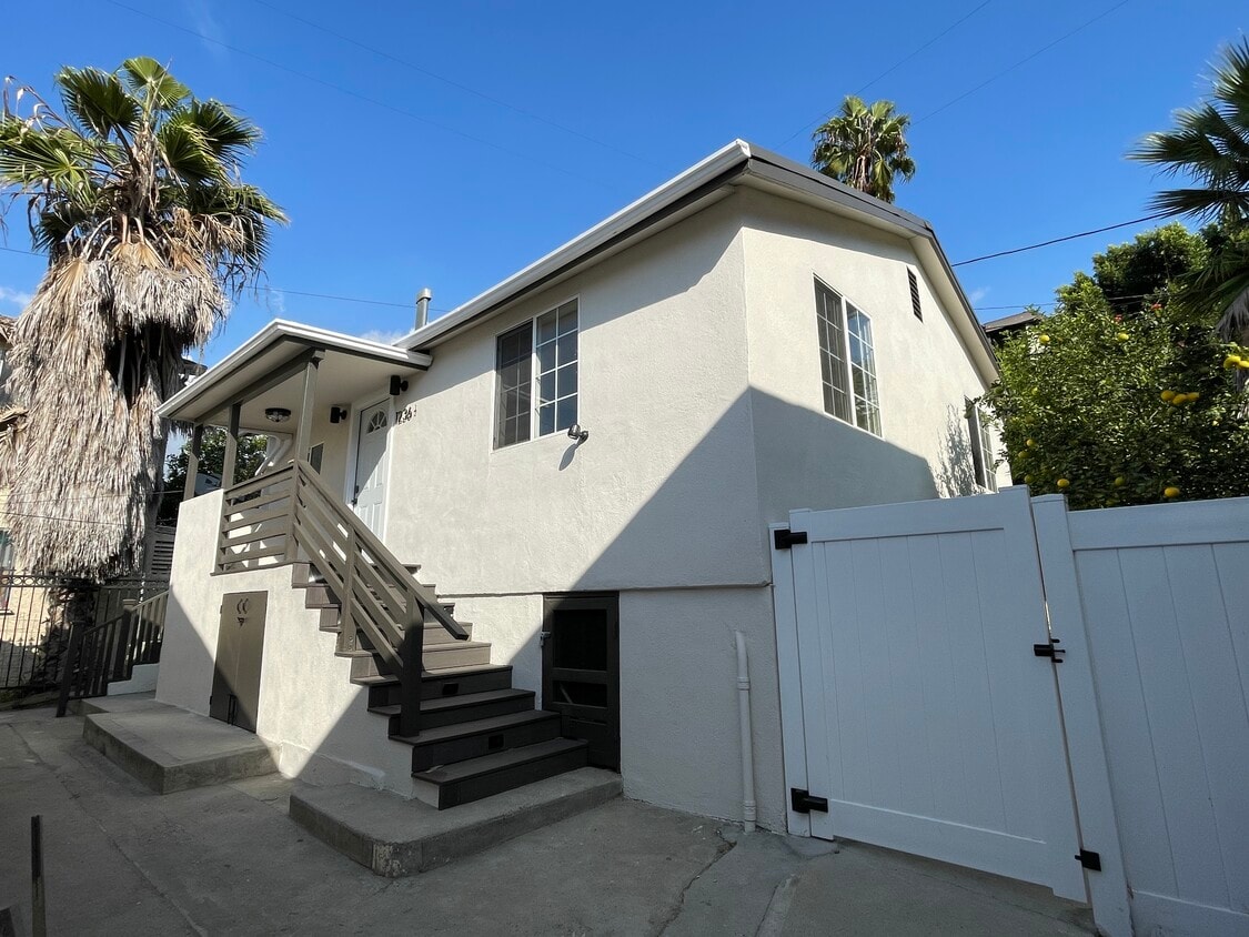
1236 N Evergreen Ave
Los Angeles, CA 90033
2 Weeks Ago
Favorites
1236 N Evergreen Ave

Favorites
Check Back Soon for Upcoming Availability
| Beds | Baths | Average SF |
|---|---|---|
| 2 Bedrooms 2 Bedrooms 2 Br | 1 Bath 1 Bath 1 Ba | 672 SF |
Fees and Policies
The fees below are based on community-supplied data and may exclude additional fees and utilities.
- Dogs Allowed
-
Fees not specified
- Cats Allowed
-
Fees not specified
Details
Utilities Included
-
Water
-
Trash Removal
About This Property
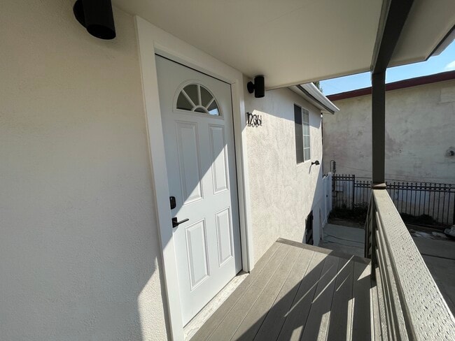
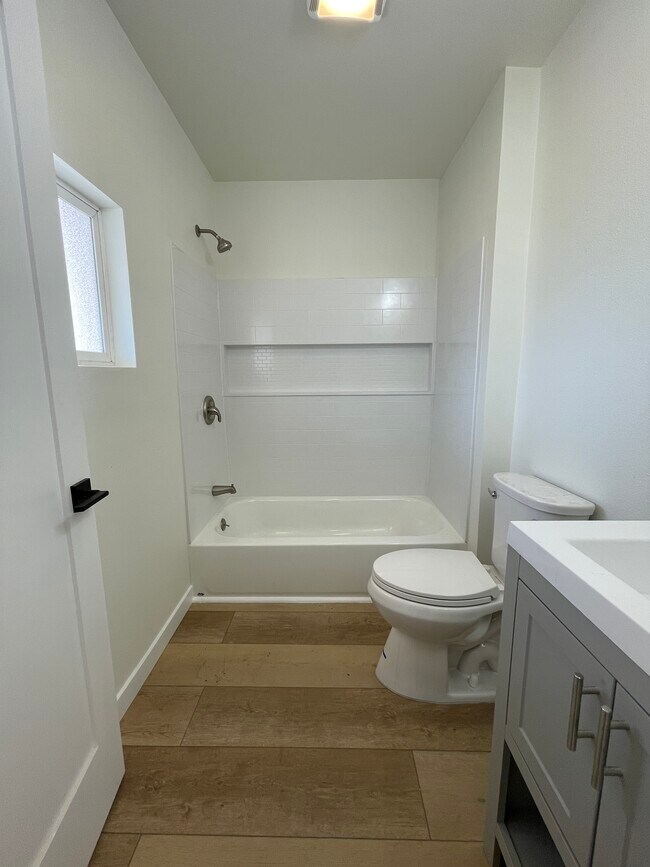
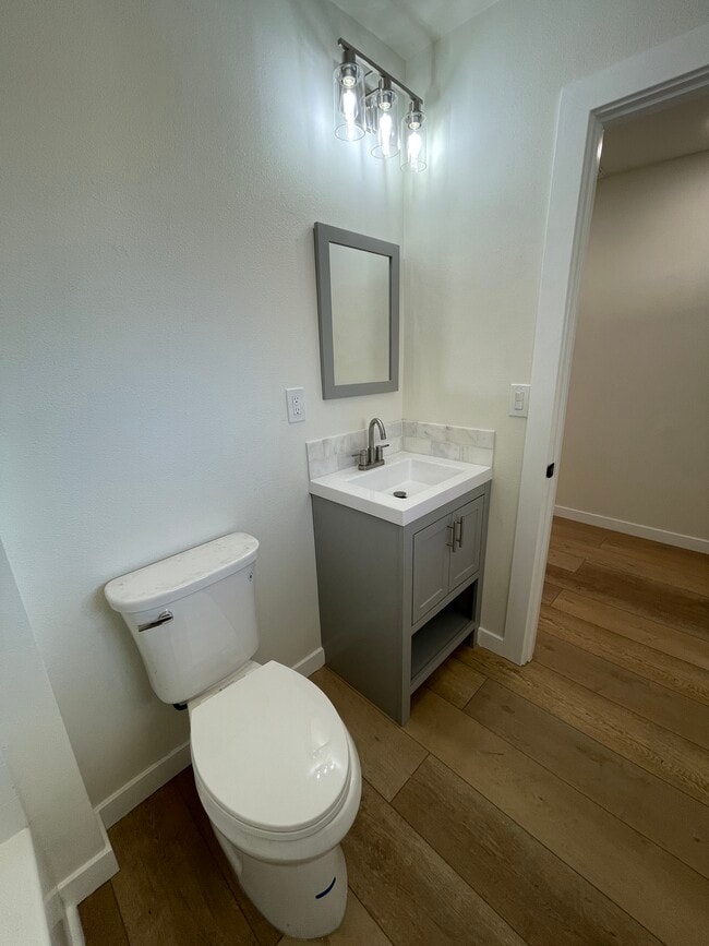
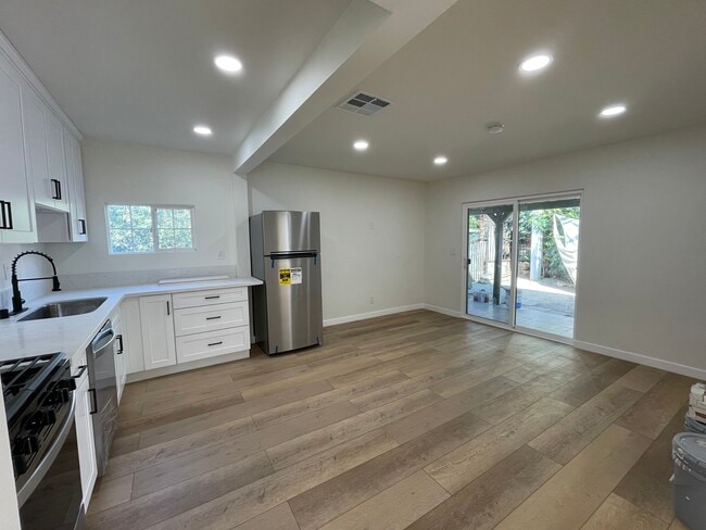
Newly remodeled 2 bedroom, 1 bathroom home available for rent in the vibrant city of Boyle Heights. This is a detached back house of a duplex property and is a separate structure with its own private gated backyard area. This home has been fully remodeled with brand new appliances, washer and dryer, and central heating and air. One uncovered parking space is included. You also get access to one of the very few pools in the area! The property is nearby LAC/USC Hospital, Cal State Los Angeles, White Memorial Hospital, East LA College, DTLA, tons of amazing food options, and much more! Water and trash is included. Security deposit to be first month's rent. Background/credit check to be provided with rental application. Pets ok (limited to 1 dog and 1 cat). Available starting December 1st. Vouchers will be considered.
1236 N Evergreen Ave is a house located in Los Angeles County and the 90033 ZIP Code.
House Features
Washer/Dryer
Washer/Dryer Hookup
Tub/Shower
Heating
- Washer/Dryer
- Washer/Dryer Hookup
- Heating
- Cable Ready
- Tub/Shower
- Handrails
- Framed Mirrors
- Gated
Location
Get Directions
Southeast Los Angeles is directly south of the Fashion District and east of the University of Southern California (USC). This large neighborhood is minutes from downtown Los Angeles, Hollywood, and Beverly Hills, with easy access to the 110 Freeway. This great location places you near sunny beaches, nature trails, and a bevy of leading employers. Students can access both USC and California State University Long Beach from their Southeast LA apartment.
This densely populated, diverse neighborhood features everything from food trucks and corner markets to wide sidewalks and residential areas filled with bungalows, ranch, and Spanish Colonial architecture. Southeast LA features palm trees and mountain views, tampered with gritty undertones to give it a cool, funky vibe.
As for outdoor fun, take your pick between Catalina Island, Venus Beach, or the Santa Monica Pier. Nearby, you’ll find more sunny beaches like White Point, Cabrillo, and Long Beach.
Learn more about living in Southeast Los AngelesBelow are rent ranges for similar nearby apartments
Amenities
- Washer/Dryer
- Washer/Dryer Hookup
- Heating
- Cable Ready
- Tub/Shower
- Handrails
- Framed Mirrors
- Gated
Expenses
Utilities Included
Water, Trash Removal
Included
Education
| Colleges & Universities | Distance | ||
|---|---|---|---|
| Colleges & Universities | Distance | ||
| Drive: | 3 min | 1.2 mi | |
| Drive: | 6 min | 2.3 mi | |
| Drive: | 9 min | 3.8 mi | |
| Drive: | 9 min | 4.9 mi |
1236 N Evergreen Ave is within 3 minutes or 1.2 miles from USC, Health Sciences Campus. It is also near Cal State Los Angeles and East Los Angeles College.
Transportation options available in Los Angeles include Soto Station, located 1.4 miles from 1236 N Evergreen Ave. 1236 N Evergreen Ave is near Bob Hope, located 17.3 miles or 24 minutes away, and Los Angeles International, located 19.0 miles or 32 minutes away.
| Transit / Subway | Distance | ||
|---|---|---|---|
| Transit / Subway | Distance | ||
| Drive: | 3 min | 1.4 mi | |
| Drive: | 5 min | 1.9 mi | |
| Drive: | 4 min | 2.1 mi | |
| Drive: | 5 min | 2.7 mi | |
| Drive: | 7 min | 3.2 mi |
| Commuter Rail | Distance | ||
|---|---|---|---|
| Commuter Rail | Distance | ||
| Drive: | 5 min | 2.7 mi | |
|
|
Drive: | 6 min | 3.0 mi |
| Drive: | 15 min | 6.9 mi | |
| Drive: | 10 min | 6.9 mi | |
| Drive: | 14 min | 8.0 mi |
| Airports | Distance | ||
|---|---|---|---|
| Airports | Distance | ||
|
Bob Hope
|
Drive: | 24 min | 17.3 mi |
|
Los Angeles International
|
Drive: | 32 min | 19.0 mi |
Time and distance from 1236 N Evergreen Ave.
| Shopping Centers | Distance | ||
|---|---|---|---|
| Shopping Centers | Distance | ||
| Drive: | 3 min | 1.7 mi | |
| Drive: | 4 min | 1.8 mi | |
| Drive: | 5 min | 1.8 mi |
1236 N Evergreen Ave has 3 shopping centers within 1.8 miles, which is about a 5-minute drive. The miles and minutes will be for the farthest away property.
| Parks and Recreation | Distance | ||
|---|---|---|---|
| Parks and Recreation | Distance | ||
|
Hollenbeck Lake
|
Drive: | 4 min | 2.1 mi |
|
Vista Hermosa Natural Park
|
Drive: | 9 min | 4.6 mi |
|
Audubon Center at Debs Park
|
Drive: | 9 min | 4.7 mi |
|
Elysian Park
|
Drive: | 12 min | 4.8 mi |
|
Chavez Ravine Arboretum
|
Drive: | 9 min | 5.7 mi |
1236 N Evergreen Ave has 5 parks within 5.7 miles, including Hollenbeck Lake, Audubon Center at Debs Park, and Elysian Park.
| Hospitals | Distance | ||
|---|---|---|---|
| Hospitals | Distance | ||
| Drive: | 3 min | 1.2 mi | |
| Drive: | 3 min | 1.3 mi | |
| Drive: | 8 min | 3.1 mi |
1236 N Evergreen Ave has 3 hospitals within 3.1 miles, the nearest is LAC + USC Medical Center which is 1.2 miles away and a 3 minute drive.
| Military Bases | Distance | ||
|---|---|---|---|
| Military Bases | Distance | ||
| Drive: | 29 min | 20.6 mi | |
| Drive: | 36 min | 24.0 mi |
1236 N Evergreen Ave is 20.6 miles from Los Angeles Air Force Base, and is convenient to other military bases, including Los Alamitos Army Airfield.
You May Also Like
Similar Rentals Nearby


What Are Walk Score®, Transit Score®, and Bike Score® Ratings?
Walk Score® measures the walkability of any address. Transit Score® measures access to public transit. Bike Score® measures the bikeability of any address.
What is a Sound Score Rating?
A Sound Score Rating aggregates noise caused by vehicle traffic, airplane traffic and local sources

1236 N Evergreen Ave
Los Angeles, CA 90033