
$1,940
Total Monthly Price
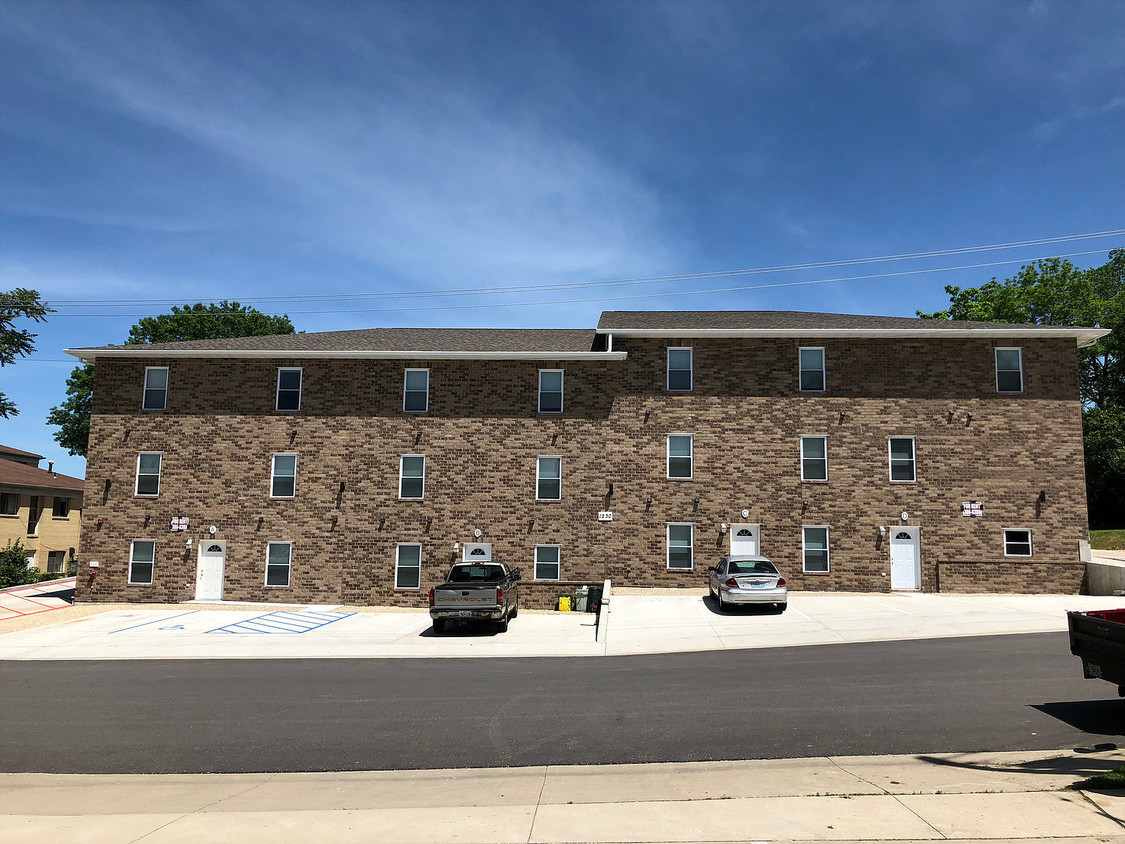
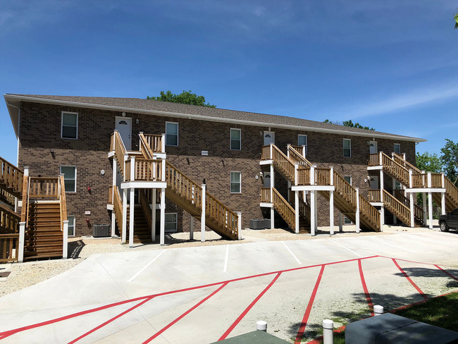
1232 N Oak St Unit a
Rolla, MO 65401
Favorites
1232 N Oak St Unit a

Favorites
Check Back Soon for Upcoming Availability
| Beds | Baths | Average SF |
|---|---|---|
| 4 Bedrooms 4 Bedrooms 4 Br | 4 Baths 4 Baths 4 Ba | 1,300 SF |
Fees and Policies
The fees listed below are community-provided and may exclude utilities or add-ons. All payments are made directly to the property and are non-refundable unless otherwise specified.
- Parking
-
Surface Lot--
Details
Lease Options
-
12 Months
About This Property
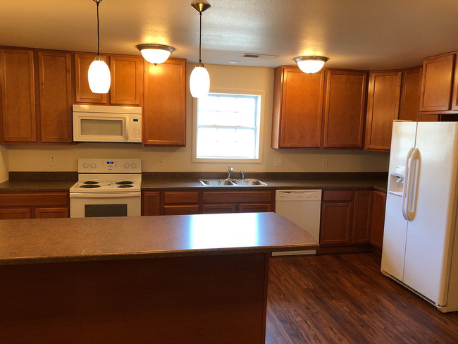
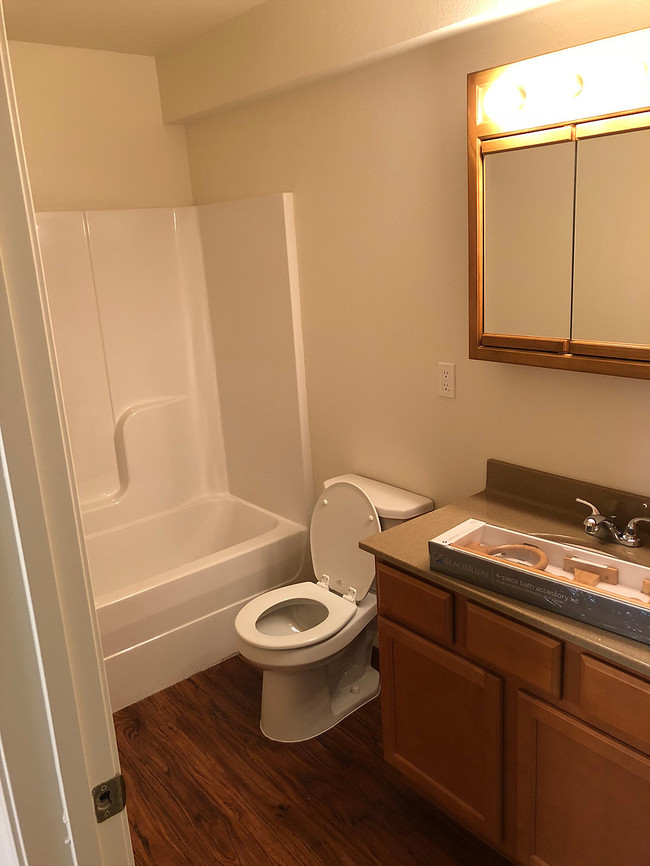
Utilities included in rent Large living room/kitchen 3 blocks from campus
1232 N Oak St is an apartment community located in Phelps County and the 65401 ZIP Code.
Apartment Features
- Washer/Dryer
- Kitchen
1232 N Oak St,
Rolla,
MO
65401
Rolla is a small city in central Missouri, located roughly halfway between Saint Louis and Springfield along Interstate 44. The city is perhaps best known as the home of Missouri University of Science and Technology, which serves around 9,000 students from around the world and operates as one of the community’s biggest employers. The Downtown district along Pine Street is just a short walk from campus, providing a diverse mix of shopping, dining, and nightlife catering to the college crowd and locals alike.
The landscape surrounding Rolla is ideal for outdoor exploration, with Fort Leonard Wood and Mark Twain National Forest sitting just outside the city limits and sprawling greenspaces like Southview and Ber Juan Parks just a few blocks away from most neighborhoods.
Learn more about living in Rolla
Amenities
- Washer/Dryer
- Kitchen
Education
| Colleges & Universities | Distance | ||
|---|---|---|---|
| Colleges & Universities | Distance | ||
| Walk: | 5 min | 0.3 mi |
1232 N Oak St Unit a is within 5 minutes or 0.3 mile from Missouri Univ. of Sci. &Tech..
Walkability Near 1232 N Oak St Rolla, MO 65401
Getting Around
 What do Walkability, Transit, Drivability, and Bikeability mean?
Walkability measures the walking distance to day-to-day needs.
Transit measures access to public transportation.
Drivability measures congestion, parking availability, and access to major roads.
Bikeability measures the suitability for cycling.
How It Works
What do Walkability, Transit, Drivability, and Bikeability mean?
Walkability measures the walking distance to day-to-day needs.
Transit measures access to public transportation.
Drivability measures congestion, parking availability, and access to major roads.
Bikeability measures the suitability for cycling.
How It Works
Moderately Walkable
Walkability
60
/ 100
Very Drivable
Drivability
80
/ 100
Fairly Bikeable
Bikeability
50
/ 100
Scores provided by
-
Soundscore™
-
/ 100
Traffic
-Airport
-Businesses
-Scores provided by
HowLoud What is a Sound Score Rating? A Sound Score Rating aggregates noise caused by vehicle traffic, airplane traffic and local sources. How It WorksSimilar Rentals Nearby


What Are Walk Score®, Transit Score®, and Bike Score® Ratings?
Walk Score® measures the walkability of any address. Transit Score® measures access to public transit. Bike Score® measures the bikeability of any address.
What is a Sound Score Rating?
A Sound Score Rating aggregates noise caused by vehicle traffic, airplane traffic and local sources.

1232 N Oak St
Rolla, MO 65401