

$2,500
/ Month
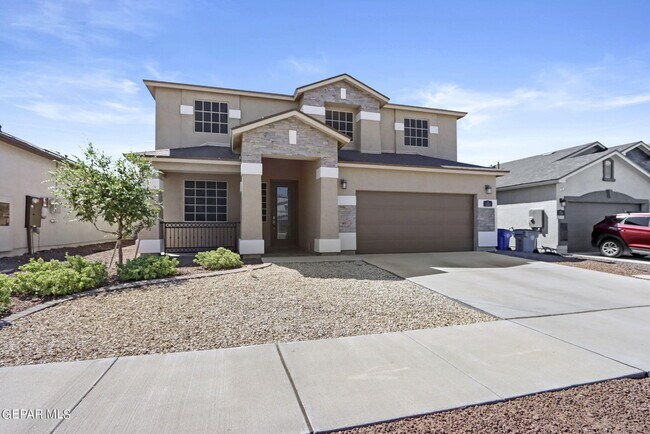
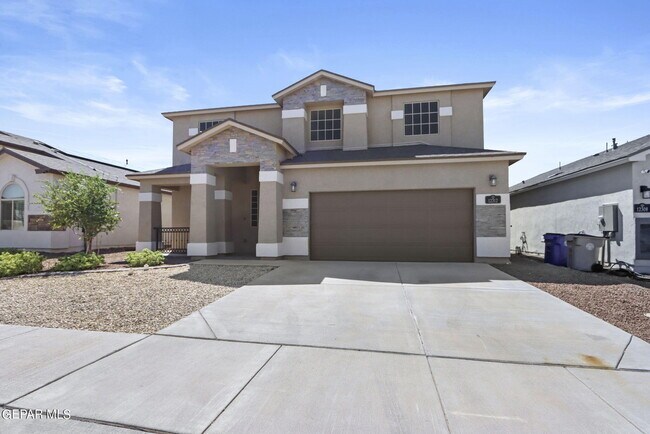
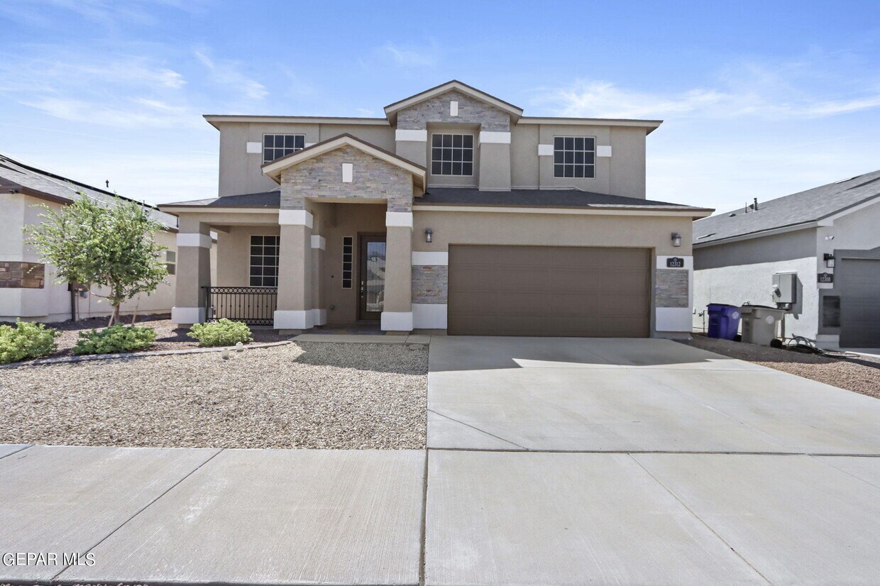
12312 Desert Path Ct
El Paso, TX 79938
Favorites
12312 Desert Path Ct

Favorites
Check Back Soon for Upcoming Availability
| Beds | Baths | Average SF |
|---|---|---|
| 4 Bedrooms 4 Bedrooms 4 Br | 2.5 Baths 2.5 Baths 2.5 Ba | 2,930 SF |
About This Property
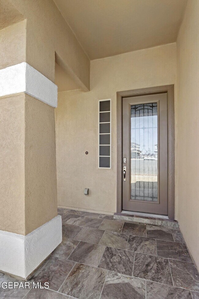
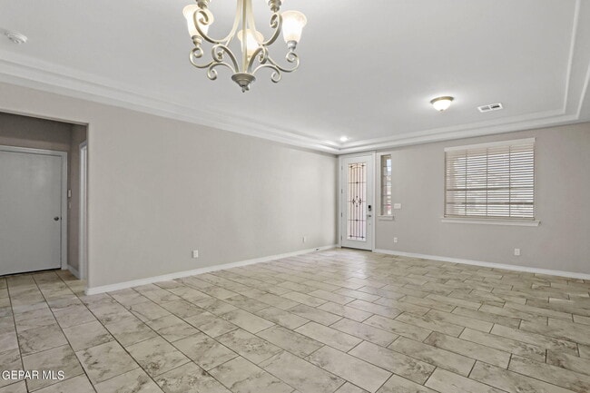
This spacious two story home offers 4 bedrooms, 2.5 baths, an upstairs game room/ loft space, laundry room with cabinetry. Kitchen has granite countertops, dark cabinetry, large center island. Escape to the comfortable owner's suite with a formal sitting area which could double as an office, nursery or lounge area. In the backyard you will find a spacious covered patio that overlooks a backyard full of turf for low maintenance. Also a 3-car tandem garage for extra space. Home is located right off of Montana for easy access to 375 where you will head straight to Ft. Bliss! Call us to schedule a showing today!
12312 Desert Path Ct is a house located in El Paso County and the 79938 ZIP Code. This area is served by the Socorro Independent School District attendance zone.
House Features
Dishwasher
Microwave
Refrigerator
Disposal
- Ceiling Fans
- Dishwasher
- Disposal
- Microwave
- Refrigerator
- Carpet
12312 Desert Path Ct,
El Paso,
TX
79938
El Paso sits where West Texas, New Mexico, and the Mexican state of Chihuahua converge, giving the city a cross-border identity that shapes everything from its architecture to its daily rhythm. With the Franklin Mountains rising inside city limits and the Rio Grande forming its southern edge, the geography alone sets it apart from anywhere else in Texas. Fort Bliss, one of the largest U.S. Army installations in the country, and the University of Texas at El Paso are two of the city's most significant economic and institutional anchors. The Chamizal National Memorial marks the site of a peacefully resolved international border dispute, a piece of history few American cities can claim.
Neighborhoods range widely in character. Manhattan Heights offers historic homes close to downtown, while Northeast El Paso spreads out with newer residential development near Fort Bliss. Kern Place, adjacent to UTEP's campus, has an established, walkable feel.
Learn more about living in El Paso
Amenities
- Ceiling Fans
- Dishwasher
- Disposal
- Microwave
- Refrigerator
- Carpet
Education
| Colleges & Universities | Distance | ||
|---|---|---|---|
| Colleges & Universities | Distance | ||
| Drive: | 21 min | 10.8 mi | |
| Drive: | 18 min | 11.3 mi | |
| Drive: | 23 min | 16.7 mi | |
| Drive: | 27 min | 16.8 mi |
12312 Desert Path Ct is within 21 minutes or 10.8 miles from El Paso C.C., Valle Verde. It is also near El Paso C.C., Mission Del Paso and El Paso C.C., Transmountain.
Schools


Public Elementary School
Grades PK-5
1,017 Students
Attendance Zone
Public Middle School
Grades 6-8
1,088 Students
Attendance Zone
Public High School
Grades 9-12
2,245 Students
Attendance Zone
Private Elementary, Middle & High School
Grades K-12
79 Students
Nearby
Private Elementary, Middle & High School
Grades K-12
Nearby
Private Elementary School
Grades PK-5
129 Students
Nearby
Private Elementary, Middle & High School
Grades K-12
34 Students
Nearby
School data provided by
 The GreatSchools Rating helps parents compare schools within a state based on a variety of school quality indicators and provides a helpful picture of how effectively each school serves all of its students. Ratings are on a scale of 1 (below average) to 10 (above average) and can include test scores, college readiness, academic progress, advanced courses, equity, discipline and attendance data. We also advise parents to visit schools, consider other information on school performance and programs, and consider family needs as part of the school selection process.
View GreatSchools Rating Methodology
Data provided by GreatSchools.org © 2026. All rights reserved.
View GreatSchools Rating Methodology
Data provided by GreatSchools.org © 2026. All rights reserved.
Walkability Near 12312 Desert Path Ct El Paso, TX 79938
Getting Around
 What do Walkability, Transit, Drivability, and Bikeability mean?
Walkability measures the walking distance to day-to-day needs.
Transit measures access to public transportation.
Drivability measures congestion, parking availability, and access to major roads.
Bikeability measures the suitability for cycling.
How It Works
What do Walkability, Transit, Drivability, and Bikeability mean?
Walkability measures the walking distance to day-to-day needs.
Transit measures access to public transportation.
Drivability measures congestion, parking availability, and access to major roads.
Bikeability measures the suitability for cycling.
How It Works
Somewhat Walkable
Walkability
30
/ 100
Limited Public Transit
Transit
30
/ 100
Exceptionally Drivable
Drivability
100
/ 100
Not Bikeable
Bikeability
0
/ 100
Scores provided by
Calm
Soundscore™
99
/ 100
Traffic
CalmAirport
CalmBusinesses
CalmScores provided by
HowLoud What is a Sound Score Rating? A Sound Score Rating aggregates noise caused by vehicle traffic, airplane traffic and local sources. How It WorksYou May Also Like
Similar Rentals Nearby
-
-

-

-

-

-

-

-

-

-
 4 Beds, 3 Baths, 1,605 sq ft$1,800Total Monthly Price12 Month LeaseTotal Monthly Price NewPrices include all required monthly fees.14904 Tierra Coruna Ave
What Are Walk Score®, Transit Score®, and Bike Score® Ratings?
Walk Score® measures the walkability of any address. Transit Score® measures access to public transit. Bike Score® measures the bikeability of any address.
What is a Sound Score Rating?
A Sound Score Rating aggregates noise caused by vehicle traffic, airplane traffic and local sources.
12312 Desert Path Ct
El Paso, TX 79938