
$900
/ Month
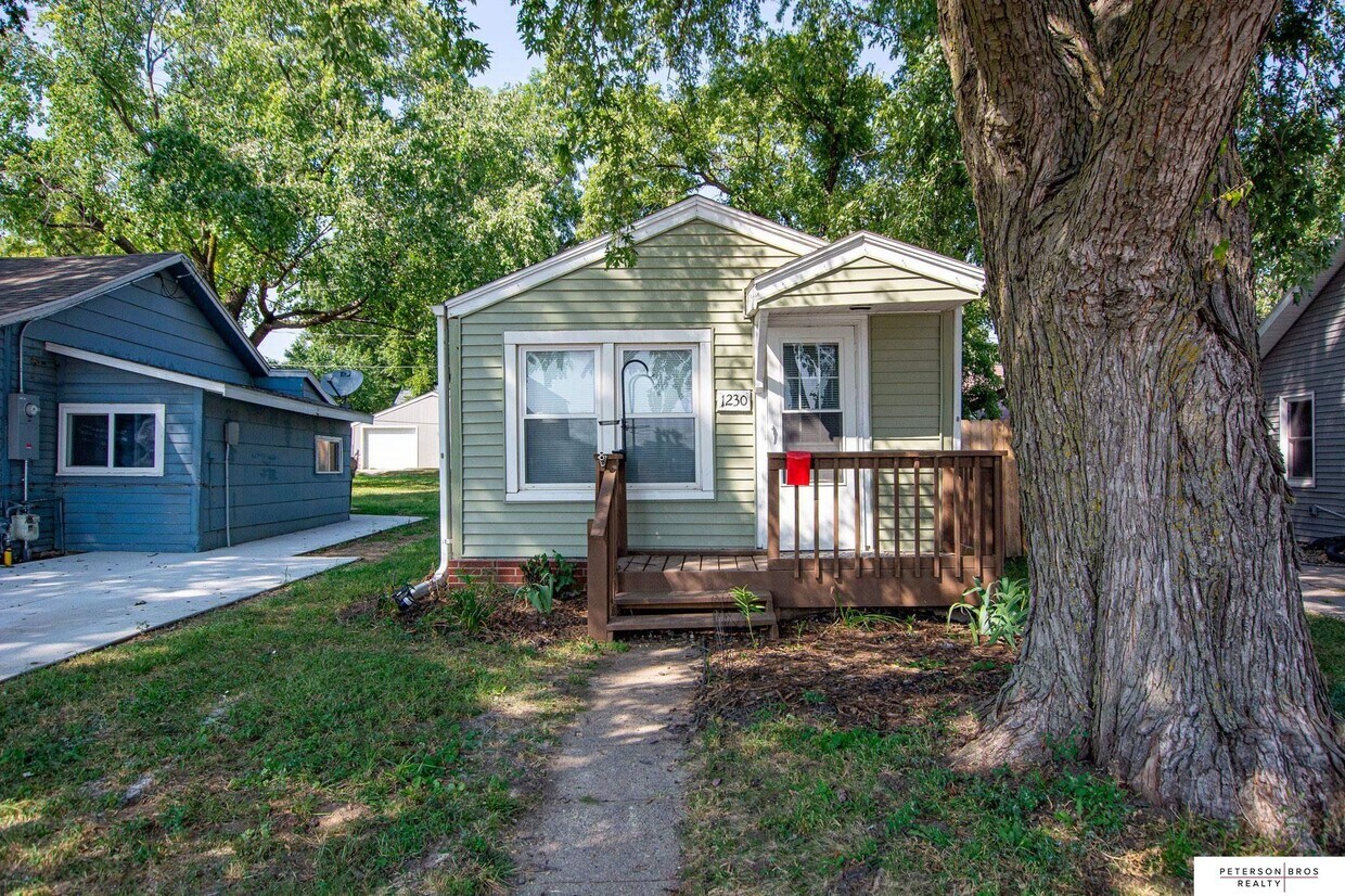
1230 State St
Blair, NE 68008
Favorites
1230 State St

Favorites
Check Back Soon for Upcoming Availability
| Beds | Baths | Average SF |
|---|---|---|
| 1 Bedroom 1 Bedroom 1 Br | 1 Bath 1 Bath 1 Ba | 585 SF |
About This Property
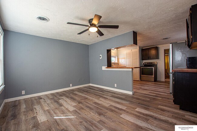
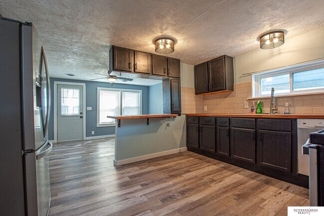
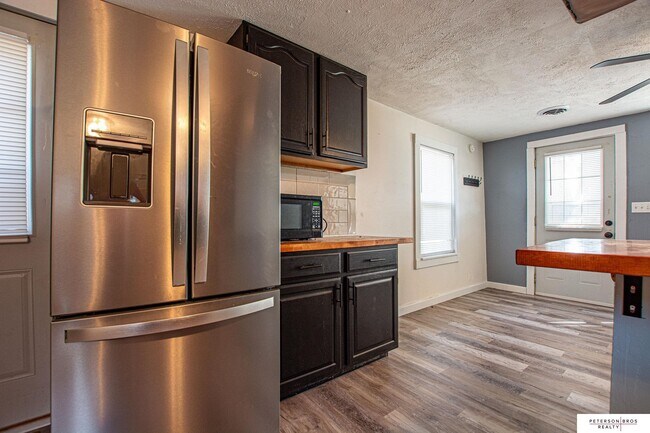
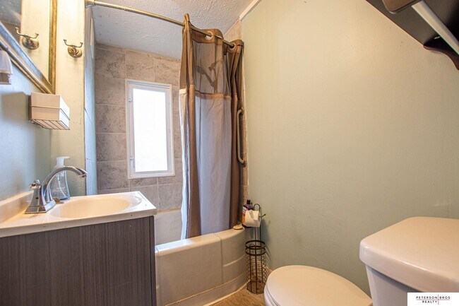
Adm Beth Pigsley-Dirks, Home: , , - This 1 Bedroom / 1 Bath home is ready to rent and features a washer/dryer and fenced backyard!Rent: $900.00Liability to Landlord Insurance: $12.50Total: $912.50Resident responsible for All Utility Connection and Billing.Move in requirements: Credit score above 600 & GROSS income must be 3 times rental price.
1230 State St is a house located in Washington County and the 68008 ZIP Code. This area is served by the Blair Community Schools attendance zone.
House Features
- Dishwasher
- Microwave
- Refrigerator
1230 State St,
Blair,
NE
68008
Blair sits about 25 miles north of Omaha as the county seat of Washington County, a compact city of roughly six square miles with a population just under 10,000. Its position within the Omaha-Council Bluffs metro area gives residents access to a major urban center while daily life here moves at a noticeably quieter pace. Dana College, which closed in 2010, shaped the character of the city for over a century, and its legacy is still part of how locals talk about the town's identity. The presence of industry along the Missouri River corridor, alongside local government and small businesses, anchors Blair's economy. Renters will find a practical mix of single-family home rentals, smaller apartment communities, and townhome-style options spread across a walkable footprint. The housing stock reflects the city's modest, unpretentious character without sacrificing comfort.
Learn more about living in Blair
Amenities
- Dishwasher
- Microwave
- Refrigerator
Education
| Colleges & Universities | Distance | ||
|---|---|---|---|
| Colleges & Universities | Distance | ||
| Walk: | 12 min | 0.7 mi | |
| Drive: | 21 min | 16.6 mi | |
| Drive: | 31 min | 21.5 mi | |
| Drive: | 34 min | 24.1 mi |
1230 State St is within 12 minutes or 0.7 mile from Metro C.C. of Omaha, Wash Tech. It is also near Metro C.C. of Omaha, ATC and Metro C.C. of Omaha, Ft Omaha.
Schools


Public Elementary School
Grades K-5
475 Students
Nearby
Public Elementary School
Grades PK-5
172 Students
Nearby
Public Middle School
Grades 6-8
506 Students
Nearby
Public High School
Grades 9-12
710 Students
Attendance Zone
Private Elementary, Middle & High School
Grades PK-12
336 Students
Nearby
Private Elementary & Middle School
Grades PK-8
Nearby
School data provided by
 The GreatSchools Rating helps parents compare schools within a state based on a variety of school quality indicators and provides a helpful picture of how effectively each school serves all of its students. Ratings are on a scale of 1 (below average) to 10 (above average) and can include test scores, college readiness, academic progress, advanced courses, equity, discipline and attendance data. We also advise parents to visit schools, consider other information on school performance and programs, and consider family needs as part of the school selection process.
View GreatSchools Rating Methodology
Data provided by GreatSchools.org © 2026. All rights reserved.
View GreatSchools Rating Methodology
Data provided by GreatSchools.org © 2026. All rights reserved.
Walkability Near 1230 State St Blair, NE 68008
Getting Around
 What do Walkability, Transit, Drivability, and Bikeability mean?
Walkability measures the walking distance to day-to-day needs.
Transit measures access to public transportation.
Drivability measures congestion, parking availability, and access to major roads.
Bikeability measures the suitability for cycling.
How It Works
What do Walkability, Transit, Drivability, and Bikeability mean?
Walkability measures the walking distance to day-to-day needs.
Transit measures access to public transportation.
Drivability measures congestion, parking availability, and access to major roads.
Bikeability measures the suitability for cycling.
How It Works
Fairly Walkable
Walkability
40
/ 100
Very Drivable
Drivability
80
/ 100
Fairly Bikeable
Bikeability
40
/ 100
Scores provided by
-
Soundscore™
-
/ 100
Traffic
-Airport
-Businesses
-Scores provided by
HowLoud What is a Sound Score Rating? A Sound Score Rating aggregates noise caused by vehicle traffic, airplane traffic and local sources. How It WorksYou May Also Like
Similar Rentals Nearby
-
-
1 Bed$1,934+2 Beds$2,367+3 Beds$2,847+Total Monthly PriceTotal Monthly Price NewPrices include base rent and required monthly fees of $290. Variable costs based on usage may apply.Base Rent:1 Bed$1,644+2 Beds$2,077+3 Beds$2,557+Specials
Pets Allowed Fitness Center Pool Kitchen In Unit Washer & Dryer Walk-In Closets Clubhouse
-
-

-

-

-

-

-

-


What Are Walk Score®, Transit Score®, and Bike Score® Ratings?
Walk Score® measures the walkability of any address. Transit Score® measures access to public transit. Bike Score® measures the bikeability of any address.
What is a Sound Score Rating?
A Sound Score Rating aggregates noise caused by vehicle traffic, airplane traffic and local sources.
1230 State St
Blair, NE 68008