
$2,900 / Month
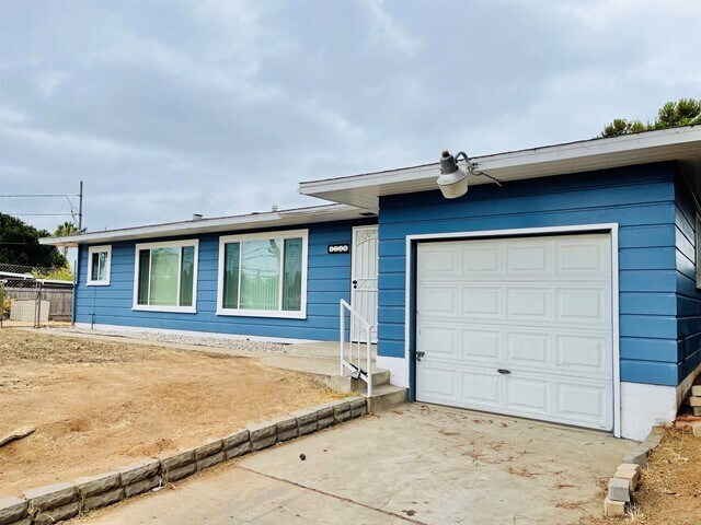
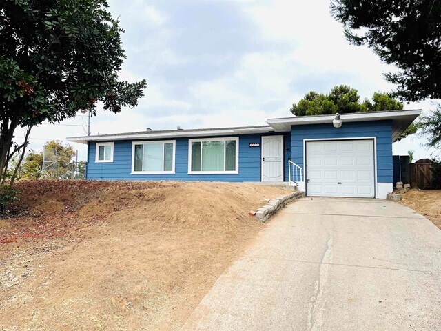
1230 Palmer Way
National City, CA 91950
2 Weeks Ago
Favorites
1230 Palmer Way

Favorites
Check Back Soon for Upcoming Availability
| Beds | Baths | Average SF |
|---|---|---|
| 3 Bedrooms 3 Bedrooms 3 Br | 2 Baths 2 Baths 2 Ba | 1,360 SF |
Fees and Policies
The fees below are based on community-supplied data and may exclude additional fees and utilities.
- Parking
-
Other--
Details
Utilities Included
-
Trash Removal
-
Sewer
Lease Options
-
12 Months
About This Property
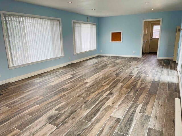
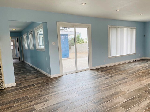
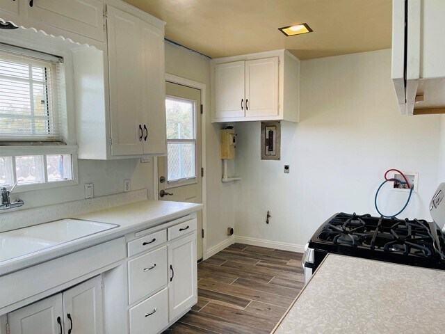
A rare find! Live in this lovely home in a tucked away spot of National City yet accessible to schools, business establishments close to the base and freeway. This single-story home sits on a cul de sac and features a 3 bedroom, 2 bath home with a large private yard for your family. It features new tile flooring, new blinds, new paint, double-paned windows you can certainly appreciate!
1230 Palmer Way is a house located in San Diego County and the 91950 ZIP Code. This area is served by the National Elementary attendance zone.
House Features
- Washer/Dryer Hookup
- Air Conditioning
Location
Get Directions
National City is a great place to live – it provides all the necessities combined with the comforts of home! Its affordability makes it an ideal choice for people who seek the conveniences of San Diego without breaking the bank.
The city is just north of Chula Vista and encompassed by two wildlife refuges. There are several parks in the community that are perfect for family-friendly activities. Celebrations, carnivals, and the National City Automobile Heritage Car Show help bring this diverse community together.
From shopping malls like Westfield Plaza Bonita to the auto mall at Mile of Cars, National City continues to thrive for its residents. Residents appreciate the direct access to Interstate 5 and Interstate 805.
Learn more about living in National City
Amenities
- Washer/Dryer Hookup
- Air Conditioning
Expenses
Utilities Included
Trash Removal, Sewer
Included
Education
| Colleges & Universities | Distance | ||
|---|---|---|---|
| Colleges & Universities | Distance | ||
| Drive: | 11 min | 7.3 mi | |
| Drive: | 12 min | 7.7 mi | |
| Drive: | 16 min | 8.3 mi | |
| Drive: | 12 min | 8.4 mi |
1230 Palmer Way is within 16 minutes or 8.3 miles from Southwestern Coll, Chula Vista. It is also near San Diego City College and Thomas Jefferson School of Law.
Schools


Public Elementary School
Grades K-6
467 Students
Nearby
Public Elementary School
Grades K-6
409 Students
Attendance Zone
Public Middle School
Grades 7-9
794 Students
Attendance Zone
Public High School
Grades 9-12
2,679 Students
Attendance Zone
Private Elementary & Middle School
Grades K-8
92 Students
Nearby
Private Elementary, Middle & High School
Grades K-12
73 Students
Nearby
School data provided by
 The GreatSchools Rating helps parents compare schools within a state based on a variety of school quality indicators and provides a helpful picture of how effectively each school serves all of its students. Ratings are on a scale of 1 (below average) to 10 (above average) and can include test scores, college readiness, academic progress, advanced courses, equity, discipline and attendance data. We also advise parents to visit schools, consider other information on school performance and programs, and consider family needs as part of the school selection process.
View GreatSchools Rating Methodology
Data provided by GreatSchools.org © 2025. All rights reserved.
View GreatSchools Rating Methodology
Data provided by GreatSchools.org © 2025. All rights reserved.
Transportation options available in National City include Euclid Avenue, located 2.8 miles from 1230 Palmer Way. 1230 Palmer Way is near San Diego International, located 10.9 miles or 17 minutes away.
| Transit / Subway | Distance | ||
|---|---|---|---|
| Transit / Subway | Distance | ||
|
|
Drive: | 7 min | 2.8 mi |
|
|
Drive: | 6 min | 2.9 mi |
|
|
Drive: | 8 min | 3.4 mi |
|
|
Drive: | 6 min | 3.4 mi |
|
|
Drive: | 7 min | 3.6 mi |
| Commuter Rail | Distance | ||
|---|---|---|---|
| Commuter Rail | Distance | ||
|
|
Drive: | 14 min | 8.5 mi |
|
|
Drive: | 16 min | 11.5 mi |
|
|
Drive: | 27 min | 20.0 mi |
|
|
Drive: | 35 min | 27.0 mi |
|
|
Drive: | 38 min | 30.7 mi |
| Airports | Distance | ||
|---|---|---|---|
| Airports | Distance | ||
|
San Diego International
|
Drive: | 17 min | 10.9 mi |
Time and distance from 1230 Palmer Way.
| Shopping Centers | Distance | ||
|---|---|---|---|
| Shopping Centers | Distance | ||
| Walk: | 5 min | 0.3 mi | |
| Walk: | 10 min | 0.5 mi | |
| Walk: | 14 min | 0.7 mi |
1230 Palmer Way has 3 shopping centers within 0.7 mile, which is about a 14-minute walk. The miles and minutes will be for the farthest away property.
| Parks and Recreation | Distance | ||
|---|---|---|---|
| Parks and Recreation | Distance | ||
|
Living Coast Discovery Center
|
Drive: | 9 min | 5.0 mi |
|
Sweetwater Regional Park
|
Drive: | 10 min | 5.2 mi |
|
Chollas Lake Park
|
Drive: | 16 min | 5.7 mi |
|
San Diego Bay National Wildlife Refuge
|
Drive: | 11 min | 5.7 mi |
|
Sweetwater Lane County Park
|
Drive: | 12 min | 5.7 mi |
1230 Palmer Way has 5 parks within 5.7 miles, including Sweetwater Regional Park, Living Coast Discovery Center, and San Diego Bay National Wildlife Refuge.
| Hospitals | Distance | ||
|---|---|---|---|
| Hospitals | Distance | ||
| Drive: | 3 min | 1.2 mi | |
| Drive: | 12 min | 7.2 mi | |
| Drive: | 12 min | 7.4 mi |
1230 Palmer Way has 3 hospitals within 7.4 miles, the nearest is Paradise Valley Hospital which is 1.2 miles away and a 3 minute drive.
| Military Bases | Distance | ||
|---|---|---|---|
| Military Bases | Distance | ||
| Drive: | 7 min | 3.0 mi | |
| Drive: | 18 min | 11.1 mi |
1230 Palmer Way is 3.0 miles from San Diego Naval Air Station, and is convenient to other military bases, including US Naval Amphibious Base.
You May Also Like
Similar Rentals Nearby


What Are Walk Score®, Transit Score®, and Bike Score® Ratings?
Walk Score® measures the walkability of any address. Transit Score® measures access to public transit. Bike Score® measures the bikeability of any address.
What is a Sound Score Rating?
A Sound Score Rating aggregates noise caused by vehicle traffic, airplane traffic and local sources

1230 Palmer Way
National City, CA 91950