1230-1232 N Flores St
1230-1232 N Flores St,
West Hollywood,
CA
90069
-
Monthly Rent
$2,000
-
Bedrooms
Studio bd
-
Bathrooms
1 ba
-
Square Feet
400 sq ft
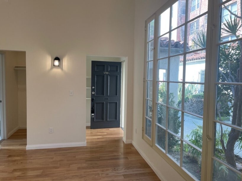
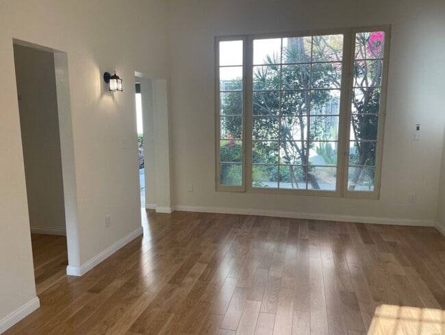
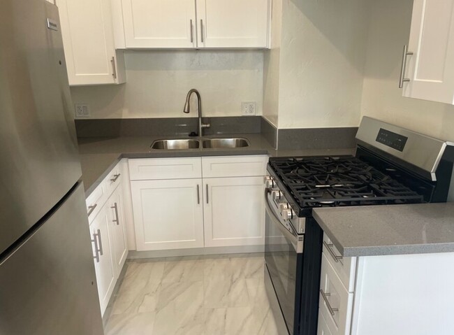
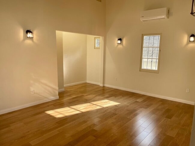
Charming 1920's historical building, newly renovated studio apartment with full kitchen & bath, 10-12' high ceilings, newly painted, garage parking, private entrance, quiet building, work/desk space, lots of cabinets, air conditioning
Pricing & Floor Plans
-
Unit 1230price $2,000square feet 400availibility Now
-
Unit 1230price $2,000square feet 400availibility Now
Fees and Policies
The fees below are based on community-supplied data and may exclude additional fees and utilities.
- Cats
- One-Time Pet Fee$0
- Pet Deposit$0
- Monthly Pet Fee$0 / mo
- Garage Lot
Property Fee Disclaimer: Based on community-supplied data and independent market research. Subject to change without notice. May exclude fees for mandatory or optional services and usage-based utilities.
Details
Utilities Included
-
Water
-
Trash Removal
Lease Options
-
12 mo
Property Information
-
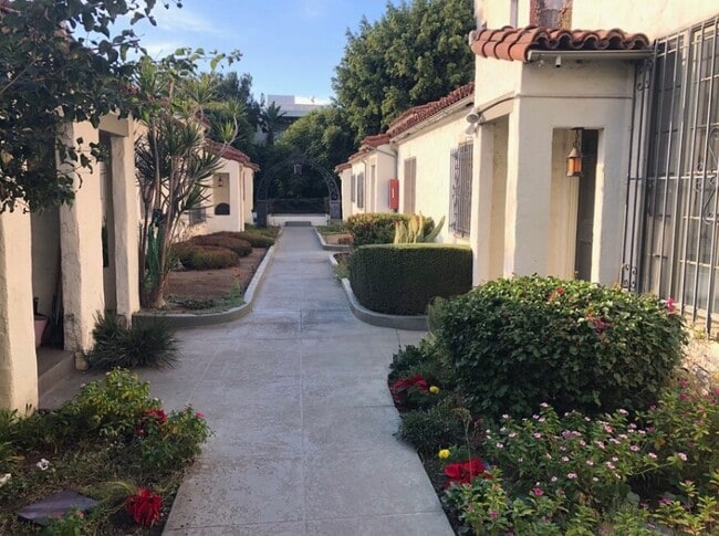
Built in 1928
-
11 units/1 story
About 1230-1232 N Flores St West Hollywood, CA 90069
Charming 1920's historical building, newly renovated studio apartment with full kitchen & bath, 10-12' high ceilings, newly painted, garage parking, private entrance, quiet building, work/desk space, lots of cabinets, air conditioning
1230-1232 N Flores St is an apartment community located in Los Angeles County and the 90069 ZIP Code. This area is served by the Los Angeles Unified attendance zone.
Contact
Community Amenities
- Laundry Facilities
Apartment Features
Air Conditioning
Hardwood Floors
Refrigerator
Tub/Shower
- Air Conditioning
- Smoke Free
- Tub/Shower
- Disposal
- Kitchen
- Oven
- Range
- Refrigerator
- Hardwood Floors
- High Ceilings
- Laundry Facilities
- Air Conditioning
- Smoke Free
- Tub/Shower
- Disposal
- Kitchen
- Oven
- Range
- Refrigerator
- Hardwood Floors
- High Ceilings
| Monday | 10am - 5pm |
|---|---|
| Tuesday | 10am - 5pm |
| Wednesday | 10am - 5pm |
| Thursday | 10am - 5pm |
| Friday | 10am - 5pm |
| Saturday | Closed |
| Sunday | Closed |
It's the Sunset Strip, Santa Monica Boulevard, the Roxy Theater, and the Comedy Club. Everything you love about living in LA is in West Hollywood. It's the most pedestrian-friendly city in California, and the nightlife is unrivaled -- even for LA. West Hollywood's neighborhoods are equally famous -- West Hollywood West and the Norma Triangle are located here.
The Pacific Design Center is a West Hollywood landmark -- a giant 1.6-million square foot design community with 100 showrooms displaying everything from furniture to contemporary art. The PDC also contains the SiverScreen Theater and the Red Seven by Wolfgang Puck restaurant. It is located on Melrose Avenue, which is lined with boutiques, restaurants, and antique stores. West Hollywood is home to several legendary music venues, including Whisky a Go Go, the Roxy Theatre, and the House of Blues.
Learn more about living in West Hollywood| Colleges & Universities | Distance | ||
|---|---|---|---|
| Colleges & Universities | Distance | ||
| Drive: | 5 min | 2.9 mi | |
| Drive: | 6 min | 3.3 mi | |
| Drive: | 10 min | 5.0 mi | |
| Drive: | 13 min | 7.0 mi |


View GreatSchools Rating Methodology
Data provided by GreatSchools.org © 2025. All rights reserved.
Transportation options available in West Hollywood include Hollywood/Highland Station, located 2.8 miles from 1230-1232 N Flores St. 1230-1232 N Flores St is near Bob Hope, located 11.2 miles or 21 minutes away, and Los Angeles International, located 12.3 miles or 24 minutes away.
| Transit / Subway | Distance | ||
|---|---|---|---|
| Transit / Subway | Distance | ||
|
|
Drive: | 5 min | 2.8 mi |
|
|
Drive: | 7 min | 3.5 mi |
|
|
Drive: | 9 min | 4.5 mi |
|
|
Drive: | 11 min | 5.7 mi |
|
|
Drive: | 11 min | 6.1 mi |
| Commuter Rail | Distance | ||
|---|---|---|---|
| Commuter Rail | Distance | ||
|
|
Drive: | 16 min | 8.8 mi |
|
|
Drive: | 18 min | 9.1 mi |
|
|
Drive: | 16 min | 9.6 mi |
|
|
Drive: | 20 min | 10.1 mi |
| Drive: | 20 min | 10.6 mi |
| Airports | Distance | ||
|---|---|---|---|
| Airports | Distance | ||
|
Bob Hope
|
Drive: | 21 min | 11.2 mi |
|
Los Angeles International
|
Drive: | 24 min | 12.3 mi |
Time and distance from 1230-1232 N Flores St.
| Shopping Centers | Distance | ||
|---|---|---|---|
| Shopping Centers | Distance | ||
| Walk: | 8 min | 0.4 mi | |
| Walk: | 11 min | 0.6 mi | |
| Walk: | 12 min | 0.7 mi |
| Parks and Recreation | Distance | ||
|---|---|---|---|
| Parks and Recreation | Distance | ||
|
Runyon Canyon
|
Drive: | 5 min | 2.1 mi |
|
Zimmer Children's Museum
|
Drive: | 5 min | 2.6 mi |
|
Virginia Robinson Gardens
|
Drive: | 8 min | 3.1 mi |
|
La Brea Tar Pits
|
Drive: | 6 min | 3.3 mi |
|
Franklin Canyon Park
|
Drive: | 16 min | 5.0 mi |
| Hospitals | Distance | ||
|---|---|---|---|
| Hospitals | Distance | ||
| Drive: | 3 min | 1.7 mi | |
| Drive: | 6 min | 3.0 mi | |
| Drive: | 6 min | 3.2 mi |
| Military Bases | Distance | ||
|---|---|---|---|
| Military Bases | Distance | ||
| Drive: | 24 min | 14.0 mi |
1230-1232 N Flores St Photos
1230-1232 N Flores St West Hollywood, CA 90069 has studios available with rent ranges from $2,000/mo. to $2,000/mo.
Yes, to view the floor plan in person, please schedule a personal tour.
What Are Walk Score®, Transit Score®, and Bike Score® Ratings?
Walk Score® measures the walkability of any address. Transit Score® measures access to public transit. Bike Score® measures the bikeability of any address.
What is a Sound Score Rating?
A Sound Score Rating aggregates noise caused by vehicle traffic, airplane traffic and local sources

1230-1232 N Flores St
West Hollywood, CA 90069
Responded To This Review