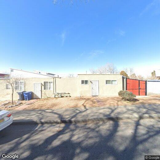
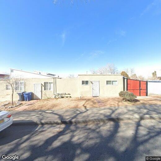
1218 Coal Ave SE
1218 Coal Ave SE
Albuquerque, NM 87106
2 Weeks Ago
|
Edit
Favorites
1218 Coal Ave SE

Favorites
Check Back Soon for Upcoming Availability
| Beds | Baths | Average SF |
|---|---|---|
| 1 Bedroom 1 Bedroom 1 Br | 1 Bath 1 Bath 1 Ba | — |
1218 Coal Ave SE,
Albuquerque,
NM
87106
Albuquerque sits where the Rio Grande cuts through the high desert, framed by the Sandia Mountains to the east and the West Mesa to the west — a geography that shapes everything from the light to the pace of daily life. Founded in 1706 as a Spanish colonial outpost, the city carries that layered history through neighborhoods like Old Town, where adobe architecture and centuries-old plazas coexist with working galleries and local markets. The University of New Mexico anchors the central part of the city, while Kirtland Air Force Base and Sandia National Laboratories give Albuquerque a strong foothold in aerospace and technology. Nob Hill draws renters with its walkable, eclectic stretch along historic Route 66, and the North Valley offers a quieter setting along the river. Downtown continues to grow as a hub for arts, civic life, and commuters.
The rental market reflects the city's range.
Learn more about living in Albuquerque
Education
| Colleges & Universities | Distance | ||
|---|---|---|---|
| Colleges & Universities | Distance | ||
| Walk: | 11 min | 0.6 mi | |
| Walk: | 16 min | 0.9 mi | |
| Drive: | 15 min | 8.9 mi | |
| Drive: | 20 min | 10.3 mi |
1218 Coal Ave SE is within 11 minutes or 0.6 mile from Central NM C.C., Albuquerque. It is also near University of New Mexico and Central NM C.C., Sourth Valley.
Walkability Near 1218 Coal Ave SE Albuquerque, NM 87106
Getting Around
 What do Walkability, Transit, Drivability, and Bikeability mean?
Walkability measures the walking distance to day-to-day needs.
Transit measures access to public transportation.
Drivability measures congestion, parking availability, and access to major roads.
Bikeability measures the suitability for cycling.
How It Works
What do Walkability, Transit, Drivability, and Bikeability mean?
Walkability measures the walking distance to day-to-day needs.
Transit measures access to public transportation.
Drivability measures congestion, parking availability, and access to major roads.
Bikeability measures the suitability for cycling.
How It Works
Moderately Walkable
Walkability
70
/ 100
Some Public Transit
Transit
40
/ 100
Very Drivable
Drivability
80
/ 100
Moderately Bikeable
Bikeability
60
/ 100
Scores provided by
-
Soundscore™
-
/ 100
Traffic
-Airport
-Businesses
-Scores provided by
HowLoud What is a Sound Score Rating? A Sound Score Rating aggregates noise caused by vehicle traffic, airplane traffic and local sources. How It WorksYou May Also Like
Similar Rentals Nearby
-
-
1 / 36
 2 Beds$2,8383 Beds$3,119+4 Beds$3,468+Total Monthly PriceTotal Monthly Price NewPrices include base rent and required monthly fees of $113. Variable costs based on usage may apply.Base Rent:2 Beds$2,7253 Beds$3,006+4 Beds$3,355+3 Months Free
Pets Allowed Fitness Center In Unit Washer & Dryer Walk-In Closets Stainless Steel Appliances Gated EV Charging
-
-

-
 3 Beds$2,010Total Monthly PriceTotal Monthly Price NewPrices include all required monthly fees.House for Rent
 -
 3 Beds$2,005Total Monthly PriceTotal Monthly Price NewPrices include all required monthly fees.House for Rent
 -
 3 Beds$2,410Total Monthly PriceTotal Monthly Price NewPrices include all required monthly fees.House for Rent
 -
 3 Beds$2,250Total Monthly PriceTotal Monthly Price NewPrices include all required monthly fees.House for Rent
 -
 3 Beds$2,265Total Monthly PriceTotal Monthly Price NewPrices include all required monthly fees.House for Rent
 -
 3 Beds$2,285Total Monthly PriceTotal Monthly Price NewPrices include all required monthly fees.House for Rent


What Are Walk Score®, Transit Score®, and Bike Score® Ratings?
Walk Score® measures the walkability of any address. Transit Score® measures access to public transit. Bike Score® measures the bikeability of any address.
What is a Sound Score Rating?
A Sound Score Rating aggregates noise caused by vehicle traffic, airplane traffic and local sources.
1218 Coal Ave SE
Albuquerque, NM 87106