$1,699
/ Month
1210 Westview Terrace
Laurel, MD 20707
2 Weeks Ago
|
Edit
Favorites
1210 Westview Terrace

Favorites
Check Back Soon for Upcoming Availability
| Beds | Baths | Average SF |
|---|---|---|
| 2 Bedrooms 2 Bedrooms 2 Br | 1.5 Baths 1.5 Baths 1.5 Ba | 855 SF |
About This Property
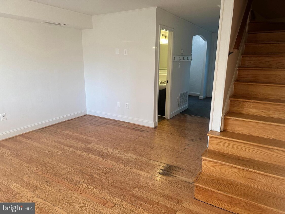
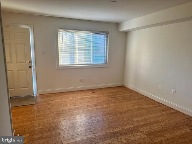
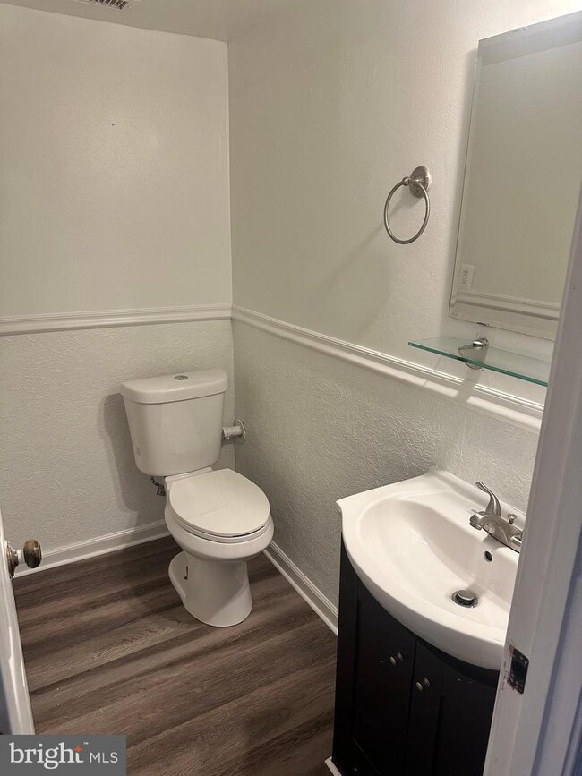
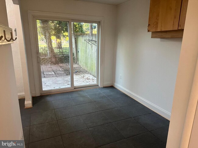
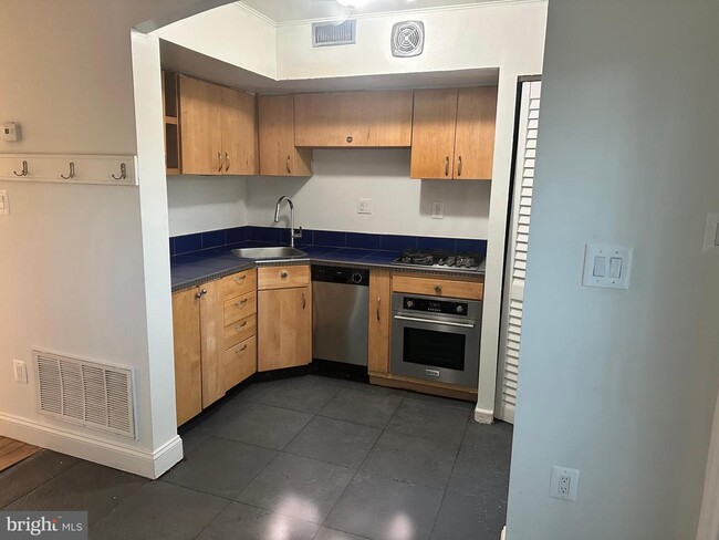
Updated 2 bedroom townhome style condo in the heart of Laurel. Rent includes condo fee which includes hot water and cold water. New fridge. Hardwood and laminate flooring, no carpet. Property backs to a cemetery. No laundry
1210 Westview Terrace is a townhome located in Prince George's County and the 20707 ZIP Code. This area is served by the Prince George's County Public Schools attendance zone.
Location
Get Directions
Located between Washington, D.C., and Baltimore, Laurel combines suburban living with easy access to major cities. The historic downtown area features a welcoming Main Street lined with independent businesses, while the Patuxent River winds through numerous parks and green spaces. The Laurel Lakes area offers outdoor recreation opportunities, and the Laurel Museum, housed in an 1840s mill workers' home, preserves the area's rich history. Housing options range from contemporary apartments near Towne Centre at Laurel to historic properties in the Old Town district. Current rental rates average $1,697 for one-bedroom units and $2,035 for two bedrooms, with year-over-year increases of 2.2% and 3.2% respectively.
Originally established as a mill town in the early 19th century, Laurel maintains strong connections to government and technology sectors, with NSA and Fort Meade located nearby.
Learn more about living in Laurel
Education
| Colleges & Universities | Distance | ||
|---|---|---|---|
| Colleges & Universities | Distance | ||
| Drive: | 19 min | 10.7 mi | |
| Drive: | 19 min | 10.8 mi | |
| Drive: | 21 min | 11.9 mi | |
| Drive: | 22 min | 14.3 mi |
1210 Westview Terrace is within 19 minutes or 10.7 miles from Bowie State University. It is also near University of Maryland and Howard Community College.
Schools


Public Elementary School
Grades PK-6
612 Students
Attendance Zone
Public Middle School
Grades 6-8
1,084 Students
Attendance Zone
Public High School
Grades 9-12
2,134 Students
Attendance Zone
Private Elementary & Middle School
Grades PK-8
156 Students
Nearby
Private Elementary & Middle School
Grades K-8
274 Students
Nearby
Private Middle & High School
Grades 7-12
Nearby
Private High School
Grades 9-12
406 Students
Nearby
School data provided by
 The GreatSchools Rating helps parents compare schools within a state based on a variety of school quality indicators and provides a helpful picture of how effectively each school serves all of its students. Ratings are on a scale of 1 (below average) to 10 (above average) and can include test scores, college readiness, academic progress, advanced courses, equity, discipline and attendance data. We also advise parents to visit schools, consider other information on school performance and programs, and consider family needs as part of the school selection process.
View GreatSchools Rating Methodology
Data provided by GreatSchools.org © 2025. All rights reserved.
View GreatSchools Rating Methodology
Data provided by GreatSchools.org © 2025. All rights reserved.
Transportation options available in Laurel include Greenbelt, Green/Yellow Line Center Platform, located 10.5 miles from 1210 Westview Terrace. 1210 Westview Terrace is near Baltimore/Washington International Thurgood Marshall, located 18.0 miles or 26 minutes away, and Ronald Reagan Washington Ntl, located 24.0 miles or 41 minutes away.
| Transit / Subway | Distance | ||
|---|---|---|---|
| Transit / Subway | Distance | ||
| Drive: | 15 min | 10.5 mi | |
|
|
Drive: | 18 min | 11.7 mi |
| Drive: | 23 min | 12.0 mi |
| Commuter Rail | Distance | ||
|---|---|---|---|
| Commuter Rail | Distance | ||
|
|
Drive: | 4 min | 1.6 mi |
|
|
Drive: | 8 min | 3.2 mi |
|
|
Drive: | 9 min | 4.8 mi |
|
|
Drive: | 12 min | 5.4 mi |
|
|
Drive: | 16 min | 7.6 mi |
| Airports | Distance | ||
|---|---|---|---|
| Airports | Distance | ||
|
Baltimore/Washington International Thurgood Marshall
|
Drive: | 26 min | 18.0 mi |
|
Ronald Reagan Washington Ntl
|
Drive: | 41 min | 24.0 mi |
Time and distance from 1210 Westview Terrace.
| Shopping Centers | Distance | ||
|---|---|---|---|
| Shopping Centers | Distance | ||
| Drive: | 3 min | 1.4 mi | |
| Drive: | 3 min | 1.4 mi | |
| Drive: | 4 min | 1.6 mi |
1210 Westview Terrace has 3 shopping centers within 1.6 miles, which is about a 4-minute drive. The miles and minutes will be for the farthest away property.
| Parks and Recreation | Distance | ||
|---|---|---|---|
| Parks and Recreation | Distance | ||
|
Fairland Regional Park
|
Drive: | 8 min | 4.0 mi |
|
Patuxent Research Refuge - North Tract
|
Drive: | 15 min | 6.8 mi |
|
Maydale Conservation Park and Nature Center
|
Drive: | 14 min | 8.2 mi |
|
Patuxent Research Refuge - South Tract
|
Drive: | 17 min | 8.5 mi |
|
Browns Bridge Recreation Area
|
Drive: | 17 min | 8.9 mi |
1210 Westview Terrace has 5 parks within 8.9 miles, including Fairland Regional Park, Patuxent Research Refuge - North Tract, and Maydale Conservation Park and Nature Center.
| Hospitals | Distance | ||
|---|---|---|---|
| Hospitals | Distance | ||
| Drive: | 5 min | 2.0 mi | |
| Drive: | 12 min | 8.0 mi | |
| Drive: | 20 min | 12.0 mi |
1210 Westview Terrace has 3 hospitals within 12.0 miles, the nearest is Laurel Regional Medical Center which is 2.0 miles away and a 5 minute drive.
| Military Bases | Distance | ||
|---|---|---|---|
| Military Bases | Distance | ||
| Drive: | 16 min | 8.3 mi |
1210 Westview Terrace is 8.3 miles and a 16 minute drive from Fort George Meade.
You May Also Like
Similar Rentals Nearby


What Are Walk Score®, Transit Score®, and Bike Score® Ratings?
Walk Score® measures the walkability of any address. Transit Score® measures access to public transit. Bike Score® measures the bikeability of any address.
What is a Sound Score Rating?
A Sound Score Rating aggregates noise caused by vehicle traffic, airplane traffic and local sources

1210 Westview Terrace
Laurel, MD 20707