$1,895
Total Monthly Price
1209 S La Cienega Blvd Unit c
Los Angeles, CA 90035
2 Weeks Ago
|
Edit
Favorites
-
Bedrooms
Studio
-
Bathrooms
1
-
Square Feet
600 sq ft
Highlight
- Pets Allowed
1209 S La Cienega Blvd Unit c

Favorites
About This Home
12 Month Lease,
$1,895 deposit
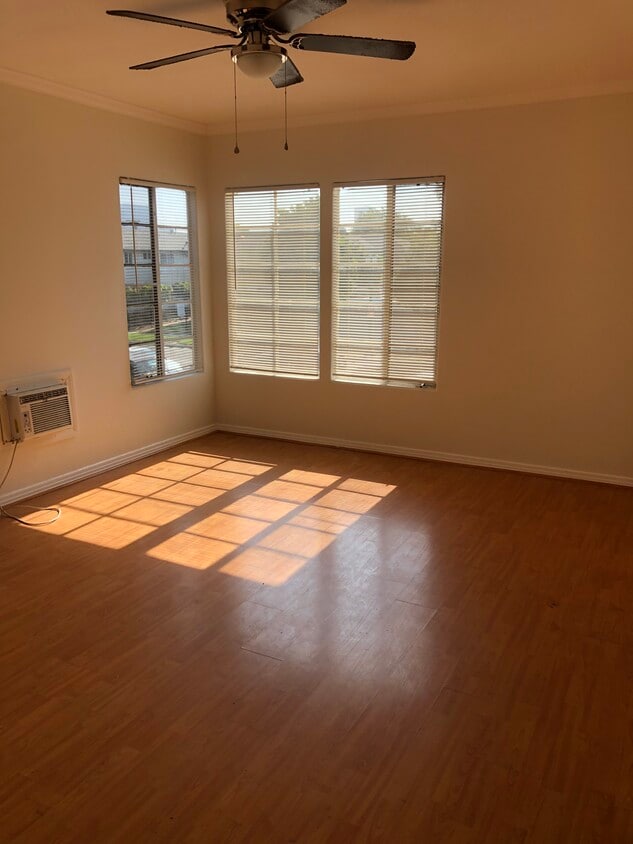
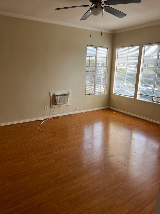
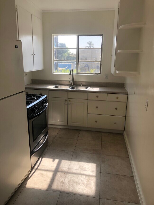
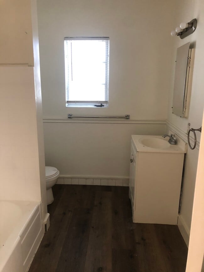
Stunning Upper Unit in the Heart of LA - Minutes to Everything! Option 1: The Premium Lifestyle Ad (Focus on Location & Amenities) Live Central! Spacious Upper Unit near Beverly Hills & UCLA. Step into this bright, delightful upper unit offering unparalleled access to the best of Los Angeles. Perfect for students, medical professionals, or anyone seeking a luxury location with upgraded comforts. Unit Features & Comforts: Modern New Kitchen: Includes a complete kitchen renovation with a new stove and refrigerator, ready for immediate use. A/C Included: Enjoy comfort year-round with a dedicated Air Conditioning unit in the living area. Spa-Like Bath: Private, full bathroom featuring both a relaxing bathtub and a refreshing Shower . Excellent Storage: Very spacious closet areas for all your storage needs. Convenience: On-site laundry facilities The Ultimate LA Location: You are centrally located in the heart of Los Angeles, offering rapid access to: Beverly Hills & West Hollywood Culver City & Beverly Center Cedars Sinai Medical Center & UCLA Lease Details: This is a 1-year lease. Required upon signing: First month's rent + one month's security deposit. A $25 credit check fee is required with the application. Ready to View? If interested, please reply with your phone number and a brief introduction so we can gladly set up a private appointment. Thank you for your interest!
1209 S La Cienega Blvd is an apartment community located in Los Angeles County and the 90035 ZIP Code.
* Price shown is total price based on community-supplied monthly required fees. Excludes user-selected optional fees and variable or usage-based fees and required charges due at or prior to move-in or at move-out. Price, availability, fees, and any applicable rent special are subject to change without notice.
* Square footage definitions vary. Displayed square footage is approximate.
Apartment Features
- Air Conditioning
- Kitchen
- Refrigerator
- Laundry Facilities
- Spa
Fees and Policies
The fees listed below are community-provided and may exclude utilities or add-ons. All payments are made directly to the property and are non-refundable unless otherwise specified.
- Dogs Allowed
-
Fees not specified
- Cats Allowed
-
Fees not specified
- Parking
-
Surface Lot--
Details
Utilities Included
-
Water
-
Trash Removal
Property Information
-
12 units
Contact
Location
Get Directions
Pico-Robertson is a popular Los Angeles neighborhood situated directly south of Beverly Hills and east of Century City. Despite its location in the heart of glittery West Los Angeles near the Miracle Mile, Beverlywood, Carthay, and Cheviot Hills, Pico-Robertson is much more low-key. You won't find trendy hotspots and wild nightlife in Pico-Robertson, but you will find a strong sense of community and a quiet setting.
Pico-Robertson offers a unique collection of delis, bakeries, and more. It is named for the intersection of Pico Boulevard and Robertson Boulevard, and that's where you'll find the majority of the neighborhood's shops, restaurants, and cafes.
Learn more about living in Pico-Robertson
Education
| Colleges & Universities | Distance | ||
|---|---|---|---|
| Colleges & Universities | Distance | ||
| Drive: | 12 min | 4.8 mi | |
| Drive: | 13 min | 5.6 mi | |
| Drive: | 11 min | 5.7 mi | |
| Drive: | 12 min | 6.0 mi |
1209 S La Cienega Blvd Unit c is within 12 minutes or 4.8 miles from West Los Angeles College. It is also near UCLA and Musicians Institute.
Transportation options available in Los Angeles include La Cienega/Jefferson, located 2.3 miles from 1209 S La Cienega Blvd Unit c. 1209 S La Cienega Blvd Unit c is near Los Angeles International, located 9.4 miles or 19 minutes away, and Bob Hope, located 14.0 miles or 27 minutes away.
| Transit / Subway | Distance | ||
|---|---|---|---|
| Transit / Subway | Distance | ||
|
|
Drive: | 6 min | 2.3 mi |
|
|
Drive: | 6 min | 2.4 mi |
|
|
Drive: | 6 min | 3.2 mi |
|
|
Drive: | 8 min | 3.9 mi |
|
|
Drive: | 9 min | 3.9 mi |
| Commuter Rail | Distance | ||
|---|---|---|---|
| Commuter Rail | Distance | ||
|
|
Drive: | 18 min | 10.9 mi |
|
|
Drive: | 20 min | 11.0 mi |
|
|
Drive: | 21 min | 11.6 mi |
|
|
Drive: | 24 min | 11.9 mi |
|
|
Drive: | 25 min | 12.9 mi |
| Airports | Distance | ||
|---|---|---|---|
| Airports | Distance | ||
|
Los Angeles International
|
Drive: | 19 min | 9.4 mi |
|
Bob Hope
|
Drive: | 27 min | 14.0 mi |
Getting Around
 What do Walkability, Transit, Drivability, and Bikeability mean?
Walkability measures the walking distance to day-to-day needs.
Transit measures access to public transportation.
Drivability measures congestion, parking availability, and access to major roads.
Bikeability measures the suitability for cycling.
How It Works
What do Walkability, Transit, Drivability, and Bikeability mean?
Walkability measures the walking distance to day-to-day needs.
Transit measures access to public transportation.
Drivability measures congestion, parking availability, and access to major roads.
Bikeability measures the suitability for cycling.
How It Works
Very Walkable
Walkability
80
/ 100
Good Public Transit
Transit
60
/ 100
Moderately Drivable
Drivability
70
/ 100
Moderately Bikeable
Bikeability
60
/ 100
Scores provided by
-
Soundscore™
-
/ 100
Traffic
-Airport
-Businesses
-Scores provided by
HowLoud What is a Sound Score Rating? A Sound Score Rating aggregates noise caused by vehicle traffic, airplane traffic and local sources. How It WorksTime and distance from 1209 S La Cienega Blvd Unit c.
| Shopping Centers | Distance | ||
|---|---|---|---|
| Shopping Centers | Distance | ||
| Walk: | 5 min | 0.3 mi | |
| Walk: | 7 min | 0.4 mi | |
| Walk: | 9 min | 0.5 mi |
1209 S La Cienega Blvd Unit c has 3 shopping centers within 0.5 mile, which is about a 9-minute walk. The miles and minutes will be for the farthest away property.
| Parks and Recreation | Distance | ||
|---|---|---|---|
| Parks and Recreation | Distance | ||
|
Zimmer Children's Museum
|
Drive: | 3 min | 1.4 mi |
|
La Brea Tar Pits
|
Drive: | 4 min | 1.9 mi |
|
Virginia Robinson Gardens
|
Drive: | 10 min | 4.0 mi |
|
Kenneth Hahn State Recreation Area
|
Drive: | 12 min | 4.4 mi |
|
Mathias Botanical Garden
|
Drive: | 11 min | 5.2 mi |
1209 S La Cienega Blvd Unit c has 5 parks within 5.2 miles, including Zimmer Children's Museum, La Brea Tar Pits, and Virginia Robinson Gardens.
| Hospitals | Distance | ||
|---|---|---|---|
| Hospitals | Distance | ||
| Drive: | 2 min | 1.2 mi | |
| Drive: | 3 min | 1.3 mi | |
| Drive: | 3 min | 1.4 mi |
1209 S La Cienega Blvd Unit c has 3 hospitals within 1.4 miles, the nearest is Docs Surgical Hospital which is 1.2 miles away and a 2 minute drive.
| Military Bases | Distance | ||
|---|---|---|---|
| Military Bases | Distance | ||
| Drive: | 19 min | 11.0 mi |
1209 S La Cienega Blvd Unit c is 11.0 miles and a 19 minute drive from Los Angeles Air Force Base.
Amenities
- Air Conditioning
- Kitchen
- Refrigerator
- Laundry Facilities
- Spa
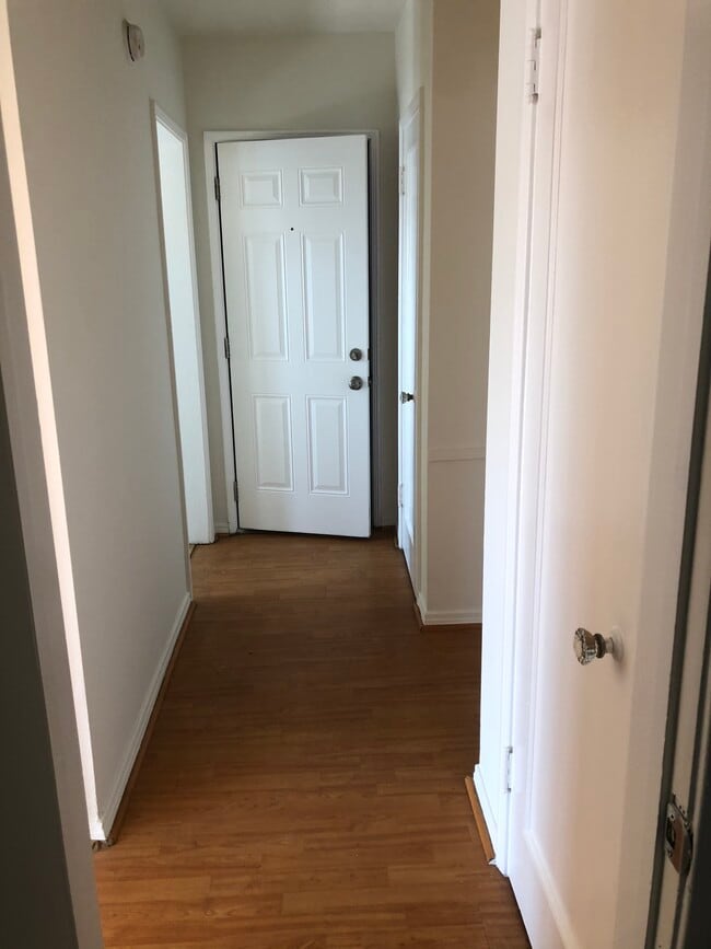
1209 S La Cienega Blvd Unit c Photos
What Are Walk Score®, Transit Score®, and Bike Score® Ratings?
Walk Score® measures the walkability of any address. Transit Score® measures access to public transit. Bike Score® measures the bikeability of any address.
What is a Sound Score Rating?
A Sound Score Rating aggregates noise caused by vehicle traffic, airplane traffic and local sources.

1209 S La Cienega Blvd
Los Angeles, CA 90035