
$2,700
/ Month
1205 Drum Ave
Capitol Heights, MD 20743
Today
|
Edit
Favorites
240-262-5022
-
Bedrooms
5
-
Bathrooms
2
-
Square Feet
--
-
Available
Available Now
Highlights
- Raised Ranch Architecture
- Forced Air Heating and Cooling System
1205 Drum Ave

Favorites
About This Home
Available Now
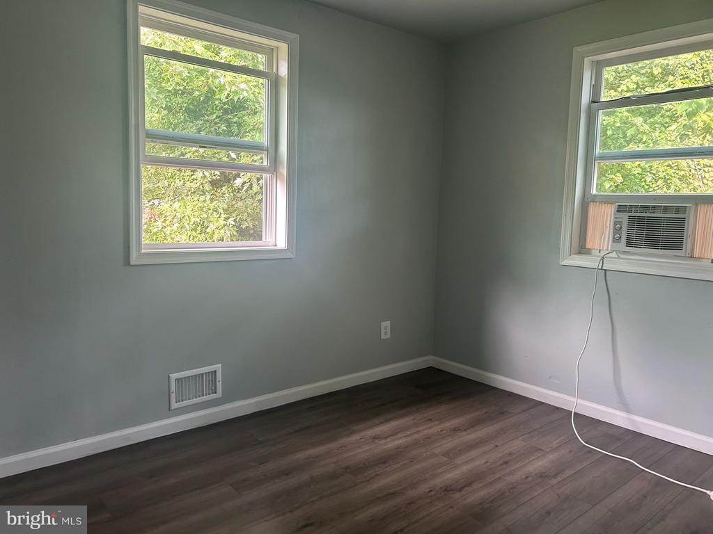
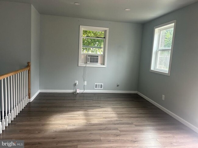
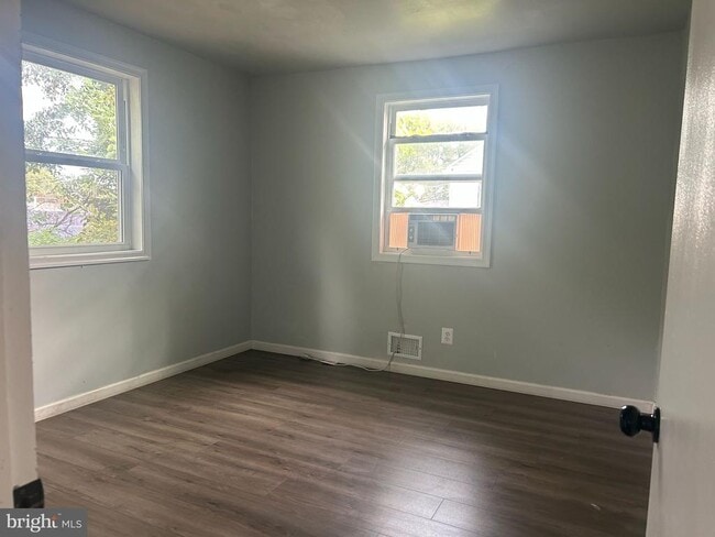
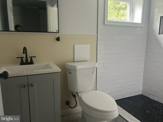
Beautiful 5-bedroom, 2-bath rental in Capitol Heights! This home features generous living space and multiple bedrooms, perfect for families or shared living, all in a convenient location near transit, shops, and major commuter routes.
1205 Drum Ave is a house located in Prince George's County and the 20743 ZIP Code. This area is served by the Prince George's County Public Schools attendance zone.
* Price shown is base rent. Excludes user-selected optional fees and variable or usage-based fees and required charges due at or prior to move-in or at move-out. Price, availability, fees, and any applicable rent special are subject to change without notice.
* Square footage definitions vary. Displayed square footage is approximate.
Home Details
Home Type
Single Family Detached Home
Year Built
Built in 1969
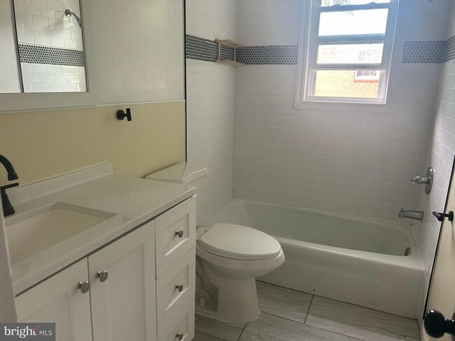
Bedrooms and Bathrooms
5 Bedrooms | 3 Main Level Bedrooms
2 Full Bathrooms
Home Design
Raised Ranch Architecture
Brick Exterior Construction
Interior Spaces
1,924 Sq Ft Home
Property has 2 Levels
Listing and Financial Details
Security Deposit $2,999
12-Month Lease Term
Available 9/25/25
Assessor Parcel Number 17182066736
Residential Lease
Lot Details
6,000 Sq Ft Lot
Property is zoned RSF65
Utilities
Forced Air Heating and Cooling System
Natural Gas Water Heater
Cooling System Utilizes Natural Gas
Community Details
Pet Policy
No Pets Allowed
Contact
- Listed by Axel Schamis | Samson Properties
- Phone Number
- Contact
-
Source
 Bright MLS, Inc.
Copyright © 2025 Bright MLS, Inc.
Location
Get Directions
Amenities
- Basement
Coral Hills is a neighborhood in Prince George’s County less than 10 miles from Washington, DC. The neighborhood is accessible to the country’s capital via State Route 4 or public transportation. Coral Hills is largely residential featuring different styles of moderately-priced rentals. The other parts of Coral Hills provide shopping plazas, especially along Marlboro Pike, as well as parks and community amenities like the John Eager Howard Community Center.
Learn more about living in Coral Hills
Education
| Colleges & Universities | Distance | ||
|---|---|---|---|
| Colleges & Universities | Distance | ||
| Drive: | 11 min | 5.0 mi | |
| Drive: | 12 min | 5.9 mi | |
| Drive: | 12 min | 5.9 mi | |
| Drive: | 12 min | 6.5 mi |
1205 Drum Ave is within 11 minutes or 5.0 miles from Gallaudet University. It is also near Georgetown Law and Georgetown.
Schools

Public Elementary & Middle School
Grades PK-8
496 Students
Attendance Zone
Public High School
Grades 9-12
1,834 Students
Attendance Zone
Private Elementary, Middle & High School
Grades PK-12
149 Students
Nearby
Private Elementary & Middle School
Grades PK-8
130 Students
Nearby
Private Elementary & Middle School
Grades PK-8
156 Students
Nearby
Private Elementary & Middle School
Grades K-8
Nearby
School data provided by
 The GreatSchools Rating helps parents compare schools within a state based on a variety of school quality indicators and provides a helpful picture of how effectively each school serves all of its students. Ratings are on a scale of 1 (below average) to 10 (above average) and can include test scores, college readiness, academic progress, advanced courses, equity, discipline and attendance data. We also advise parents to visit schools, consider other information on school performance and programs, and consider family needs as part of the school selection process.
View GreatSchools Rating Methodology
Data provided by GreatSchools.org © 2025. All rights reserved.
View GreatSchools Rating Methodology
Data provided by GreatSchools.org © 2025. All rights reserved.
Transportation options available in Capitol Heights include Benning Road, located 1.4 miles from 1205 Drum Ave. 1205 Drum Ave is near Ronald Reagan Washington Ntl, located 9.9 miles or 20 minutes away, and Baltimore/Washington International Thurgood Marshall, located 30.0 miles or 45 minutes away.
| Transit / Subway | Distance | ||
|---|---|---|---|
| Transit / Subway | Distance | ||
|
|
Drive: | 4 min | 1.4 mi |
|
Capitol Heights, Blue/Silver Line Center Platform
|
Drive: | 4 min | 1.7 mi |
|
|
Drive: | 5 min | 2.4 mi |
|
|
Drive: | 7 min | 2.7 mi |
|
|
Drive: | 10 min | 3.2 mi |
| Commuter Rail | Distance | ||
|---|---|---|---|
| Commuter Rail | Distance | ||
|
|
Drive: | 10 min | 5.2 mi |
|
|
Drive: | 11 min | 5.4 mi |
|
|
Drive: | 12 min | 5.8 mi |
|
|
Drive: | 12 min | 5.8 mi |
| Drive: | 16 min | 9.2 mi |
| Airports | Distance | ||
|---|---|---|---|
| Airports | Distance | ||
|
Ronald Reagan Washington Ntl
|
Drive: | 20 min | 9.9 mi |
|
Baltimore/Washington International Thurgood Marshall
|
Drive: | 45 min | 30.0 mi |
Time and distance from 1205 Drum Ave.
| Shopping Centers | Distance | ||
|---|---|---|---|
| Shopping Centers | Distance | ||
| Walk: | 5 min | 0.3 mi | |
| Walk: | 5 min | 0.3 mi | |
| Walk: | 11 min | 0.6 mi |
1205 Drum Ave has 3 shopping centers within 0.6 mile, which is about a 11-minute walk. The miles and minutes will be for the farthest away property.
| Parks and Recreation | Distance | ||
|---|---|---|---|
| Parks and Recreation | Distance | ||
|
Fort Dupont Park
|
Drive: | 5 min | 1.8 mi |
|
Kingman and Heritage Island Park
|
Drive: | 6 min | 3.2 mi |
|
Frederick Douglass National Historic Site
|
Drive: | 10 min | 4.0 mi |
|
Suitland Bog
|
Drive: | 9 min | 4.1 mi |
|
National Arboretum
|
Drive: | 13 min | 5.4 mi |
1205 Drum Ave has 5 parks within 5.4 miles, including Fort Dupont Park, Kingman and Heritage Island Park, and Frederick Douglass National Historic Site.
| Hospitals | Distance | ||
|---|---|---|---|
| Hospitals | Distance | ||
| Drive: | 12 min | 4.6 mi | |
| Drive: | 11 min | 4.8 mi | |
| Drive: | 11 min | 5.2 mi |
1205 Drum Ave has 3 hospitals within 5.2 miles, the nearest is St. Elizabeth's Hospital which is 4.6 miles away and a 12 minute drive.
| Military Bases | Distance | ||
|---|---|---|---|
| Military Bases | Distance | ||
| Drive: | 11 min | 4.7 mi | |
| Drive: | 13 min | 5.5 mi |
1205 Drum Ave is 4.7 miles from Washington Navy Yard, and is convenient to other military bases, including Anacostia Naval Station.
You May Also Like
Similar Rentals Nearby


What Are Walk Score®, Transit Score®, and Bike Score® Ratings?
Walk Score® measures the walkability of any address. Transit Score® measures access to public transit. Bike Score® measures the bikeability of any address.
What is a Sound Score Rating?
A Sound Score Rating aggregates noise caused by vehicle traffic, airplane traffic and local sources

1205 Drum Ave
Capitol Heights, MD 20743