
$3,100
/ Month
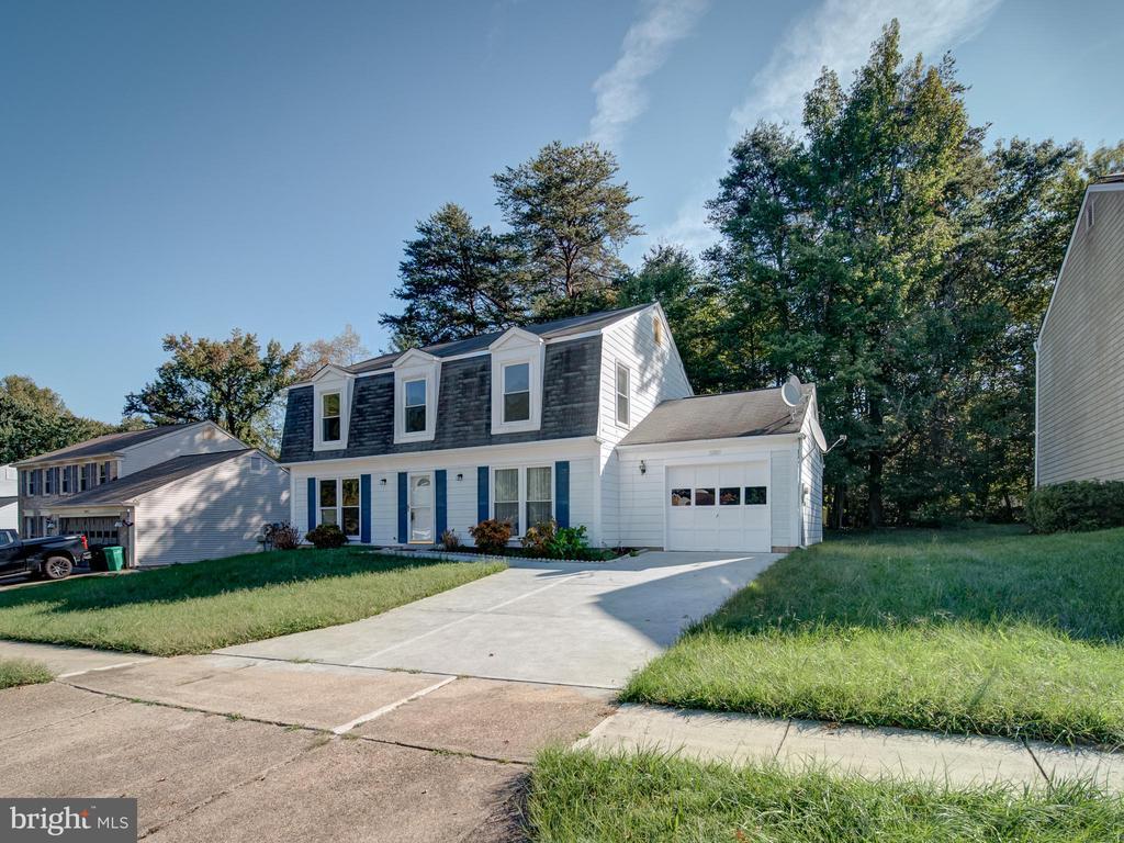
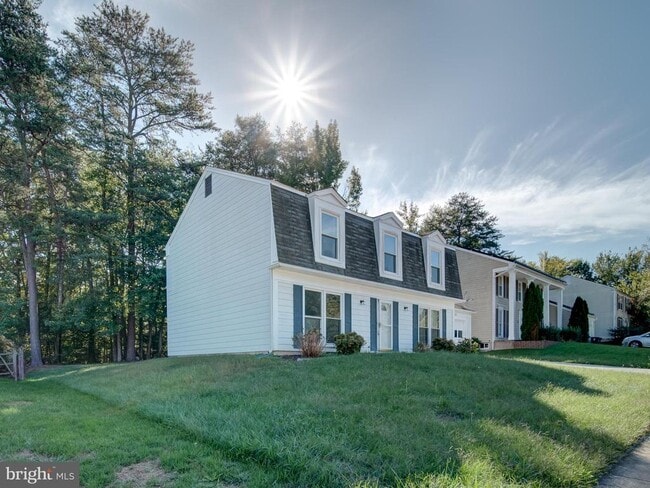
12009 Amblewood Dr
Laurel, MD 20708
Today
|
Edit
Favorites
301-325-9017
-
Bedrooms
4
-
Bathrooms
2.5
-
Square Feet
2,016 sq ft
-
Available
Available Now
Highlights
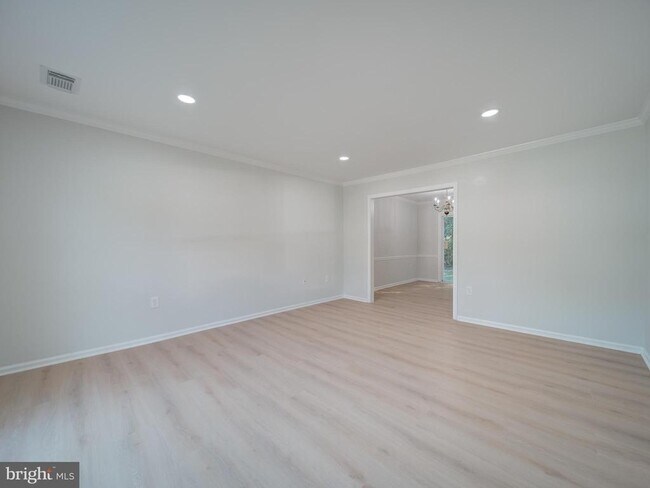
- Open Floorplan
- Colonial Architecture
- Backs to Trees or Woods
- Attic
- Upgraded Countertops
- 1 Car Attached Garage
12009 Amblewood Dr

Favorites
About This Home
Available Now
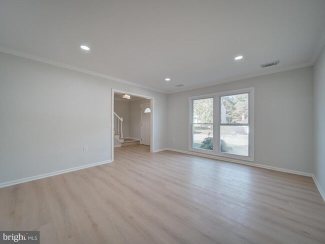
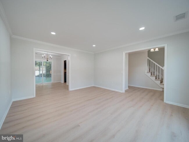
Move right into this huge 4 bedrooms, 2.5-bathroom, family room, eat-in kitchen, separate dining room, new flooring, newer appliances, fresh paint, 1 car garage, huge yard and much much more! Ready to move in today!*****NEW DISHWASHER IS ON THE WAY***
12009 Amblewood Dr is a house located in Prince George's County and the 20708 ZIP Code. This area is served by the Prince George's County Public Schools attendance zone.
* Price shown is base rent. Excludes user-selected optional fees and variable or usage-based fees and required charges due at or prior to move-in or at move-out. Price, availability, fees, and any applicable rent special are subject to change without notice.
* Square footage definitions vary. Displayed square footage is approximate.
Home Details
Home Type
Single Family Detached Home
Year Built
Built in 1980
Bedrooms and Bathrooms
2.5 Bathrooms
En-Suite Bathroom
4 Bedrooms
Home Design
Colonial Architecture
Vinyl Siding
Composition Roof
Block Foundation
Interior Spaces
Open Floorplan
Chair Railings
Crown Molding
Dining Area
Window Screens
2,016 Sq Ft Home
Property has 2 Levels
Window Treatments
Kitchen
Upgraded Countertops
Eat-In Kitchen
Stove
Dishwasher
Disposal
Laundry
Dryer
Washer
Listing and Financial Details
Security Deposit $3,250
12-Month Min and 36-Month Max Lease Term
Available 10/2/25
Assessor Parcel Number 17101055441
Residential Lease
Lot Details
10,010 Sq Ft Lot
Backs to Trees or Woods
Property is zoned RR
Outdoor Features
Patio
Parking
1 Car Attached Garage
Front Facing Garage
Off-Street Parking
Utilities
Central Air
Heat Pump System
Electric Water Heater
Vented Exhaust Fan
Community Details
Amenities
Common Area
Overview
$5 Monthly HOA Fees
Montpelier Woods Subdivision
Association fees include reserve funds
Pet Policy
Pets allowed on a case-by-case basis
Contact
- Listed by Bonnie M Gregorio | RE/MAX Professionals
- Phone Number
- Contact
-
Source
 Bright MLS, Inc.
Copyright © 2025 Bright MLS, Inc.
Location
Get Directions
Amenities
- Dishwasher
Located between Washington, D.C., and Baltimore, Laurel combines suburban living with easy access to major cities. The historic downtown area features a welcoming Main Street lined with independent businesses, while the Patuxent River winds through numerous parks and green spaces. The Laurel Lakes area offers outdoor recreation opportunities, and the Laurel Museum, housed in an 1840s mill workers' home, preserves the area's rich history. Housing options range from contemporary apartments near Towne Centre at Laurel to historic properties in the Old Town district. Current rental rates average $1,697 for one-bedroom units and $2,035 for two bedrooms, with year-over-year increases of 2.2% and 3.2% respectively.
Originally established as a mill town in the early 19th century, Laurel maintains strong connections to government and technology sectors, with NSA and Fort Meade located nearby.
Learn more about living in Laurel
Education
| Colleges & Universities | Distance | ||
|---|---|---|---|
| Colleges & Universities | Distance | ||
| Drive: | 12 min | 5.9 mi | |
| Drive: | 21 min | 11.4 mi | |
| Drive: | 22 min | 13.9 mi | |
| Drive: | 26 min | 15.8 mi |
12009 Amblewood Dr is within 12 minutes or 5.9 miles from Bowie State University. It is also near University of Maryland and Univ. of Md. Univ. Coll..
Schools


Public Elementary School
Grades PK-5
562 Students
Attendance Zone
Public Middle School
Grades 6-8
1,084 Students
Attendance Zone
Public High School
Grades 9-12
2,134 Students
Attendance Zone
Private Elementary, Middle & High School
Grades 1-12
110 Students
Nearby
Private Elementary & Middle School
Grades PK-8
157 Students
Nearby
School data provided by
 The GreatSchools Rating helps parents compare schools within a state based on a variety of school quality indicators and provides a helpful picture of how effectively each school serves all of its students. Ratings are on a scale of 1 (below average) to 10 (above average) and can include test scores, college readiness, academic progress, advanced courses, equity, discipline and attendance data. We also advise parents to visit schools, consider other information on school performance and programs, and consider family needs as part of the school selection process.
View GreatSchools Rating Methodology
Data provided by GreatSchools.org © 2025. All rights reserved.
View GreatSchools Rating Methodology
Data provided by GreatSchools.org © 2025. All rights reserved.
Transportation options available in Laurel include Greenbelt, Green/Yellow Line Center Platform, located 9.8 miles from 12009 Amblewood Dr. 12009 Amblewood Dr is near Baltimore/Washington International Thurgood Marshall, located 15.5 miles or 25 minutes away, and Ronald Reagan Washington Ntl, located 23.2 miles or 37 minutes away.
| Transit / Subway | Distance | ||
|---|---|---|---|
| Transit / Subway | Distance | ||
| Drive: | 18 min | 9.8 mi | |
|
|
Drive: | 18 min | 10.8 mi |
| Drive: | 22 min | 12.4 mi | |
| Drive: | 23 min | 12.7 mi | |
|
|
Drive: | 22 min | 13.2 mi |
| Commuter Rail | Distance | ||
|---|---|---|---|
| Commuter Rail | Distance | ||
|
|
Drive: | 9 min | 4.4 mi |
|
|
Drive: | 10 min | 5.0 mi |
|
|
Drive: | 12 min | 5.1 mi |
|
Bowie State Marc Sb
|
Drive: | 10 min | 5.4 mi |
|
Bowie State Marc Nb
|
Drive: | 12 min | 6.0 mi |
| Airports | Distance | ||
|---|---|---|---|
| Airports | Distance | ||
|
Baltimore/Washington International Thurgood Marshall
|
Drive: | 25 min | 15.5 mi |
|
Ronald Reagan Washington Ntl
|
Drive: | 37 min | 23.2 mi |
Time and distance from 12009 Amblewood Dr.
| Shopping Centers | Distance | ||
|---|---|---|---|
| Shopping Centers | Distance | ||
| Walk: | 12 min | 0.6 mi | |
| Drive: | 5 min | 1.6 mi | |
| Drive: | 5 min | 2.4 mi |
12009 Amblewood Dr has 3 shopping centers within 2.4 miles, which is about a 5-minute walk. The miles and minutes will be for the farthest away property.
| Parks and Recreation | Distance | ||
|---|---|---|---|
| Parks and Recreation | Distance | ||
|
Patuxent Research Refuge - South Tract
|
Drive: | 10 min | 3.8 mi |
|
Fairland Regional Park
|
Drive: | 15 min | 6.8 mi |
|
NASA Goddard Space Flight Center
|
Drive: | 14 min | 6.8 mi |
|
Patuxent Research Refuge - North Tract
|
Drive: | 14 min | 6.8 mi |
|
Howard Owens Science Center
|
Drive: | 15 min | 7.9 mi |
12009 Amblewood Dr has 5 parks within 7.9 miles, including Patuxent Research Refuge - South Tract, Fairland Regional Park, and NASA Goddard Space Flight Center.
| Hospitals | Distance | ||
|---|---|---|---|
| Hospitals | Distance | ||
| Drive: | 10 min | 4.5 mi | |
| Drive: | 16 min | 8.7 mi | |
| Drive: | 18 min | 9.8 mi |
12009 Amblewood Dr has 3 hospitals within 9.8 miles, the nearest is Laurel Regional Medical Center which is 4.5 miles away and a 10 minute drive.
| Military Bases | Distance | ||
|---|---|---|---|
| Military Bases | Distance | ||
| Drive: | 15 min | 8.3 mi |
12009 Amblewood Dr is 8.3 miles and a 15 minute drive from Fort George Meade.
You May Also Like
Similar Rentals Nearby


What Are Walk Score®, Transit Score®, and Bike Score® Ratings?
Walk Score® measures the walkability of any address. Transit Score® measures access to public transit. Bike Score® measures the bikeability of any address.
What is a Sound Score Rating?
A Sound Score Rating aggregates noise caused by vehicle traffic, airplane traffic and local sources

12009 Amblewood Dr
Laurel, MD 20708