
$2,795
/ Month
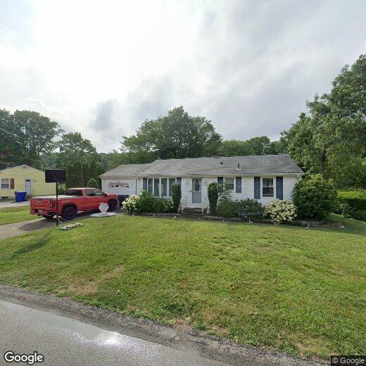
12 Janet Dr
West Warwick, RI 02893
2 Weeks Ago
|
Edit
Favorites
-
Bedrooms
3
-
Bathrooms
1
-
Square Feet
--
12 Janet Dr

Favorites
About This Home
$2,795 deposit
This delightful residence combines comfort and convenience in a peaceful neighborhood. Perfect for families or anyone looking for a serene place to call home. Lease terms: 6 Month lease, with month to month after. Key Features: Spacious Living: Open-concept layout with abundant natural light, perfect for entertaining. Modern Kitchen: Updated appliances, ample counter space, and a cozy breakfast nook. Three Bedrooms: Generous-sized bedrooms with plenty of closet space. Outdoor Retreat: Private backyard with a patio, ideal for summer gatherings and relaxation. Finished Basement: Versatile space for a family room, home gym, or office. Convenient Location: Close to parks, schools, shopping, and easy access to highways. Upgraded Amenities: Central heating and cooling, newer roof, and energy-efficient windows. Off-Street Parking: Parking is made easy with off-street parking available, ensuring a hassle-free experience for you and your guests. Don't miss the opportunity to make this charming house your new home! Resident Benefits Package: All Lyon Property Group residents are enrolled in the Resident Benefits Package (RBP) for $40/month which includes renters insurance, credit building to help boost your credit score with timely rent payments, $1M Identity Protection, move-in concierge service making utility connection and home service setup a breeze during your move-in, our best-in-class resident rewards program, and much more! More details upon application.
12 Janet Dr is a house located in Kent County and the 02893 ZIP Code. This area is served by the Cranston School District attendance zone.
* Price shown is base rent. Excludes user-selected optional fees and variable or usage-based fees and required charges due at or prior to move-in or at move-out. Price, availability, fees, and any applicable rent special are subject to change without notice.
* Square footage definitions vary. Displayed square footage is approximate.
Contact
Location
Get Directions
West Warwick sits along the Pawtuxet River as Rhode Island's youngest town, incorporated in 1913 after splitting from its larger neighbor, and that industrial heritage still shapes its character today. The town spans just nine square miles in Kent County, placing it within easy reach of Providence to the northeast and the coast to the south via Route 4. Compact and walkable in its core areas, West Warwick carries the feel of a working New England town where longtime residents and newer arrivals share the same tree-lined streets and local gathering spots.
The rental market reflects the town's modest scale, with a mix of converted mill buildings, two- and three-family homes, and smaller apartment communities that offer more space per dollar than many nearby communities. Studios through three-bedroom units are available across the town's distinct village areas, including Riverpoint, Arctic, and Phenix, each with its own pocket of character.
Learn more about living in West Warwick
Education
| Colleges & Universities | Distance | ||
|---|---|---|---|
| Colleges & Universities | Distance | ||
| Drive: | 6 min | 1.9 mi | |
| Drive: | 11 min | 5.5 mi | |
| Drive: | 19 min | 9.0 mi | |
| Drive: | 19 min | 10.6 mi |
12 Janet Dr is within 6 minutes or 1.9 miles from C.C. of Rhode Island, Knight. It is also near New England Tech and C.C. of Rhode Island, Liston.
Schools


Public Elementary School
Grades K-5
Nearby
Public Elementary School
Grades PK-5
Nearby
Public Middle School
Grades 6-8
729 Students
Nearby
Public Middle School
Grades 6-8
Nearby
Public High School
Grades 9-12
Nearby
Private Elementary & Middle School
Grades PK-8
Nearby
Private Middle & High School
Grades 6-12
Nearby
School data provided by
 The GreatSchools Rating helps parents compare schools within a state based on a variety of school quality indicators and provides a helpful picture of how effectively each school serves all of its students. Ratings are on a scale of 1 (below average) to 10 (above average) and can include test scores, college readiness, academic progress, advanced courses, equity, discipline and attendance data. We also advise parents to visit schools, consider other information on school performance and programs, and consider family needs as part of the school selection process.
View GreatSchools Rating Methodology
Data provided by GreatSchools.org © 2026. All rights reserved.
View GreatSchools Rating Methodology
Data provided by GreatSchools.org © 2026. All rights reserved.
Getting Around
 What do Walkability, Transit, Drivability, and Bikeability mean?
Walkability measures the walking distance to day-to-day needs.
Transit measures access to public transportation.
Drivability measures congestion, parking availability, and access to major roads.
Bikeability measures the suitability for cycling.
How It Works
What do Walkability, Transit, Drivability, and Bikeability mean?
Walkability measures the walking distance to day-to-day needs.
Transit measures access to public transportation.
Drivability measures congestion, parking availability, and access to major roads.
Bikeability measures the suitability for cycling.
How It Works
Fairly Walkable
Walkability
40
/ 100
Minimal Public Transit
Transit
10
/ 100
Exceptionally Drivable
Drivability
100
/ 100
Fairly Bikeable
Bikeability
40
/ 100
Scores provided by
-
Soundscore™
-
/ 100
Traffic
-Airport
-Businesses
-Scores provided by
HowLoud What is a Sound Score Rating? A Sound Score Rating aggregates noise caused by vehicle traffic, airplane traffic and local sources. How It WorksYou May Also Like
Similar Rentals Nearby
-
-

-

-

-

-

-

-

-

-
 3 Beds, 1 Bath, 1,200 sq ft$2,300Total Monthly Price12 Month LeaseTotal Monthly Price NewPrices include all required monthly fees.60 Concord St
What Are Walk Score®, Transit Score®, and Bike Score® Ratings?
Walk Score® measures the walkability of any address. Transit Score® measures access to public transit. Bike Score® measures the bikeability of any address.
What is a Sound Score Rating?
A Sound Score Rating aggregates noise caused by vehicle traffic, airplane traffic and local sources.

12 Janet Dr
West Warwick, RI 02893