
Dronfield Astoria
13140 Dronfield Ave,
Sylmar, CA 91342
$1,726 - $2,168
1 Bed
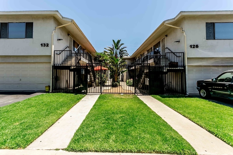
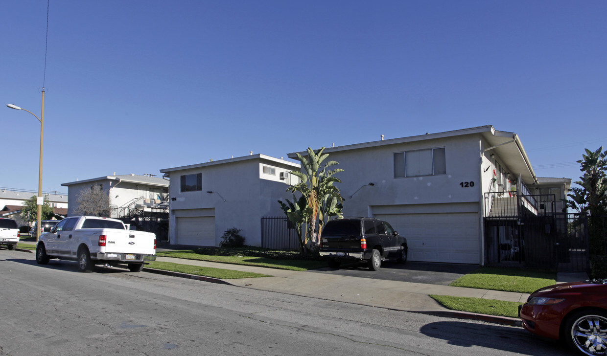

Experience San Fernando living at 116-132 Harps St SW. This property is situated in the 91340 area of San Fernando. The professional leasing staff is ready to help you find your dream apartment. Drop by the leasing office to schedule a tour and find your new home at 116-132 Harps St SW.
116-132 Harps St SW is an apartment community located in Los Angeles County and the 91340 ZIP Code. This area is served by the Los Angeles Unified attendance zone.
High Speed Internet Access
Smoke Free
Heating
Range
Nestled at the foothills of the San Gabriel Mountains, San Fernando is a small city in the northwestern region of Los Angeles County. Situated between Interstates 5 and 210, getting around from San Fernando is a breeze.
In addition to stunning mountain views, San Fernando boasts endless opportunities for outdoor recreation with close proximity to a number of parks such as Hansen Dam Recreation Center, Veterans Memorial Community Regional Park, Wilson Canyon Park, and O’Melveny Park. San Fernando is home to a diverse range of shopping and dining options, including the San Fernando Swap Meet and authentic Latin American cuisine. Discovery Cube Los Angeles and Nethercutt Museum are also close to San Fernando.
Learn more about living in San Fernando| Colleges & Universities | Distance | ||
|---|---|---|---|
| Colleges & Universities | Distance | ||
| Drive: | 6 min | 2.9 mi | |
| Drive: | 14 min | 7.8 mi | |
| Drive: | 15 min | 9.9 mi | |
| Drive: | 16 min | 10.0 mi |


Transportation options available in San Fernando include North Hollywood Station, located 10.4 miles from 116-132 Harps St SW. 116-132 Harps St SW is near Bob Hope, located 8.0 miles or 14 minutes away, and Los Angeles International, located 28.3 miles or 38 minutes away.
| Transit / Subway | Distance | ||
|---|---|---|---|
| Transit / Subway | Distance | ||
|
|
Drive: | 14 min | 10.4 mi |
| Commuter Rail | Distance | ||
|---|---|---|---|
| Commuter Rail | Distance | ||
|
|
Drive: | 3 min | 1.3 mi |
|
|
Drive: | 10 min | 6.1 mi |
|
|
Drive: | 11 min | 6.2 mi |
|
|
Drive: | 18 min | 10.1 mi |
|
|
Drive: | 19 min | 10.1 mi |
| Airports | Distance | ||
|---|---|---|---|
| Airports | Distance | ||
|
Bob Hope
|
Drive: | 14 min | 8.0 mi |
|
Los Angeles International
|
Drive: | 38 min | 28.3 mi |
Time and distance from 116-132 Harps St SW.
| Shopping Centers | Distance | ||
|---|---|---|---|
| Shopping Centers | Distance | ||
| Walk: | 7 min | 0.4 mi | |
| Walk: | 11 min | 0.6 mi | |
| Walk: | 13 min | 0.7 mi |
| Parks and Recreation | Distance | ||
|---|---|---|---|
| Parks and Recreation | Distance | ||
|
El Cariso Regional Park
|
Drive: | 6 min | 3.0 mi |
|
Veterans Memorial Park
|
Drive: | 11 min | 4.1 mi |
|
Aliso Canyon Park
|
Drive: | 14 min | 7.6 mi |
|
Cal State Northridge Botanic Garden
|
Drive: | 14 min | 8.4 mi |
|
Placerita Canyon State Park
|
Drive: | 17 min | 12.5 mi |
| Hospitals | Distance | ||
|---|---|---|---|
| Hospitals | Distance | ||
| Drive: | 3 min | 1.7 mi | |
| Drive: | 7 min | 4.3 mi | |
| Drive: | 8 min | 4.5 mi |
| Military Bases | Distance | ||
|---|---|---|---|
| Military Bases | Distance | ||
| Drive: | 39 min | 30.9 mi |
What Are Walk Score®, Transit Score®, and Bike Score® Ratings?
Walk Score® measures the walkability of any address. Transit Score® measures access to public transit. Bike Score® measures the bikeability of any address.
What is a Sound Score Rating?
A Sound Score Rating aggregates noise caused by vehicle traffic, airplane traffic and local sources

116-132 Harps St SW
San Fernando, CA 91340


