
Skyline On Stokes
2132 Stokes Blvd,
Cleveland, OH 44106
$1,310 - $3,506
Studio - 2 Beds


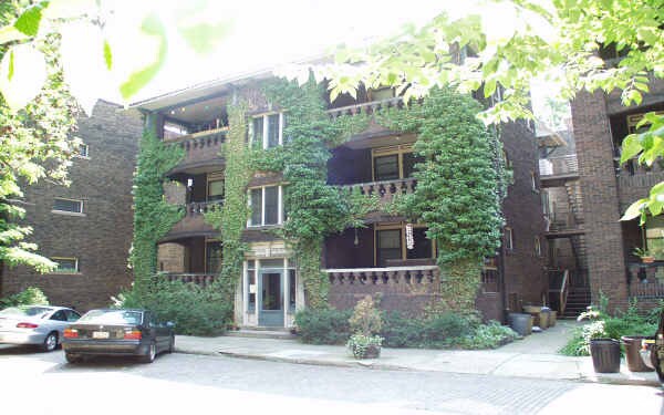
Meet your new place at 11420 Hessler Rd. The location in Cleveland's 44106 area has so much to offer its residents. The professional leasing staff is ready for you to visit. Schedule a time to see the available floorplan options. Contact us or stop by today.
11420 Hessler Rd is an apartment community located in Cuyahoga County and the 44106 ZIP Code. This area is served by the Cleveland Metropolitan School District attendance zone.
The upbeat neighborhood of University Circle houses world-renowned museums, prestigious universities, locally owned restaurants, and numerous community parks. This area is appealing, affordable, and exciting for potential renters. Just five miles from downtown Cleveland, University Circle is conveniently located and offers public transportation that will take you straight to downtown and wherever else you need to go in the surrounding area.
Case Western Reserve University, Cleveland Institute of Music, and Cleveland Institute of Art reside in University Circle. These highly rated universities bring a warm, college town feel to the neighborhood. History is easy to find, and there are multiple museums to visit. The Cleveland Museum of Art and the Cleveland Museum of Natural History are two tourist attractions and local gems in University Circle.
Learn more about living in University CircleCompare neighborhood and city base rent averages by bedroom.
| University Circle | Cleveland, OH | |
|---|---|---|
| Studio | $1,483 | $1,198 |
| 1 Bedroom | $1,939 | $1,380 |
| 2 Bedrooms | $2,972 | $1,734 |
| 3 Bedrooms | $3,831 | $2,097 |
| Colleges & Universities | Distance | ||
|---|---|---|---|
| Colleges & Universities | Distance | ||
| Walk: | 3 min | 0.2 mi | |
| Walk: | 5 min | 0.3 mi | |
| Walk: | 10 min | 0.5 mi | |
| Drive: | 11 min | 4.7 mi |


Transportation options available in Cleveland include Little Italy-Univ Circle Station, located 0.3 mile from 11420 Hessler Rd. 11420 Hessler Rd is near Cleveland-Hopkins International, located 18.1 miles or 32 minutes away.
| Transit / Subway | Distance | ||
|---|---|---|---|
| Transit / Subway | Distance | ||
| Walk: | 6 min | 0.3 mi | |
|
|
Drive: | 3 min | 1.2 mi |
|
|
Drive: | 4 min | 1.7 mi |
|
|
Drive: | 5 min | 1.8 mi |
|
|
Drive: | 6 min | 2.3 mi |
| Commuter Rail | Distance | ||
|---|---|---|---|
| Commuter Rail | Distance | ||
|
|
Drive: | 16 min | 7.3 mi |
| Drive: | 23 min | 11.6 mi | |
| Drive: | 25 min | 13.4 mi | |
| Drive: | 33 min | 19.3 mi | |
|
Boston Mill
|
Drive: | 41 min | 24.3 mi |
| Airports | Distance | ||
|---|---|---|---|
| Airports | Distance | ||
|
Cleveland-Hopkins International
|
Drive: | 32 min | 18.1 mi |
Scores provided by
Traffic
-Airport
-Businesses
-Scores provided by
HowLoud What is a Sound Score Rating? A Sound Score Rating aggregates noise caused by vehicle traffic, airplane traffic and local sources. How It WorksTime and distance from 11420 Hessler Rd.
| Shopping Centers | Distance | ||
|---|---|---|---|
| Shopping Centers | Distance | ||
| Walk: | 3 min | 0.2 mi | |
| Drive: | 4 min | 1.7 mi | |
| Drive: | 6 min | 2.0 mi |
| Parks and Recreation | Distance | ||
|---|---|---|---|
| Parks and Recreation | Distance | ||
|
Cleveland Botanical Garden
|
Walk: | 8 min | 0.4 mi |
|
Cleveland Museum of Natural History
|
Walk: | 12 min | 0.7 mi |
|
Children's Museum of Cleveland
|
Walk: | 13 min | 0.7 mi |
|
Nature Center at Shaker Lakes
|
Drive: | 9 min | 3.7 mi |
|
Great Lakes Science Center
|
Drive: | 13 min | 7.2 mi |
| Hospitals | Distance | ||
|---|---|---|---|
| Hospitals | Distance | ||
| Walk: | 6 min | 0.3 mi | |
| Walk: | 6 min | 0.3 mi | |
| Drive: | 4 min | 1.4 mi |
| Military Bases | Distance | ||
|---|---|---|---|
| Military Bases | Distance | ||
| Drive: | 106 min | 86.9 mi | |
| Drive: | 109 min | 87.6 mi |

What Are Walk Score®, Transit Score®, and Bike Score® Ratings?
Walk Score® measures the walkability of any address. Transit Score® measures access to public transit. Bike Score® measures the bikeability of any address.
What is a Sound Score Rating?
A Sound Score Rating aggregates noise caused by vehicle traffic, airplane traffic and local sources.
11420 Hessler Rd
Cleveland, OH 44106


